Wright Valley facts for kids
Quick facts for kids Wright Valley |
|
|---|---|
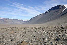
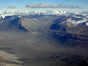
View west towards Lake Vanda and Dais from the foot of Bull Pass.
|
|
| Lua error in Module:Location_map at line 420: attempt to index field 'wikibase' (a nil value). | |
| Geography | |
| Population centers | Vanda Station |
| Rivers | Onyx River |
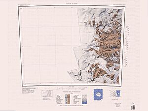
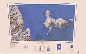
The Wright Valley (77°31′S 161°50′E / 77.517°S 161.833°E) is a huge valley in Antarctica, stretching from east to west. Most of it is free of ice now, though it was once covered by a large glacier. Only the Wright Upper Glacier at its western end and the Wright Lower Glacier at its eastern end still remain.
This valley was named after Sir Charles Wright by a group of explorers in 1958-59. Another expedition had already named a glacier in the valley after him much earlier, between 1910 and 1913.
The Wright Valley is the central one of three special places called the McMurdo Dry Valleys. These valleys are found in the Transantarctic Mountains, west of McMurdo Sound.
Inside the Wright Valley, you'll find the Onyx River, which is the longest river in all of Antarctica! It starts at Lake Brownworth and flows into Lake Vanda. There's also a unique place called Don Juan Pond in the valley's southern part, and a rocky area known as the Labyrinth at the western end.
Contents
- Exploring the Wright Valley
- Where is Wright Valley?
- Amazing Features of the Valley
- The Labyrinth: A Maze of Rocks
- Minotaur Pass: A Mountain Pathway
- Dais Col: An Ice-Free Connection
- The Dais: A Flat-Topped Mountain
- Don Juan Pond: A Super Salty Lake
- North Fork: The Valley's Northern Arm
- South Fork: The Valley's Southern Arm
- Lake Vanda: A Mysterious Lake
- Lake Bull: A Small Lake Near Vanda
- Lake Canopus: High Above Lake Vanda
- Onyx River: Antarctica's Longest River
- Bull Pass: A Route Through the Mountains
- Lake Brownworth: Source of the Onyx River
- Side Valleys and Glaciers
- Donner Valley: A Thunderous Name
- Sykes Glacier: Named for a Film Director
- Heimdall Glacier: A Norse Mythology Name
- Valhalla Glacier: Another Norse Name
- Conrow Glacier: Honoring an Explorer
- Bartley Glacier: Remembering a Brave Driver
- Meserve Glacier: Named for a Geological Helper
- Hart Glacier: Another Geological Assistant's Name
- Goodspeed Glacier: Honoring a Field Assistant
- Denton Glacier: Named for a Geological Assistant
- Pukeko Pond: Named After a New Zealand Bird
- Martin Cirque: A Large, Ice-Free Bowl
- Learn More About Antarctica
Exploring the Wright Valley
Even though parts of this connected valley system were first seen in 1903 by the Discovery Expedition led by Captain Robert Falcon Scott, the Wright Valley itself wasn't discovered until 1947. That's when scientists took aerial photographs of the region.
By the mid-1960s, scientists were very curious about something strange. The valley was right next to the huge, permanent East Antarctic Ice Sheet, yet it had been free of ice for thousands of years! Also, Lake Vanda is covered by about 3 meters (10 feet) of ice all year. But surprisingly, temperatures of 25 degrees Celsius (77 degrees Fahrenheit) were measured deep inside the lake, at about 65 meters (213 feet).
Because more research was happening in the summer, and there was a need to study the valley in winter, New Zealand's Antarctic Division and the National Science Foundation of the United States decided to build a more permanent base. In 1968, New Zealand set up Vanda Station near the eastern side of Lake Vanda.
Where is Wright Valley?
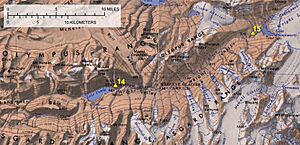
The Wright Valley is one of the famous McMurdo Dry Valleys. It stretches from the Wright Upper Glacier in the west to the Wright Lower Glacier in the east.
This valley acts like a natural divider. It separates the Olympus Range to the north from the Asgard Range to the south.
Amazing Features of the Valley
The Wright Valley is full of interesting places. Moving from west to east, some of these features include the Labyrinth, Don Juan Pond, the Dais, North Fork, South Fork, Lake Vanda, Lake Canopus, the Onyx River, and Lake Brownworth.
The Labyrinth: A Maze of Rocks
77°33′S 160°50′E / 77.550°S 160.833°E This is a large, flat area at the western end of Wright Valley. It has been deeply carved out by nature. Explorers from 1958-59 named it the Labyrinth because the eroded rocks look just like a maze!
Minotaur Pass: A Mountain Pathway
77°30′S 160°50′E / 77.500°S 160.833°E Minotaur Pass is a high pathway, or saddle, about 1,600 meters (5,250 feet) above sea level. It's located between Apollo Peak and Mount Electra in the Olympus Range. This pass allows people to walk from McKelvey Valley into Wright Valley. It was named in 1984, linking to other names from Greek mythology in the Olympus Range.
Dais Col: An Ice-Free Connection
77°33′S 161°03′E / 77.550°S 161.050°E This is an ice-free saddle, about 600 meters (1,970 feet) high. It connects the eastern edge of the Labyrinth with the western edge of the Dais in Wright Valley. It was named in 1997 because of its closeness to the Dais.
The Dais: A Flat-Topped Mountain
77°33′S 161°16′E / 77.550°S 161.267°E The Dais is a long, flat-topped mountain (mesa) located between the Labyrinth and Lake Vanda in the western part of Wright Valley. Explorers from 1958-59 gave it this descriptive name.
Don Juan Pond: A Super Salty Lake
77°34′S 161°11′E / 77.567°S 161.183°E Don Juan Pond is a shallow, very salty lake found south of the Dais in the South Fork of Wright Valley. It was first spotted on October 11, 1961, during a helicopter flight. Over the next three months, a research team studied the pond. They named it after Lieutenants Donald Roe and John Hickey, who helped their team. A new mineral, calcium chloride hexahydrate, was discovered here and was proposed to be called Antarcticite.
North Fork: The Valley's Northern Arm
77°32′S 161°15′E / 77.533°S 161.250°E This is the northern branch of Wright Valley. It is separated from the South Fork by the Dais. Explorers from 1958-59 gave it this name.
South Fork: The Valley's Southern Arm
77°34′S 161°15′E / 77.567°S 161.250°E This is the southern branch of Wright Valley. Like the North Fork, it is separated by the Dais. It was also named by the 1958-59 expedition.
Lake Vanda: A Mysterious Lake
77°32′S 161°33′E / 77.533°S 161.550°E Lake Vanda is about 3 nautical miles (5.6 kilometers) long. It's located just east of the Dais in Wright Valley. It was named by explorers in 1958-59 after a dog used by C. Bull, who led a British expedition to North Greenland.
Lake Bull: A Small Lake Near Vanda
77°32′S 161°42′E / 77.533°S 161.700°E This small lake is about 0.5 nautical miles (0.9 kilometers) east of Lake Vanda. It was likely named in the 1960s, possibly because of its closeness to Bull Pass, or after physicist Colin Bull, for whom the pass is named.
Lake Canopus: High Above Lake Vanda
77°33′S 161°31′E / 77.550°S 161.517°E Lake Canopus is a small lake located about 65 meters (213 feet) above the southern shore of Lake Vanda. It was named in 1963-64 after Canopus, a pilot from ancient Greek mythology.
Onyx River: Antarctica's Longest River
77°32′S 161°45′E / 77.533°S 161.750°E The Onyx River is a stream formed by melting ice. It flows westward through the Wright Valley, from the Wright Lower Glacier all the way to Lake Vanda. It was mapped and named by explorers in 1958-59.
Bull Pass: A Route Through the Mountains
77°28′S 161°42′E / 77.467°S 161.700°E Bull Pass is a low pathway through the Olympus Range, found between Mount Jason and Mount Orestes. It connects the McKelvey Valley and the Wright Valley. It was named by the 1958-59 expedition after C. Bull, who led that group.
Lake Brownworth: Source of the Onyx River
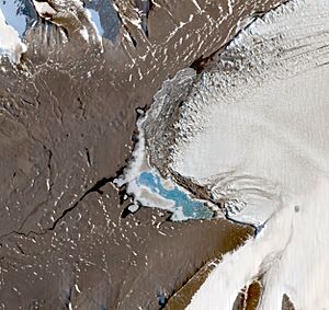
77°26′S 162°45′E / 77.433°S 162.750°E Lake Brownworth is a lake formed by melting ice, located just west of the Wright Lower Glacier at the eastern end of Wright Valley. The U.S. Geological Survey (USGS) mapped this lake using surveys and air photos taken between 1956 and 1960. It was named after Frederick S. Brownworth, a USGS engineer who worked in Antarctica for several seasons. In 1970-71, he oversaw aerial photography of the dry valleys, including this lake.
Side Valleys and Glaciers
Many smaller valleys and glaciers flow into the Wright Valley from the Asgard Range. From west to east, these include Donner Valley, Sykes Glacier, Odin Valley, Heimdall Glacier, Bartley Glacier, Meserve Glacier, Hart Glacier, Goodspeed Glacier, and Denton Glacier.
Donner Valley: A Thunderous Name
77°37′S 161°27′E / 77.617°S 161.450°E This is a small valley, mostly free of ice, located north-northeast of Mount Thundergut in the Asgard Range. It was named by the New Zealand Antarctic Place-Names Committee (NZ-APC), probably because "donner" is a German word for "thunder," linking it to nearby Mount Thundergut.
Sykes Glacier: Named for a Film Director
77°35′S 161°32′E / 77.583°S 161.533°E This glacier flows north and is located just east of Plane Table in the Asgard Range. It was named by the NZ-APC for Jeremy Sykes, a New Zealand film director who sadly passed away in a helicopter accident near Mount McLennan on November 19, 1969.
Heimdall Glacier: A Norse Mythology Name
77°35′S 161°50′E / 77.583°S 161.833°E Heimdall Glacier is a small glacier just east of Siegfried Peak and Siegmund Peak on the south side of Wright Valley. The NZ-APC gave it this name, which comes from Norse mythology, where Heimdall is the guardian of Asgard.
Valhalla Glacier: Another Norse Name
77°34′S 161°58′E / 77.567°S 161.967°E This small glacier is in the Asgard Range, between Mount Valhalla and Conrow Glacier. It flows partway down the northern wall of the range towards Wright Valley. It was named by the US-ACAN and NZ-APC together.
Conrow Glacier: Honoring an Explorer
77°34′S 162°07′E / 77.567°S 162.117°E Conrow Glacier is a small glacier, located west of Bartley Glacier. It flows north from the Asgard Range partway down the south wall of Wright Valley. Roy E. Cameron, who led a research team to the area in 1966-67, named it after Howard P. Conrow, a member of his team.
Bartley Glacier: Remembering a Brave Driver
77°32′S 162°13′E / 77.533°S 162.217°E This is a hanging glacier on the south wall of Wright Valley, just west of Meserve Glacier. It was named by the US-ACAN for Ollie Barrett Bartley, a construction driver with the United States Navy. He sadly lost his life on January 14, 1957, when the vehicle he was driving fell through the sea ice at Hut Point, McMurdo Sound.
Meserve Glacier: Named for a Geological Helper
77°31′S 162°17′E / 77.517°S 162.283°E Meserve Glacier is a hanging glacier on the south wall of Wright Valley, found between the Bartley and Hart Glaciers. United States geologist Robert Nichols named it after William Meserve, who was his geological assistant near Marble Point during the 1959-60 field season.
Hart Glacier: Another Geological Assistant's Name
77°30′S 162°23′E / 77.500°S 162.383°E This is a small hanging glacier on the south wall of Wright Valley, located between the Meserve and Goodspeed Glaciers. United States geologist Robert Nichols named it after Roger Hart, who was his geological assistant near Marble Point during the 1959-60 field season.
Goodspeed Glacier: Honoring a Field Assistant
77°29′S 162°27′E / 77.483°S 162.450°E Goodspeed Glacier is a small hanging glacier on the south wall of Wright Valley, between the Hart and Denton Glaciers. United States geologist Robert Nichols named it after Robert Goodspeed, who was his geological assistant near Marble Point during the 1959-60 field season.
Denton Glacier: Named for a Geological Assistant
77°29′S 162°36′E / 77.483°S 162.600°E This is a small hanging glacier that drains the northwest slopes of Mount Newall and ends on the south wall of Wright Valley. United States geologist Robert Nichols named it after George Denton, who was his geological assistant near Marble Point during the 1958-59 field season.
Pukeko Pond: Named After a New Zealand Bird
77°29′05″S 162°34′19″E / 77.484849°S 162.571882°E Pukeko Pond is a pond about 0.25 nautical miles (0.46 kilometers) long. It's located between Mount Loke and the western side of Denton Glacier. The New Zealand Geographic Board (NZGB) named it in 1998 after a type of water bird found in New Zealand.
Martin Cirque: A Large, Ice-Free Bowl
77°28′00″S 162°40′00″E / 77.466667°S 162.666667°E This is a noticeable cirque (a bowl-shaped hollow) about 1.9 nautical miles (3.5 kilometers) northwest of Mount Newall in the Asgard Range. It takes up the south wall of Wright Valley between Denton Glacier and Nichols Range. The cirque is 1 nautical mile (1.85 kilometers) wide, and its floor, at 850 meters (2,790 feet) elevation, is almost completely free of ice. The Advisory Committee on Antarctic Names (US-ACAN) named it in 1997 after Craig J. Martin, who worked on many Antarctic construction and engineering projects from 1977 onwards.
Learn More About Antarctica
- Dry Valleys Geology
- Taylor Valley (south)
- Victoria Valley (north)
 | Sharif Bey |
 | Hale Woodruff |
 | Richmond Barthé |
 | Purvis Young |


