
Image: Cache Creek Wilderness (16044992702)
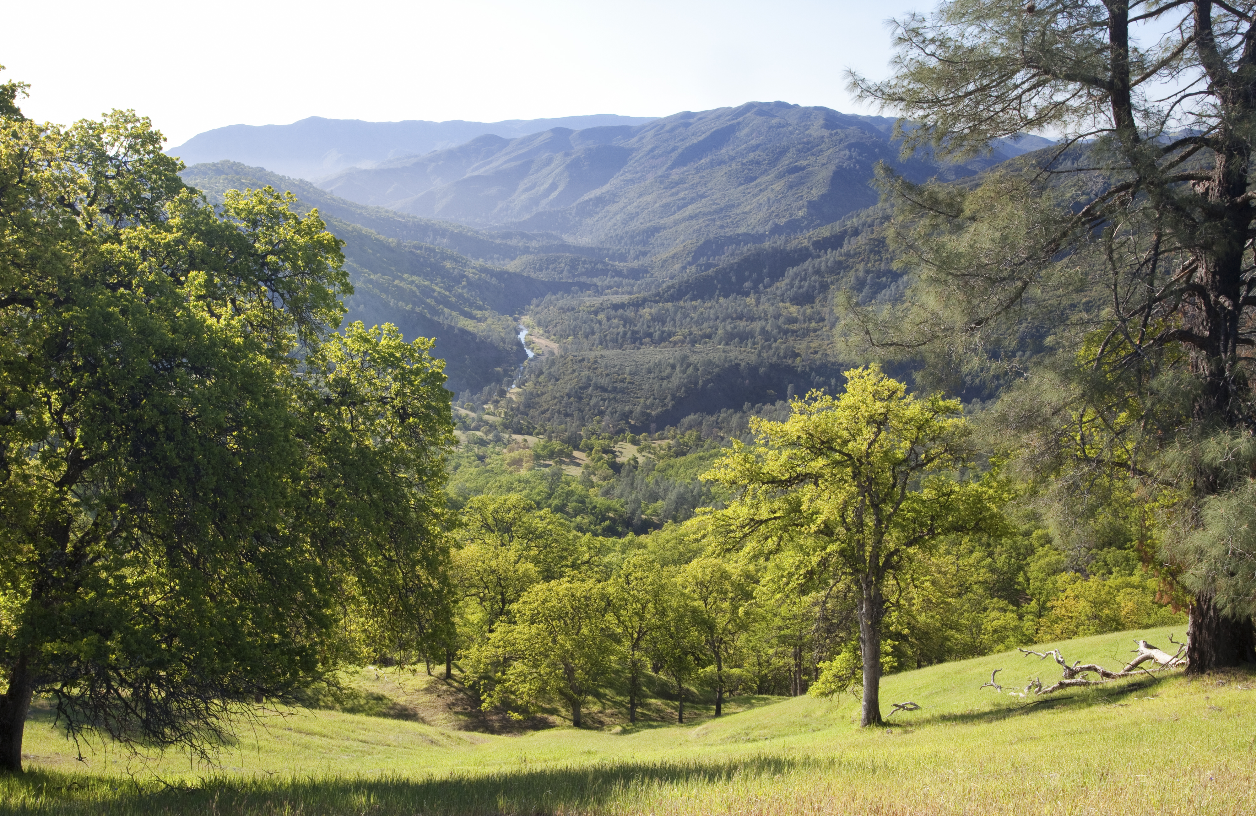
Description: This secluded, hilly expanse of oak woodlands, grasslands, and chaparral is a combination of over 70,000 acres of BLM managed lands and 4,700 acres of State and County lands. The Natural Area is traversed by Cache Creek, with its year-round water flow. Elevation ranges from 3200 feet atop Brushy Sky High, down to 600 feet in the eastern end of Cache Creek along State Route 16. Showcasing the area is about 35 miles of the main fork of Cache Creek and 2.5 miles of the north fork. Also present are several tributary creeks that contain permanent water. The Cache Creek Natural Area is a primitive area, closed to motorized vehicles. There are no developed campgrounds or facilities. Non-hunting (target) shooting is not allowed. Instead, the area is managed to improve habitat for wildlife and rare plants, to protect cultural resource values, and to offer primitive recreation opportunities, including wildlife viewing, river running, hiking, equestrian use, hunting and fishing. On October 17, 2006, President George W. Bush signed the Northern California Coastal Wild Heritage Act, designating approximately 27,245 acres within the Cache Creek Natural Area as the Cache Creek Wilderness Area. Learn more: www.blm.gov/ca/st/en/fo/ukiah/cachecreek.html Photo: Bob Wick, BLM
Title: Cache Creek Wilderness (16044992702)
Credit: Cache Creek Wilderness
Author: Bureau of Land Management
Usage Terms: Public domain
License: Public domain
Attribution Required?: No
Image usage
The following page links to this image:

.jpg)