
Image: Cairn Stoney Cove Pike - geograph.org.uk - 1751936
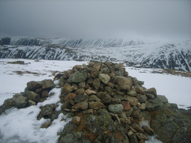
Description: Cairn Stoney Cove Pike Looking towards the High Street Ridge. Stoney Cove Pike as a name was first seen recorded in the year 1614. The fell is also referred to as Caudale Moor which really relates to the moorland at the top of Caudale Head to the north east. Caudale comes from Old Norse 'kaldr' meaning cold which would fit with this north facing valley. Just south of Caudale Moor is John Bells Banner another interesting name thought to relate to a boundary mark. Two candidates for John Bell are 'Old' John Bell a local man who put his mark on a deed dated 1589 but a more likely John Bell is the curate from Ambleside at around 1617. He is recorded to have built paved roads with his pupils in the area. (Whaley 2006).
Title: Cairn Stoney Cove Pike - geograph.org.uk - 1751936
Credit: From geograph.org.uk
Author: Michael Graham
Usage Terms: Creative Commons Attribution-Share Alike 2.0
License: CC BY-SA 2.0
License Link: https://creativecommons.org/licenses/by-sa/2.0
Attribution Required?: Yes
Image usage
The following page links to this image:
