
Image: Caleb Pusey Land Holme 1687 Map
No higher resolution available.
Caleb_Pusey_Land_Holme_1687_Map.jpg (581 × 543 pixels, file size: 99 KB, MIME type: image/jpeg)
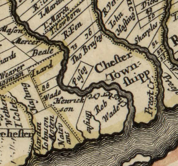
Description: 1687 map of the improved part of Pennsylvania, rotated 30 degrees CCW (so north is up) and cropped to show (near center) land owned by Caleb Pusey near Chester Creek and the Delaware River in Upland PA
Title: Caleb Pusey Land Holme 1687 Map
Credit: https://www.loc.gov/resource/g3820.ct004135/
Author: Thomas Holme
Usage Terms: Public domain
License: Public domain
Attribution Required?: No
Image usage
The following page links to this image:

All content from Kiddle encyclopedia articles (including the article images and facts) can be freely used under Attribution-ShareAlike license, unless stated otherwise.