
Image: Canada Alberta Density 2016 CB

Size of this PNG preview of this SVG file: 363 × 598 pixels. Other resolution: 145 × 240 pixels.
Original image (SVG file, nominally 1,388 × 2,288 pixels, file size: 23.3 MB)
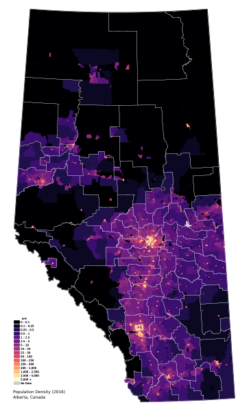
Description: Population density map of Alberta, Canada. Boundary open data, waterbodies, and final counts from Canadian 2016 Census, accessed on April 22 2018.
Title: Canada Alberta Density 2016 CB
Credit: Own work
Author: awmcphee
Usage Terms: Creative Commons Attribution 3.0
License: CC BY 3.0
License Link: https://creativecommons.org/licenses/by/3.0
Attribution Required?: Yes
Image usage
The following page links to this image:

All content from Kiddle encyclopedia articles (including the article images and facts) can be freely used under Attribution-ShareAlike license, unless stated otherwise.