
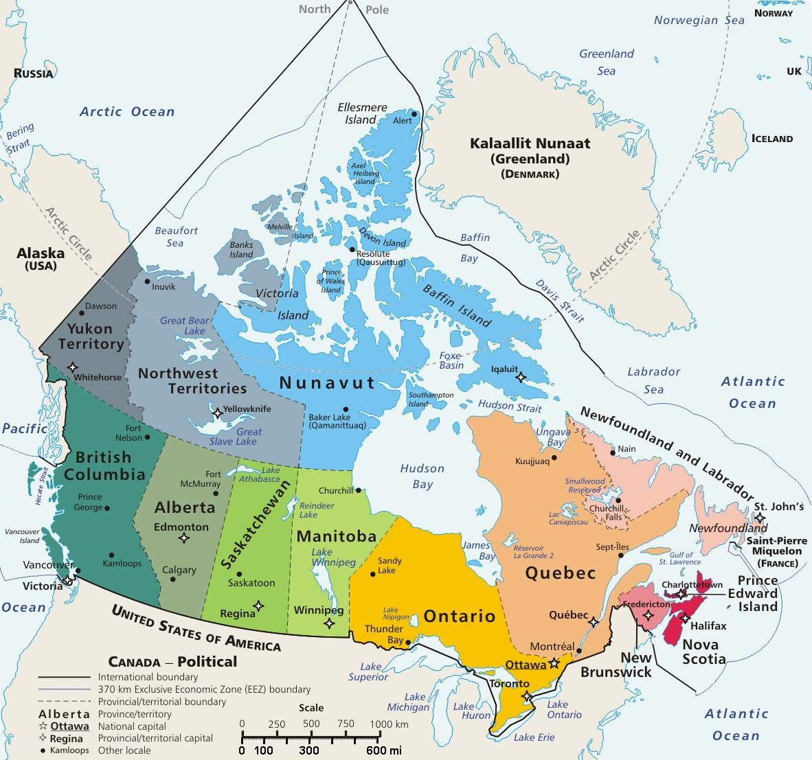
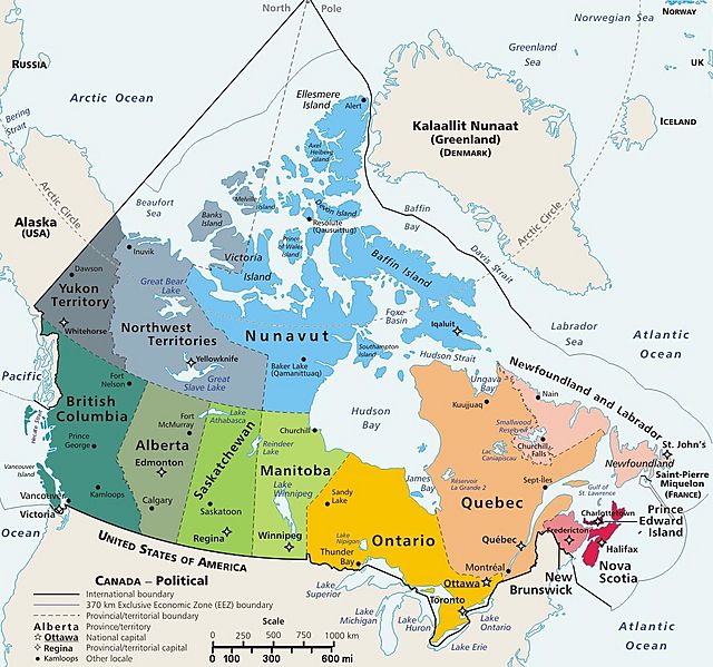
Image: Canada geopolitical map trim
Description: Map of Canada, showing largest cities, lakes and province names. This map has locator code "CanadaGeo" for use in map-locator templates, such as English Wiki Template:Location_map_CanadaGeo & Template:Location_map_polarx (which skews northern coordinates for multiple map markers/labels on a polar map). The latitude/longitude coordinates are not equirectangular, but rather, in polar projection, narrowing at the north, with longitudes about 84% closer together at the top. The use of the narrowing longitudes provides more accurate mapping of area and distance than with rectangular coordinates. The original map image was public domain; the following modifications have been made to the original: shaded province Nunavut in gray (had been watery blue); trimmed edges & modified the location of some names; see the original map for the unchanged version which is also Public Domain. feel free to change around more if you think something is essential to have in the image.
Title: Canada geopolitical map trim
Credit: Derivative of map from User:E Pluribus Anthony geopolitical map (Wikimedia Commons): Image:Geopolitical map of Canada.png (enlarging labels, adding flag & coat-of-arms, magnifying 15%)
Author: User:E Pluribus Anthony (trimmed by Wikid77, enlarging labels)
Usage Terms: Public domain
License: Public domain
Attribution Required?: No
Image usage
The following page links to this image:
