
Cod Island facts for kids

Cod Island
Location in Newfoundland and Labrador
|
|

Cod Island
Location in CanadaGeo
|
|
| Geography | |
|---|---|
| Location | Labrador Sea, Eastern Canada |
| Coordinates | 57°47′00″N 61°46′56″W / 57.783455°N 61.782345°W |
| Area | 132.71 km2 (51.24 sq mi) |
| Highest elevation | 914 m (2,999 ft) |
| Highest point | Cod Island High Point |
| Administration | |
|
Canada
|
|
| Province | Newfoundland and Labrador |
| Demographics | |
| Population | Uninhabited |
| Additional information | |
| Time zone | |
| • Summer (DST) | |
Cod Island is an island in Canada, located off the northern coast of Newfoundland and Labrador. It is in the Labrador Sea, which is part of the Atlantic Ocean. This island is not home to any people. It covers about 133 square kilometers, which is a bit smaller than a big city. It is about 1,700 kilometers northeast of Canada's capital city, Ottawa.
Early mapmakers called the island "Ogua-Lik." On March 7, 1957, it was officially named Cod Island.
Contents
Background
Cod Island gets its name from the Atlantic cod, a type of fish often found in the waters nearby.
In the 1600s and 1700s, especially in places like Massachusetts and Newfoundland, cod fish was very important. It helped create big trading networks and connections between different cultures.
Geography
Cod Island has many hills. Three of its highest points are part of the Kaumajet Mountains. The very highest spot on the island is 914 meters above the sea. The island stretches about 15.7 kilometers from north to south and 15.4 kilometers from east to west.
The land around Cod Island is mostly covered in grasslands. Very few people live in this area, with less than two people per square kilometer. The climate here is a continental climate, meaning it has cold winters and warm summers. The average temperature for the whole year is -5 °C. July is the warmest month, with an average temperature of 12 °C. February is the coldest, with temperatures around -20 °C.
Table Hill
Table Hill is a hill on the south side of Cod Island. The top of Table Hill is 819 meters above sea level. This means it rises 551 meters above the land around it. At its base, Table Hill is about 6.1 kilometers wide.
Besides Table Hill, the island also has two other hills that are shaped like domes.
Images for kids
-
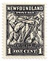
A postage stamp from Newfoundland featuring a cod fish.

