Newfoundland and Labrador facts for kids
Quick facts for kids
Newfoundland and Labrador
Terre-Neuve-et-Labrador (French)
|
|||
|---|---|---|---|
|
|||
| Motto(s): | |||
| Country | Canada | ||
| Confederation | March 31, 1949 (12th) | ||
| Capital | St. John's | ||
| Largest city | St. John's | ||
| Largest metro | Greater St. John's | ||
| Government | |||
| • Type | Constitutional monarchy | ||
| Area | |||
| • Total | 405,720 km2 (156,650 sq mi) | ||
| • Land | 373,872 km2 (144,353 sq mi) | ||
| • Water | 31,340 km2 (12,100 sq mi) 7.7% | ||
| Area rank | Ranked 10th | ||
| 4.1% of Canada | |||
| Population
(2021)
|
|||
| • Total | 510,550 | ||
| • Estimate
()
|
522,453 | ||
| • Rank | Ranked 9th | ||
| • Density | 1.37/km2 (3.5/sq mi) | ||
| Demonym(s) | Newfoundlander Labradorian (see notes) |
||
| Official languages | English (de facto) | ||
| GDP | |||
| • Rank | 8th | ||
| • Total (2011) | C$33.624 billion | ||
| • Per capita | C$65,556 (5th) | ||
| HDI | |||
| • HDI (2019) | 0.894 — Very high ([[List of Canadian provinces and territories by Human Development Index|13th]]) | ||
| Time zones | |||
| Newfoundland | UTC-03:30 (Newfoundland Time Zone) | ||
| Labrador (Black Tickle and North) | UTC-04:00 (Atlantic Time Zone) | ||
| Postal abbr. |
NL (formerly NF)
|
||
| Postal code prefix |
A
|
||
| ISO 3166 code | CA-NL | ||
| Flower | Pitcher plant | ||
| Tree | Black spruce | ||
| Bird | Atlantic puffin | ||
| Rankings include all provinces and territories | |||
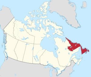
Newfoundland and Labrador (often shortened to NL) is Canada's easternmost province. It is located in the Atlantic region of the country. The province is made up of two main parts: the large island of Newfoundland and the mainland area called Labrador. Together, they cover about 405,212 square kilometers.
In 2021, about 521,758 people lived here. Most of the people (about 94%) live on the island of Newfoundland. More than half of them live on the Avalon Peninsula. English is the main language spoken by almost everyone (97.0%). Some people in Labrador also speak Indigenous languages like Innu-aimun and Inuktitut.
The capital and largest city is St. John's. It is home to almost 40% of the province's population. St. John's is where the government meets and where the highest court is located.
Newfoundland and Labrador used to be a separate country called the Dominion of Newfoundland, part of the British Empire. After facing tough economic times in the 1930s, it joined Canadian Confederation on March 31, 1949. At first, it was just called "Newfoundland." In 2001, its name was officially changed to Newfoundland and Labrador.
Contents
- Understanding the Name: Etymology of Newfoundland and Labrador
- Exploring the Land: Geography of Newfoundland and Labrador
- The Land's Foundation: Geology of Newfoundland and Labrador
- A Look Back: History of Newfoundland and Labrador
- Who Lives Here: Demographics of Newfoundland and Labrador
- How People Make a Living: Economy of Newfoundland and Labrador
- How the Province is Run: Government and Politics
- Expressing Ourselves: Culture of Newfoundland and Labrador
- Fun and Games: Sports in Newfoundland and Labrador
- Getting Around: Transportation in Newfoundland and Labrador
- See also
Understanding the Name: Etymology of Newfoundland and Labrador
The name "New founde lande" was first used by King Henry VII for the land explored by the Cabots. In Portuguese, it is Terra Nova, meaning "new land." This name is still used on the island, for example, in Terra Nova National Park.
The name Labrador comes from the surname of a Portuguese explorer named João Fernandes Lavrador. He was a navigator who explored the area.
In the Inuttitut/Inuktitut language, spoken in Nunatsiavut, Labrador is called Nunatsuak. This means "the big land," which is a common nickname for Labrador in English. Newfoundland's Inuttitut/Inuktitut name is Ikkarumikluak, meaning "place of many shoals."
Exploring the Land: Geography of Newfoundland and Labrador
Newfoundland and Labrador is Canada's most easterly province. It sits at the northeastern tip of North America. The Strait of Belle Isle divides the province into two main parts. One part is Labrador, a large area on the Canadian mainland. The other is Newfoundland, an island in the Atlantic Ocean. The province also includes over 7,000 smaller islands.
Newfoundland island is shaped roughly like a triangle. Each side is about 400 kilometers (250 miles) long. The island and its nearby small islands cover about 111,390 square kilometers (43,010 square miles).
Labrador is also roughly triangular. Its western border with Quebec follows the natural water divide. Rivers flowing into the Atlantic Ocean from this area are part of Labrador. Most of Labrador's southern border with Quebec is along the 52nd parallel. Labrador's northern tip touches Nunavut on Killiniq Island. Labrador, including its small islands, covers about 294,330 square kilometers (113,640 square miles).
Together, Newfoundland and Labrador make up 4.06% of Canada's total area, with 405,720 square kilometers (156,650 square miles).
The Land's Foundation: Geology of Newfoundland and Labrador
Labrador is the eastern part of the Canadian Shield. This is a huge area of very old metamorphic rock that covers much of northeastern North America.
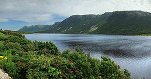
Newfoundland's geology has been shaped by colliding tectonic plates. Gros Morne National Park is a great example of how these plates have moved. Because of this, it is a World Heritage Site. The Long Range Mountains on Newfoundland's west coast are the northernmost part of the Appalachian Mountains.
The province stretches from south to north (46°36′N to 60°22′N). This, along with westerly winds, cold ocean currents, and local features like mountains and coastlines, creates different climates across the province.
Weather Patterns: Climate in Newfoundland and Labrador
Most of Newfoundland has a humid continental climate. This means it has cool summers. The island's weather is greatly influenced by the sea, as no part of it is more than 100 km (62 mi) from the ocean.
Northern Labrador has a polar tundra climate. Southern Labrador has a subarctic climate.
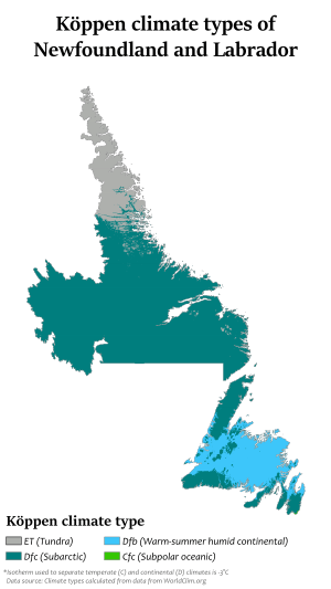
The sea helps keep winter temperatures a bit warmer and summer temperatures a bit cooler along the coast compared to inland areas. This maritime climate brings more changeable weather, lots of rain and snow, more humidity, lower visibility, more clouds, less sunshine, and stronger winds than a continental climate.
| Location | July (°C) | July (°F) | January (°C) | January (°F) |
|---|---|---|---|---|
| St. John's | 20/11 | 68/52 | −1/−9 | 30/16 |
| Grand Falls-Windsor | 23/11 | 73/52 | –2/–12 | 27/9 |
| Gander | 21/11 | 71/51 | −3/−12 | 26/11 |
| Corner Brook | 22/13 | 71/55 | −3/−10 | 28/15 |
| Stephenville | 20/12 | 68/54 | −2/−9 | 27/15 |
| Fogo Island | 19/10 | 66/50 | –3/–9 | 26/16 |
| Labrador City | 19/8 | 66/47 | –16/–27 | 2/–18 |
| Happy Valley-Goose Bay | 21/10 | 69/50 | −12/−22 | 9/−8 |
| Nain | 15/5 | 59/41 | −14/−23 | 7/−10 |
A Look Back: History of Newfoundland and Labrador
First Peoples: Early History
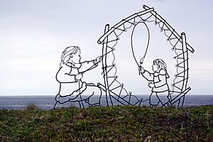
People have lived in Newfoundland and Labrador for about 9,000 years. The Maritime Archaic peoples were ancient hunters of sea mammals. They lived along the Atlantic Coast of North America from about 7000 BC to 1500 BC. They built longhouses and traded goods over long distances.
Later, the Dorset culture (Late Paleo-Eskimo) arrived and lived in the area from about 2000 BC to AD 800. They were very good at living in cold climates and hunted sea mammals through ice holes.
The Beothuk culture appeared around 1 AD. They were the only Indigenous group living permanently on Newfoundland island when Europeans arrived. The Inuit, mostly found in Labrador, are descendants of the Thule people. They came from western Alaska around AD 1000 and reached Labrador around 1300–1500.
The Innu people live in an area they call Nitassinan, which includes much of northeastern Quebec and Labrador. They traditionally hunted caribou, deer, and small animals. Coastal Innu also farmed and fished.
The Miꞌkmaq people of southern Newfoundland spent summers on the coast fishing and winters inland hunting. Both the Mi'kmaq and Innu divided their lands into districts, each with its own chief and council.
The Beothuk People
When Europeans first came in the early 1500s, the Beothuk were the only Indigenous group living year-round on Newfoundland island. Unlike other groups, the Beothuk did not trade much with European settlers. They tried to avoid contact to protect their way of life.
As English fishing grew, the Beothuk were pushed further inland. This led to more conflict over resources. By the early 1800s, violence, hunger, and disease greatly reduced the Beothuk population. They became extinct by 1829.
First Europeans: European Contact
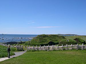
The earliest confirmed European contact was about a thousand years ago by Vikings (Norse people). Their sagas mention Leif Erikson landing in three places, including Vinland (possibly Newfoundland). Archaeologists found evidence of a Norse settlement at L'Anse-aux-Meadows in Newfoundland. This site was named a World Heritage Site in 1978.
There are other stories of early European visits, like Irish monks or Portuguese sailors. However, the most famous confirmed visit was by John Cabot. In 1497, he landed in Cape Bonavista after getting permission from English King Henry VII. The governments of Canada and the United Kingdom recognize Bonavista as Cabot's official landing spot.
Portuguese explorers also mapped the coast, and the name "Labrador" comes from one of them, João Fernandes Lavrador. In 1583, Humphrey Gilbert claimed Newfoundland for Queen Elizabeth I of England. This made it England's first possession in North America.
Becoming a Colony: Colony of Newfoundland
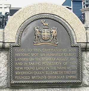
Before 1563, Basque fishermen had a seasonal fishing spot called Plaisance (now Placentia). In 1583, Sir Humphrey Gilbert claimed Newfoundland for England. European fishing boats from Basque Country, England, France, and Portugal had been visiting Newfoundland for a century.
From 1610 to 1728, governors were appointed to start permanent settlements. John Guy was governor of the first settlement at Cuper's Cove.
The waters around Newfoundland were known for excellent fishing. By 1620, 300 fishing boats worked the Grand Banks, employing about 10,000 sailors. They dried and salted cod on the coast to sell in Spain and Portugal.
In 1655, France appointed a governor in Plaisance, starting a period of French colonization. This also led to wars between England and France in the region. The Mi'kmaq, who were allies of the French, fought alongside them against the English.
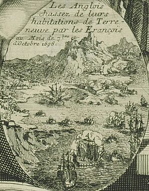
In the 1690s, French forces destroyed almost every English settlement on the island. However, the Treaty of Utrecht in 1713 ended the war. France gave up its claims to Newfoundland and its possessions in Acadia to the British.
During the Seven Years' War (1756–1763), control of Newfoundland was again a major conflict. In 1762, a French force tried to take the island but was defeated by the British in the Battle of Signal Hill.
In 1854, the British government gave Newfoundland responsible government. This meant Newfoundlanders could make more of their own decisions. In 1869, Newfoundland voted against joining Canada.
A Self-Governing Nation: Dominion of Newfoundland
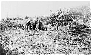
Newfoundland became a self-governing country, a Dominion, in 1907. This meant it was largely independent from British rule.
Newfoundland's own soldiers, the Royal Newfoundland Regiment, fought in World War I. On July 1, 1916, almost the entire regiment was lost at Beaumont-Hamel. Despite their bravery, the war left the Dominion with a huge debt.
Newfoundland and Quebec had a long-standing border dispute over Labrador. In 1927, the British government decided that modern-day Labrador was part of the Dominion of Newfoundland.
Joining Canada: Commission of Government and Canadian Confederation
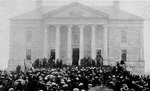
Because of its large debt from World War I and the railway, and falling fish prices during the Great Depression, Newfoundland's government collapsed in 1933. The British government took direct control. A group called the Commission of Government was put in charge in 1934. For 15 years, there were no elections.
When World War II brought back good times, people wanted to end the Commission and get their own government back. In 1946, the British government set up the Newfoundland National Convention to decide Newfoundland's future.
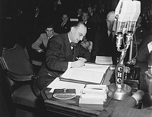
Joey Smallwood, a member of the Convention, pushed for Newfoundland to join Canada. After a close vote, a second referendum was held on July 22, 1948. This time, 52.3% voted to join Canada, and 47.7% voted for an independent government.
Newfoundland officially joined Canada at midnight on March 31, 1949. Some people believed the vote was unfair, but most historians agree that Newfoundlanders made the final decision themselves, even if it was a very close call.
Who Lives Here: Demographics of Newfoundland and Labrador
Population Trends
As of October 1, 2021, Newfoundland and Labrador had a population of 521,758 people. More than half of them live on the Avalon Peninsula of Newfoundland. Since 2006, the province's population has started to grow again after declining in the 1990s.
The largest religious group is the Roman Catholic Church, with 35.8% of the population. Major Protestant groups include the Anglican Church of Canada (25.1%) and the United Church of Canada (15.5%).
The largest ethnic groups are English (39.4%), Irish (19.7%), and Scots (6.0%). Many people also identify as "Canadian" or "Newfoundlander."
In 2021, Newfoundland and Labrador started a new immigration program. It aims to attract skilled newcomers in areas like technology and ocean sciences. The goal is to bring in 2,500 new permanent residents each year.
| Municipality | 2006 | 2011 | 2016 | 2021 |
|---|---|---|---|---|
| St. John's | 100,646 | 106,172 | 108,860 | 110,525 |
| Conception Bay South | 21,966 | 24,848 | 26,199 | 27,168 |
| Mount Pearl | 24,671 | 24,284 | 22,957 | 22,477 |
| Paradise | 12,584 | 17,695 | 21,389 | 22,957 |
| Corner Brook | 20,083 | 19,886 | 19,806 | 19,333 |
| Grand Falls-Windsor | 13,558 | 13,725 | 14,171 | 13,853 |
| Gander | 9,951 | 11,054 | 11,688 | 11,880 |
| Portugal Cove-St. Philip's | 6,575 | 7,366 | 8,147 | 8,415 |
| Happy Valley-Goose Bay | 7,519 | 7,572 | 8,109 | 8,040 |
| Torbay | 6,281 | 7,397 | 7,899 | 7,852 |
| Table source: Statistics Canada | ||||
Languages Spoken
Newfoundland English refers to the unique accents and dialects of English found in the province. Many of these dialects are similar to those spoken in the West Country of England or in southeastern Ireland.
The Irish language used to be spoken in Newfoundland, but it is now extinct there. Scots Gaelic was also once spoken in the southwest.
A small community of French speakers still lives on Newfoundland's Port au Port Peninsula. This is a leftover from the "French Shore" along the island's west coast.
Several Indigenous languages are spoken in the province. These include Miꞌkmaq, Innu-aimun, and Inuktitut.
Main Languages Spoken – Mother Tongue (2011)
| Rank | Language | Respondents | Percentage |
|---|---|---|---|
| 1. | English | 498,095 | 97.7 |
| 2. | French | 2,745 | 0.5 |
| 3. | Innu-aimun | 1,585 | 0.3 |
| 4. | Chinese | 1,080 | 0.2 |
| 5. | Spanish | 670 | 0.16 |
| 6. | German | 655 | 0.15 |
| 7. | Inuktitut | 595 | 0.1 |
| 8. | Urdu | 550 | 0.1 |
| 9. | Arabic | 540 | 0.1 |
| 10. | Dutch | 300 | < 0.1 |
| 11. | Russian | 225 | < 0.1 |
| 12. | Italian | 195 | < 0.1 |
How People Make a Living: Economy of Newfoundland and Labrador
For many years, Newfoundland and Labrador had a struggling economy. After the cod fishery collapsed in the early 1990s, many people lost their jobs, and the population decreased.
However, thanks to a big boom in energy and natural resources, the economy has greatly improved since the year 2000. Unemployment rates went down, and the population became stable. The province has even had record surpluses, meaning it has more money than it spends.
In 2010, the province's total economic output (GDP) reached C$28.1 billion.
Key Industries: Primary Sector
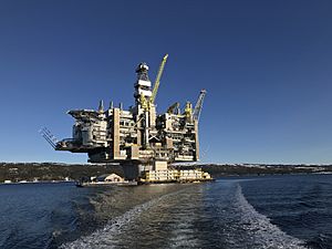
Oil production from offshore oil platforms on the Hibernia, White Rose, and Terra Nova oil fields is a huge part of the economy. In 2006, it made up over 15% of the province's GDP. Total production from Hibernia from 1997 to 2006 was worth an estimated $36 billion.
The mining sector in Labrador is also growing. The iron ore mine at Wabush/Labrador City and the nickel mine in Voisey's Bay produced $3.3 billion worth of ore in 2010. The province produces 55% of Canada's total iron ore.
The fishing industry is still very important. It employs about 20,000 people and adds over $440 million to the GDP. In 2017, the catch of fish like cod and halibut was 92,961 tonnes, worth $141 million. Shellfish like crab and shrimp were even more valuable, at $634 million. aquaculture (fish farming) also produced over $161 million worth of salmon and mussels in 2015.
Agriculture in Newfoundland is limited to certain areas. Farmers grow potatoes, carrots, and cabbage for local use. Poultry and eggs are also produced. Wild blueberries, partridgeberries, and bakeapples are harvested for jams and wine. Dairy farming is also a big part of the agriculture industry.
Making Things: Secondary Sector
Newsprint (paper for newspapers) is made at a paper mill in Corner Brook. It can produce 420,000 tonnes per year. The value of newsprint exports changes depending on the global market. Lumber is also produced by many mills in Newfoundland. Besides seafood processing, paper making, and oil refining, other manufacturing in the province includes smaller industries that make food and beverages.
Providing Services: Tertiary Sector
Service industries make up the largest part of the economy. These include financial services, health care, and public administration. Other important industries are mining, oil production, and manufacturing. In 2017, the average income per person was $62,573, which was higher than the national average.
Tourism is also a big part of the province's economy. In 2017, tourists from outside the province spent an estimated $575 million. Tourism is most popular from June to September, when the weather is warmest.
How the Province is Run: Government and Politics
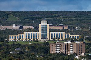
Newfoundland and Labrador has a parliamentary government. This means it has a system where the government is chosen by elected representatives. The Queen of England, Elizabeth II, is the head of state, but she lives in the United Kingdom. Her representative in Newfoundland and Labrador is the Lieutenant Governor of Newfoundland and Labrador, currently Judy Foote.
The Queen and Lieutenant Governor have limited roles in daily government. Their powers are used by the Executive Council, which is a group of ministers. This council is led by the Premier of Newfoundland and Labrador, who is the head of government. The Premier is usually the leader of the political party that wins the most seats in the Newfoundland and Labrador House of Assembly.
There are 40 Members of the House of Assembly (MHAs). Each MHA is elected by voters in their local area. Elections are held every four years, or sometimes earlier if the government loses a vote of confidence.
Historically, politics in the province have been dominated by the Liberal Party and the Progressive Conservative Party. More recently, the New Democratic Party has also gained more support.
Expressing Ourselves: Culture of Newfoundland and Labrador
Visual Arts
Before 1950, visual arts like painting were not as big as music or theatre in Newfoundland. Most early art was by visiting artists.
After Newfoundland and Labrador joined Canada in 1949, government support helped visual artists. Many young Newfoundland artists who studied abroad returned. These included Rae Perlin, Helen Parsons Shepherd, and Reginald Shepherd. The Shepherds even started the province's first art school.
Famous painters like Christopher Pratt and Mary Pratt (painter) returned in 1961. David Blackwood became well-known for his art about Newfoundland culture.
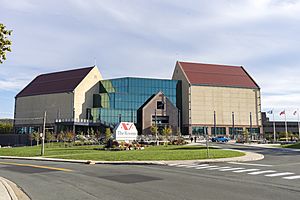
Today, Newfoundland and Labrador's art community is recognized worldwide. Places like The Rooms Provincial Art Gallery and Fogo Island Arts support artists.
Music and Sounds
Newfoundland and Labrador has a rich folk music heritage. It comes from the Irish, English, and Scottish traditions brought here centuries ago. Much of the music is about the strong seafaring tradition, including sea shanties. Some modern traditional musicians include Great Big Sea and The Ennis Sisters.
The Newfoundland Symphony Orchestra started in St. John's in 1962. Memorial University has a music school with various concerts.
Provincial Anthems
The official provincial anthem is the "Ode to Newfoundland." It was written in 1902 by British governor Sir Charles Cavendish Boyle. It was adopted as the official anthem in 1904 and again in 1980. Newfoundland and Labrador is the only Canadian province with an official anthem. It is still sung at public events.
Stories and Words: Literature
Prose Fiction
Margaret Duley (1894–1968) was Newfoundland's first novelist to become famous internationally. Her books include The Eyes of the Gull (1936). Later novelists include Harold Horwood and Percy Janes.
Contemporary Novelists
Michael Crummey is a modern novelist whose books often become bestsellers, like River Thieves (2001). Wayne Johnston's stories are mostly about Newfoundland and Labrador, often set in the past. His novel The Colony of Unrequited Dreams was about politician Joey Smallwood. Lisa Moore's books include short stories and novels. Her novel February tells the story of a woman who lost her husband in the Ocean Ranger oil rig disaster.
Poetry
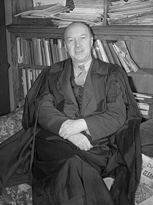
Early poems about Newfoundland were often written by visitors. One of the first was Robert Hayman's Quodlibets in 1628.
After World War II, Newfoundland poet E. J. Pratt wrote about the challenges of life by the sea. His collection Newfoundland Verse (1923) described maritime life and the losses from World War I. He is remembered for his long narrative poems.
More recent poets include Tom Dawe, Mary Dalton, and John Steffler.
Playwrights
In 1967, the St. John's Arts and Culture Centre opened. This led to more plays being written in Newfoundland and Labrador. Playwrights like Cassie Brown, Tom Cahill, and Ted Russell became well-known. Later, Michael Cook and Al Pittman also became important writers.
What Represents Us: Symbols of Newfoundland and Labrador
| Provincial symbols | |
| Official flower | Pitcher plant |
| Official tree | Black spruce |
| Official bird | Atlantic puffin |
| Official horse | Newfoundland pony |
| Official animal | Caribou |
| Official game bird | Ptarmigan |
| Official mineral | Labradorite |
| Official dogs | Newfoundland Dog and Labrador Retriever |
| Provincial anthem | "Ode to Newfoundland" |
| Provincial holiday | 24 June Discovery Day |
| Patron saint | John the Baptist |
| Official tartan | |
| Great seal | |
| Coat of arms | |
| Escutcheon | |
Flags of the Province
Newfoundland and Labrador's current provincial flag was designed by artist Christopher Pratt. It was officially adopted on May 28, 1980.
The flag's colors have special meanings:
- Blue stands for the sea.
- White stands for snow and ice.
- Red stands for the hard work and struggles of the people.
- Gold stands for the confidence of Newfoundlanders and Labradorians.
The blue triangles honor the British heritage. The two red triangles represent Labrador (the mainland) and the island of Newfoundland. The golden arrow points towards a "brighter future."
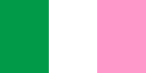
There is also an unofficial flag, often called the "Pink, White and Green" tricolour. It was used by the Star of the Sea Association, a Catholic Church group. Some people mistakenly thought it was the original "Native Flag" of Newfoundland. This flag is popular among those who feel connected to Irish heritage. However, a 2005 poll showed that most Newfoundlanders did not want it to be the official provincial flag.
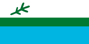
Labrador has its own unofficial flag. It was created in 1973 by Mike Martin, a former politician from Labrador South.
Fun and Games: Sports in Newfoundland and Labrador
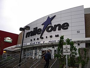
Newfoundland and Labrador has a slightly different sports culture than the rest of Canada. This is partly because of its long history separate from Canada. Ice hockey is still very popular. A professional minor league team, the Newfoundland Growlers of the ECHL, plays in St. John's.
Association football (soccer) and rugby union are more popular here than in other parts of Canada. Soccer games are held at King George V Park, which was built as Newfoundland's national stadium when it was a Dominion. Swilers Rugby Park is home to a rugby club and a regional team.
Gridiron football (American or Canadian) is not very common. It was not until 2013 that the province saw its first amateur teams form.
Cricket used to be popular, especially in the late 1800s and early 1900s. However, it was later replaced by soccer and baseball. With new immigrants, cricket is now gaining interest again.
Getting Around: Transportation in Newfoundland and Labrador
Ferries for Travel
The province's Department of Transportation operates 15 ferry routes. These ferries connect communities along the long coastline.
A ferry service crosses the Strait of Belle Isle. It connects the island of Newfoundland with Labrador on the mainland. This ferry travels from St. Barbe, Newfoundland to Blanc-Sablon, Quebec, which is near L'Anse-au-Clair, Labrador.
Several smaller ferries connect other coastal towns and offshore islands around Newfoundland and up the Labrador coast. There are also ferries that run between Bell Island and Portugal Cove-St. Philip's, and between Fogo Island, Change Islands, and Farewell.
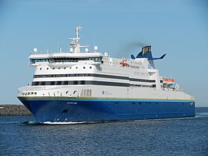
Marine Atlantic, a federal company, provides ferry services between provinces. These ferries carry cars and passengers from North Sydney, Nova Scotia, to Port aux Basques and Argentia on Newfoundland island.
Air Travel
The St. John's International Airport (YYT) and the Gander International Airport (YQX) are the main airports in the province. St. John's International Airport handles almost 1.2 million passengers each year. This makes it the busiest airport in the province and the eleventh busiest in Canada. The Deer Lake Regional Airport (YDF) handles over 300,000 passengers a year.
Railways
The Newfoundland Railway operated on the island of Newfoundland from 1898 to 1988. It was the longest narrow-gauge railway system in North America.
Tshiuetin Rail Transportation operates passenger train service from Sept-Îles, Quebec, to Schefferville, Quebec. This route passes through Labrador and stops in several towns.
See also
 In Spanish: Terranova y Labrador para niños
 | John T. Biggers |
 | Thomas Blackshear |
 | Mark Bradford |
 | Beverly Buchanan |


