Northwest Territories facts for kids
Quick facts for kids
Northwest Territories
Territoires du Nord-Ouest (French)
|
|||
|---|---|---|---|
|
|||
| Country | Canada | ||
| Confederation | July 15, 1870 (5th, with Manitoba) | ||
| Capital | Yellowknife | ||
| Largest city | Yellowknife | ||
| Largest metro | Yellowknife | ||
| Government | |||
| • Type | Parliamentary system, with consensus government | ||
| Area | |||
| • Total | 1,346,106 km2 (519,734 sq mi) | ||
| • Land | 1,183,085 km2 (456,792 sq mi) | ||
| • Water | 163,021 km2 (62,943 sq mi) 12.1% | ||
| Area rank | Ranked 3rd | ||
| 13.5% of Canada | |||
| Population
(2021)
|
|||
| • Total | 41,070 | ||
| • Estimate
(Q2 2024)
|
44,920 | ||
| • Rank | Ranked 11th | ||
| • Density | 0.03/km2 (0.08/sq mi) | ||
| Demonym(s) | Northwest Territorian FR: Franco-Ténois(e) |
||
| Official languages |
|
||
| GDP | |||
| • Rank | 11th | ||
| • Total (2017) | C$4.856 billion | ||
| • Per capita | C$108,065 (1st) | ||
| HDI | |||
| • HDI (2021) | 0.930—Very high ([[List of Canadian provinces and territories by Human Development Index|4th]]) | ||
| Time zone | UTC−07:00 | ||
| • Summer (DST) | UTC−06:00 | ||
| Postal abbr. |
NT
|
||
| Postal code prefix |
X0, X1 (Yellowknife)
|
||
| ISO 3166 code | CA-NT | ||
| Flower | Mountain avens | ||
| Tree | Tamarack larch | ||
| Bird | Gyrfalcon | ||
| Rankings include all provinces and territories | |||
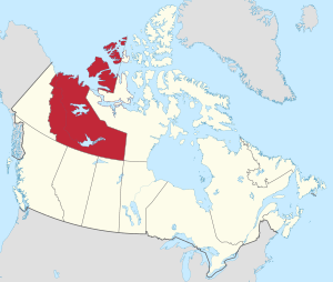
The Northwest Territories (often called NT or NWT) is a large territory in Canada. It is the second largest and most populated of Canada's three northern territories. In 2021, about 41,070 people lived there.
Yellowknife is the capital city. It is also the largest community in the territory. Yellowknife became the capital in 1967. The Northwest Territories joined Canadian Confederation on July 15, 1870. Over time, parts of the territory were used to create new provinces and territories. Its current size was set on April 1, 1999. This happened when Nunavut was created to the east.
The Northwest Territories has a slightly warmer climate than Nunavut. It has both boreal forests (also called taiga) and tundra regions. Its northernmost parts are in the Arctic Archipelago. The territory shares borders with Nunavut to the east and Yukon to the west. It also borders British Columbia, Alberta, and Saskatchewan to the south. It even touches Manitoba at one point. The land area of the Northwest Territories is huge. It is about the same size as France, Portugal, and Spain combined.
Contents
What's in a Name?
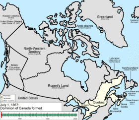
The name "Northwest Territories" describes where it is located. The British government chose this name a long time ago. It showed that the land was northwest of Rupert's Land. The name was shortened from "North-Western Territory."
In Inuktitut, the Northwest Territories is called Nunatsiaq. This means "beautiful land." The northern part is home to the Inuvialuit people. The southern part is called Denendeh. This is an Athabaskan word meaning "our land." Denendeh is a vast area for the Dene people. It stretches from Alaska to Hudson Bay.
People have talked about changing the territory's name. Some suggested using an Indigenous language name. "Denendeh" was one idea. Another funny suggestion was "Bob," which started as a joke.
Exploring the Geography
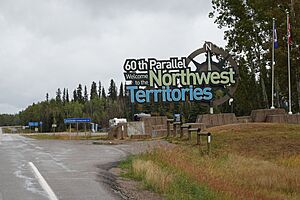
The Northwest Territories is in northern Canada. It borders Yukon to the west and Nunavut to the east. It also touches four provinces: British Columbia, Alberta, Saskatchewan, and Manitoba. The land area is about 1,183,085 km2 (456,792 sq mi).
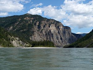
Important natural features include Great Bear Lake. This is the largest lake completely within Canada. Great Slave Lake is also here. It is the deepest body of water in North America, at 614 m (2,014 ft) deep. The Mackenzie River flows through the territory. You can also find the beautiful canyons of Nahanni National Park Reserve. This park is a World Heritage Site. Some islands in the Canadian Arctic Archipelago are part of the territory. These include Banks Island and parts of Victoria Island. The highest point is Mount Nirvana, which is 2,773 m (9,098 ft) tall.
Understanding the Climate
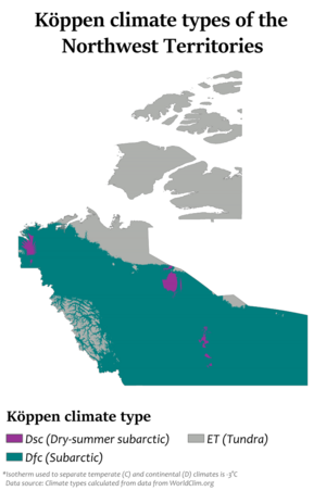
The Northwest Territories is very large. So, its climate changes a lot from south to north. The southern part has a subarctic climate. This means it has long, cold winters and short, mild summers. The islands and northern coast have a polar climate. This means it is very cold all year.
In the north, summers are short and cool. Temperatures are usually around 14–17 °C (57–63 °F) during the day. Winters are long and very harsh. Daytime temperatures are often −20 to −25 °C (−4 to −13 °F). The coldest nights can drop to −40 to −45 °C (−40 to −49 °F).
In the south, summer temperatures can reach 36 °C (97 °F). Winter temperatures can drop to −40 °C (−40 °F). But sometimes they can be warmer, around −10 °C (14 °F). In the north, summer highs can reach 30 °C (86 °F). Winter lows can be −50 °C (−58 °F).
Thunderstorms happen in the south but are rare in the north. Tornadoes are very rare. The territory has a dry climate because of the mountains to the west. About half of the territory is above the tree line. This means there are not many trees in the eastern and northern parts.
| City | July (°C) | January (°C) |
|---|---|---|
| Fort Simpson | 24/11 | −20/−29 |
| Yellowknife | 21/13 | −22/−30 |
| Inuvik | 20/9 | −23/−31 |
| Sachs Harbour | 10/3 | −24/−32 |
A Look at History
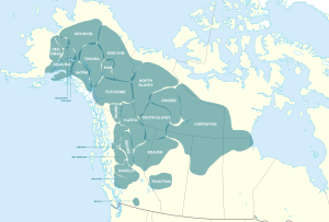
Many Indigenous groups have lived in the Northwest Territories for a very long time. These include the Dene, Inuvialuit, and Métis peoples. The Dene people's traditional lands, called Denendeh, cover much of the territory. The Inuvialuit live along the northern coast. Their land is called Inuvialuit Nunangit.
In 1670, the Hudson's Bay Company (HBC) was formed. They were given control over a large area called Rupert's Land. The Northwest Territories was not officially part of Rupert's Land. But the HBC used it for trading. Europeans came to the region for fur trading and to find new trade routes. One famous route they looked for was the Northwest Passage.
The first residential school in the region opened in Fort Resolution in 1867. More schools opened later.
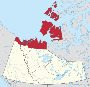
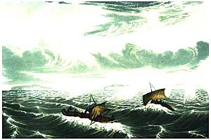
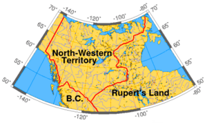
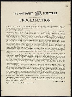
In July 1870, the Northwest Territories became part of Canada. This happened after the Hudson's Bay Company gave its lands to the British Crown, which then gave them to Canada. This huge area included almost all of modern-day Canada. Over the years, parts of the Northwest Territories were used to create new provinces. Manitoba was made larger in 1881. Ontario and Quebec also grew. In 1898, Yukon became a separate territory.
In 1905, Alberta and Saskatchewan were created. They were mostly formed from parts of the Northwest Territories. In 1906, the Canadian Parliament officially changed the name to "Northwest Territories." They removed the hyphen.
In 1925, the territory's borders were extended all the way to the North Pole. This made it much larger. Between 1925 and 1999, the Northwest Territories covered a huge area of 3,439,296 km2 (1,327,920 sq mi). This was more than one-third of Canada! On April 1, 1999, Nunavut was created. It became a separate territory for the Inuit people.
Who Lives Here?
Visible minority and indigenous identity (2016): European Canadian (39.7%) First Nations (32.1%) Inuit (9.9%) Visible minority (9.6%) Métis (8.2%) Other Indigenous responses (0.5%)
The Northwest Territories is one of only two places in Canada where Indigenous peoples are the majority. They make up 50.4% of the population.
In 2016, the main ethnic groups were:
- First Nations – 36.8%
- Canadian – 18.6%
- English – 15.9%
- Scottish – 14.8%
- Irish – 12.3%
- Inuit (Inuvialuit) – 10.9%
- French – 10.3%
- German – 8.3%
- Métis – 7.1%
- Ukrainian – 3.1%
- Yukon became a separate territory in 1898.
- Alberta and Saskatchewan were created from parts of the Northwest Territories in 1905.
- Nunavut was separated from the Northwest Territories in 1999.
Languages Spoken
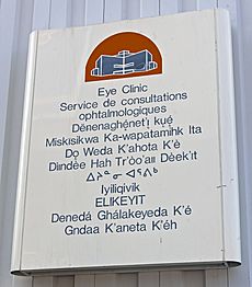
The Northwest Territories has eleven official languages! This means they are recognized by the government. These languages are:
People in the NWT can use any of these languages in court. They can also use them in the legislature (where laws are made). However, laws are only legally binding in English and French. English services are available everywhere. Services in other languages depend on demand.
In 2016, most people (78.3%) spoke English as their first language. Other common languages included Dogrib (Tłı̨chǫ), French, and South Slavey.
Religious Beliefs
In 2021, about 55.2% of people in the NWT were Christian. Most of them were Catholic. A growing number of people (39.8%) said they had no religious affiliation. About 5.0% followed other religions.
Communities and Cities
| Municipality | 2016 |
|---|---|
| Yellowknife | 19,569 |
| Hay River | 3,528 |
| Inuvik | 3,243 |
| Fort Smith | 2,542 |
| Behchokǫ̀ | 1,874 |
The NWT has 33 official communities. They range in size from Yellowknife (about 19,569 people) to Kakisa (36 people). Yellowknife has the largest number of Indigenous peoples. However, Behchokǫ̀ is the largest First Nations community. Inuvik is the largest Inuvialuit community. There is one Indian reserve in the NWT, called Hay River Reserve.
Economy and Resources
The Northwest Territories has a strong economy. In 2017, its economy was worth C$4.856 billion. It has the highest income per person of all Canadian provinces and territories.
Mining for Riches
The territory is rich in natural resources. These include gold, diamonds, natural gas, and oil. Diamonds from the NWT are known as "conflict-free" diamonds. This means they are not linked to conflict or war. Two of the world's biggest mining companies, BHP and Rio Tinto, mine diamonds here.
The Eldorado Mine once produced uranium. This uranium was used for the Manhattan Project. The mine also produced radium, silver, and copper.
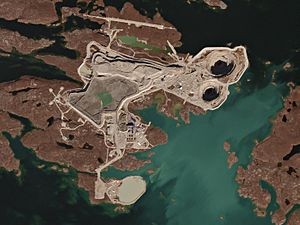
- Eldorado Mine – (radium, uranium, silver, copper)
- Con Mine – (gold)
- Negus Mine – (gold)
- Ptarmigan and Tom Mine – (gold)
- Thompson-Lundmark Mine – (gold)
- Giant Mine – (gold)
- Discovery Mine – (gold)
- Rayrock Mine – (uranium)
- Camlaren Mine – (gold)
- Cantung Mine – (tungsten)
- Echo Bay Mines – (silver and copper)
- Pine Point Mine – (lead and zinc)
- Tundra Mine – (gold)
- Terra Mine – (silver and copper)
- Salmita Mine – (gold)
- Colomac Mine – (gold)
- Ekati Diamond Mine – (diamonds)
- Diavik Diamond Mine – (diamonds)
- Snap Lake Diamond Mine – (diamonds)
Tourism and Adventure
Many visitors come to Yellowknife in winter. They want to see the amazing auroras (Northern Lights). There are five national parks and reserves in the territory. These include Aulavik National Park, Tuktut Nogait National Park, and parts of Wood Buffalo National Park. Other park reserves are Nááts'ihch'oh National Park Reserve, Nahanni National Park Reserve, and Thaidene Nëné National Park Reserve.
Culture and Traditions
Indigenous land claims are important in the NWT. The Inuvialuit Final Agreement was signed in 1984. It was the first land claim agreement in the territory. It led to the creation of Nunavut for the Inuit people.
Another agreement with the Tłı̨chǫ people created the Tli Cho region. This area gives the Tłı̨chǫ their own government and control over some matters. This region includes two of Canada's three diamond mines.
Fun Festivals
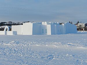
The Northwest Territories hosts several fun festivals. These include the Great Northern Arts Festival. There is also the Snowking Winter Festival and Folk on the Rocks music festival in Yellowknife.
Getting Around
Roads and Highways
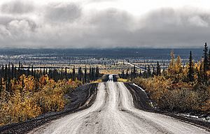
The Northwest Territories has nine main highways. The Mackenzie Highway is the longest. It goes from the Alberta border north to Wrigley, Northwest Territories. Ice roads and winter roads are also very important. They allow people to drive to towns and mines in winter. These places can only be reached by plane at other times.
The Yellowknife Highway connects to Yellowknife. The Dempster Highway goes for over 700 km (430 mi) to Inuvik. Since 2017, the Inuvik-Tuktoyaktuk Highway connects Inuvik to communities along the Arctic Ocean.
Yellowknife did not have a year-round road connection until 2012. Before that, people used a ferry in summer and an ice road in winter. This caused problems when the ice was too thin for cars but too thick for the ferry. During these times, everything had to be flown in.
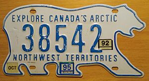
The Northwest Territories is unique in North America. Its licence plates are shaped like a polar bear!
Public Transport
Yellowknife Transit is the only public transportation system in the NWT. It serves the city of Yellowknife.
Air Travel
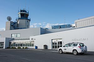
Yellowknife Airport is the busiest airport in the territory. It is the main airport for flights within the NWT. It is a hub for several regional airlines. Major airlines like Buffalo Airways and Canadian North serve destinations in the Northwest Territories.
See also
 In Spanish: Territorios del Noroeste para niños
 | John T. Biggers |
 | Thomas Blackshear |
 | Mark Bradford |
 | Beverly Buchanan |


