
Fort Simpson facts for kids
Quick facts for kids
Fort Simpson
Łı́ı́dlı̨ı̨ Kų́ę́
|
||
|---|---|---|
|
Village
|
||
 |
||
|
||

Fort Simpson
Location in Northwest Territories

Fort Simpson
Location in Canada
|
||
| Country | Canada | |
| Territory | Northwest Territories | |
| Region | Dehcho Region | |
| Constituency | Nahendeh | |
| Census division | Region 4 | |
| Settled | 1803 | |
| Village | 1822 | |
| Village (incorporated) | 1 January 1973 | |
| Area | ||
| • Land | 77.89 km2 (30.07 sq mi) | |
| Elevation | 169 m (554 ft) | |
| Population
(2021)
|
||
| • Total | 1,100 | |
| • Density | 14.1/km2 (37/sq mi) | |
| Time zone | UTC−07:00 (MST) | |
| • Summer (DST) | UTC−06:00 (MDT) | |
| Canadian Postal code |
X0E 0N0
|
|
| Area code(s) | 867 | |
| Telephone exchange | 695 | |
| - Living cost (2018) | 142.5 | |
| - Food price index (2019) | 147.6 | |
| Website | www.fort-Simpson.com | |
| Sources: Department of Municipal and Community Affairs, Prince of Wales Northern Heritage Centre, Canada Flight Supplement 2018 figure based on Edmonton = 100 2019 figure based on Yellowknife = 100 |
||

Fort Simpson is a small village in the Northwest Territories, Canada. It's the only village in this entire Canadian territory! The local Slavey name for the village is Łı́ı́dlı̨ı̨ Kų́ę́, which means "place where rivers come together".
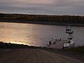
This special village sits on an island where two big rivers meet: the Mackenzie and the Liard. It's about 500 kilometers (310 miles) west of Yellowknife, the capital city. For a long time, these rivers were like highways for trading goods, used by both the Hudson's Bay Company and the local Dene people.
Fort Simpson is an important hub for the Dehcho Region. It's also known as the starting point for adventures to the beautiful South Nahanni River and the amazing Nahanni National Park Reserve. You can get to Fort Simpson by plane, boat, or car. The village has schools for all ages, from elementary to high school. The Mackenzie Highway was built to reach Fort Simpson in the early 1970s.
The main part of the village is on the island. But some industrial areas and homes are along the highway, stretching out to the Fort Simpson Airport. Just past the airport, you'll find the ferry crossing for the Liard River.
Contents
History of Fort Simpson
Early Trading Post Days
Fort Simpson began as a place for fur trading in 1803. It was first called Fort of the Forks. In July 1822, the Hudson's Bay Company built a permanent trading post here. They named it after George Simpson, who was in charge of a large area called Rupert's Land. Until 1910, the village was mostly run by this company, with some help from Anglican and Roman Catholic missions. The Dene people have always known this place as Łı́ı́dlı̨ı̨ Kų́ę́, meaning "the place where the rivers come together". In 1969, it was recognized as a National Historic Site of Canada.
A Special Visitor: Pope John Paul II
In September 1984, Pope John Paul II tried to visit Fort Simpson during his trip to Canada. But thick fog stopped his plane from landing. He spoke to the community over the radio from Yellowknife and promised to visit another time. He kept his promise! In September 1987, he made a special trip to Fort Simpson.
Culture and Festivals
Fort Simpson hosts two main festivals each year. These events bring the community together and celebrate local traditions.
Beavertail Jamboree
The first festival is called the "Beavertail Jamboree." It happens in March. This is a winter carnival filled with fun activities. You can see traditional games, exciting snowmobile races, and talent shows.
Open Sky Festival
The other big festival is the "Open Sky Festival." It takes place every year around the Canada Day long weekend. This festival celebrates different kinds of art. It has been happening annually since 2001.
Festival events include music, theater, and other performances. You can also see traditional Dehcho Dene crafts, visual art, and new media exhibits. There are also workshops and demonstrations. The Open Sky Creative Society, an arts group, organizes this festival.
Local Indigenous Groups
The Dene people in Fort Simpson are represented by the Łı́ı́dlı̨ı̨ Kų́ę́ First Nation. The Métis people are represented by Fort Simpson Métis Local 52. Both of these groups are part of the larger Dehcho First Nations organization.
Climate and Weather
Fort Simpson has a subarctic climate. This means it has very long, cold winters. The summers are warm but short. July temperatures can be quite warm for a northern area, showing how much the climate changes with the seasons.
The weather changes quickly from warm to cold as the days get shorter. Spring and fall are very brief. The year is mostly dominated by winter, and then summer. The average monthly temperatures range from about -24.2°C (-11.6°F) in January to 17.4°C (63.3°F) in July. Most of the rain and snow falls during the summer months.
Temperature Records
The highest temperature ever recorded in Fort Simpson was 36.6°C (97.9°F). This happened on July 25, 1994, and again on July 13, 2014. The coldest temperature ever recorded was a very chilly -56.1°C (-69.0°F) on February 1, 1947.
| Climate data for Fort Simpson (Fort Simpson Airport) WMO ID: 71946; coordinates 61°45′37″N 121°14′12″W / 61.76028°N 121.23667°W; elevation: 169.2 m (555 ft); 1981–2010 normals, extremes 1895–present |
|||||||||||||
|---|---|---|---|---|---|---|---|---|---|---|---|---|---|
| Month | Jan | Feb | Mar | Apr | May | Jun | Jul | Aug | Sep | Oct | Nov | Dec | Year |
| Record high humidex | 12.0 | 13.9 | 15.0 | 26.4 | 31.8 | 35.8 | 41.3 | 39.7 | 32.2 | 24.0 | 11.3 | 14.0 | 41.3 |
| Record high °C (°F) | 13.2 (55.8) |
15.6 (60.1) |
16.1 (61.0) |
25.5 (77.9) |
32.8 (91.0) |
35.0 (95.0) |
36.6 (97.9) |
35.4 (95.7) |
30.0 (86.0) |
25.6 (78.1) |
13.3 (55.9) |
14.5 (58.1) |
36.6 (97.9) |
| Mean daily maximum °C (°F) | −19.8 (−3.6) |
−15.3 (4.5) |
−6.4 (20.5) |
5.8 (42.4) |
15.0 (59.0) |
21.8 (71.2) |
23.7 (74.7) |
20.9 (69.6) |
13.7 (56.7) |
1.8 (35.2) |
−11.5 (11.3) |
−17.5 (0.5) |
2.7 (36.9) |
| Daily mean °C (°F) | −24.2 (−11.6) |
−20.6 (−5.1) |
−13.0 (8.6) |
−0.4 (31.3) |
8.7 (47.7) |
15.3 (59.5) |
17.4 (63.3) |
14.7 (58.5) |
8.2 (46.8) |
−2.0 (28.4) |
−15.5 (4.1) |
−21.7 (−7.1) |
−2.8 (27.0) |
| Mean daily minimum °C (°F) | −28.5 (−19.3) |
−25.9 (−14.6) |
−19.7 (−3.5) |
−6.7 (19.9) |
2.2 (36.0) |
8.8 (47.8) |
11.2 (52.2) |
8.5 (47.3) |
2.6 (36.7) |
−5.9 (21.4) |
−19.4 (−2.9) |
−25.9 (−14.6) |
−8.2 (17.2) |
| Record low °C (°F) | −54.4 (−65.9) |
−56.1 (−69.0) |
−46.7 (−52.1) |
−39.4 (−38.9) |
−22.8 (−9.0) |
−3.9 (25.0) |
−1.1 (30.0) |
−6.1 (21.0) |
−20.6 (−5.1) |
−27.8 (−18.0) |
−46.1 (−51.0) |
−53.3 (−63.9) |
−56.1 (−69.0) |
| Record low wind chill | −59 | −55 | −48 | −44 | −25 | −6 | −3 | −5 | −24 | −35 | −53 | −60 | −60 |
| Average precipitation mm (inches) | 18.9 (0.74) |
17.6 (0.69) |
15.4 (0.61) |
17.0 (0.67) |
29.4 (1.16) |
51.3 (2.02) |
61.1 (2.41) |
61.4 (2.42) |
32.2 (1.27) |
39.4 (1.55) |
24.8 (0.98) |
19.1 (0.75) |
387.6 (15.26) |
| Average rainfall mm (inches) | 0.2 (0.01) |
0.0 (0.0) |
0.1 (0.00) |
2.5 (0.10) |
21.0 (0.83) |
51.2 (2.02) |
61.1 (2.41) |
60.9 (2.40) |
28.5 (1.12) |
12.9 (0.51) |
0.1 (0.00) |
0.0 (0.0) |
238.6 (9.39) |
| Average snowfall cm (inches) | 27.4 (10.8) |
24.2 (9.5) |
19.0 (7.5) |
17.4 (6.9) |
7.6 (3.0) |
0.1 (0.0) |
0.0 (0.0) |
0.5 (0.2) |
4.2 (1.7) |
29.0 (11.4) |
33.4 (13.1) |
24.3 (9.6) |
187.0 (73.6) |
| Average precipitation days (≥ 0.2 mm) | 10.9 | 10.6 | 9.4 | 5.6 | 8.8 | 11.3 | 12.1 | 11.0 | 10.6 | 11.8 | 12.0 | 10.7 | 124.7 |
| Average rainy days (≥ 0.2 mm) | 0.2 | 0.1 | 0.2 | 1.0 | 7.1 | 11.3 | 12.1 | 11.0 | 9.8 | 4.2 | 0.2 | 0.0 | 57.1 |
| Average snowy days (≥ 0.2 cm) | 11.6 | 11.7 | 9.8 | 5.0 | 2.3 | 0.0 | 0.0 | 0.1 | 1.4 | 9.2 | 12.7 | 11.3 | 75.1 |
| Average relative humidity (%) (at 15:00) | 78.8 | 77.2 | 69.3 | 52.5 | 43.6 | 44.8 | 50.5 | 53.7 | 59.2 | 76.7 | 83.2 | 81.1 | 64.2 |
| Mean monthly sunshine hours | 55.7 | 95.1 | 180.6 | 248.6 | 293.4 | 313.0 | 307.1 | 263.8 | 163.9 | 77.8 | 49.4 | 30.0 | 2,078.3 |
| Percent possible sunshine | 28.5 | 38.0 | 49.6 | 56.3 | 53.8 | 53.7 | 53.3 | 53.4 | 42.0 | 25.0 | 22.8 | 17.7 | 41.2 |
| Source: Environment and Climate Change Canada | |||||||||||||
Notable People from Fort Simpson
Many interesting people have connections to Fort Simpson. Here are a few:
- Jim Antoine: He was the eighth leader (premier) of the Northwest Territories.
- William Lafferty: A politician, a Canadian Forces officer, and a newspaper writer.
- Melaw Nakehk'o: An actress, artist, and activist.
- Nick Sibbeston: He was the fourth leader (premier) of the Northwest Territories.
- Dahti Tsetso: An environmentalist and educator from the Tłı̨chǫ people, born in Fort Simpson.
Images for kids
-
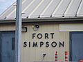
Welcome to Fort Simpson
-
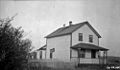
Radio Station, Fort Simpson, circa 1925
-
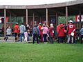
Ehdaa National Historic Site of Canada on Canada Day 2011
-
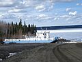
Lafferty ferry dry docked for winter
-
Liard River ferry Lafferty
.jpg)
_(38766481151).jpg)


