Killiniq Island facts for kids

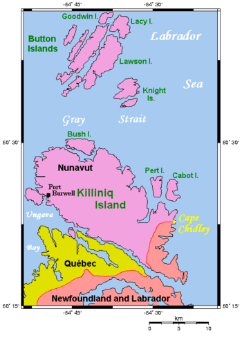
Map of Killiniq Island
|
|
| Geography | |
|---|---|
| Location | Northern Canada |
| Coordinates | 60°24′45″N 64°38′25″W / 60.41250°N 64.64028°W |
| Archipelago | Arctic Archipelago |
| Area | 269 km2 (104 sq mi) |
| Administration | |
|
Canada
|
|
| Province / Territory | Newfoundland and Labrador; and Nunavut |
| Demographics | |
| Population | Uninhabited |
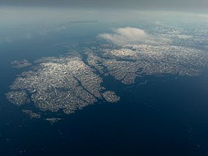
Killiniq Island is a small, faraway island in Canada. Its name means "ice floes" in English. The island is located in the southeastern part of Nunavut.
This island is special because it has the only land border between Nunavut and Newfoundland and Labrador. Most other islands near northern Quebec and Labrador belong only to Nunavut.
Contents
Where is Killiniq Island?
Killiniq Island is found at the very northern tip of Labrador. It sits between Ungava Bay and the Labrador Sea. Some maps might not show the island's borders correctly. For example, some maps might show it as part of Quebec. This is because Quebec and Labrador have had a long disagreement about their border.
Geography of the Island
The northernmost point of Newfoundland and Labrador is on this island. It is called Cape Chidley. The biggest landform on the island is the Torngat Mountains. These mountains are part of the Arctic Cordillera. They stretch from the north to the south of Killiniq Island.
Life on the Island: Past and Present
Killiniq Island used to be home to a small community. This settlement was also called Killiniq. It was known by other names too, like Port Burwell. Europeans knew about this place as early as 1569. It was even marked on an old map called a Mercator map.
A Look Back: The Former Community
Until 1978, the island had a small town. This town had many important services. There was a weather station to record the weather. A Canadian Coast Guard radio station helped ships communicate. It also had a trading post, where people could trade goods. There was a missionary post for religious work. People also used it as a fishing station. Even the Royal Canadian Mounted Police had a post there.
In 1978, the government of the Northwest Territories decided to move everyone off the island. The community was evacuated. It was located on the side of the island that is now part of Nunavut. This area is called the Qikiqtaaluk Region.
Today: An Uninhabited Island
Now, Killiniq Island has no people living on it. It is an uninhabited island. However, one important thing still works there. An automated radio transmitter is still in operation. This transmitter helps the Iqaluit Coast Guard Radio.
See also
 In Spanish: Isla Killiniq para niños
- Isla Killiniq para niños (in Spanish)
 | DeHart Hubbard |
 | Wilma Rudolph |
 | Jesse Owens |
 | Jackie Joyner-Kersee |
 | Major Taylor |


