Northern Canada facts for kids
Quick facts for kids
Northern Canada
Nord du Canada (French)
|
|
|---|---|
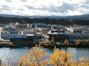
Downtown Whitehorse, Yukon (the territories’ largest city) seen from the east side of the Yukon River
|
|
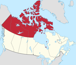
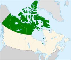
Northern Canada, defined politically to comprise (from west to east) Yukon, Northwest Territories and Nunavut.
|
|
| Country | Canada |
| Territories | |
| Largest city | Whitehorse |
| Area | |
| • Total | 3,535,263 km2 (1,364,973 sq mi) |
| Population
(2021)
|
|
| • Total | 118,160 |
| • Density | 0.0334233/km2 (0.086566/sq mi) |
Northern Canada (in French: Nord du Canada), often called the North or the Territories, is a huge area in the northern part of Canada. It's defined by its geography and its political borders. Politically, it includes the three territories of Canada: Yukon, Northwest Territories, and Nunavut. This region makes up almost half of Canada's total land area. However, less than 0.5% of Canada's people live here.
Sometimes, "northern Canada" means the same as "the far north." This "far north" usually refers to the Canadian Arctic. This part of Canada is north of the Arctic Circle, east of Alaska, and west of Greenland. But often, people treat these two areas as one big region.
Contents
Capital Cities of the North
The three northern territories each have a capital city. From west to east, they are:
Understanding Northern Canada's Regions
Northern Canada can be defined in different ways, like by its climate or its political borders. Here are some ways to look at it:
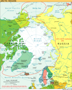
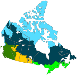
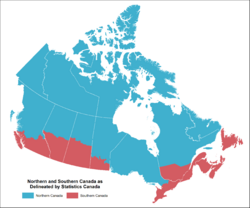
| Climate | Political Borders | Natural Habitats | Development Areas |
|---|---|---|---|
| Areas within the red line are part of the Arctic Region. This is based on their average temperature in the warmest month. | This shows Northern Canada as the three territories. They are generally north of the 60th parallel. | Light blue shows Barren Grounds and tundra. Dark blue shows the taiga and boreal forest. | For development, Northern Canada includes the three territories. It also includes northern parts of seven provinces. This definition is used by groups like the Conference Board of Canada. |
Two Main Subdivisions: Near North and Far North
The Canadian North is often divided into two main parts. These are the near north and the far north. This division is based on their different climates. These climates lead to very different plants, ways of life, and histories.
The Near North: Forests and Fur Trade
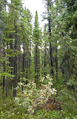
The "near north" is also called the sub-Arctic. It mostly matches the Canadian boreal forest. This is a huge area with many evergreen trees and a subarctic climate.
Historically, this area was home to the Indigenous peoples of the Subarctic. These First Nations people were hunters of moose, fishers in freshwater, and trappers. This region was very important during the North American fur trade. Many Métis people, whose families came from this trade, live here.
From 1670 to 1869, much of this area was called Rupert's Land. It was controlled by the Hudson's Bay Company (HBC). In 1670, King Charles II of England gave the HBC control over all lands that drained into Hudson Bay. This was about 40% of what is now Canada. However, the HBC mostly controlled only the areas around its forts. They needed the cooperation of First Nations for the fur trade. For a long time, the HBC stayed near the coast. Later, they moved inland to compete with other fur traders.
In 1869, the Canadian government bought Rupert's Land from the HBC. They renamed it the Northwest Territories. Soon after, the government made agreements with local First Nations about land. This allowed non-Native people to settle there. It also opened the region for logging, mining, and oil and gas drilling.
In 1896, gold was found in the Yukon. This led to the Klondike Gold Rush from 1896 to 1899. Many people moved to the near north. To manage the growing population in the Klondike, the Yukon Territory was created in 1898.
Today, millions of people live in the near north. About 15% of all Canadians live here. Large parts of the near north are not in the territories. They are the northern parts of provinces like Quebec, Ontario, Manitoba, Saskatchewan, and Alberta. This means they have different political histories. In the late 1800s and early 1900s, Canada made the Northwest Territory smaller. They created new provinces and the Yukon Territory. They also gave some parts of the Northwest Territory to Ontario and Quebec.
The Far North: Tundra and Inuit Culture
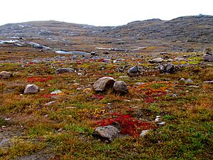
The "far north" is the area north of the tree line. This includes the Barren Grounds and tundra. This region is home to the Inuit people. The Inuit are different from other Indigenous peoples in Canada. They traditionally hunted marine mammals and caribou, especially barren-ground caribou. They also fished and hunted migratory birds.
The Inuit lived in groups, following a hunter-gatherer lifestyle. Their leaders were usually the best hunters or the angakkuq (sometimes called shamans). The fur trade had some impact here, but the whaling industry was more important.
Britain claimed the far north as part of the British Arctic Territories. In 1880, Britain gave this claim to Canada. Canada then added the far north to the Northwest Territories.
The Inuit did not know about these claims. They didn't know their lands were now part of Canada under international law. It wasn't until the 1920s that the Royal Canadian Mounted Police (RCMP) came to enforce Canadian law. This made Canadian control over the region real.
The far north was not part of the early 20th-century land treaties. Instead, the Canadian government recognized aboriginal title to the land. This led to the creation of autonomous territories instead of Indian reserves.
In 1982, people voted on splitting the Northwest Territories. This was followed by another vote in 1992. Most people in the far north voted to create a new territory. This led to the creation of Nunavut in 1999.
Very few non-Indigenous people live in these areas. The people living in the far north make up less than 1% of Canada's total population.
The far north is often divided into western and eastern parts. The eastern Arctic includes Nunavut, Nunavik (part of Quebec), and Nunatsiavut (part of Newfoundland and Labrador). The western Arctic includes the northernmost part of the Northwest Territories and a small part of Yukon. This area is called the Inuvialuit Settlement Region.
| Flag | Arms | Territory | Capital | Area | Population (2021) | Population density |
|---|---|---|---|---|---|---|
 |
 |
Northwest Territories | Yellowknife | 1,346,106 km2 (519,734 sq mi) | 41,070 | 0.031/km2 (0.080/sq mi) |
 |
 |
Yukon | Whitehorse | 482,443 km2 (186,272 sq mi) | 40,232 | 0.083/km2 (0.21/sq mi) |
 |
 |
Nunavut | Iqaluit | 2,038,722 km2 (787,155 sq mi) | 36,858 | 0.018/km2 (0.047/sq mi) |
Territorial Claims in the Arctic
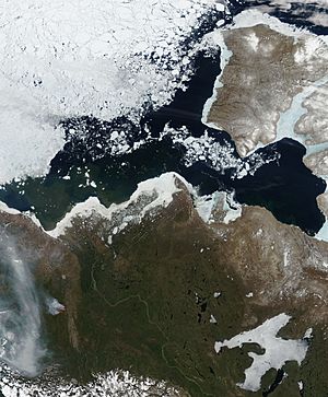
Since 1925, Canada has claimed the part of the Arctic between 60°W and 141°W longitude. This claim extends all the way north to the North Pole. All islands in the Arctic Archipelago and Herschel Island (off the Yukon coast) are Canadian territory. The waters around these islands are also claimed by Canada.
Countries have different ideas about who owns what in the Arctic. Canada and Russia believe their land extends in a "sector" shape to the North Pole. The United States does not agree with this "sector principle." Countries also use claims that undersea features are part of their continental shelf. For example, Denmark (through Greenland) claims territory to the North Pole.
Ships from other countries, both civilian and military, can usually pass through a country's waters if they are not causing harm. This is called "innocent passage." However, this right does not apply to "internal waters," which are like enclosed lakes or waters inside a chain of islands.
Disagreements about these claims are why there are different territorial claims in the Arctic. Most countries recognize Canada's claim, but some, like the United States, do not. Denmark, Russia, and Norway have similar claims in the Arctic. The European Union and the United States oppose these claims.
This is especially important for the Northwest Passage. Canada says this passage is part of Canadian Internal Waters because it is close to Canadian islands. But the United States says it is in international waters. For now, ice and cold temperatures make this less of an issue for shipping. However, climate change might make the passage easier to use. As the polar ice cap melts, Canada and Russia also become closer to each other.
People and Population in the North
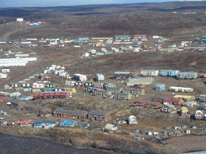
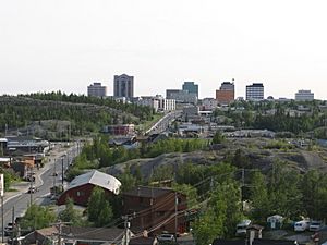
If we look at the three northern territories, they cover about 3,921,739 square kilometers. This is about 39.3% of Canada's total land area.
Even though it's a huge area, very few people live there. In 2021, only about 118,160 people lived in the North. This is very small compared to the 36,991,981 people in the rest of Canada.
The North has a very low population density. It's about 0.03 people per square kilometer. For comparison, Canada as a whole has about 4.2 people per square kilometer.
The region has many natural resources, like minerals. But it's very expensive to get them out of the ground. Also, these areas are often very sensitive to environmental changes. Even though the average income per person is higher than in other parts of Canada, the region is still quite poor. This is because most goods are very expensive. The Canadian government also provides a lot of financial help to the region.
In 2016, more than half (53.3%) of the people in the three territories were Indigenous. This includes Inuit, First Nations, or Métis people. The Inuit are the largest group of Indigenous peoples in Northern Canada. About 53% of all Inuit in Canada live in the North. Nunavut alone is home to 46.4% of them. The region also has several First Nations groups, mainly Dene people. The Chipewyan are the largest Dene subgroup. Each of the three territories has a higher percentage of Indigenous people than any of Canada's provinces. There are also many people who have moved there from other parts of the world. Yukon has the most non-Indigenous people, while Nunavut has the fewest.
As of 2021, the largest community in Northern Canada is Whitehorse. It is the capital of Yukon and has 28,201 people. The second largest is Yellowknife, the capital of the Northwest Territories, with 20,340 people. Third is Iqaluit, the capital of Nunavut, with 7,429 people.
|
Largest cities or towns in Northern Canada
Statistics Canada 2021 |
||
|---|---|---|
| Rank | Pop. | |
| 1 | Whitehorse | 28,201 |
| 2 | Yellowknife | 20,340 |
| 3 | Iqaluit | 7,429 |
| 4 | Hay River | 3,169 |
| 5 | Inuvik | 3,137 |
| 6 | Rankin Inlet | 2,975 |
| 7 | Arviat | 2,864 |
| 8 | Fort Smith | 2,248 |
| 9 | Baker Lake | 2,061 |
| 10 | Igloolik | 2,049 |
Recent Population Changes
Some towns and cities in the North have seen population growth. This hasn't happened for many decades. Yellowknife has become a major center for diamond production in Canada. Canada is now one of the top three diamond-producing countries.
In the 2006 Canadian Census, the combined population of the three territories reached over 100,000 people. This was the first time in Canadian history.
Land and Landscape (Topography)
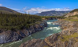
Most of the Arctic is covered by permanent ice and the Canadian Arctic tundra. This is the area north of the tree line. But it also has different types of land. The Innuitian Mountains are part of the Arctic Cordillera mountain system. They are geologically different from the Arctic Region, which is mostly flat lowlands.
The Arctic Lowlands and Hudson Bay Lowlands are a big part of the geographic region. They are often considered part of the Canadian Shield. The ground in the Arctic is mostly made of permafrost. This is ground that stays frozen all year. Permafrost makes building difficult and farming almost impossible.
The Arctic watershed collects water from northern Manitoba, Alberta, British Columbia, most of the Northwest Territories and Nunavut, and parts of Yukon. This water flows into the Arctic Ocean, including the Beaufort Sea and Baffin Bay. The Mackenzie River is Canada's longest river. It drains most of this huge watershed. Other important parts of this watershed are the Peace and Athabasca rivers. Also, Great Bear Lake and Great Slave Lake are the largest lakes entirely within Canada. All these waters eventually join the Mackenzie River.
Climate of the North
General Climate Overview
Much of mainland Northern Canada has a subarctic climate. Most of the Arctic Archipelago and northern coasts have a tundra climate. Some parts of the Arctic Cordillera have an ice cap climate.
For more than half the year, Northern Canada is covered in snow and ice. Coastal areas are a bit warmer due to the ocean. But temperatures generally stay below freezing from October to May. During the coldest three months, average monthly temperatures range from about -29°C (-20°F) in the south to -34°C (-30°F) in the north. Temperatures can even drop to -48°C to -51°C (-55°F to -60°F). Because the air is very dry and cold, snowfall is often light.
During the short summers, most of Northern Canada is free of snow. The Arctic Cordillera, however, stays covered with snow and ice all year. In summer, temperatures average below 7°C (45°F). But they can sometimes go above 18°C (65°F). Most of the rain falls in the summer months. It ranges from 2.5 to 5 cm (1 to 2 inches) in the northernmost islands. It can be up to 18 cm (7 inches) at the southern end of Baffin Island.
 | Audre Lorde |
 | John Berry Meachum |
 | Ferdinand Lee Barnett |


