Peace River facts for kids
Quick facts for kids Peace River |
|
|---|---|
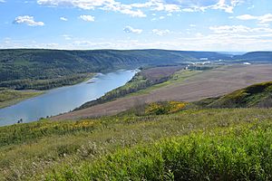
Peace River Valley in BC
|
|
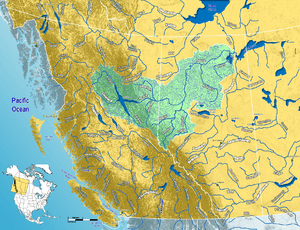
Map of the Peace River watershed in western Canada
|
|
| Native name | Rivière de la Paix |
| Country | Canada |
| Province | British Columbia, Alberta |
| Cities | Fort Saint John, British Columbia, Peace River, Alberta |
| Physical characteristics | |
| Main source | Finlay River Thutade Lake, British Columbia 1,140 m (3,740 ft) 57°04′29″N 126°53′36″W / 57.07472°N 126.89333°W |
| 2nd source | Parsnip River Near Mount Barton, British Columbia 1,716 m (5,630 ft) 54°30′02″N 121°26′26″W / 54.50056°N 121.44056°W |
| River mouth | Slave River Confluence of Peace with Athabasca River, Alberta 59°00′01″N 111°24′38″W / 59.00028°N 111.41056°W |
| Length | 1,923 km (1,195 mi) |
| Basin features | |
| River system | Mackenzie River watershed |
| Basin size | 306,000 km2 (118,000 sq mi) |
| Tributaries |
|
The Peace River (French: rivière de la Paix) is a very long river in Canada. It stretches for about 1,923-kilometre-long (1,195 mi). The river starts high up in the Rocky Mountains in northern British Columbia. From there, it flows northeast through northern Alberta.
The Peace River eventually joins the Athabasca River. Together, they form the Slave River. The Slave River then flows into the Mackenzie River. The Finlay River is the main source of the Peace River. It is also considered the ultimate source of the huge Mackenzie River system. The entire Finlay–Peace–Slave–Mackenzie river system is one of the longest in the world!
Contents
History of the Peace River
The areas along the Peace River have a rich history. They are the traditional home of the Danezaa people. Europeans called them the Beaver people.
Early Explorers and Traders
A fur trader named Peter Pond is thought to have visited the river in 1785. Later, in 1788, Charles Boyer set up a fur trading post. This post was located where the Peace River meets the Boyer River.
Between 1792 and 1793, the famous explorer Alexander Mackenzie traveled up the river. He went all the way to the Continental Divide. Mackenzie called the river Unjegah. This was a native word meaning "large river."
Peace Treaty and Settlements
For many years, there were conflicts between the Danezaa and the Cree people. The Cree were stronger during this time. However, a serious disease, a smallpox epidemic, hit the Cree in 1781. This greatly weakened them.
After this, the "Treaty of the Peace" was made. People celebrated it by smoking a ceremonial pipe. This treaty made the Peace River a border. The Danezaa lived to the North, and the Cree lived to the South.
In 1794, another fur trading post was built. It was located on the Peace River at Fort St. John. This was the first non-native settlement on the mainland of British Columbia.
Life Along the River Today
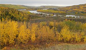
The fertile soil in the Peace River valley in Alberta has been used for farming for a long time. People have been growing wheat there since the late 1800s. Today, farmers in the region also grow other grains.
The Peace River area is also important for its natural resources. It produces a lot of oil and natural gas. There are also plants along the river that make pulp and paper.
The Peace River has two parts that ships can travel on. These parts are separated by the Vermilion Chutes. These chutes are near Fort Vermilion.
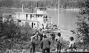
The first steam-powered ship on the Peace River was the Grahame. It was built by the Hudson's Bay Company. Later, other ships were built to travel the river. Many of these early ships used wood for fuel. The last cargo ship, the Watson's Lake, stopped operating in 1952.
Geography of the Peace River
The Peace River is about 1,923 kilometres (1,195 mi) long. This measurement is from the start of the Finlay River to Lake Athabasca. The river drains a huge area, covering about 302,500 square kilometres (116,800 sq mi).
River's Path
A large human-made lake, Williston Lake, was created on the upper part of the river. This happened when the W. A. C. Bennett Dam was built. The dam helps create hydroelectric power. Before the lake was formed, the Finlay River and Parsnip River met at a place called Finlay Forks.
Today, the river flows into Dinosaur Lake. This is another reservoir for the Peace Canyon Dam. After the dams, the river flows east into Alberta. Then it continues north and east into the Peace–Athabasca Delta in Wood Buffalo National Park. This delta is at the western end of Lake Athabasca. Water from the delta flows into the Slave River. It then reaches the Arctic Ocean through the Great Slave Lake and Mackenzie River.
Towns and Parks Along the River
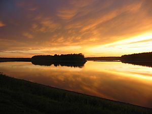
Several towns are located right on the Peace River:
- Hudson's Hope, British Columbia
- Taylor, British Columbia
- Peace River, Alberta
- Fort Vermilion, Alberta
Many provincial parks and wildland reserves are also found along the river. These include Butler Ridge Provincial Park and Peace River Corridor Provincial Park in British Columbia. In Alberta, you can find Dunvegan Provincial Park and Wood Buffalo National Park.
Some Indian reserves are also located on the river banks. Examples include Beaver Ranch 163 and Peace Point 222.
Rivers Joining the Peace River
Many smaller rivers and creeks flow into the Peace River. These are called tributaries.
- From Williston Lake
- Finlay River
- Omineca River
- Parsnip River
- From Northeastern British Columbia
- Halfway River
- Moberly River
- Pine River
- Beatton River
- Kiskatinaw River
- From Alberta
- Pouce Coupe River
- Clear River
- Montagneuse River
- Smoky River
- Heart River
- Whitemud River
- Cadotte River
- Notikewin River
- Wolverine River
- Buffalo River
- Keg River
- Boyer River
- Caribou River
- Wabasca River
- Lawrence River
- Mikkwa River
- From Lake Claire
- Birch River
- McIvor River
See also
 In Spanish: Río de la Paz (Canadá) para niños
 | John T. Biggers |
 | Thomas Blackshear |
 | Mark Bradford |
 | Beverly Buchanan |


