
Rocky Mountains facts for kids
Quick facts for kids Rocky Mountains |
|
|---|---|
| The Rockies (en), Les montagnes Rocheuses (fr), Montañas Rocosas, Rocallosas (es) | |
 |
|
| Highest point | |
| Peak | Mount Elbert |
| Elevation | 14,440 ft (4,400 m) |
| Dimensions | |
| Length | 3,000 mi (4,800 km) |
| Area | 300,000 sq mi (780,000 km2) |
| Geography | |
| Country |
|
| Range coordinates | 44°09′N 113°48′W / 44.15°N 113.80°W |
| Parent range | North American Cordillera |
| Geology | |
| Age of rock | |
| Type of rock | |
The Rocky Mountains, often called the Rockies, are a huge mountain range in western North America. They stretch across 3,000 miles from northern Western Canada all the way down to New Mexico in the Southwestern United States. This giant mountain system crosses through two countries, six American states, and two Canadian provinces. Because of their giant size, the Rockies are the longest mountain chain on the continent.
These mountains are famous for their tall peaks, deep valleys, and beautiful wilderness areas. Many peaks rise more than 14,000 feet into the sky. The highest point in the entire system is Mount Elbert in Colorado. People from all around the world visit the Rockies to enjoy outdoor fun like hiking, camping, and skiing. They are also home to thousands of wild animals, including grizzly bears, elk, and bighorn sheep.
Contents
- What Are the Rocky Mountains and Where Are They?
- How the Rocky Mountains Formed: Geology and Rocks
- Climate and Life Zones in the Rockies
- People and History in the Mountains
- Working and Playing in the Rockies
- Famous Peaks of the Rocky Mountains
- Staying Safe in the High Mountains
- Amazing Facts About the Rocky Mountains
- Images for kids
- See Also
What Are the Rocky Mountains and Where Are They?

The Rocky Mountains form the eastern part of a huge system called the North American Cordillera. A cordillera is a big group of connected mountain ranges. The Rockies are different from ranges that sit farther west, like the Cascade Range and the Sierra Nevada. In straight-line distance, the mountains stretch an incredible length through wild lands and snowy forests.
In Canada, the northern end of the range begins near the Liard River in British Columbia. Some scientists say the northernmost foothills reach even higher toward the Brooks Range and British Mountains. In the south, the range ends near the Albuquerque metropolitan area and Santa Fe, New Mexico. There, the high ridges stand close to the Sandia–Manzano Mountains and the sunny desert.
How the Mountains Are Named
The name "Rocky Mountains" comes from Native American words. Specifically, it comes from the Plains Cree language, an Algonquian language spoken on the northern plains. The Cree people used the word asinîwaciy, which means "rocky mountain" or "stony mountain." French explorer Jacques Legardeur de Saint-Pierre wrote the French name down in his journal in 1752 as "montagnes de Roche."
Other Native American nations had their own descriptive names for the towering ridges. The Cree also used the name Aseniwuche to describe parts of the high ground. As more traders and explorers traveled west, people began using the word "Rockies" as a friendly nickname. Today, people all over the planet know them by this historic name.
Main Regions and Subranges

The Rockies are made of dozens of smaller mountain groups called subranges. High valleys, wide basins, and rolling tablelands separate these subranges from one another. On the eastern side, the mountains rise sharply out of the flat Interior Plains. These eastern ranges include the Front Range and the Sangre de Cristo Mountains in Colorado and New Mexico. Other eastern groups are the Bighorn Mountains and the Wind River Range in Wyoming, and the Clark Range in Alberta.
Central subranges include the Uinta Mountains of Utah and Wyoming, which run from east to west instead of north to south. Near the Utah border lie the La Sal Mountains, the Abajo Mountains, and the Henry Mountains. Further north sits the jagged Teton Range, famous for its tall, steep spires. On the western side, ranges like the Wasatch Range near Salt Lake City and the Bitterroot Range mark the border between Idaho and Montana.
In Canada, the Canadian Rockies have their own special regions. Geographers divide them into the Northern Rockies, which include the Muskwa Ranges and Hart Ranges, and the Continental Ranges. The western border of the Canadian Rockies features the Rocky Mountain Trench. This trench is a very long, straight valley that stretches hundreds of miles through British Columbia.
The Continental Divide and River Systems

The Rocky Mountains contain the famous Continental Divide of the Americas. This imaginary line runs along the high mountain ridges and decides which way water flows across North America. Rain or snow that falls on the western side of the divide flows toward the Pacific Ocean. Water that falls on the eastern side flows toward the Atlantic Ocean or the Gulf of Mexico.
In Glacier National Park in Montana, a special peak called Triple Divide Peak sends water in three directions. Water from this single mountain flows to the Pacific Ocean, the Atlantic Ocean, and north toward Hudson Bay. In the Canadian north, large rivers like the Athabasca River feed water into the giant Mackenzie River. The Mackenzie then empties into the icy Beaufort Sea in the Arctic Ocean.
Other great rivers begin in the melting snow of the Rockies. The famous Rio Grande starts high in the mountains and runs south through New Mexico and Texas. The Platte River carries melted snow east across the plains. These mountain streams supply drinking water, irrigate farmland, and create electricity for millions of people living far downstream.
How the Rocky Mountains Formed: Geology and Rocks
The story of the Rocky Mountains begins deep inside the Earth billions of years ago. The rocks that make up these peaks are much older than the mountains themselves. Deep within the core of the range, geologists find ancient metamorphic rock that formed during the Precambrian time. Some pieces of metamorphic and igneous rock in Montana's Beartooth Mountains are more than 3.3 billion years old.
Hundreds of millions of years ago, during the Paleozoic era, a shallow sea covered much of western North America. Marine creatures lived and died in this warm water, leaving behind thick layers of shells and mud. Over millions of years, these layers turned into sedimentary rock, such as limestone and dolomite. Today, scientists find fossils of ancient sea creatures high up on dry mountain tops.
The Ancient Rockies and Early Collisions
Around 300 million years ago, tectonic forces pushed the Earth's crust upward to form the Ancestral Rocky Mountains. These old mountains were mostly made of Precambrian rock pushed through the limestone layers. Over millions of years during the Mesozoic Era, wind and rain wore these ancient peaks down until they were nearly flat. The crumbled pieces became new layers of sedimentary rock that buried the ancient cores.
About 350 million years ago, giant chunks of land called Terranes began crashing into the western edge of North America. This long period of mountain-building was the Antler orogeny. For a very long time, these collisions only affected lands near the Pacific coast. However, the moving plates continued to squeeze the continent, setting the stage for bigger events deep inland.
The Laramide Orogeny

The modern Rocky Mountains formed during an event called the Laramide orogeny. This massive mountain-building event happened between 80 million and 55 million years ago. Usually, when an oceanic plate slides under a continental plate, a process called subduction, it dives down at a steep angle. This steep angle creates volcanoes close to the coastline, like the Cascades.
During the Laramide event, the ancient Farallon Plate slid underneath the North American Plate at a very shallow angle. Instead of sinking quickly, it scraped along the bottom of the continent for hundreds of miles. This flat sliding pushed rocks upward far inland, creating giant folds and cracks called thrust faults. In Canada, this squeezed the land like a rug sliding across a smooth floor, bunching rocks up into tall ridges.
As the crust crumpled, huge sheets of rock piled on top of each other. At first, the Rockies formed a high, flat area much like the Tibetan Plateau in Asia today. Over millions of years, rain, wind, and rivers wore down the high plateau. This erosion carved away softer surface rocks, creating the jagged peaks, canyons, and towers we see today.
How Glaciers Shaped the Peaks

During the Pleistocene epoch, often called the ice age, massive sheets of ice covered the northern parts of the world. Huge rivers of ice called glaciers moved slowly down the mountain valleys. As these glaciers slid downhill, they acted like giant bulldozers, scooping up dirt and grinding down solid rock.
Glaciers carved sharp, bowl-shaped hollows called cirques into the sides of tall peaks. They also turned narrow, V-shaped river valleys into broad, steep-sided U-shaped valleys. In places like Glacier National Park, visitors can still see active glaciers like Jackson Glacier. Although many glaciers have shrunk over the past century, their ice continues to supply fresh water to mountain streams.
Climate and Life Zones in the Rockies

Because the Rocky Mountains are so long and tall, they feature many different climates. In the northern mountains of Canada, winters are freezing cold and long, with temperatures dropping far below zero. In the southern ranges of New Mexico, summers can be warm and dry. High peaks often receive up to 60 inches of precipitation every year, mostly as heavy snow, while sheltered valleys receive very little rain.
Because temperature and moisture change as you climb higher, scientists divide the mountains into different life zones. Each life zone has its own special collection of plants and animals that are adapted to the local conditions:
- Plains Zone: Found at the base of the mountains, dominated by grasses of the Great Plains.
- Foothills Zone: Found on lower slopes, filled with scrub oak, pinyon pines, and juniper bushes.
- Montane Zone: Mid-level forests containing tall ponderosa pines, Douglas firs, and colorful quaking aspen trees.
- Subalpine Zone: High-altitude forests featuring tough lodgepole pines, western hemlock, and Engelmann spruce.
- Alpine Tundra: Cold, windy areas above the tree line where only tiny, hardy plants can survive.
Plant Life Across the Elevations
Plants in the Rockies have developed clever ways to survive harsh weather. Down in the dry foothills, trees like pinyon pines have waxy needles that trap moisture during hot summer days. Quaking aspens grow in large family groups connected underground by their roots. In the autumn, their leaves turn brilliant shades of gold and orange, lighting up whole hillsides.
Near the tops of the highest peaks, the wind blows too hard and it is too cold for normal trees to grow. This boundary is called the tree line. Just below the tree line, trees like the whitebark pine and bristlecone pine become twisted and bent into weird shapes called krummholz. Above the tree line, in the Alpine tundra, plants grow very low to the ground to hide from the wind, forming dense cushions of tiny leaves and bright flowers.
Wildlife of the Rocky Mountains

The Rocky Mountains provide safe homes for some of the most famous wild animals in North America. North America's largest herds of elk roam the meadows and forests, especially in the Alberta–British Columbia foothills forests. In early autumn, male elk make loud calling sounds called bugles to attract mates and warn rivals. Giant western moose wade through mountain ponds, eating water plants and willow branches.
On steep, rocky cliffs, mountain goats and bighorn sheep hop along tiny rock ledges where predators cannot follow. Their special hooves have rough, rubbery pads that grip rocks like climbing shoes. Down in the open meadows, speedy pronghorn run across the grassy flats, while mule deer and white-tailed deer browse among the bushes. Small animals like badgers, ground squirrels, and pikas also thrive among the rocks.
Many powerful meat-eating hunters live across the mountain system:
- Grizzly bear: Very large bears with dish-shaped faces and big shoulder humps, found in northern ranges.
- American black bear: Smaller, agile bears that climb trees easily and eat berries, insects, and nuts.
- Wolf: Social pack hunters that travel great distances across the wild valleys.
- North American cougar: Sleek, quiet big cats that hunt deer and sheep on steep slopes.
- Canada lynx: Wild cats with thick fur coats and wide, snowshoe-like paws for walking on deep snow.
- Wolverine: Tough, strong members of the weasel family that can hike across snowy peaks in winter.
- Coyote: Smart, adaptable canines found hunting mice and rabbits in valleys and meadows.
Bird species are plentiful too. The magnificent bald eagle and speedy peregrine falcon ride rising air currents above the cliffs. High on the cold tundra, the white-tailed ptarmigan changes the color of its feathers from speckled brown in summer to pure white in winter to hide from enemies. Lakes and rivers support lovely trumpeter swans, while clear mountain streams provide homes for the rare greenback cutthroat trout and the ancient white sturgeon.
People and History in the Mountains
Indigenous Nations of the Rockies

People have lived in the Rocky Mountains for thousands of years. After the last ice age ended, early Native American hunters followed giant animals into the valleys. These early people hunted the mammoth and the huge ancient bison, which was much bigger than bison living today. Over thousands of years, Native Americans learned to live in balance with the mountain environment.
Many distinct nations made their homes in or near the Rockies. These included the Blackfoot, Crow Nation, Flathead, Shoshone, Bannock, Cheyenne, and Arapaho in the northern and central areas. In the south lived the Ute Tribe, Apache, and Sioux. In Canada, tribes like the Ktunaxa, Sekani, and Dunne-za lived in the valleys. Along the Continental Divide in Colorado, archaeologists have found ancient stone game drive walls built more than 5,000 years ago to guide animals toward hunters.
Native tribes traveled with the seasons. In winter, they stayed in lower valleys or moved out to the plains to hunt bison. In summer, they hiked high into the mountains to catch fish, hunt elk and deer, and collect nutritious roots and sweet berries.
European Explorers and Mountain Men
.jpg)
European explorers arrived in the Rocky Mountain region starting in the 1500s. The Spanish explorer Francisco Vázquez de Coronado led an expedition into the southern regions in 1540. Later, in 1610, the Spanish established the town of Santa Fe, New Mexico, near the southern tip of the range. The arrival of European tools, horses, and firearms brought big changes to the lives of Native nations.
In 1793, Sir Alexander Mackenzie became the first European to cross the Canadian Rockies to reach the Pacific Ocean. He traveled along rivers and rugged trails, finally reaching the ocean at Bella Coola, British Columbia. A decade later, the American Lewis and Clark Expedition crossed the Rockies between 1804 and 1806. They mapped routes, met Native tribes, and collected plant and animal samples for scientists back east.
During the early 1800s, adventurous trappers called mountain men roamed the high valleys. They were looking for beaver pelts, which were valuable for making fancy hats in Europe and eastern cities. Famous trappers included Jim Bridger, Kit Carson, and Jedediah Smith. Companies like the Hudson's Bay Company and the North West Company built trading posts, like Rocky Mountain House in Alberta, where traders and Native hunters exchanged furs for goods.
Settlers, Gold Rushes, and Railroads

In the 1840s, thousands of American pioneers began traveling west on the famous Oregon Trail. Families packed their belongings into covered wagons and crossed the Continental Divide through South Pass in Wyoming. In 1847, Mormon pioneers moved into the valley near the Great Salt Lake in Utah, building farms and towns along the base of the Wasatch Range.
Between 1859 and 1864, prospectors discovered gold in Colorado, Idaho, Montana, and British Columbia. These discoveries sparked wild gold rushes. Thousands of miners rushed to the mountains, setting up tent camps that quickly grew into bustling mining towns like Aspen, Colorado. The gold produced by Idaho mines even helped fund the Union Army during the American Civil War.
To connect the growing towns with the rest of the continent, companies built great railroads across the mountains. The first American transcontinental railroad was finished in 1869. In Canada, workers built the Canadian Pacific Railway through difficult passes like Kicking Horse Pass and Rogers Pass, finishing the line in 1885. Trains allowed settlers, heavy machinery, and visitors to travel easily into the rugged wilderness.
Working and Playing in the Rockies
Natural Resources and Industry
The Rocky Mountains hold rich deposits of valuable minerals. Deep mines produce copper, silver, gold, lead, and zinc. Mountains near Leadville, Colorado, contained the Climax mine, which once produced most of the world's supply of molybdenum, a metal used to make super-strong steel. Canada's largest coal mines are located near Fernie, British Columbia, and Sparwood, British Columbia.
Energy production is another major industry in the region today. Deep rock formations hold large pools of petroleum and natural gas. Basins like the San Juan Basin and the Powder River Basin produce coalbed methane, which supplies energy to heat homes and power businesses. In addition, logging provides wood for construction, and ranchers raise cattle and sheep on mountain pastures.
Protecting Nature: National Parks

As more people moved west, leaders realized that these beautiful landscapes needed protection. In 1872, the United States established Yellowstone National Park in Wyoming, Montana, and Idaho. It was the very first national park in the world. Yellowstone is famous for its bubbling mud pots, colorful hot springs, and shooting geysers like Castle Geyser.
In Canada, leaders created wonderful national parks along the railroad route, including Banff National Park, Jasper National Park, Yoho National Park, and Kootenay National Park. In 1932, Waterton Lakes National Park in Alberta and Glacier National Park in Montana were joined together as the Waterton-Glacier International Peace Park, celebrating friendship between two nations.
Today, millions of people visit these parks every year:
- In the United States: Grand Teton National Park, Rocky Mountain National Park, Great Sand Dunes National Park and Preserve, and Flathead Lake.
- In Canada: Mount Robson Provincial Park, Mount Assiniboine Provincial Park, and Northern Rocky Mountains Provincial Park.
Outdoor Fun and Tourism

Tourism is one of the most important parts of the modern Rocky Mountain economy. Every summer, travelers come to camp under the stars, hike along pine-scented trails, and fish for trout in cold streams. Photographers love to take pictures of bright turquoise lakes like Peyto Lake, which get their unique color from tiny bits of rock ground up by glaciers, called rock flour.
When cold weather arrives, the mountains transform into a winter playground. Snow falls deep on the slopes, attracting skiers and snowboarders from all around the world. Famous ski towns like Aspen, Vail, and Banff welcome guests to slide down snowy trails and ride warm chairlifts up the peaks. The love for these mountains runs so deep that musician John Denver wrote a famous song called "Rocky Mountain High," which is now an official state song of Colorado.
Famous Peaks of the Rocky Mountains

The Rocky Mountains contain hundreds of tall peaks, including over 50 mountains that rise above 14,000 feet in Colorado alone. Mountain climbers call these giant peaks "fourteeners." Climbers travel from all over to test their skills on these high, rocky summits.
Here are some of the most prominent summits in the Rocky Mountains:
| Mountain Name | Elevation (Meters) | Elevation (Feet) | Location |
|---|---|---|---|
| Mount Robson | 3,959 m | 12,989 ft | British Columbia, Canada |
| Mount Elbert | 4,401 m | 14,440 ft | Colorado, United States |
| Mount Columbia | 3,741 m | 12,274 ft | Alberta / British Columbia |
| Cloud Peak | 4,013 m | 13,167 ft | Wyoming, United States |
| Gannett Peak | 4,209 m | 13,809 ft | Wyoming, United States |
| Mount Assiniboine | 3,616 m | 11,864 ft | Alberta / British Columbia |
| Mount Edith Cavell | 3,363 m | 11,033 ft | Alberta, Canada |
Staying Safe in the High Mountains
Visiting the Rocky Mountains is exciting, but the high wilderness requires preparation and care. Weather in the mountains can change very quickly. A sunny morning can turn into a cold afternoon with heavy thunderstorms, lightning, and hail. In winter, deep snow can slide downhill in dangerous avalanches, and temperatures can drop far below zero.
Visitors must also respect local wildlife. Bears, moose, and mountain lions are wild animals that need plenty of space. Park rangers teach hikers to carry bear spray, make noise while walking through thick woods, and store food in bear-proof containers. By staying on marked trails, packing warm clothes, and respecting the animals, visitors can safely enjoy the beauty of the Rocky Mountains.
Amazing Facts About the Rocky Mountains
- The highest point in the Rocky Mountains is Mount Elbert in Colorado. It stands at 14,440 feet (4,401 meters) above sea level. That is almost three miles high!
- The name "Rocky Mountains" was likely given by Indigenous peoples who described the mountains as "rocky" because of their jagged, stony appearance.
- The Rockies are often called the "Water Tower of North America." The snow that falls on the peaks in the winter melts in the spring and summer, providing fresh water for millions of people, farms, and animals living in the dry lands below.
- Many of the towns in the Rockies, like Aspen or Telluride, started as mining camps. People came from all over the world to dig for gold and silver. Today, these towns are famous for skiing and mountain biking instead.
Images for kids
-
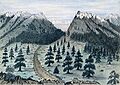
The historic Cherokee Trail near Fort Collins, Colorado, in an 1859 sketch
-
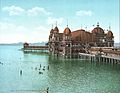
The historic Saltair Pavilion on the shore of the Great Salt Lake
-
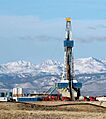
A natural gas drilling rig near the Wind River Range in Wyoming
-
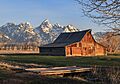
The historic John Moulton Barn with the Teton Range behind it
-
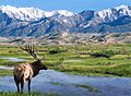
Elk gathered near Big Spring Creek
-
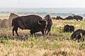
Bison grazing peacefully in a wildlife refuge
-
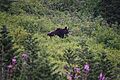
A grizzly bear searching for sweet huckleberries on a hillside
-
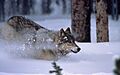
A gray wolf running across snowy ground in Yellowstone
-
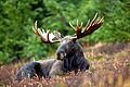
A large male moose resting quietly in a grassy field
-
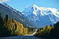
Snow-covered slopes on Mount Robson
-
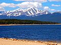
Mount Elbert in Colorado, the highest peak in the Rockies
-
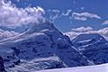
Mount Columbia and Mount King Edward in Canada
-
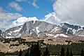
Cloud Peak rising above the valley floor in Wyoming
-
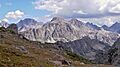
Ladd Peak standing near Gannett Peak in Wyoming
-
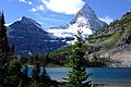
Mount Assiniboine reflecting in the clear waters of Sunburst Lake
-
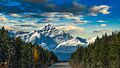
Mount Edith Cavell standing tall in Alberta, Canada


.jpg)
.jpg)


.jpg)


See Also
 In Spanish: Montañas Rocosas para niños
