Cherokee Trail facts for kids

The Cherokee Trail was an important travel route in the western United States. It went through parts of Oklahoma, Kansas, Colorado, and Wyoming. People used this trail from the late 1840s until the early 1890s.
The trail began in 1849. A group of people, including many Cherokee people, formed a wagon train. They were heading to California to find gold. Lewis Evans was chosen as their leader. Because of this, the journey is sometimes called the Evans/Cherokee Train.
What makes this trail special? It was a path made by Native Americans and their friends. They didn't just cross the mountains; they created a new way through them. The trail was also sometimes called the Trappers' Trail. But it was different from another older Trapper's Trail.
Where Did the Trail Go?
The Cherokee Trail started near Grand River in what is now Salina, Oklahoma. Some people say it started closer to Fort Gibson. The trail stretched for over 900 miles (1,400 km) to Fort Bridger, Wyoming.
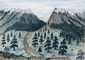
The trail went west from Oklahoma along the Arkansas River Valley in Colorado. It followed Cherry Creek (Colorado) to the South Platte River. Then it went north along the eastern side of the Rocky Mountains. It passed near Laporte and Virginia Dale. From there, it crossed over to the Laramie Plains.
In 1850, four wagon trains of Cherokee and white travelers crossed the South Platte River near modern-day Denver. They went north, making a new wagon road to the Laramie Plains. Then they traveled west along the border of Wyoming and Colorado to the Green River. From there, they went northwest to Fort Bridger. This route was sometimes called the "disease free" or "middle" route. More and more people used it each year. By 1857, it was the most used trail to California.
In 1857, a new shortcut was made on the Cherokee Trail. The U.S. Army built a road over Bridger Pass to Fort Bridger. By 1862, this Bridger Pass route was a well-used road. The Overland Mail and Stage moved from another route to this one. The railroad reached Utah in 1869, which ended the Overland Mail. However, the Cherokee Trail continued to be used by people moving west. The last wagon train on this trail was recorded in 1883.
In 1854, another path was created on the west side of the South Platte River. It crossed the Cache la Poudre River and went to the Laramie Plains. There, the trail turned west near Tie Siding. It continued along the Colorado/Wyoming border to Green River and then to Fort Bridger. At Fort Bridger, it connected with other trails used by settlers.
Today, you can still see parts of the 1854 trail on land managed by the Bureau of Land Management in Wyoming. In Sweetwater County, these parts of the trail are marked with 4-foot (1.2 m) high concrete posts.
Trail History
Parts of this trail were used even before 1849. General William Ashley used some of this route as early as 1824. People heading to Oregon wrote about routes in and out of Browns Park in 1839. By 1849, three ways to cross the Continental Divide were known. The Cherokee Trail followed the Twin Groves route.
In 1849, Lieutenant Abraham Buford was taking mail from Santa Fe to the east. He turned south at McPherson, Kansas, to follow the new Evans/Cherokee Trail. This expedition was led by Captain Lewis Evans and Lieutenant Captain Peter Mankins. They went to Fort Gibson, Oklahoma, and then connected to another trail to Fort Smith, Arkansas. Starting in 1850, people looking for gold, settlers, and cattle drivers used the trail all the time. They came from Arkansas, Texas, Missouri, and the Cherokee Nation.
In 1850, a person on a wagon train found gold in Ralston Creek. This creek is north of modern-day Denver. Stories of this gold discovery led to more trips in 1858. This then led to the big Colorado Gold Rush in 1859.
In the 1860s, parts of the Cherokee Trail in northern Colorado and Wyoming became part of the Overland Trail. This was a stagecoach route between Kansas and Salt Lake City, Utah.
 | George Robert Carruthers |
 | Patricia Bath |
 | Jan Ernst Matzeliger |
 | Alexander Miles |

