
Colorado facts for kids
Quick facts for kids
Colorado
|
|||
|---|---|---|---|
|
|||
| Nickname(s): | |||
| Motto(s):
Nil sine numine
(English: Nothing without providence) |
|||
| Anthem: Where the Columbines Grow and Rocky Mountain High |
|||

Location of Colorado within the United States
|
|||
| Country | United States | ||
| Before statehood | Territory of Colorado | ||
| Admitted to the Union | August 1, 1876 (38th) | ||
| Capital (and largest city) |
Denver | ||
| Largest county or equivalent | El Paso | ||
| Largest metro and urban areas | Denver | ||
| Legislature | General Assembly | ||
| • Upper house | Senate | ||
| • Lower house | House of Representatives | ||
| Judiciary | Supreme Court (list) | ||
| U.S. senators | Michael Bennet (D) John Hickenlooper (D) |
||
| U.S. House delegation | 4 Democrats 4 Republicans (list) |
||
| Area | |||
| • Total | 104,185 sq mi (269,837 km2) | ||
| • Land | 103,718 sq mi (268,875 km2) | ||
| • Water | 376 sq mi (962 km2) 0.36% | ||
| Area rank | 8th | ||
| Dimensions | |||
| • Length | 280 mi (451 km) | ||
| • Width | 380 mi (612 km) | ||
| Elevation | 6,800 ft (2,070 m) | ||
| Highest elevation | 14,440 ft (4,401.2 m) | ||
| Lowest elevation | 3,317 ft (1,011 m) | ||
| Population
(2025)
|
|||
| • Total | |||
| • Rank | 20th | ||
| • Density | 56.25/sq mi (21.72/km2) | ||
| • Density rank | 37th | ||
| • Median household income | $92,900 (2023) | ||
| • Income rank | 9th | ||
| Demonym(s) | Coloradan | ||
| Language | |||
| • Official language | English | ||
| Time zone | UTC−07:00 (MST) | ||
| • Summer (DST) | UTC−06:00 (MDT) | ||
| USPS abbreviation |
CO
|
||
| ISO 3166 code | US-CO | ||
| Latitude | 37°N to 41°N | ||
| Longitude | 102.0467°W to 109.0467°W | ||


Colorado is a beautiful state located in the western part of the United States. It's known for its amazing landscapes, including towering mountains, thick forests, wide-open plains, deep canyons, and winding rivers. Colorado shares borders with Wyoming, Nebraska, Kansas, Oklahoma, New Mexico, Utah, and touches Arizona at the Four Corners.
Colorado is the 8th largest state by land area and the 21st most populated. About 5.8 million people live here. The state gets its name from the Spanish word "colorado," which means "colored red." This likely refers to the red rocks and soil found in the region. Colorado is also called the "Centennial State" because it became a state in 1876, exactly one century after the United States Declaration of Independence was signed.
People have lived in this area for over 13,500 years, including many Native American groups. The Pike's Peak Gold Rush in the mid-1800s brought many new settlers looking for gold.
Denver is the capital and largest city in Colorado. It's a busy center for many people. Colorado Springs is the second largest city. The state's economy relies on things like government jobs, mining, farming, and tourism.
Contents
- Colorado's Past: A Look at History
- Colorado's Amazing Geography
- Colorado's Weather and Climate
- Animals of Colorado
- Plants of Colorado
- How Colorado's Government Works
- Counties and Cities of Colorado
- People of Colorado
- Colorado's Economy and Jobs
- Colorado's Culture and Fun
- Getting Around Colorado
- Learning in Colorado
- Native American Reservations
- Military Presence in Colorado
- Protected Natural Areas
- Sports in Colorado
- Images for kids
- See also
Colorado's Past: A Look at History


The land that is now Colorado has been home to Native Americans for over 13,000 years. These early peoples traveled along the eastern edge of the Rocky Mountains.
In 1803, the U.S. bought a large area of land from France called the Louisiana Purchase. This included parts of eastern Colorado. Spain also claimed some of this land. In 1819, the U.S. and Spain signed a treaty that set the borders. Later, after the Mexican–American War in 1848, the U.S. gained even more land from Mexico, which included most of Colorado.
The Gold Rush and Becoming a Territory
In 1858, the Pike's Peak Gold Rush started, bringing many people hoping to find gold. This led to more settlements in the area. To help organize the growing population, the Territory of Colorado was created in 1861. This happened just before the American Civil War began.
During the Civil War, Colorado volunteers helped stop a Confederate invasion in New Mexico. After the war, more people stayed in Colorado, building mines, farms, and towns.
Colorado Becomes a State


On August 1, 1876, Colorado officially became the 38th state in the Union. This was just a few weeks after the 100th birthday of the United States, which is why it's called the "Centennial State."
A big silver discovery near Leadville in 1878 led to a silver boom. In 1893, Colorado became the second state to give women the right to vote.
Over time, tourism became a very important part of Colorado's economy. The state's beautiful scenery attracts millions of visitors each year.
Colorado's Amazing Geography
Colorado has a very diverse landscape. You can find tall mountains, dry plains, huge sand dunes, deep canyons, and beautiful rock formations. It also has many rivers, lakes, and forests.


Mountains and High Points
Mount Elbert is the highest point in Colorado and in the entire Rocky Mountains. It stands at 14,440 feet (4,401.2 m) (14,440 feet) tall. Colorado is the only U.S. state that is entirely above 1,000 meters (3,281 feet) in elevation. Even the lowest point in Colorado, where the Arikaree River flows into Kansas, is still 3,317 feet (1,011 m) (3,317 feet) high! This lowest point is actually higher than the highest points in 18 other states.
The Continental Divide of the Americas runs through the Rocky Mountains in Colorado. This divide separates the rivers that flow to the Pacific Ocean from those that flow to the Atlantic Ocean. West of the divide, water flows into the Colorado River and eventually to the Gulf of California.
The Rocky Mountains in Colorado have about 53 peaks that are 14,000 feet (14,000 feet (4,267 m)) or higher. These are called "fourteeners." Many of these mountains are covered with trees like conifers and aspens up to the tree line. Above the tree line, only small alpine plants grow.
Plains and Valleys


Almost half of Colorado is made up of flat or gently rolling land. This area, known as the Eastern Plains, is where crops like corn, wheat, and hay are grown. Farmers use water from rivers and underground sources to irrigate their fields. Many cattle ranches and hog farms are also found here.
Within the Rocky Mountains, there are also large, flat areas called "parks" or basins. The San Luis Valley in southern Colorado is one such area, where the Rio Grande river begins.
The Front Range Urban Corridor

About 70% of Colorado's population lives along the eastern edge of the Rocky Mountains. This area is called the Front Range Urban Corridor. It includes major cities like Denver, Boulder, Fort Collins, Colorado Springs, and Pueblo. The tall Rockies protect this region from many storms coming from the Pacific Ocean.
On the other side of the mountains, in Western Colorado, the main cities are Grand Junction, Durango, and Montrose. This "Western Slope" is drained by the Colorado River and its branches.
Unique Landscapes


Colorado has many unique natural features. You can visit the Great Sand Dunes National Park and Preserve, which has the tallest sand dunes in North America. There's also Black Canyon of the Gunnison National Park, known for its incredibly deep and narrow canyon.
The Four Corners Monument is a special spot where Colorado, Arizona, New Mexico, and Utah all meet. You can stand in four states at the same time!
Colorado's Weather and Climate
Colorado's weather is quite varied because of its different landscapes. The climate changes a lot depending on whether you are in the mountains, plains, or deserts. Southern Colorado isn't always warmer than northern Colorado, unlike in many other states.
Eastern Plains Weather

The Eastern Plains have a semi-arid climate, meaning it's quite dry. This area gets a lot of sunshine and has cool, clear nights. This causes big differences between daytime and nighttime temperatures.
Summers on the plains can be very hot, often reaching over 95°F (35°C). Winters are usually dry and cold, with lows sometimes dropping below 0°F (-18°C). Most of the rain falls from April to September, often from thunderstorms. Snowstorms can be heavy in winter and early spring.
Mountain and Foothill Weather
Just west of the plains, in the foothills and mountains, the climate varies greatly. Places just a few miles apart can have very different weather due to the landscape. Valleys often have a semi-arid climate, while higher elevations have an alpine climate (cold and snowy).
Extreme Weather Events

Colorado can experience sudden and extreme weather changes. Thunderstorms are common in spring and summer, especially east of the Continental Divide. Hail is also common. The Eastern Plains are part of Tornado Alley and can have strong tornadoes.
Floods can happen on the plains, caused by heavy thunderstorms or by snow melting quickly in the mountains. Colorado is generally a dry state, so droughts are common. This lack of rain can lead to severe wildfires.
However, the mountains receive a lot of snow in winter. When this snow melts in spring, it feeds major rivers like the Colorado River and the Rio Grande. This water is very important for farms and cities in many southwestern and midwestern states.
Animals of Colorado

Colorado is home to many different animals. The gray wolf used to be gone from the state, but a new pack was seen in 2019. In 2020, people in Colorado voted to bring wolves back to the state.
Mountain goats were not originally from Colorado, but they were brought here between 1947 and 1972. Even though they were introduced, the state declared them a native species in 1993.
The number of pronghorn (a type of antelope) in Colorado has changed a lot. Thanks to conservation efforts, their population has grown. You can often see them in the northern and eastern parts of the state.
In the mountains, you might spot mule deer, moose, American pika, and red fox. The foothills have deer, fox squirrels, and coyotes. On the prairies, you can find black-tailed prairie dogs and American badgers.
Plants of Colorado
Colorado's mountains and forests are home to many magnificent trees.
- Blue Spruce: This is Colorado's official state tree! It's famous for its beautiful blue-green needles and its strong, conical shape. You can find them growing in the mountains, and they are also often planted in parks and yards.
- Aspen: These trees are easy to spot with their smooth, white bark and leaves that shimmer and "quake" in the breeze. In the fall, Aspen groves turn a brilliant golden yellow, making the mountainsides look like they're on fire with color!
- Ponderosa Pine: These are tall, stately trees with long needles and bark that smells a bit like vanilla or butterscotch if you get close enough! They are very common in the lower and middle elevations of Colorado's mountains.
When spring and summer arrive, Colorado's meadows and mountainsides burst into color with countless wildflowers.
- Colorado Columbine: This is the state flower of Colorado! It's a beautiful and delicate flower, usually blue and white, with a unique shape that looks like a little crown. You can find it growing in shady, moist areas in the mountains.
- Indian Paintbrush: This flower has bright red or orange "brushes" that look like they've been dipped in paint. It's a very common and striking wildflower.
- Sunflower: While many people think of sunflowers in fields, wild sunflowers are native to Colorado's plains. They follow the sun and provide seeds for birds and other animals.
- Prickly Pear Cactus: In the drier, eastern parts of Colorado, you might even find cacti! The prickly pear has flat, paddle-like stems and produces beautiful yellow or pink flowers, followed by edible fruits.
Crops
Crops are plants that farmers grow on purpose, usually in large fields, to be harvested for food, animal feed, or other useful things. Colorado's farmers work hard to grow many different kinds of crops that are important for people all over the country.
- Corn: One of the most important crops in Colorado! Corn is used in many ways. Some corn is eaten by people as corn on the cob or popcorn, but a lot of it is used to feed farm animals like cows, pigs, and chickens. It's also used to make things like corn syrup and ethanol (a type of fuel). Colorado's eastern plains, with their sunny days and fertile soil, are perfect for growing corn.
- Wheat: Another super important grain! Wheat is ground into flour, which is then used to make bread, pasta, cakes, and many other delicious foods. Colorado grows a lot of "winter wheat," which is planted in the fall, grows a little bit before winter, and then finishes growing in the spring. This helps it use the moisture from winter snows.
- Hay: This isn't a food for people, but it's vital for animals! Hay is made from grasses and other plants like alfalfa that are cut, dried, and then stored. It's a main food source for livestock, especially during the winter when fresh grass isn't available. You'll see big bales of hay in fields all over Colorado.
- 'Barley: This grain is similar to wheat and is used for animal feed, but it's also famous for making malt, which is an ingredient in many drinks and foods.
Colorado's climate is also great for growing a variety of vegetables.
- Potatoes: Did you know Colorado is one of the top potato-producing states in the U.S.? Especially in the San Luis Valley, where the cool nights and sunny days help potatoes grow big and tasty. There are many kinds of potatoes, from russets to reds and yellows, all grown in Colorado.
- Onions: These flavorful vegetables are another big crop. They add a delicious taste to so many meals! Colorado's dry climate and rich soil are ideal for growing sweet and pungent onions.
- Sugar Beets: These look a bit like large, white carrots, but they are grown for their sugar! Farmers harvest sugar beets, and then they are processed to extract the sugar we use every day. This was a very important crop in Colorado's history, helping to build many towns.
- Dry Beans: Think pinto beans, navy beans, and kidney beans! These are packed with protein and are a staple in many diets. Colorado's dry conditions are actually quite good for growing these types of beans.
While not as famous for fruits as some other states, Colorado has some delicious fruit-growing regions.
- Peaches: The Western Slope of Colorado, especially around towns like Palisade, is famous for its juicy, sweet peaches! The warm days and cool nights, along with water from the mountains, create perfect conditions for these fuzzy fruits. Peach season in late summer is a big deal!
- Apples and Cherries: You can also find orchards growing apples and cherries in the same Western Slope region. These fruits love the sunshine and the unique climate.
How Colorado's Government Works
Colorado's government is set up like the U.S. federal government, with three main parts:
- The executive branch is led by the Governor of Colorado. Other important elected officials include the Lieutenant Governor, Secretary of State, State Treasurer, and Attorney General.
- The judicial branch includes the Colorado Supreme Court, which is the state's highest court. There are also other courts for different types of cases, including special courts for water rights.
- The legislative branch is called the Colorado General Assembly. It has two parts: the House of Representatives and the Senate. These groups make the laws for the state.
Most people who live in Colorado were born in other states. This means that many of Colorado's leaders, including governors, have come from other places.
Counties and Cities of Colorado
Colorado is divided into 64 areas called counties. Two of these, the City and County of Broomfield and the City and County of Denver, are both cities and counties combined. Counties are important because Colorado doesn't have smaller local governments like townships.
.jpg)
El Paso County, where Colorado Springs is located, has the most people. The City and County of Denver is the second most populated. Most of the counties with the largest populations are in the Front Range Urban Corridor.
Colorado's Cities and Towns
Colorado has 272 official cities and towns. Most Coloradans live in one of these places. The largest city is the City and County of Denver. There are 12 cities with over 100,000 residents.

The City of Grand Junction is the largest city on the Western Slope of Colorado. Some small towns, like the Town of Carbonate, have no year-round residents because of harsh winters and difficult access.
Unincorporated Communities

Besides cities and towns, Colorado has many unincorporated communities. These are places where people live but are not part of an official city or town government. Highlands Ranch, south of Denver, is the largest of these communities.
Special Districts and Services

Colorado has over 4,000 "special districts." These are local groups that provide specific services like schools, fire protection, water, or transportation. They often collect their own taxes to pay for these services. This can make sales tax rates different from one street corner to another!
Some important special districts include:
- The Regional Transportation District (RTD): This group helps with public transportation, like buses and trains, in the Denver area.
- The Scientific and Cultural Facilities District (SCFD): This district collects a small sales tax to support arts, music, theater, museums, and zoos. It helps fund places like the Denver Art Museum and the Denver Zoo.
People of Colorado

As of 2023, Colorado has about 5.8 million people. The population has been growing steadily.
Many different groups of people live in Colorado. A large part of the population is of European descent, especially German, Irish, and English. Colorado also has a significant Hispanic and Latino population, many of whom are Mexican-American. In southern Colorado, there are many "Hispanos," who are descendants of early Spanish settlers.

There are also communities of African Americans in cities like Denver. The state has a growing number of Asian Americans from various countries.
The number of Native Americans in Colorado is smaller, but they are concentrated in Denver and the southwestern part of the state, where two Ute reservations are located.
Most immigrants to Colorado come from Mexico, India, China, Vietnam, Korea, Germany, and Canada.
Languages Spoken
English is the official language and most common language spoken in Colorado. Spanish is the second most common language. One Native American language still spoken in Colorado is the Colorado River Numic language, also known as the Ute dialect.
Religion in Colorado
Many different religions are practiced in Colorado. About 64% of people identify as Christian, including Protestants and Catholics. Other religions like Mormonism, Judaism, Islam, and Buddhism are also present. About 29% of the population does not identify with a specific religion.
The Catholic Church has the most followers in Colorado. The first permanent Catholic church was built by Spanish colonists in Conejos.
Colorado's Economy and Jobs

Colorado's economy has grown a lot since its early days of mining. Today, it's very diverse.
Key Industries
- Agriculture: Farming is important, especially in the Eastern Plains. Farmers grow crops like corn, wheat, hay, potatoes, and peaches, and raise livestock like cattle.
- Government and Defense: The U.S. government has many important facilities in Colorado. These include NORAD (North American Aerospace Defense Command), the United States Air Force Academy, and Fort Carson.
- Mining: Colorado still has mining for minerals like gold, silver, and molybdenum. It also has large amounts of oil, natural gas, and coal.
- Tourism: Millions of tourists visit Colorado every year because of its beautiful mountains and diverse landscapes. This brings a lot of money to the state.
- Technology and Research: Colorado is known for its focus on scientific research and high-tech industries. Places like the National Renewable Energy Laboratory (NREL) are located here.
- Manufacturing: The state produces things like food products, transportation equipment, and chemicals. Colorado also makes the most beer of any state!
Many well-known companies started in Colorado, including Samsonite luggage, Coors beer, and Celestial Seasonings herbal teas.
Taxes
Colorado has a flat income tax rate of 4.55%. This means everyone pays the same percentage of their income in state taxes. The state also has a sales tax of 2.9% on retail sales. However, many counties and cities add their own sales taxes, so the total tax rate can vary.
Colorado's Culture and Fun

Colorado has a rich culture, especially known for its connection to the American West and its outdoor lifestyle.
Arts and Entertainment
Many movies, especially Westerns, have been filmed in Colorado. The state's historic forts, railways, and ghost towns have been used to create realistic settings. Famous landmarks like The Stanley Hotel have also appeared in films.
Colorado hosts several film festivals, such as the Denver Film Festival and the Telluride Film Festival. Many famous writers have also lived or spent time in Colorado, including Jack Kerouac and Oscar Wilde.
Food and Drink
Colorado is known for its Southwestern and Rocky Mountain cuisine. Mexican restaurants are very popular throughout the state.
Boulder, Colorado is famous for its food scene, with many national food companies, top restaurants, and farmers' markets. The Food & Wine Classic is held every year in Aspen, Colorado.
Colorado is also a big name in the world of craft beer. The area around Denver, Boulder, and Fort Collins is sometimes called the "Napa Valley of Beer" because of all its amazing microbreweries. Colorado also produces award-winning Colorado wines, with some of the highest vineyards in the U.S.
Getting Around Colorado
.jpg)
Most people in Colorado travel by car on the state's highway system. Interstate 25 runs north-south, connecting major cities like Pueblo, Colorado Springs, Denver, and Fort Collins. Interstate 70 runs east-west, linking Grand Junction with Denver and other mountain communities.

Denver International Airport (DIA) is one of the busiest airports in the world. It's a major hub for flights across the western United States.
Public transportation includes bus services and the Regional Transportation District (RTD) light rail system in the Denver area.

Amtrak operates two passenger train lines in Colorado. The state also has a long history with railroads, especially the Denver and Rio Grande Western Railroad, which was famous for mountain railroading. Today, large freight railroads like Union Pacific and BNSF operate extensively in Colorado.
Learning in Colorado
Colorado has many colleges and universities. The first higher education institution was the Colorado Seminary, which later became the University of Denver in 1880. The University of Colorado was founded in 1876, and Colorado State University opened in 1879.
The United States Air Force Academy was established in Colorado Springs in 1954. It trains officers for the U.S. Air Force and, more recently, the United States Space Force.
Native American Reservations

Colorado is home to two Native American reservations:
These reservations are home to the Ute people, who have lived in this region for a very long time.
Military Presence in Colorado


Colorado has several important military installations:
- Buckley Space Force Base
- Fort Carson (U.S. Army)
- Peterson Space Force Base
- Pueblo Chemical Depot (U.S. Army)
- Schriever Space Force Base
- United States Air Force Academy
These bases play a big role in national defense and provide many jobs in the state.
Protected Natural Areas

Colorado is full of beautiful natural places that are protected for everyone to enjoy. These include:
- 4 National Parks (like Rocky Mountain National Park)
- 9 National Monuments
- 11 National Forests
- 42 State Parks
These areas offer opportunities for hiking, camping, wildlife viewing, and enjoying Colorado's stunning scenery.
Sports in Colorado


Colorado is home to many professional sports teams, mostly based in the Denver area. It's the least populated state to have a team in each of the major professional sports leagues!
Professional Sports Teams
| Team | Home | First game | Sport | League |
|---|---|---|---|---|
| Colorado Avalanche | Denver | October 6, 1995 | Ice hockey | National Hockey League |
| Colorado Eagles | Loveland | October 17, 2003 | Ice hockey | American Hockey League |
| Colorado Mammoth | Denver | January 3, 2003 | Lacrosse | National Lacrosse League |
| Colorado Rapids | Commerce City | April 13, 1996 | Soccer | Major League Soccer |
| Colorado Rapids 2 | Denver | March 27, 2022 | Soccer | MLS Next Pro |
| Colorado Rockies | Denver | April 5, 1993 | Baseball | Major League Baseball |
| Colorado Springs Switchbacks FC | Colorado Springs | March 28, 2015 | Soccer | USL Championship |
| Denver Barbarians | Denver | Spring 1967 | Rugby union | Pacific Rugby Premiership |
| Denver Broncos | Denver | September 9, 1960 | American football | National Football League |
| Denver Nuggets | Denver | September 27, 1967 | Basketball | National Basketball Association |
| Denver Summit FC | Denver | March 14, 2026 | Soccer | National Women's Soccer League |
| Glendale Raptors | Glendale | Fall 2006 | Rugby union | Major League Rugby |
| Grand Junction Rockies | Grand Junction | June 18, 2012 | Baseball | Pioneer League |
| Northern Colorado Hailstorm FC | Windsor | April 6, 2022 | Soccer | USL League One |
| Northern Colorado Owlz | Windsor | May 25, 2022 | Baseball | Pioneer League |
| Rocky Mountain Vibes | Colorado Springs | June 2019 | Baseball | Pioneer League |
| Colorado Summit | Golden | May 7, 2022 | Ultimate frisbee | Ultimate Frisbee Association |
College Sports
Many universities and colleges in Colorado have strong sports programs. The University of Colorado Buffaloes are very popular.
| Team | School | City | Conference |
|---|---|---|---|
| Air Force Falcons | United States Air Force Academy | Colorado Springs | Mountain West |
| Colorado Buffaloes | University of Colorado Boulder | Boulder | Pac-12 |
| Colorado State Rams | Colorado State University | Fort Collins | Mountain West |
| Denver Pioneers | University of Denver | Denver | NCHC / Summit |
| Northern Colorado Bears | University of Northern Colorado | Greeley | Big Sky |
| Colorado College Tigers | Colorado College | Colorado Springs | NCHC / Mountain West |
Images for kids
-
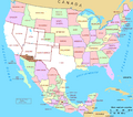
Map of the Mexican cession, with the white representing the territory the United States received from Mexico. Well over half of Colorado was received during this treaty.

See also
 In Spanish: Colorado para niños
