Four Corners facts for kids
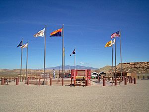
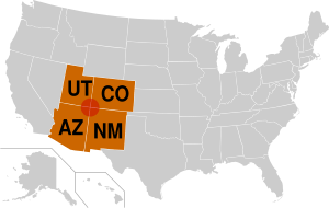
The Four Corners is a special area in the Southwestern United States. It's where the corners of four states meet: the southwestern part of Colorado, the southeastern part of Utah, the northeastern part of Arizona, and the northwestern part of New Mexico.
This area gets its name from the exact spot where these four states come together. This unique meeting point is marked by the Four Corners Monument. It's the only place in the entire United States where four states touch at one single point!
Most of the Four Corners region is home to Native American nations. The biggest one is the Navajo Nation. Other important nations include the Hopi, Ute, and Zuni tribes.
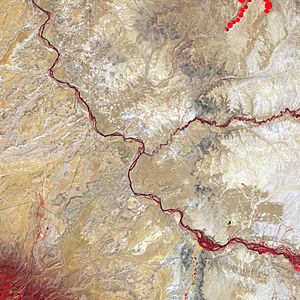
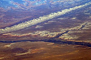
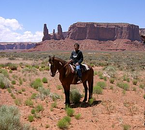
The Four Corners region is part of a larger area called the Colorado Plateau. It's mostly a quiet, rugged, and dry place. Besides the monument, popular spots to visit include Monument Valley, Mesa Verde National Park, Chaco Canyon, Canyons of the Ancients National Monument, and Canyon de Chelly National Monument. The largest city in the Four Corners area is Farmington, New Mexico, followed by Durango, Colorado.
Contents
History of the Four Corners
How the Area Became Part of the U.S.
The United States gained control of the Four Corners region from Mexico after the Mexican–American War ended in 1848. Later, in 1863, the U.S. Congress created the Arizona Territory. This new territory was made from the western part of the New Mexico Territory.
The border for Arizona was set as a line going straight south from the southwest corner of the Colorado Territory. This was unusual because Congress usually used lines of latitude or longitude, or rivers, to define borders. By connecting the new border to an existing corner, Congress made sure that four states would eventually meet at one point, even if there were small errors in surveying.
The Surveying of the Four Corners Point
The U.S. Government first surveyed this area in 1868. This was part of the process to make Colorado Territory into a state. The first marker was placed at the spot where the Four Corners Monument is today.
However, the first surveyor made a small mistake. The marker was placed about 1,821 feet (555 meters) east of where Congress had originally intended it to be. In 1925, this surveying error was brought to the U.S. Supreme Court. To fix the problem, the Supreme Court officially moved the Four Corners point to where the original survey had placed it. This is why the monument is located where it is today.
The first government for the Navajo Nation was set up in 1923. This was done to help manage the growing number of oil exploration activities happening on Navajo land.
Geography of the Four Corners
Location and Landscape
The Four Corners Monument is located at 36°59′56.3″N 109°02′42.6″W / 36.998972°N 109.045167°W.
The Four Corners area is part of the high Colorado Plateau. This high land plays a role in how weather systems form. These weather systems often become stable over the plateau. Then, they move eastward through Colorado and into the central United States, bringing snow and rain.
Protected Areas and Mountains
There are many protected natural areas in the Four Corners. These include Canyon de Chelly National Monument, Hovenweep National Monument, Mesa Verde National Park, and Canyons of the Ancients National Monument.
The region also has several mountain ranges. Some of these are the Sleeping Ute Mountains, the Abajo Mountains, and the Chuska Mountains.
Governments in the Four Corners
Who Manages the Area?
Six different governments have authority over the area around the Four Corners Monument. These are the states of Arizona, Colorado, New Mexico, and Utah. Also, the tribal governments of the Navajo Nation and the Ute Mountain Ute Tribe are involved.
The Navajo Nation Department of Parks and Recreation is in charge of managing the Four Corners Monument itself. Other Native American nations in the wider Four Corners region include the Hopi and other Ute tribes.
Tribal Headquarters and U.S. Government Presence
The capital city for the Navajo tribal government is Window Rock, Arizona. The headquarters for the Ute Mountain Ute Tribe are in Towaoc, Colorado.
The U.S. federal government also has a big presence here. This includes the Department of the Interior with its Bureau of Indian Affairs, and the Department of Agriculture with the Forest Service.
Cities and Towns in the Four Corners
The Four Corners region is mostly a rural area, meaning it has more countryside than big cities. The main economic center and largest city is Farmington, New Mexico. It's the only metropolitan area in the region.
The town closest to the very center of the Four Corners is Teec Nos Pos, Arizona. Other cities and towns in the region include:
- In Colorado: Cortez and Durango.
- In Utah: Monticello and Blanding.
- In Arizona: Kayenta and Chinle.
- In New Mexico: Shiprock, Aztec, and Bloomfield.
Transportation in the Four Corners
Airports and Highways
If you want to fly to the Four Corners area, there are airports in:
- Durango, Colorado (the Durango-La Plata County Airport)
- Farmington, New Mexico (the Four Corners Regional Airport)
- Cortez, Colorado (the Cortez Municipal Airport)
Interstate 40 runs along the southern edge of the Four Corners region. Several important U.S. Highways also serve the area directly. These include U.S. Route 64, U.S. Route 160 (which goes right to the Four Corners Monument), U.S. Route 163, U.S. Route 191, U.S. Route 491 (which used to be called U.S. Route 666), and U.S. Route 550.
Railroads
The main train line of the Atchison, Topeka and Santa Fe Railway, now run by the BNSF Railway, also passes along the southern edge of the Four Corners.
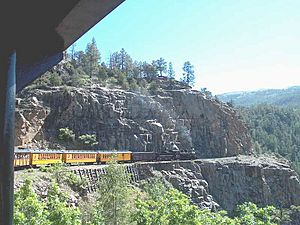
The area is also home to old train lines that are now used for fun rides, called heritage railways. These include the Durango and Silverton Narrow Gauge Railroad and the Cumbres and Toltec Scenic Railroad. Another train line, the Black Mesa and Lake Powell Railroad, which connects a power plant to a coal mine, also comes close to the Four Corners.
See also
 In Spanish: Cuatro Esquinas para niños
 | Misty Copeland |
 | Raven Wilkinson |
 | Debra Austin |
 | Aesha Ash |


