Chinle, Arizona facts for kids
Quick facts for kids
Chinle, Arizona
Chíńlį́
|
|
|---|---|
 |
|

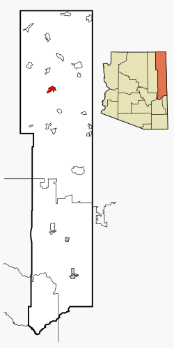
Location in Apache County and Arizona
|
|
| Country | United States |
| State | Arizona |
| County | Apache |
| Area | |
| • Total | 16.32 sq mi (42.26 km2) |
| • Land | 16.29 sq mi (42.19 km2) |
| • Water | 0.03 sq mi (0.06 km2) |
| Elevation | 5,506 ft (1,678 m) |
| Population
(2020)
|
|
| • Total | 4,573 |
| • Density | 280.71/sq mi (108.38/km2) |
| Time zone | UTC-7 (MST) |
| • Summer (DST) | UTC-6 (MDT) |
| ZIP codes |
86503
|
| Area code | 928 |
| FIPS code | 04-12770 |
| GNIS feature ID | 2408029 |
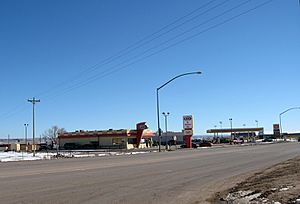
Chinle (pronounced CHIN-lee) is a community in Apache County, Arizona, United States. Its name comes from the Navajo language and means "flowing out." This refers to the place where water flows out of the famous Canyon de Chelly. In 2020, the population of Chinle was 4,573 people.
Contents
History of Chinle
Early Days and Trading
During the time of Spanish rule, Chinle was an important spot for both trading and fighting. After the Mexican–American War, the United States took control of this area. Relations between the people living there and the U.S. changed in the 1860s.
A peace meeting was held by the United States, with Kit Carson representing them, and the Navajo people. This meeting aimed to end the war between the Navajo and the U.S. The first trading post in Chinle started in a tent in 1882. By 1885, a larger camp had grown around it.
Schools and Government Presence
The Chinle Boarding School was opened in 1910 by the Bureau of Indian Affairs (BIA). This school helped the federal government have a lasting presence in Chinle. The BIA then played a big role in governing the town.
The spelling of the town's name was changed from "Chin Lee" to "Chinle" on April 1, 1941.
Canyon de Chelly National Monument
Chinle is known as the main entrance to Canyon de Chelly National Monument. This monument was created in 1931. Its main purpose is to protect old archaeological sites and the history of ancient people. Canyon de Chelly is special because it is entirely on Navajo Nation land. There are even people who live in the canyon itself.
Community Life and Changes
In the 1950s, Chinle had people from many different backgrounds. These included Navajo, other Native Americans, white people, and Black people. They often lived in separate areas. The total population was less than 200 at that time.
The Bureau of Indian Affairs (BIA) and the schools were major employers. Employees of the BIA and the schools lived in their own housing areas. The Chinle Boarding School and a public health clinic were also big employers.
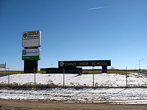
In 2019, a TV show called Basketball or Nothing came out on Netflix. It featured the basketball team from Chinle High School.
The COVID-19 pandemic in Arizona was very difficult for the Chinle community.
Geography and Climate
Where Chinle Is Located
Chinle is a large area, covering about 16.32 square miles (42.26 square kilometers). Most of this area is land, with a very small part being water.
Chinle's Weather
Chinle has a cold semi-arid climate. This means it is generally dry, but it can get cold, especially in winter.
| Climate data for Chinle, Arizona (Canyon de Chelly, 1991–2020 normals, extremes 1908–present) | |||||||||||||
|---|---|---|---|---|---|---|---|---|---|---|---|---|---|
| Month | Jan | Feb | Mar | Apr | May | Jun | Jul | Aug | Sep | Oct | Nov | Dec | Year |
| Record high °F (°C) | 70 (21) |
72 (22) |
85 (29) |
90 (32) |
101 (38) |
105 (41) |
105 (41) |
102 (39) |
99 (37) |
90 (32) |
79 (26) |
68 (20) |
105 (41) |
| Mean maximum °F (°C) | 57.3 (14.1) |
64.1 (17.8) |
74.6 (23.7) |
82.6 (28.1) |
91.3 (32.9) |
99.4 (37.4) |
100.9 (38.3) |
96.9 (36.1) |
92.4 (33.6) |
83.4 (28.6) |
69.8 (21.0) |
58.8 (14.9) |
101.8 (38.8) |
| Mean daily maximum °F (°C) | 43.8 (6.6) |
50.6 (10.3) |
60.7 (15.9) |
68.9 (20.5) |
79.0 (26.1) |
90.0 (32.2) |
92.9 (33.8) |
89.7 (32.1) |
82.7 (28.2) |
69.9 (21.1) |
55.5 (13.1) |
43.3 (6.3) |
68.9 (20.5) |
| Mean daily minimum °F (°C) | 19.0 (−7.2) |
23.6 (−4.7) |
29.2 (−1.6) |
35.8 (2.1) |
43.7 (6.5) |
52.5 (11.4) |
60.2 (15.7) |
58.8 (14.9) |
49.8 (9.9) |
37.5 (3.1) |
26.5 (−3.1) |
19.6 (−6.9) |
38.0 (3.3) |
| Mean minimum °F (°C) | 5.2 (−14.9) |
10.3 (−12.1) |
17.1 (−8.3) |
22.9 (−5.1) |
31.3 (−0.4) |
40.1 (4.5) |
51.9 (11.1) |
51.4 (10.8) |
36.1 (2.3) |
24.2 (−4.3) |
12.1 (−11.1) |
5.0 (−15.0) |
1.2 (−17.1) |
| Record low °F (°C) | −32 (−36) |
−22 (−30) |
1 (−17) |
9 (−13) |
10 (−12) |
20 (−7) |
38 (3) |
38 (3) |
23 (−5) |
10 (−12) |
−3 (−19) |
−27 (−33) |
−32 (−36) |
| Average precipitation inches (mm) | 0.76 (19) |
0.73 (19) |
0.65 (17) |
0.48 (12) |
0.51 (13) |
0.27 (6.9) |
1.07 (27) |
1.30 (33) |
0.85 (22) |
0.83 (21) |
0.58 (15) |
0.72 (18) |
8.75 (222) |
| Average snowfall inches (cm) | 1.1 (2.8) |
0.9 (2.3) |
0.6 (1.5) |
0.1 (0.25) |
0.0 (0.0) |
0.0 (0.0) |
0.0 (0.0) |
0.0 (0.0) |
0.0 (0.0) |
0.1 (0.25) |
0.6 (1.5) |
1.5 (3.8) |
4.9 (12) |
| Average precipitation days (≥ 0.01 inch) | 4.4 | 4.5 | 4.1 | 3.1 | 2.8 | 1.8 | 6.3 | 7.0 | 5.3 | 4.1 | 3.4 | 4.6 | 51.4 |
| Average snowy days (≥ 0.1 inch) | 0.8 | 0.6 | 0.8 | 0.1 | 0.0 | 0.0 | 0.0 | 0.0 | 0.0 | 0.1 | 0.4 | 1.1 | 3.9 |
| Source: National Oceanic and Atmospheric Administration | |||||||||||||
People of Chinle
Languages Spoken
In 2000, most people in Chinle spoke the Navajo language at home, about 71.9%. The rest, about 28.1%, spoke English.
Population Details
| Historical population | |||
|---|---|---|---|
| Census | Pop. | %± | |
| 2020 | 4,573 | — | |
| U.S. Decennial Census | |||
As of the 2000 census, there were 5,366 people living in Chinle. Most of the population, 91.3%, were Native American. About 6.4% were White, and smaller percentages were from other racial groups. About 1.8% of the people were Hispanic or Latino.
Many households had children under 18 living with them. The average household had about 3.84 people.
Education in Chinle
Schools for Kids
The schools in Chinle are part of the Chinle Unified School District.
The district has several schools for different age groups:
- Tsaile Elementary School (Kindergarten to 8th grade)
- Many Farms Elementary School (Kindergarten to 6th grade)
- Canyon de Chelly Elementary School (Kindergarten to 6th grade)
- Chinle Elementary School (Kindergarten to 6th grade)
- Mesa View Elementary School (Kindergarten to 6th grade)
- Chinle Junior High School (7th to 8th grade)
- Chinle High School (9th to 12th grade)
The Bureau of Indian Education (BIE) also runs the Cottonwood Day School nearby. The Chinle Boarding School, which was a Bureau of Indian Affairs (BIA) school, moved in 1976 and is now called Many Farms Community School.
Colleges and Universities
Chinle also has branches of several colleges. These include Diné College, Northern Arizona University, and Navajo Technical University.
Places to Visit Nearby
- Canyon de Chelly National Monument
- Hubbell Trading Post National Historic Site
Famous People from Chinle
- Keats Begay, a Navajo painter, was born here.
- Jeremiah Bitsui, an actor, was born in Chinle.
- Shawna Ann Claw, a member of the Navajo Nation Council.
- Robert Draper, a Navajo painter.
- Megalyn Echikunwoke, an actress, grew up in the town.
- Carl Nelson Gorman, a Navajo code talker during World War II.
- Russell Means, a Native American activist.
See also
 In Spanish: Chinle (Arizona) para niños
 | May Edward Chinn |
 | Rebecca Cole |
 | Alexa Canady |
 | Dorothy Lavinia Brown |


