Kayenta, Arizona facts for kids
Quick facts for kids
Kayenta, Arizona
Tó Dínéeshzheeʼ
|
||
|---|---|---|
|
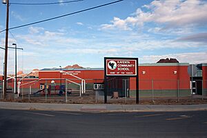
A panorama of Kayenta, downtown Kayenta in 2011, a Bashas' Diné store, the Kayenta Community School, the outskirts of Kayenta
|
||
|
||

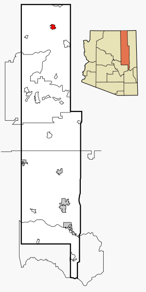
Location in Navajo County and the U.S. state of Arizona
|
||
| Country | ||
| State | ||
| County | Navajo | |
| Area | ||
| • Total | 13.24 sq mi (34.28 km2) | |
| • Land | 13.17 sq mi (34.12 km2) | |
| • Water | 0.06 sq mi (0.16 km2) | |
| Elevation | 5,712 ft (1,741 m) | |
| Population
(2020)
|
||
| • Total | 4,670 | |
| • Density | 354.54/sq mi (136.89/km2) | |
| Time zone | UTC-7 (MST) | |
| • Summer (DST) | UTC-6 (MDT) | |
| ZIP code |
86033
|
|
| Area code(s) | 928 | |
| FIPS code | 04-36990 | |
| GNIS feature ID | 2408461 | |
Kayenta is a town in Navajo County, Arizona, United States. It is part of the Navajo Nation. The Navajo name for Kayenta is Tó Dínéeshzheeʼ. This means "Fingers of Water," describing how rain flows down the rocks.
Kayenta was officially started on November 13, 1986. It is special because it is the only "township" that follows the laws of the Navajo Nation. In 2020, about 4,670 people lived there.
The town is about 25 miles (40 km) south of Monument Valley. Many hotels and motels in Kayenta serve people visiting Monument Valley. The Navajo Nation uses Daylight Saving Time, even though the rest of Arizona does not.
Kayenta Township has its own local government, which is unique on the Navajo Nation. A group of five elected people, called the town board, manages the township. They also hire a manager to help run things.
Contents
Exploring Kayenta's Location
Kayenta is located in the northeastern part of Arizona. It is a CDP, which means it's a special area counted by the U.S. Census Bureau. The total area of Kayenta is about 13.2 square miles (34.2 square kilometers). All of this area is land.
Kayenta's Climate and Weather
Kayenta has a semi-arid climate. This means it is generally dry, but not a desert. It gets some rain, especially during certain times of the year.
| Climate data for Kayenta, Arizona (Betatakin, 1991–2020 normals, extremes 1939–present) | |||||||||||||
|---|---|---|---|---|---|---|---|---|---|---|---|---|---|
| Month | Jan | Feb | Mar | Apr | May | Jun | Jul | Aug | Sep | Oct | Nov | Dec | Year |
| Record high °F (°C) | 61 (16) |
69 (21) |
76 (24) |
90 (32) |
94 (34) |
101 (38) |
100 (38) |
98 (37) |
96 (36) |
93 (34) |
70 (21) |
78 (26) |
101 (38) |
| Mean maximum °F (°C) | 51.8 (11.0) |
55.9 (13.3) |
65.6 (18.7) |
74.1 (23.4) |
82.8 (28.2) |
91.3 (32.9) |
93.5 (34.2) |
90.7 (32.6) |
86.0 (30.0) |
77.0 (25.0) |
64.4 (18.0) |
54.1 (12.3) |
94.5 (34.7) |
| Mean daily maximum °F (°C) | 39.9 (4.4) |
43.8 (6.6) |
52.5 (11.4) |
60.7 (15.9) |
70.8 (21.6) |
82.1 (27.8) |
85.7 (29.8) |
82.9 (28.3) |
76.2 (24.6) |
63.9 (17.7) |
50.7 (10.4) |
40.3 (4.6) |
62.5 (16.9) |
| Mean daily minimum °F (°C) | 22.0 (−5.6) |
24.5 (−4.2) |
30.2 (−1.0) |
35.1 (1.7) |
44.3 (6.8) |
54.6 (12.6) |
60.1 (15.6) |
58.2 (14.6) |
51.7 (10.9) |
41.2 (5.1) |
30.2 (−1.0) |
22.1 (−5.5) |
39.5 (4.2) |
| Mean minimum °F (°C) | 7.3 (−13.7) |
10.3 (−12.1) |
16.6 (−8.6) |
20.4 (−6.4) |
29.3 (−1.5) |
41.0 (5.0) |
51.0 (10.6) |
49.0 (9.4) |
38.4 (3.6) |
25.4 (−3.7) |
13.8 (−10.1) |
7.8 (−13.4) |
2.8 (−16.2) |
| Record low °F (°C) | −11 (−24) |
−14 (−26) |
2 (−17) |
0 (−18) |
19 (−7) |
28 (−2) |
31 (−1) |
33 (1) |
23 (−5) |
7 (−14) |
−2 (−19) |
−14 (−26) |
−14 (−26) |
| Average precipitation inches (mm) | 1.17 (30) |
1.03 (26) |
0.79 (20) |
0.64 (16) |
0.58 (15) |
0.18 (4.6) |
1.23 (31) |
1.45 (37) |
1.23 (31) |
0.96 (24) |
0.69 (18) |
1.16 (29) |
11.11 (282) |
| Average snowfall inches (cm) | 8.3 (21) |
9.1 (23) |
3.7 (9.4) |
3.3 (8.4) |
0.4 (1.0) |
0.0 (0.0) |
0.0 (0.0) |
0.0 (0.0) |
0.0 (0.0) |
0.3 (0.76) |
3.2 (8.1) |
7.2 (18) |
35.5 (90) |
| Average precipitation days (≥ 0.01 inch) | 5.0 | 5.1 | 4.2 | 2.9 | 3.0 | 1.3 | 5.8 | 6.6 | 4.5 | 3.4 | 3.7 | 4.7 | 50.2 |
| Average snowy days (≥ 0.1 inch) | 4.1 | 3.4 | 2.0 | 1.0 | 0.1 | 0.0 | 0.0 | 0.0 | 0.0 | 0.3 | 2.1 | 3.8 | 16.8 |
| Source: National Oceanic and Atmospheric Administration | |||||||||||||
People of Kayenta
| Historical population | |||
|---|---|---|---|
| Census | Pop. | %± | |
| 2020 | 4,670 | — | |
| U.S. Decennial Census | |||
In 2010, there were 5,189 people living in Kayenta. The population density was about 393 people per square mile. Most people in Kayenta are Native American. There are also people of White, Black, Asian, and other backgrounds. Some residents are also Hispanic or Latino.
The population in Kayenta is quite young. In 2010, about 38.9% of the people were under 18 years old. The average age was 22 years.
Fun Events in Kayenta
Kayenta hosts an exciting annual event called the Kayenta Fourth of July Rodeo. This multi-day event takes place from July 1st to July 4th. Many different rodeo activities happen each day.
On July 4th, the "Best of the Best" rodeo competition takes place, followed by a fireworks show. This rodeo is very well-known. It has won "Rodeo of the Year" six times and "Outstanding Rodeo" twice from the All Indian Rodeo Cowboys Association. This makes it one of the best rodeos to attend in the Southwest.
Learning in Kayenta
Kayenta has its own school system, called the Kayenta Unified School District. This district runs several schools that serve students from Kayenta and nearby communities like Chilchinbeto, Dennehotso, and Shonto.
The schools include:
- Debbie Braff Elementary School (for younger students)
- Baker Middle School (for middle school students)
- Monument Valley High School (for high school students)
- ABC Preschool (for very young children)
Some of these schools have recently been renamed to honor important people from the community. A group of five elected trustees manages the school district. They work to make sure students get a good education. James Nez is the current President of this governing board.
Kayenta also has the Kayenta Community School. This school is for students from kindergarten to 8th grade. It is run by the Bureau of Indian Education. It is a boarding school, meaning some students live there, while others attend during the day.
Kayenta Community Life
Local Places and Activities
Kayenta has a large recreation center for everyone in the community. Outside the center, there is a skating park and an outdoor park with playgrounds for kids.
On the east side of town, there is a paved landing strip. Small planes use this strip for air tours and for air ambulance services in emergencies.
Churches in Kayenta
Many different religious groups have churches in Kayenta. These include:
- Baptist churches
- Presbyterian Church
- Lamb of God Pentecostal Church
- Potter's House Christian Church
- Kayenta Church of Christ
- The Living Word Assembly of God Church (Assemblies of God)
- Catholic Church (Our Lady of Guadalupe)
- A meetinghouse for the Church of Jesus Christ of Latter-day Saints
- A Kingdom Hall for Jehovah's Witnesses
There is also a Bible church located on a hill in Kayenta.
See also
 In Spanish: Kayenta para niños
 | William Lucy |
 | Charles Hayes |
 | Cleveland Robinson |


