
Navajo County, Arizona facts for kids
Quick facts for kids
Navajo County
|
||
|---|---|---|

Historic Navajo County Courthouse and Museum in Holbrook
|
||
|
||

Location within the U.S. state of Arizona
|
||
 Arizona's location within the U.S. |
||
| Country | ||
| State | ||
| Founded | March 21, 1895 | |
| Named for | Navajo Nation | |
| Seat | Holbrook | |
| Largest city | Show Low | |
| Area | ||
| • Total | 9,960 sq mi (25,800 km2) | |
| • Land | 9,950 sq mi (25,800 km2) | |
| • Water | 9.3 sq mi (24 km2) 0.09% | |
| Population
(2020)
|
||
| • Total | 106,717 | |
| • Estimate
(2023)
|
109,175 |
|
| • Density | 10.715/sq mi (4.1369/km2) | |
| Time zone | UTC−7 (Mountain) | |
| Congressional district | 2nd | |

Navajo County (which is called Navajo: Tʼiisyaakin Áłtsʼíísí Bił Hahoodzo in the Navajo language) is a county located in the northern part of Arizona. It is a state in the United States.
In 2020, about 106,717 people lived here. The main town where the county government is located is Holbrook. Navajo County is also home to parts of the Hopi Indian Reservation, the Navajo Nation, and the Fort Apache Indian Reservation.
Contents
Navajo County was created on March 21, 1895. It was formed by splitting off from Apache County. The very first sheriff of Navajo County was Commodore Perry Owens. He was a famous gunman who had also been the sheriff of Apache County before. This area was also where many events of the Pleasant Valley War took place.
Navajo County covers a large area of about 9,960 square miles. Most of this is land, with only a small part being water.
This county is known for its amazing natural beauty. You can find parts of the famous Monument Valley here. It also includes Keams Canyon and a section of the Petrified Forest National Park. Navajo County is also home to one of the largest continuous ponderosa pine forests in North America.
In 2022, a writer from The Atlantic described Navajo County as a very rural area. This means it has a lot of open land and fewer cities.
Neighboring Counties
Navajo County shares its borders with several other counties:
- Apache County to the east
- Graham County to the south
- Gila County to the southwest
- Coconino County to the west
- San Juan County, Utah to the north
Native American Reservations in the County
Navajo County has a large amount of land set aside as Native American reservations. About 6,632 square miles of the county are reservation lands. This is the third largest amount of reservation land in any county in the United States.
The reservations partly located in Navajo County are:
- The Navajo Nation (the largest part)
- The Hopi Indian Reservation
- The Fort Apache Indian Reservation
Protected Natural Areas
Several important protected natural areas are found within Navajo County:
- Apache-Sitgreaves National Forest (part of it)
- Navajo National Monument
- Petrified Forest National Park (part of it)
Navajo County has seen its population grow over the years. In 1900, there were about 8,829 people. By 2020, the population had grown to 106,717 people.
Based on the 2010 census, there were 107,449 people living in Navajo County. The population density was about 10.8 people per square mile.
The people living in the county come from many different backgrounds:
- About 49.3% were White.
- About 43.4% were American Indian.
- About 0.9% were Black or African American.
- About 0.5% were Asian.
- About 0.1% were Pacific Islander.
- About 3.4% were from other races.
- About 2.5% were from two or more races.
- People of Hispanic or Latino origin made up 10.8% of the population.
Many families live in Navajo County. In 2010, about 39.2% of households had children under 18. The average household had about 2.95 people. The average family had about 3.50 people. The average age of people in the county was 34.7 years old.
Religious Diversity
Navajo County is one of the most religiously diverse places in the United States. A study in 2020 found that it has a very high score for religious diversity. This means many different religious groups live there. Only a few other counties in the U.S. have higher scores, and those are usually much larger cities.
Many different school districts serve the students in Navajo County. These districts help provide education for children and teens across the county.
- Blue Ridge Unified School District
- Cedar Unified School District
- Heber-Overgaard Unified School District
- Holbrook Unified School District
- Joseph City Unified School District
- Kayenta Unified School District
- Piñon Unified School District
- Show Low Unified School District
- Snowflake Unified School District
- Whiteriver Unified School District
- Winslow Unified School District
There is also a special school called Little Singer Community School. It is a tribal elementary school connected to the Bureau of Indian Education. A medicine man named Hataalii Yazhi suggested starting the school in the 1970s. He wanted children in the area to have a school closer to home. The school was named after him.
The school's original buildings were unique, using two dome shapes. By 2014, the old campus needed repairs. The school asked for money for a new building in 2004. A new building, costing $28 million, was finished in 2020. It has a modern design with intersecting circles. The school is located near Birdsprings but has a Winslow postal address.
Getting Around: Transportation
Navajo County has several important roads and airports that help people travel.
Major Roads
 Interstate 40
 U.S. Route 60
 U.S. Route 160
 U.S. Route 163
 U.S. Route 180
 State Route 73
 State Route 77
 State Route 87
 State Route 98
 State Route 99
 State Route 260
 State Route 264
 State Route 277
 State Route 377
Airports in the County
There are several public airports in Navajo County:
- Cibecue Airport (Z95) near Cibecue
- Holbrook Municipal Airport (P14) near Holbrook
- Kayenta Airport (0V7) near Kayenta
- Polacca Airport (P10) near Polacca
- Show Low Regional Airport (SOW) near Show Low
- Taylor Airport (TYL) near Taylor
- Whiteriver Airport (E24) near Whiteriver
- Winslow–Lindbergh Regional Airport (INW) near Winslow
Towns and Communities
Navajo County has many different cities, towns, and smaller communities.
Cities
Towns
Census-Designated Places (CDPs)
CDPs are areas that are like towns but are not officially incorporated as cities or towns.
- Chilchinbito
- Cibecue
- Clay Springs
- Dilkon
- East Fork
- First Mesa
- Fort Apache
- Greasewood
- Hard Rock
- Heber-Overgaard
- Hondah
- Hotevilla-Bacavi
- Indian Wells
- Jeddito
- Joseph City
- Keams Canyon
- Kykotsmovi Village
- Lake of the Woods
- Linden
- Low Mountain
- McNary (mostly in Apache County)
- North Fork
- Oljato-Monument Valley
- Pinedale
- Pinetop Country Club
- Pinon
- Rainbow City
- Seba Dalkai
- Second Mesa
- Seven Mile
- Shongopovi
- Shonto
- Shumway
- Sun Valley
- Tees Toh
- Turkey Creek
- Wagon Wheel
- White Mountain Lake
- Whitecone
- Whiteriver
- Winslow West (partially in Coconino County)
- Woodruff
Other Communities
- Birdsprings
- Oraibi
Native American Communities
These are specific communities located within the larger reservations:
Other Places of Interest
- Alchesay Flat: A flat area about 7 miles north of Whiteriver.
Ghost Towns
These are towns that used to exist but are now abandoned:
Images for kids
-
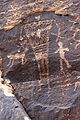
Petroglyphs at Rock Art Canyon Ranch near Winslow

Error: no page names specified (help). In Spanish: Condado de Navajo para niños
