Mount Elbert facts for kids
Quick facts for kids Mount Elbert |
|
|---|---|

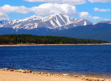
Mount Elbert seen from Turquoise Lake
|
|
| Highest point | |
| Elevation | 14437.6 feet (4400.58 m) NAPGD2022 |
| Prominence | 9,093 feet (2772 m) |
| Isolation | 671 miles (1079 km) |
| Listing |
|
| Naming | |
| Etymology | Samuel Hitt Elbert |
| Geography | |
| Location | High point of Lake County and the State of Colorado, U.S. |
| Parent range | Highest summit of the Rocky Mountains, Southern Rocky Mountains, Sawatch Range, and Elbert Massif |
| Topo map | USGS 7.5' topographic map Mount Elbert, Colorado |
| Climbing | |
| First ascent | 1874 by Henry W. Stuckle |
| Easiest route | Northeast Ridge: Hike, class 1 |
Mount Elbert is the highest mountain in the Rocky Mountains of North America. It stands at an elevation of about 14,438 feet (4,401 meters). This makes it the highest point in the U.S. state of Colorado. It's also the second-highest peak in the contiguous United States (the main part of the U.S., not including Alaska or Hawaii). Only Mount Whitney in California is a little taller.
Mount Elbert is the tallest peak in the Sawatch Range. It's also the highest point in the entire Mississippi River area where water drains. You can find Mount Elbert in San Isabel National Forest. It's about 12 miles (19.4 km) southwest of the city of Leadville in Lake County, Colorado.
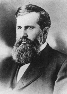
The mountain was named after Samuel Hitt Elbert. He was an important person in Colorado's early history. He served as the Governor of the Territory of Colorado from 1873 to 1874. The first person to officially climb the peak was Henry W. Stuckle in 1874. He was part of a group called the Hayden Survey. The easiest ways to climb Mount Elbert are considered simple hikes. Because of this, Mount Elbert is often called the "gentle giant" of the Rocky Mountains.
Contents
Where is Mount Elbert Located?
Mount Elbert is southwest of Leadville. You can often see its top covered in snow, even in summer. Many other very tall mountains, called fourteeners, are around Elbert. It is also very close to central Colorado's Collegiate Peaks.
To the north, Mount Massive is the second-highest peak in the Rocky Mountains. It's also the third-highest in the main United States. To the south, La Plata Peak is the fifth-highest in the Rockies. The small town of Twin Lakes is at the base of Mount Elbert. Denver is about 130 miles (209 km) to the east. Vail is about 50 miles (80 km) north, and Aspen is about 40 miles (64 km) west. Leadville, about 16 miles (26 km) northeast, is the closest big town. Mount Elbert is the fourteenth-highest mountain in the United States, if you include Alaska and Hawaii.
What is the Weather Like on Mount Elbert?
Weather on Mount Elbert can change very quickly. Thunderstorms are common in the afternoons during summer. It can even hail or snow at any time of year. An electrical storm on the mountain's top was so unusual that it was written about in a science magazine in July 1894.
| Climate data for Mount Elbert 39.1170 N, 106.4402 W, Elevation: 14,019 ft (4,273 m) (1991–2020 normals) | |||||||||||||
|---|---|---|---|---|---|---|---|---|---|---|---|---|---|
| Month | Jan | Feb | Mar | Apr | May | Jun | Jul | Aug | Sep | Oct | Nov | Dec | Year |
| Mean daily maximum °F (°C) | 19.5 (−6.9) |
18.7 (−7.4) |
23.7 (−4.6) |
29.3 (−1.5) |
38.1 (3.4) |
49.7 (9.8) |
55.9 (13.3) |
53.9 (12.2) |
47.4 (8.6) |
36.6 (2.6) |
25.8 (−3.4) |
19.7 (−6.8) |
34.9 (1.6) |
| Daily mean °F (°C) | 7.9 (−13.4) |
6.7 (−14.1) |
11.3 (−11.5) |
16.2 (−8.8) |
24.9 (−3.9) |
35.5 (1.9) |
41.7 (5.4) |
40.2 (4.6) |
33.9 (1.1) |
24.1 (−4.4) |
14.8 (−9.6) |
8.5 (−13.1) |
22.1 (−5.5) |
| Mean daily minimum °F (°C) | −3.6 (−19.8) |
−5.2 (−20.7) |
−1.2 (−18.4) |
3.1 (−16.1) |
11.8 (−11.2) |
21.3 (−5.9) |
27.5 (−2.5) |
26.6 (−3.0) |
20.4 (−6.4) |
11.7 (−11.3) |
3.8 (−15.7) |
−2.7 (−19.3) |
9.5 (−12.5) |
| Average precipitation inches (mm) | 4.26 (108) |
4.07 (103) |
4.39 (112) |
5.39 (137) |
3.89 (99) |
1.65 (42) |
2.18 (55) |
2.42 (61) |
2.65 (67) |
3.29 (84) |
4.08 (104) |
3.78 (96) |
42.05 (1,068) |
| Source: PRISM Climate Group | |||||||||||||
How Mount Elbert Was Formed
Mount Elbert is part of the Sawatch Range. This mountain range was pushed up during a period called the Laramide Orogeny. This happened about 28 million years ago. Huge glaciers once covered the tops of these mountains. When the glaciers melted, they left behind special shapes on the peaks.
For example, at the base of Elbert on the east side, you can see igneous and metamorphic rocks. These rocks were uncovered when the glaciers moved away. There is also a large bowl-shaped area called a cirque higher up on the east side. It has a small mountain lake, or tarn. There are also lakes to the north and south: Turquoise Lake and Twin Lakes. The Twin Lakes were formed by natural dams made of rock and dirt left by glaciers. Turquoise Lake was made by a human-built dam.
Mount Elbert is mostly made of a hard rock called quartzite. However, the very top ridge is made of older metamorphic rock. This rock is about 1.7 billion years old. You can also find other types of rocks like pegmatite, gneiss, and schist. Unlike other tall mountains, Elbert doesn't have a permanent snow cap. It also doesn't have a large cirque facing north. This is because it's surrounded by other tall mountains, so it doesn't get as much snow.
History of Mount Elbert

Miners named Mount Elbert to honor Samuel Hitt Elbert. He was the governor of the Territory of Colorado at the time. In 1873, he helped make a deal with the Ute tribe. This deal opened up over 3 million acres (12,000 km²) of land for mining and railroads. The first recorded climb of the peak was by H.W. Stuckle in 1874. He was mapping the mountain as part of the Hayden Survey.
Mount Elbert was first measured at 14,433 feet (4,400 m). Later, its height was changed to 14,440 feet (4,401 m) after new measurements. This change caused some debate. After the Great Depression, there was a friendly argument about the heights of Elbert and its neighbor, Mount Massive. They are only about 12 feet (3.7 m) different in height. Supporters of Mount Massive even built large piles of stones on its top to make it taller! But Mount Elbert's fans would come and knock them down. In the end, Mount Elbert remained the highest peak in Colorado. The first time a vehicle reached the top of Elbert was in 1949. A Jeep was driven to the summit to see if it was good for skiing.
Plants and Animals on Mount Elbert
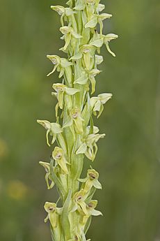
The very top of Mount Elbert is an alpine tundra environment. This means it's a cold, windy place with small, tough plants. You can find plants like sky-pilot, old-man-of-the-mountain, and alpine avens here. Other plants include different types of sedges, willows, and orchids.
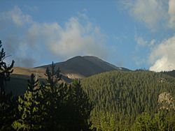
Below the treeline, the mountain is covered in thick forests. The lower parts of the mountain have a mix of lodgepole pine, spruce, aspen, and fir trees.
You might see several animals when climbing Mount Elbert. These include black bears, marmots, mule deer, pikas, and pocket gophers. There are also many kinds of birds. During the summer, you might also spot elk, grouse, turkey, and bighorn sheep. Sadly, Grizzly bears no longer live in this area.
Climbing Mount Elbert
There are three main ways to climb Mount Elbert. All of them involve climbing over 4,100 feet (1,250 m) in elevation. The most common way starts from the east. You begin on the Colorado Trail just north of Twin Lakes. This path, called the North (Main) Elbert Trail, is about 4.6 miles (7.4 km) long. It climbs about 4,500 feet (1,372 m). This trail is open for horseback riding, mountain biking, and hunting during certain times of the year.
An easier but longer way is the South Elbert Trail. It's about 5.5 miles (8.9 km) long and climbs 4,600 feet (1,402 m). This route is less steep than the North Elbert Trail. It approaches the mountain from the south and then climbs the eastern ridge.
The hardest of the main routes is the Black Cloud Trail. This climb is considered a Class 2 climb. It usually takes ten to fourteen hours to complete. It gains about 5,300 feet (1,615 m) in elevation. This route also includes climbing a smaller peak called South Elbert, which is 14,134 feet (4,308 m) tall. Even strong and experienced climbers find this route very difficult. Although there is a trail, it is extremely steep, unstable, and rocky in some places. The climb is not easy all the way up. There are also ways to climb from the western side and the southwestern ridge. These start from the South Halfmoon Creek Trailhead and Echo Canyon Trailhead.
None of the usual climbing routes need special mountaineering skills or technical rock climbing. They are hard hikes that require good physical fitness. The biggest dangers on the mountain are common to all high mountains. These include altitude sickness, which can affect anyone. In serious cases, it can cause problems with breathing or even paralysis. This can be very dangerous. Climbers are advised to start their climb early in the morning, around 6 A.M. They should reach the top and come back down before early afternoon. This helps avoid afternoon thunderstorms when they are high up. Most people hike up, but a speaker named Anna Elizabeth Dickinson once rode a mule to the top!
See also
 In Spanish: Monte Elbert para niños
- List of mountain peaks of North America
- List of mountain peaks of the United States
- List of mountain peaks of Colorado
- List of Colorado county high points
- List of Colorado fourteeners
- List of mountain peaks of Colorado
- List of mountain peaks of the United States
- List of U.S. states by elevation
- List of the highest major summits of the United States
- List of the most prominent summits of the United States
- List of the most isolated major summits of the United States
 | Roy Wilkins |
 | John Lewis |
 | Linda Carol Brown |


