Front Range facts for kids
Quick facts for kids Front Range |
|
|---|---|
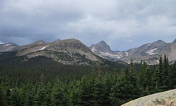
Front Range Peaks in the Indian Peaks Wilderness
|
|
| Highest point | |
| Peak | Grays Peak |
| Elevation | 14,278 ft (4,352 m) |
| Geography | |
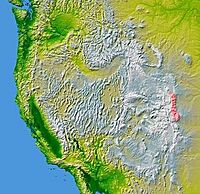
The Front Range (excluding the Laramie Mountains) is shown highlighted on a map of the western U.S.
|
|
| Country | United States |
| Parent range | Rocky Mountains |
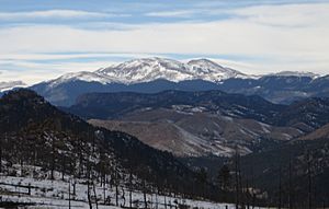
The Front Range is a mountain range in the Southern Rocky Mountains of North America. It stretches through central Colorado and southeastern Wyoming in the United States. If you travel west across the Great Plains, the Front Range is the very first mountain range you'll see.
This mountain range runs from Casper, Wyoming in the north down to Pueblo, Colorado in the south. It rises almost 10,000 feet (about 3,000 meters) above the flat plains. Famous peaks like Longs Peak, Mount Evans, and Pikes Peak are part of the Front Range. You can easily spot them from Interstate 25. The Front Range is a popular spot for fun outdoor activities. People enjoy mountain biking, hiking, climbing, and camping in summer. In winter, it's great for skiing and snowboarding. Millions of years ago, this area was home to ancient mountains, deserts, beaches, and even oceans!
The name "Front Range" also refers to the Front Range Urban Corridor. This is the busy area with cities and towns in Colorado and Wyoming. It's located just east of the mountains, stretching from Cheyenne, Wyoming to Pueblo, Colorado. The mountains help protect this urban area from strong storms.
Contents
How the Front Range Was Formed: A Look at Its Geology
The Front Range has an amazing geological history. It tells a story of how Earth's surface changed over millions of years.
Ancient Rocks and Early Seas
About one billion years ago, a lot of hot, melted rock (magma) was moving deep inside the Earth. This magma cooled and hardened, forming a type of rock called Pikes Peak Granite. This granite is very old! For the next 500 million years, the area slowly sank. This allowed layers of sand and mud, called sediments, to build up. These sediments came from the erosion of the ancient granite.
The Rise of the Ancestral Rockies
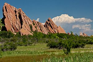
Around 300 million years ago, the sinking stopped, and the land began to push upwards. This created the Ancestral Rocky Mountains. Over the next 150 million years, these mountains slowly wore down. Wind, rain, snow, and ice carved through the granite. The eroded bits of these ancient mountains formed a rock layer called the Fountain Formation. You can see this formation at Red Rocks Amphitheatre near Denver.
Deserts and Tidal Flats
About 280 million years ago, sea levels were low. Colorado was part of a huge supercontinent called Pangaea. This area was covered by vast sand deserts, with huge sand dunes. These dunes left their mark in the rocks we now call the Lyons Sandstone. You can even find fossil footprints and leaf prints in these rocks!
Later, about 250 million years ago, the land was a smelly tidal flat. This was part of the Lykins Formation. This time was right after Earth's biggest extinction event. Ninety percent of all ocean life and much land life disappeared. But life always finds a way to bounce back!
The Age of Dinosaurs
After another 100 million years, a new environment appeared. This led to the Morrison Formation, a sandstone layer. This formation is famous for its amazing dinosaur fossils, especially those from huge plant-eating dinosaurs called sauropods. The land was covered in plants like ferns, but there was no grass yet.
Around 100 million years ago, the Dakota Sandstone formed along Colorado's eastern coast. This rock also has fern fossils and dinosaur tracks. You can see ripple marks in the rocks, showing it was a shallow sea.
A Deep Ocean and Another Extinction
For the next 30 million years, the region became a deep ocean called the Western Interior Seaway. Thick layers of mud settled, forming the Pierre Shale. This shale contains fossils of sea creatures like ammonites, fish, and huge marine reptiles like mosasaurs.
About 68 million years ago, the Front Range began to rise again. This was due to a major mountain-building event called the Laramide Orogeny.
The End of the Dinosaurs and New Beginnings
The Denver Formation formed as the land rose. It holds fossils of famous dinosaurs like Tyrannosaurus rex and Triceratops. But then, about 66 million years ago, a giant meteor hit Earth in Mexico. This caused a huge extinction event, wiping out the dinosaurs and many other species. However, some life survived and helped Earth recover.
The Front Range kept rising and eroding. By 40 million years ago, it was buried under its own eroded rock.
Volcanoes and Modern Mountains
Suddenly, 37 million years ago, a huge volcanic eruption happened in the Collegiate Peaks. Hot ash covered the landscape, creating a tough rock layer called rhyolite. But life returned, and massive floods later carved through the rhyolite. This created the Castle Rock Conglomerate.
Finally, about 10 million years ago, the Front Range began its final uplift. The strong granite at its core pushed upwards, while the softer layers on top wore away. Ice Age glaciers (about 16,000 years ago) also helped carve the mountains into the beautiful peaks we see today.
Prominent Peaks of the Front Range
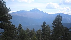
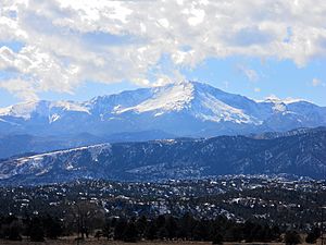
The Front Range is home to some of the tallest peaks on the eastern side of the Rocky Mountains. The highest point in the Front Range is Grays Peak. Other well-known mountains include Torreys Peak, Mount Evans, Longs Peak, Pikes Peak, and Mount Bierstadt.
Here are some of the tallest peaks in the Front Range:
| Rank | Mountain Peak | Subrange | Elevation | Prominence | Isolation |
|---|---|---|---|---|---|
| 1 | Grays Peak | Front Range | 14,278 ft 4352 m |
2,770 ft 844 m |
25.0 mi 40.3 km |
| 2 | Mount Evans | Front Range | 14,265 ft 4348 m |
2,769 ft 844 m |
9.79 mi 15.76 km |
| 3 | Longs Peak | Front Range | 14,259 ft 4346 m |
2,940 ft 896 m |
43.6 mi 70.2 km |
| 4 | Pikes Peak | Pikes Peak Massif | 14,115 ft 4302 m |
5,530 ft 1686 m |
60.8 mi 97.8 km |
| 5 | Mount Silverheels | Front Range | 13,829 ft 4215 m |
2,283 ft 696 m |
5.48 mi 8.82 km |
| 6 | Bald Mountain | Front Range | 13,690 ft 4173 m |
2,099 ft 640 m |
7.51 mi 12.09 km |
| 7 | Bard Peak | Front Range | 13,647 ft 4159 m |
1,701 ft 518 m |
5.43 mi 8.74 km |
| 8 | Hagues Peak | Mummy Range | 13,573 ft 4137 m |
2,420 ft 738 m |
15.92 mi 25.6 km |
| 9 | North Arapaho Peak | Indian Peaks | 13,508 ft 4117 m |
1,665 ft 507 m |
15.40 mi 24.8 km |
| 10 | Parry Peak | Front Range | 13,397 ft 4083 m |
1,731 ft 528 m |
9.46 mi 15.22 km |
| 11 | Mount Richthofen | Front Range | 12,945 ft 3946 m |
2,680 ft 817 m |
9.66 mi 15.54 km |
| 12 | Specimen Mountain | Front Range | 12,494 ft 3808 m |
1,731 ft 528 m |
4.86 mi 7.82 km |
| 13 | Bison Peak | Tarryall Mountains | 12,432 ft 3789 m |
2,451 ft 747 m |
19.14 mi 30.8 km |
| 14 | Waugh Mountain | South Park Hills | 11,716 ft 3571 m |
2,330 ft 710 m |
20.0 mi 32.2 km |
| 15 | Black Mountain | South Park Hills | 11,649 ft 3551 m |
2,234 ft 681 m |
8.03 mi 12.92 km |
| 16 | Williams Peak | South Williams Fork Mountains | 11,620 ft 3542 m |
2,049 ft 625 m |
10.79 mi 17.37 km |
| 17 | Puma Peak | South Park Hills | 11,575 ft 3528 m |
2,260 ft 689 m |
7.44 mi 11.97 km |
| 18 | Thirtynine Mile Mountain | South Park Hills | 11,553 ft 3521 m |
2,088 ft 636 m |
10.61 mi 17.08 km |
| 19 | Twin Sisters Peaks | Front Range | 11,433 ft 3485 m |
2,328 ft 710 m |
4.36 mi 7.01 km |
| 20 | South Bald Mountain | Laramie Mountains | 11,007 ft 3355 m |
1,844 ft 562 m |
13.66 mi 22.0 km |
Getting Around the Front Range
Many roads and train lines help people travel through the Front Range.
Roads and Highways
- Interstate 70 crosses the mountains west of Denver, Colorado.
- Interstate 80 crosses near Laramie, Wyoming.
- U.S. Route 34 goes through the mountains near Loveland, Colorado. This road is usually closed from October to May because of snow.
- U.S. Route 24 travels through the southern Front Range, west of Colorado Springs. It eventually connects with I-70.
Railroad Routes
The Union Pacific Railroad operates two train lines through the mountains.
- The first, called the Overland Route, runs through southern Wyoming. It follows I-80 for much of the way.
- The second is the Moffat Route, which used to be the Denver & Rio Grande Western Railroad. This line runs along the Colorado River and goes through the 6.5-mile-long Moffat Tunnel. This route is used for freight trains by Union Pacific and BNSF. It's also used by Amtrak's California Zephyr and Winter Park Express passenger trains.
Images for kids
-
The Front Range as viewed from Greenwood Village south of Denver, Mount Evans is on the far right
See also
 In Spanish: Cordillera Front para niños
 | Tommie Smith |
 | Simone Manuel |
 | Shani Davis |
 | Simone Biles |
 | Alice Coachman |


