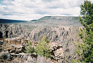
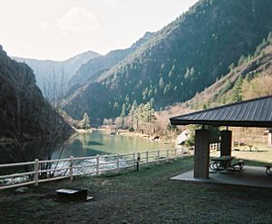
Black Canyon of the Gunnison National Park facts for kids
Quick facts for kids Black Canyon of the Gunnison |
|
|---|---|
|
IUCN Category II (National Park)
|
|
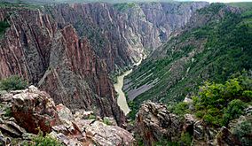
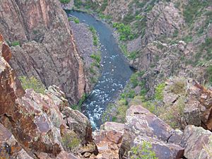
Gunnison River at the base of Black Canyon of the Gunnison
|
|
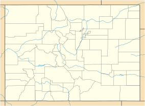
| Location | Montrose County, Colorado, United States |
| Nearest city | Montrose |
| Area | 30,750 acres (124.4 km2) |
| Established | October 21, 1999 |
| Visitors | 308,962 (in 2018) |
| Governing body | National Park Service |
| Website | Black Canyon of the Gunnison National Park |
The Black Canyon of the Gunnison National Park is a special place in western Colorado. It is managed by the National Park Service. You can enter the park from two main sides. The south entrance is about 15 miles (24 km) east of Montrose. The north entrance is about 11 miles (18 km) south of Crawford. The north entrance closes during winter.
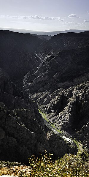
The park protects 12 miles (19 km) of the 48-mile (77 km) long Black Canyon. This part of the canyon is the deepest and most dramatic. The canyon continues outside the park into other protected areas. It is called "Black Canyon" because some parts get only about 33 minutes of sunlight each day. This makes the canyon walls look very dark. One author said that no other canyon is as deep, steep, narrow, or dark as the Black Canyon.
Contents
How the Black Canyon Was Formed
The Gunnison River carved out the Black Canyon. It drops about 34 feet per mile (6.4 m/km) through the canyon. This makes it one of the steepest river descents in North America. For comparison, the Colorado River in the Grand Canyon drops about 7.5 feet per mile (1.4 m/km). The steepest part of the Gunnison River's drop is inside the park. Here, it drops 240 feet per mile (45 m/km).
The canyon is called "Black" because it is so steep and narrow. Sunlight struggles to reach the bottom. This keeps the rocky walls in shadow, making them appear black. At its narrowest point, the canyon is only 40 feet (12 m) wide at the river.
The canyon's extreme depth and steepness happened because of several geological events. The Gunnison River did most of the carving. But other things had to happen first to create the canyon we see today.
Ancient Rocks and Uplifts
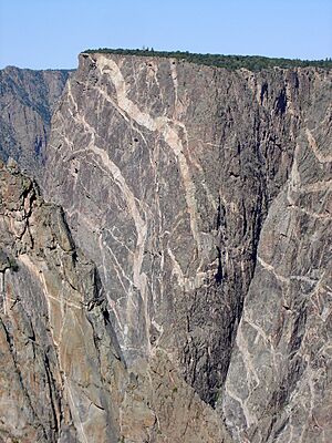
The main rocks in the canyon walls are called gneiss and schist. These rocks are very old, about 1.7 billion years old. They formed during a time when ancient volcanic islands crashed into what is now Wyoming. This caused a lot of heat and pressure, changing the rocks. The lighter-colored pegmatite dikes you can see cutting across the darker rocks formed around the same time.
Later, about 70 to 40 million years ago, the whole area was pushed upwards. This event is called the Laramide orogeny. It lifted the old gneiss and schist rocks high up. Then, about 26 to 35 million years ago, many volcanoes erupted nearby. These volcanoes buried the area under thousands of feet of volcanic ash and debris.
The Gunnison River started flowing about 15 million years ago. Water from the nearby mountains began cutting through the soft volcanic ash. This set the path for the modern river.
How the Canyon Got So Deep
About 2 to 3 million years ago, the land lifted up again. This made the Gunnison River cut deeper through the soft volcanic layers. Eventually, the river reached the very hard, ancient rocks that had been pushed up. The river couldn't change its path. So, it started to carve through these extremely hard rocks.
At that time, the river was much bigger and carried more dirt and sand. This allowed it to cut down through the hard rocks very quickly. It carved about 1 inch (25 mm) deeper every 100 years. Because the rocks were so hard and the river cut so fast, it created the very steep walls we see today.
Some smaller canyons that flow into the Black Canyon actually slope the wrong way. Scientists think that other streams in the area changed their direction. But the Gunnison River was stuck in the hard rocks of the Black Canyon. It could not change its course.
History of the Canyon
The Ute Indians knew about the Black Canyon long before Europeans arrived. They called the river "much rocks, big water." They often avoided the canyon because of old beliefs.
In 1776, when the United States declared independence, two Spanish groups passed by the canyon. In the 1800s, fur trappers likely knew about it but didn't write much down. The first official report came from Captain John Williams Gunnison in 1853. He was exploring a route for a railroad. He said the land was "the roughest" he had ever seen. He traveled around the canyon, not through it. Later that year, he died in a conflict with Ute Indians. The river, which he had called the Grand, was then renamed in his honor.
The Denver & Rio Grande Railroad
In 1881, the Denver and Rio Grande Railroad reached Gunnison from Denver. This railroad was built to connect to the gold and silver mines in the San Juan mountains. The land was too rugged for regular train tracks. So, the railroad used narrower tracks. It took over a year for workers to build 15 miles (24 km) of track. This section went from Sapinero to Cimarron and was very expensive.
On August 13, 1882, the first passenger train went through the Black Canyon. A newspaper editor rode the train. He said the canyon was "undoubtedly the largest and most rugged canyon in the world traversed by the iron horse." He described the granite walls rising thousands of feet high. He also noted that the track was very curvy. He called it an amazing feat of engineering.
The railroad wanted to build tracks through the rest of the Black Canyon. So, they sent their best engineer, Bryan Bryant, to explore it. Bryant and his 12-man crew started in December 1882. They expected to finish in 20 days but returned after 68 days. Eight of the men left early because they were scared. Bryant reported that it was impossible to build anything deep inside the canyon.
Because of Bryant's report, the railroad decided to go south of the canyon. In March 1883, the railroad connected to Salt Lake City. For a short time, the canyon was part of a major cross-country railroad route. At first, people used the railroad to get to Utah and the mines. Later, visitors came just to see the canyon's beauty.
The writer Rudyard Kipling described his train ride through the canyon in 1889. He wrote about entering a "gorge, remote from the sun." He saw rocks that were "two thousand feet sheer" and a river that "roared and howled." He called the ride "a glory and a wonder and a mystery."
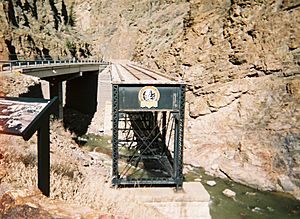
By 1890, a new route through Glenwood Springs was finished. This made the Black Canyon route less important for long-distance trains. However, local trains still used the "Black Canyon Line" until the early 1950s. Today, you can still see parts of the old railroad near Cimarron. This includes a steel bridge.
The Gunnison Tunnel
In 1901, the United States Geological Survey sent Abraham Lincoln Fellows and William Torrence to the canyon. They were looking for a place to build a tunnel. This tunnel would bring water to the Uncompahgre Valley, which needed more water for its settlers. Torrence had tried to explore the canyon before in 1900 but failed.
In August 1901, Torrence and Fellows tried again. They used a special rubber raft instead of wooden boats. They entered the canyon on August 12 with knives, ropes, and waterproof bags for their tools. Their backpacks weighed 35 pounds (16 kg) each. The raft helped them float their gear on the narrow river. After 10 days, they had climbed over rocks, gone down waterfalls, and swam through over 70 parts of the river. They were the first to travel this 30-mile (48 km) section. They also found a good spot for the tunnel.
Building the tunnel started four years later and was very difficult. Workers faced high levels of carbon dioxide, extreme heat, humidity, water, and mud. It took almost a year to dig through 2,000 feet (610 m) of water-filled rock. The tunnel went through very hard rocks like granite and quartzite. At first, miners worked by hand with candlelight. One miner held a drill, and another hit it with a hammer. This work was dangerous, and most workers only stayed for about two weeks. Sadly, 26 men died during the four-year project.
The tunnel was finished in 1909. It was 5.8 miles (9.3 km) long and cost almost 3 million dollars. At that time, the Gunnison Tunnel was the longest irrigation tunnel in the world. On September 23, President William Howard Taft officially opened the tunnel. You can visit the East Portal of the Gunnison Tunnel on the South Rim. You can see the dam that diverts the water, but not the tunnel itself.
Becoming a National Park
The Black Canyon of the Gunnison became a national monument on March 2, 1933. It was then changed to a national park on October 21, 1999.
From 1933 to 1935, the Civilian Conservation Corps built the North Rim Road. This road is five miles long and has five overlooks. It is now listed as a historic place.
Plants and Animals
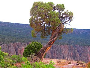
Black Canyon of the Gunnison National Park is home to many different plants and animals. Some common trees and plants include aspen, Ponderosa pine, sagebrush, desert mahogany, Utah juniper, and Gambel oak. A special wildflower called the Black Canyon gilia grows only here.
Many animals live in the park. You might see pronghorn, black bears, coyotes, muskrat, and different types of lizards. Other animals include cougars, raccoons, beavers, elk, river otters, bobcats, and mule deer.
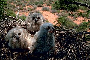
The canyon is also a great place for birds. You can find American dippers, two kinds of eagles, eight kinds of hawks, and six kinds of owls. Other birds like Steller's jay, mountain bluebird, peregrine falcon, magpie, white-throated swift, and canyon wren also live here or visit.
Weather in the Canyon
The Black Canyon of the Gunnison National Park has a cold, dry climate. This means it gets some rain and snow, but not a lot. The summers are warm, and the winters are cold.
| Climate data for South Rim Visitor Center, elevation 7,251 ft (2,210 m), 1981-2010 normals, extremes 1981-2019 | |||||||||||||
|---|---|---|---|---|---|---|---|---|---|---|---|---|---|
| Month | Jan | Feb | Mar | Apr | May | Jun | Jul | Aug | Sep | Oct | Nov | Dec | Year |
| Record high °F (°C) | 55.6 (13.1) |
63.8 (17.7) |
70.8 (21.6) |
79.4 (26.3) |
87.6 (30.9) |
93.5 (34.2) |
95.8 (35.4) |
94.0 (34.4) |
89.5 (31.9) |
80.9 (27.2) |
68.7 (20.4) |
55.8 (13.2) |
95.8 (35.4) |
| Mean daily maximum °F (°C) | 36.9 (2.7) |
41.9 (5.5) |
49.5 (9.7) |
57.4 (14.1) |
67.7 (19.8) |
78.3 (25.7) |
84.3 (29.1) |
81.9 (27.7) |
73.5 (23.1) |
60.9 (16.1) |
47.1 (8.4) |
36.9 (2.7) |
59.8 (15.4) |
| Mean daily minimum °F (°C) | 13.1 (−10.5) |
16.8 (−8.4) |
23.3 (−4.8) |
29.7 (−1.3) |
37.8 (3.2) |
45.6 (7.6) |
51.9 (11.1) |
50.8 (10.4) |
43.2 (6.2) |
32.8 (0.4) |
22.3 (−5.4) |
13.5 (−10.3) |
31.8 (−0.1) |
| Record low °F (°C) | −16.6 (−27.0) |
−20.4 (−29.1) |
−6.5 (−21.4) |
6.3 (−14.3) |
15.8 (−9.0) |
25.5 (−3.6) |
35.9 (2.2) |
37.1 (2.8) |
18.6 (−7.4) |
−1.4 (−18.6) |
−12.0 (−24.4) |
−19.1 (−28.4) |
−20.4 (−29.1) |
| Average precipitation inches (mm) | 1.34 (34) |
1.37 (35) |
2.27 (58) |
1.97 (50) |
1.82 (46) |
0.98 (25) |
1.76 (45) |
2.36 (60) |
2.04 (52) |
2.12 (54) |
1.82 (46) |
1.46 (37) |
21.31 (541) |
| Average dew point °F (°C) | 11.8 (−11.2) |
13.9 (−10.1) |
17.7 (−7.9) |
20.5 (−6.4) |
25.3 (−3.7) |
29.9 (−1.2) |
39.3 (4.1) |
41.5 (5.3) |
33.6 (0.9) |
23.8 (−4.6) |
16.7 (−8.5) |
11.7 (−11.3) |
23.9 (−4.5) |
| Source: PRISM | |||||||||||||
Things to Do at the Park
About 190,000 people visit the park each year. The main attractions are the scenic drives along US Highway 50 and Colorado Highway 92. The south rim is also very popular.
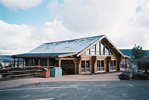
The east side of the park, near Blue Mesa Reservoir, has the most camping spots. You can find places for tents and RVs. There are also canyon tours, hiking, fishing, and boat tours. Nearby is the Curecanti National Recreation Area. It has a visitor center, boat facilities, and many campgrounds.
The west side of the park lets you get to the river by car. You can also take guided tours of the canyon. A short hike at the Blue Mesa Point Information Center leads to Pine Creek. From there, you can take boat tours, go boating, fishing, and hiking.
On the south rim, there is a campground for tents and RVs. Some spots have electricity. There are also several hiking and nature trails. The north rim has a small, basic campground and can be reached by car. You can drive down to the river on the East Portal Road from the south rim. This road is very steep, with a 16% grade. Vehicles longer than 22 feet (6.7 m) are not allowed.
You can also reach the river by hiking down steep, unmaintained trails. These are called "routes" or "draws." Hiking down takes about two hours, and hiking back up takes two to four hours. These hikes are very tough and require some climbing skills. You might face loose rocks, tricky ledges, and little shade. Poison ivy also grows in these areas, so long sleeves and hiking boots are a good idea. Check the river levels before you go, as high water can flood campsites. The National Park Service warns that these routes are hard to follow. Only people in excellent shape should try them. Hikers must be ready to find their own way and rescue themselves if needed. You need a free permit for any inner canyon trips, except at the very west end.
The Gunnison River is a great place for fishing. It is known as a "Gold Medal Water" in the park. This means it's excellent for trout fishing. You can only use artificial flies and lures. All rainbow trout must be caught and released. Fishing is not allowed within 200 yards (183 m) downstream of Crystal Dam.
The Black Canyon is also a popular spot for rock climbing. Most climbs are very difficult and only for experienced climbers.
You can go rafting in the area. However, floating through the park itself is very challenging. It's only for expert kayakers. There are parts of the river that are impossible to pass, requiring long and sometimes dangerous portages. The other rapids are very difficult. Downstream, in the Gunnison Gorge National Conservation Area, the river is a bit easier but still remote and for experienced rafters.
Music Inspired by the Canyon
The canyon inspired a musical piece by Frank Erickson (1923—1996) called Black Canyon of the Gunnison.
In 2017, the band The Infamous Stringdusters released a song about Fellows and Torrence's journey. It's called "1901: A Canyon Odyssey."
See also
 In Spanish: Parque nacional Cañón Negro del Gunnison para niños
 | Stephanie Wilson |
 | Charles Bolden |
 | Ronald McNair |
 | Frederick D. Gregory |


