Curecanti National Recreation Area facts for kids
Quick facts for kids Curecanti National Recreation Area |
|
|---|---|
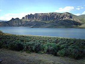
Dillion Pinnacles
|
|
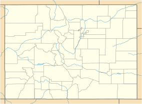
| Location | Gunnison and Montrose counties, Colorado, United States |
| Nearest city | Gunnison, CO |
| Area | 43,095 acres (174.40 km2) |
| Established | February 6, 1965 |
| Visitors | 924,468 (in 2011) |
| Governing body | National Park Service |
| Website | Curecanti National Recreation Area |
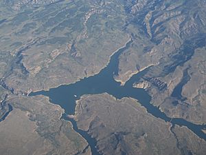
Curecanti National Recreation Area is a special place managed by the National Park Service in western Colorado. It's located on the Gunnison River. This area was created in 1965. Its job is to build and manage fun places for people. These places are around three large lakes: Blue Mesa Reservoir, Morrow Point Reservoir, and Crystal Reservoir. These lakes were made in the 1960s. They help manage the important water from the Colorado River and its smaller rivers.
Curecanti is a great spot for boating and fishing. You can find two marinas here. There are also campgrounds for families and groups. Visitors can enjoy hiking trails and places to launch boats. You can even camp right next to the water! Curecanti is famous for its lake trout and Kokanee salmon fishing. In winter, it's a popular place for ice-fishing.
Contents
History of Curecanti National Recreation Area
In 1922, seven western states made an agreement. They wanted to manage the water from the mighty Colorado River. Each state was promised a certain amount of water each year. The states were split into two groups: upper and lower. This was based on where they were located.
The lower states, like California, Nevada, and Arizona, built big dams. A famous one is the amazing Hoover Dam. These dams created huge lakes to store water. They knew they depended on the upper states. The upper states' mountain snowmelt provided most of the river's water.
By the 1950s, the upper states also saw the need for dams. These states were Colorado, Utah, New Mexico, and Wyoming. They had to send a set amount of water downstream. This was true even if water levels changed with the seasons. So, Congress passed the Colorado River Storage Act in 1956. This law allowed the four states to start building dams.
This Act was a big step in western water law. It created the Colorado River Storage Project. This project approved four main building plans. One of these was on the Gunnison River in western Colorado. The Gunnison is the fifth largest river that flows into the Colorado River.
This project was first called the Curecanti Project. Its goal was to build three dams. These dams would be on the upper parts of the Gunnison River. They would be about 27 miles west of the city of Gunnison. The lakes created would be Blue Mesa, Morrow Point, and Crystal. They would store water for the lower states. They would also provide water for local farms.
Building these dams also helped with other things. It helped control floods. It created electricity from water power. And it made new places for recreation. The National Park Service was given the job to manage the fun activities. They would also design new ways for people to enjoy the three lakes.
In 1965, the Park Service created Curecanti National Recreation Area. This new park included all three lakes. It also covered parts of the river above and below them. The park built campgrounds and places for boats. It also works to protect the environment. It studies and shares the area's natural history. And it manages the fish and animal populations.
Areas to Explore
Curecanti starts about 5 miles west of Gunnison. It ends at the eastern edge of the Black Canyon of the Gunnison National Park. Curecanti has four main areas for visitors:
Blue Mesa Reservoir: Colorado's Largest Lake
Blue Mesa Reservoir was made when the Blue Mesa Dam was built in 1966. It is the largest body of water in Colorado. The lake is fed by the Lake Fork Arm of the Gunnison River, Soap Creek, and Cebolla Creek. This long, wide lake is about 20 miles (32 km) long. It has about 96 miles (154 km) of shoreline. It's the biggest place in the United States for Lake Trout and Kokanee salmon fishing.
Most of the park's visitor spots are around Blue Mesa. You can reach them using U.S. 50. This road goes along the whole length of the lake. Other places are on the lake's deep arms, like Cebolla Creek. You can only get to these by boat or on unpaved roads.
Morrow Point Reservoir: A Remote Canyon Lake
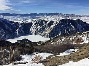
Morrow Point Reservoir is just west of Blue Mesa. It was created by the Morrow Point Dam. This dam is 12 miles west of Blue Mesa Dam. Morrow Point is in the upper part of the Black Canyon. It's narrow and has steep sides. This makes it very different from the wide Blue Mesa.
Morrow Point is more remote and harder to reach. It has fewer places for recreation. You can launch small boats by hand from Pine Creek. This is a trail entrance on U.S. 50. It's about 1 mile west of Blue Mesa Dam.
The Curecanti Needle
Morrow Point Reservoir is home to the Curecanti Needle. This is a striking and unique 700-foot tall granite rock spire. It stands on the lake's southern bank. For many years, the Needle was a symbol for the Denver & Rio Grande Western Railroad. They used this easily recognized spire in their ads. It was for their Black Canyon Route, which passed the Needle.
Now, the Needle is a popular place for climbers. You can only reach it by hand-launched boat. Or you can cross the frozen lake in winter.
Crystal Reservoir: The Smallest Lake
Crystal Reservoir is the most remote of the three lakes. It's also the hardest to get to. It was formed when the Crystal Dam opened in 1976. Building started in 1973. This was seven years after Blue Mesa Dam was finished. Crystal Dam is six miles from Morrow Point Dam. It was the last of the three dams in the Curecanti Project to be completed.
You can get to Crystal from U.S. 50 at Cimarron. A short road takes you to the water. It's just south of Morrow Point Dam.
East Portal: Gateway to the Black Canyon
East Portal is two miles below Crystal Dam. It's at the entrance to the Black Canyon of the Gunnison National Park. This area has the intake tunnel and diversion dam for the Gunnison Tunnel. This was a project started in 1902. It moved river water about 6 miles from the Gunnison. This water went to the dry lands west of Montrose for farming.
The East Portal area has places for fishing. It also has picnic areas and campgrounds. Even though it's part of Curecanti, you can only get to East Portal by the East Portal Road. This road is very steep and winding. It's located inside the Black Canyon of the Gunnison National Park.
Visitor and Fun Activities
Curecanti National Recreation Area has three visitor centers. The National Park Service runs all of them:
- Elk Creek Visitor Center is about 16 miles (26 km) west of Gunnison, Colorado. It's on U.S. Highway 50. It has exhibits about the area's nature and history.
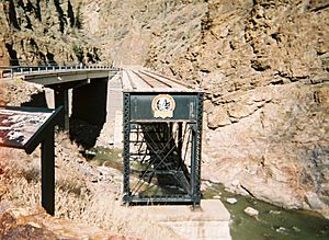
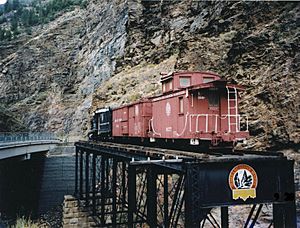
- Cimarron Visitor Center (closed) is in Cimarron, Colorado. It's near Morrow Point Dam. This center has old narrow gauge railroad cars and engines on display.
- Lake Fork Visitor Center (closed) is near Sapinero, Colorado. It's close to the Lake Fork Campground.
Boating Fun
There are two marinas and five boat launches on Blue Mesa Reservoir:
- Elk Creek Marina is near the Elk Creek visitor center. It also has a restaurant and a boat launch.
- Lake Fork Marina is near Sapinero, Colorado. It's close to the Lake Fork campground, visitor center, and boat launch.
- Steven's Creek boat launch is on U.S. 50.
- Iola boat launch is on Colorado Highway 149.
- Ponderosa boat launch.
You can launch small, hand-carried boats on Morrow Point and Crystal Reservoirs. There are trailheads at Pine Creek and Cimarron. Both can be reached from U.S. 50.
More Recreation
Curecanti offers many fun things to do! You can go boating, fishing, and camping. There are places for boat-in camping, developed campgrounds, and simple, primitive sites. You can also enjoy hiking, horseback riding, and hunting.
East of Blue Mesa, along the river, you'll find picnic areas. These are at Riverway, Neversink, Cooper Ranch, and Beaver Creek. There's a launch for kayaks and canoes at Riverway. Neversink has a nature trail. All these spots are on U.S. 50, 5 miles west of Gunnison.
Around Blue Mesa Reservoir, there are 8 developed campgrounds. Two of these are for groups. They range from the large 160-site Elk Creek to smaller, more remote spots. Examples are Ponderosa and Gateview, which are on arms of the lake. Some campsites can fit RVs. Only Elk Creek offers electric hook-ups.
Boaters can camp overnight in 4 free areas. These have a total of 9 individual sites. Boaters can also camp on the southern shore of the Cebolla and Iola Basins. Just make sure campsites are not too close to developed areas or roads.
At Morrow Point Reservoir, you can go boating (hand-carried boats only). There's also primitive camping and hiking. There are three small areas with lake access. These are the Pine Creek Trailhead, Pioneer Point Overlook, and Hermit's Rest Trailhead.
- Pine Creek Trailhead is about 1 mile west of Blue Mesa Dam on U.S. 50. It offers lake access for small boats. It also leads to boat-in campsites.
- Pioneer Point Overlook is north of the lake on Colorado Highway 92. It's about 5.5 miles west of Blue Mesa Dam. It's a great spot for views. It's also the start of the tough Curecanti Creek trail. This trail is 4 miles (6.4 km) round trip. It has a 900-foot (274 m) elevation change. Two campsites are at the end of the trail.
- Hermit's Rest Trailhead is on Co. 92. It's about 17 miles west of Blue Mesa Dam. It leads to the steep Hermit's Rest Trail. This is a 6-mile (9.6 km) round trip. It has an 1800-foot (549 m) elevation change. It ends with two campsites.
Around Crystal Reservoir, you can also go boating (hand-carried boats only). There's camping and hiking too. There are two small developed areas near the lake. These are Mesa Creek Trailhead and Crystal Creek Trailhead.
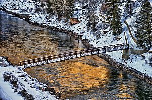
- Mesa Creek Trailhead is just west of Point Morrow Dam. You can get there from a one-mile road north of U.S. 50 at Cimarron. You can launch hand-carried boats into Crystal from Mesa Creek. A single boat-in campsite is about 4 miles west of Mesa Creek. Mesa Creek is also the start of the Mesa Creek Trail. This trail is 1.5 miles (2.4 km) round trip. It crosses the lake on a footbridge.
- Crystal Creek Trailhead is on Colorado Highway 92. It's 24 miles west of Blue Mesa Dam. It gives access to the 5-mile (8 km) Crystal Creek Trail. This trail is moderately difficult. It reaches the water but ends at a viewpoint 1800 feet (549 m) above the lake.
Other fun things at Curecanti include horse corrals for campers with horses. These are at Dry Gulch, Ponderosa, and Soap Creek. There's also the Dillon Pinnacles Trail. This is a moderately tough 4-mile (6.4 km) round trip. It leads to the Dillon Pinnacles. These are striking volcanic rock formations. They have become one of the park's most famous sights.
Other Cool Sights
- The Denver and Rio Grande Western Railroad Narrow Gauge Trestle is in Cimarron Canyon. It's near Morrow Point Dam. This is the last narrow gauge railroad trestle left in the Black Canyon of the Gunnison. The trestle was built in 1895. It was added to the National Register of Historic Places in 1976.
 | Tommie Smith |
 | Simone Manuel |
 | Shani Davis |
 | Simone Biles |
 | Alice Coachman |


