Blue Mesa Reservoir facts for kids
Quick facts for kids Blue Mesa Reservoir |
|
|---|---|
 |
|
| Location | Gunnison County, Colorado |
| Coordinates | 38°28′13″N 107°13′13″W / 38.4703°N 107.2204°W |
| Type | reservoir |
| Primary inflows | Gunnison River, Lake Fork Arm of the Gunnison River, Soap Creek, Cebolla Creek |
| Primary outflows | Gunnison River |
| Basin countries | United States |
| Max. length | 20 mi (32 km) |
| Surface area | 9,180 acres (3,720 ha) |
| Water volume | 940,800 acre-feet (1,160.5 GL) |
| Shore length1 | 96 mi (154 km) |
| Surface elevation | 7,519 ft (2,292 m) |
| 1 Shore length is not a well-defined measure. | |
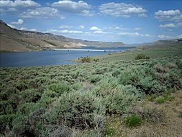
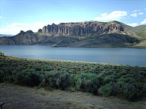
Blue Mesa Reservoir is a large lake in Gunnison County, Colorado. It's not a natural lake, but a man-made one, also called a reservoir. It was created on the Gunnison River.
This reservoir is the biggest lake completely inside Colorado. It was formed when the Blue Mesa Dam was built in 1966. The dam is 390 feet tall and helps make electricity. Blue Mesa Reservoir is part of the Curecanti National Recreation Area. It's also a great place for fishing, especially for lake trout and Kokanee salmon.
Contents
How Blue Mesa Reservoir Was Made
In 1956, the U.S. Bureau of Reclamation started a big project. This project was called the Colorado River Storage Project (CRSP). Its goal was to manage the water from the Colorado River and its branches. This included rivers in Colorado, New Mexico, Utah, and Wyoming.
One of the first parts of the CRSP was the Curecanti Unit. This unit focused on the upper part of the Gunnison River. The Gunnison River is a major branch of the Colorado River. The plan was to build four dams along a 40-mile stretch of the river. These dams would help control water flow and prevent floods. They would also store water and create hydroelectric power.
The first dam built was Blue Mesa Dam. Construction began in 1962. It was finished four years later. This dam created Blue Mesa Reservoir. The reservoir became the main water storage for the Curecanti Unit.
Where to Find Blue Mesa Reservoir
Blue Mesa Dam is about 30 miles west of the city of Gunnison. You can find it where U.S. 50 meets Colorado Highway 92. Highway 92 actually goes right over the top of the dam.
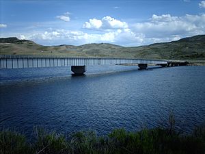
The reservoir stretches east for 20 miles. It has three main parts, or basins. These are the Iola, the Cebolla, and the Sapinero basins. U.S. 50 runs along the northern side of the Iola and Cebolla Basins. Then, it crosses the reservoir on the Middle Bridge.
You can reach the southern side of the Iola Basin using Colorado Highway 149. This highway starts near the Lake City Bridge. Most of the fun spots at Blue Mesa are easy to get to from U.S. 50. Some areas, like Cebolla Creek, are harder to reach. You might need a boat or a dirt road to get there.
Fun Things to Do at Blue Mesa Reservoir
The National Park Service helps manage the fun activities at Blue Mesa Reservoir. It's part of the Curecanti National Recreation Area. There are many things to do here. You can go boating, fishing, and camping. There are also places for hiking, horseback riding, and hunting.
Boating is very popular on Blue Mesa. There are marinas at Elk Creek and Lake Fork. Both are near the dam and can be reached from U.S. 50. You can also launch boats from Ponderosa and Stevens Creek campgrounds. In winter, the Iola Basin is a favorite spot for ice fishing.
Blue Mesa has 8 developed campgrounds. Two of these are for groups. Some campgrounds are very large, like Elk Creek. Others, like Ponderosa, are smaller and more private. Many campsites can fit RVs. Elk Creek is the only one with electrical hook-ups.
Boaters can camp overnight in 4 free areas. These areas have 9 individual campsites. You can also camp on the southern shore of the Cebolla and Iola Basins. Just make sure you are not too close to developed areas or roads.
Places to Visit Nearby
Besides Blue Mesa Reservoir, the Curecanti National Recreation Area has two other lakes. These are Morrow Point Reservoir and Crystal Reservoir. They were also created by the same project as Blue Mesa. These lakes are smaller and narrower. They are located inside the Black Canyon of the Gunnison National Park. They are harder to get to, but offer amazing views.
West of Blue Mesa is Black Canyon of the Gunnison National Park. This park has camping, hiking, and views of a deep canyon. The canyon is about 1900 feet deep. North of the reservoir is the Gunnison Ranger District. This area is part of the Grand Mesa, Uncompahgre and Gunnison National Forests. It has almost 30 campgrounds and many hiking trails.
Towns near Blue Mesa include Gunnison to the east. To the west are Montrose and Delta. All these towns can be reached using U.S. 50.
 | Stephanie Wilson |
 | Charles Bolden |
 | Ronald McNair |
 | Frederick D. Gregory |


