
Great Sand Dunes National Park and Preserve facts for kids
Quick facts for kids Great Sand Dunes National Park and Preserve |
|
|---|---|
|
IUCN Category V (Protected Landscape/Seascape)
|
|
| Location | Alamosa and Saguache Counties, Colorado, United States |
| Nearest city | Alamosa |
| Area | 149,028 acres (232.9 sq mi; 603.1 km2) |
| Established | March 17, 1932 (as a national monument) September 24, 2004 (as a national park) |
| Visitors | 527,546 (in 2019) |
| Governing body | National Park Service |
Great Sand Dunes National Park and Preserve is a super cool place in south-central Colorado, United States. It's famous for having the tallest sand dunes in all of North America! Imagine sand dunes as tall as a 75-story building! This special park also protects beautiful mountains, forests, and wetlands nearby.
President Herbert Hoover first made it a national monument in 1932 to keep it safe. Later, in 2004, it became a national park and preserve, making it much bigger and protecting even more amazing nature. Today, the park and preserve cover a huge area of about 149,028 acres, which is like protecting over 113,000 football fields! Many people visit each year to explore these unique sandy hills and the wild areas around them.
Contents
History of the Great Sand Dunes
The history of the Great Sand Dunes area is long and interesting, stretching back thousands of years.
Ancient People and the Dunes
People have lived in the San Luis Valley for about 11,000 years. The first groups were nomadic hunter-gatherers. They hunted large animals like mammoths and ancient bison using stone spears. These early people moved with the seasons, staying when food was plentiful and leaving during dry times.
.jpg)
Later, different Native American tribes knew this area well. The Ute tribe called the dunes Saa waap maa nache, meaning "sand that moves." The Jicarilla Apaches called them Sei-anyedi, or "it goes up and down." For the Navajo people, Blanca Peak, a mountain near the dunes, is one of their four sacred mountains. These tribes used parts of ponderosa pine trees for food and medicine. People from the Tewa/Tiwa-speaking pueblos believed their ancestors came into this world through a lake near the dunes, which they called Sip'ophe (Sandy Place Lake).
Early European Explorers
In 1694, Diego de Vargas, a Spanish governor, was the first European known to visit the San Luis Valley. He and his men hunted bison there. Later, other explorers like Juan Bautista de Anza (in 1776) and Zebulon Pike (in 1807) traveled through the area. Pike was one of the first to write about the amazing sand hills, describing them like a "sea in a storm."

In the mid-1800s, explorers like John C. Frémont and John Gunnison also passed through. They were looking for routes for railroads and exploring the western lands.
Settlers and Ranchers
After the explorers, settlers began to arrive in the late 1800s. They built forts, ranches, and farms. Important routes like Mosca Pass and Medano Pass helped people travel into the valley. These routes were first used by Native Americans and later by settlers.
Families like the Herards and Trujillos started ranches near the dunes. They raised cattle and horses. The Trujillo family's ranch is now part of a larger protected area. People also searched for gold in the creeks around the dunes, but it was too hard to find enough to make a business out of it.

Protecting the Dunes
By the 1920s, people in nearby towns realized how special the dunes were. They worried that gold mining or making concrete from the sand could destroy them. Local groups, like the P.E.O. Sisterhood, worked hard to protect the area. Their efforts led President Herbert Hoover to declare the Great Sand Dunes a national monument in 1932. This was a big step in keeping this natural wonder safe for everyone. Later, in 2004, it became a national park and preserve, giving it even more protection.
How the Dunes Formed: Geology

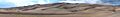
The Great Sand Dunes are the tallest and widest sand dunes in North America. They rise up to 750 feet (about 229 meters) from the valley floor. The dunes cover an area of about 30 square miles (78 square kilometers) and hold a huge amount of sand.
Mountains, Lakes, and Sand
The story of the dunes began millions of years ago when the Sangre de Cristo Range mountains rose up. Later, the San Juan Mountains formed to the west through volcanic activity. The San Luis Valley sits between these two mountain ranges. Over long periods, melting glaciers and rain washed tons of sediment, including sand, into this valley.
Scientists found evidence of a giant ancient lake, called Lake Alamosa, that once covered much of the valley. When this lake eventually drained away, it left behind huge amounts of sand. Smaller lakes remained, and more sand continued to wash into them from the mountains. As the climate changed, these smaller lakes also dried up, leaving behind a vast "sand sheet."
Wind, Water, and Dune Growth

The sand left on the valley floor was then picked up by strong southwest winds. These winds blew the sand towards a curve in the Sangre de Cristo Mountains, where it got trapped. The wind funnels through mountain passes, causing the sand to pile up in this natural pocket.
What makes these dunes so tall is a special trick of nature: the winds blow in opposite directions! Most of the time, winds blow sand from the valley towards the mountains. But during storms, the winds switch and blow sand back towards the valley. These opposing winds make the dunes grow taller instead of just spreading out.
Two creeks, Medano Creek and Sand Creek, also help recycle the sand. They pick up sand from the mountain side of the dunes and carry it back to the valley floor. Then, as the creeks disappear into the sand, the wind picks up the sand again and blows it back into the dune field. This constant movement of sand by wind and water helps the dunes stay so big.
Dune Stability and Age
Even though the top layer of sand moves, the dunes are quite stable. This is because the sand a few inches below the surface is moist, holding the dunes together. Scientists are still working to figure out the exact age of the dunes. They use a method called optically stimulated luminescence (OSL) to see how long quartz grains have been buried in the dark. Early results suggest the deepest sand deposits could be tens of thousands of years old.
You might notice dark patches on the dunes. These are deposits of magnetite, a heavy, magnetic mineral that eroded from the Sangre de Cristo Mountains. When the lighter sand blows away, the heavier magnetite stays behind, creating these dark spots.
Where is the Park? Geography

Great Sand Dunes National Park and Preserve is located in Colorado, in the San Luis Valley and the nearby Sangre de Cristo Range. The elevation here ranges from about 7,515 feet (2,291 meters) in the valley to 13,604 feet (4,146 meters) at the top of Tijeras Peak.
The main dune field covers about 30 square miles (78 square kilometers). But the surrounding flat "sand sheet" is even bigger, holding about 90% of all the sand in the park! To the east, tall, often snow-capped mountains rise over 13,000 feet (3,962 meters), making a dramatic backdrop. The park also has snow-fed creeks, alpine lakes, and wetlands that are home to many animals.
The nearest city is Alamosa, about 30 miles (48 kilometers) away. Larger cities like Colorado Springs and Denver are a few hours' drive to the northeast.
Weather and Climate
.jpg)
The Great Sand Dunes are in a high-elevation desert in the San Luis Valley, about 7,694 feet (2,345 meters) above sea level. This means the weather can change a lot!
Seasonal Weather
- Spring: The weather varies from sunny and mild to cold and snowy. Strong winds can blow in the afternoons. March often has the most snow. In late spring, Medano Creek usually flows strongest.
- Summer: Daytime temperatures average around 75-80°F (24-27°C). However, the sand surface can get super hot, up to 150°F (66°C) on sunny days! Nights are cool, often dropping below 50°F (10°C). Thunderstorms are common in July and August, bringing rain and lightning.
- Fall: Generally mild, with warm "Indian summer" days. Nights get cold, often freezing. Sometimes, fall storms bring icy rain or snow.
- Winter: Very cold temperatures are typical, but there's often lots of sunshine. The dry air makes it feel less cold than humid places. Average high temperatures are just above freezing, even in January.
| Climate data for Great Sand Dunes National Park and Preserve, Colorado, 1991–2020 normals, extremes 1950–present | |||||||||||||
|---|---|---|---|---|---|---|---|---|---|---|---|---|---|
| Month | Jan | Feb | Mar | Apr | May | Jun | Jul | Aug | Sep | Oct | Nov | Dec | Year |
| Record high °F (°C) | 67 (19) |
63 (17) |
72 (22) |
78 (26) |
89 (32) |
96 (36) |
94 (34) |
90 (32) |
87 (31) |
80 (27) |
67 (19) |
61 (16) |
96 (36) |
| Mean maximum °F (°C) | 46.8 (8.2) |
51.3 (10.7) |
63.2 (17.3) |
70.2 (21.2) |
78.4 (25.8) |
86.9 (30.5) |
88.3 (31.3) |
85.7 (29.8) |
81.0 (27.2) |
72.7 (22.6) |
60.1 (15.6) |
49.1 (9.5) |
89.2 (31.8) |
| Mean daily maximum °F (°C) | 33.4 (0.8) |
38.8 (3.8) |
48.5 (9.2) |
55.8 (13.2) |
65.9 (18.8) |
77.4 (25.2) |
80.8 (27.1) |
78.1 (25.6) |
71.6 (22.0) |
59.6 (15.3) |
45.5 (7.5) |
34.1 (1.2) |
57.5 (14.2) |
| Daily mean °F (°C) | 22.3 (−5.4) |
27.5 (−2.5) |
36.1 (2.3) |
42.5 (5.8) |
51.9 (11.1) |
62.5 (16.9) |
66.3 (19.1) |
64.1 (17.8) |
57.5 (14.2) |
46.2 (7.9) |
33.6 (0.9) |
23.1 (−4.9) |
44.5 (6.9) |
| Mean daily minimum °F (°C) | 11.3 (−11.5) |
16.2 (−8.8) |
23.7 (−4.6) |
29.2 (−1.6) |
37.8 (3.2) |
47.6 (8.7) |
51.7 (10.9) |
50.0 (10.0) |
43.5 (6.4) |
32.8 (0.4) |
21.6 (−5.8) |
12.0 (−11.1) |
31.5 (−0.3) |
| Mean minimum °F (°C) | −4.1 (−20.1) |
−0.9 (−18.3) |
7.2 (−13.8) |
15.0 (−9.4) |
25.1 (−3.8) |
36.0 (2.2) |
44.5 (6.9) |
42.9 (6.1) |
31.3 (−0.4) |
16.1 (−8.8) |
4.2 (−15.4) |
−3.9 (−19.9) |
−7.6 (−22.0) |
| Record low °F (°C) | −25 (−32) |
−22 (−30) |
−9 (−23) |
−6 (−21) |
15 (−9) |
25 (−4) |
36 (2) |
33 (1) |
22 (−6) |
0 (−18) |
−12 (−24) |
−19 (−28) |
−25 (−32) |
| Average precipitation inches (mm) | 0.58 (15) |
0.44 (11) |
0.88 (22) |
1.19 (30) |
1.19 (30) |
0.73 (19) |
2.10 (53) |
1.92 (49) |
1.31 (33) |
0.86 (22) |
0.51 (13) |
0.49 (12) |
12.20 (310) |
| Average snowfall inches (cm) | 8.1 (21) |
6.2 (16) |
8.5 (22) |
7.9 (20) |
1.7 (4.3) |
0.0 (0.0) |
0.0 (0.0) |
0.0 (0.0) |
0.0 (0.0) |
2.8 (7.1) |
5.6 (14) |
7.0 (18) |
47.8 (121) |
| Average precipitation days (≥ 0.01 in) | 4.9 | 5.2 | 5.6 | 6.1 | 7.3 | 5.2 | 10.2 | 11.3 | 7.1 | 5.4 | 4.0 | 5.4 | 77.7 |
| Average snowy days (≥ 0.1 in) | 5.3 | 5.1 | 4.5 | 4.3 | 0.9 | 0.0 | 0.0 | 0.0 | 0.0 | 1.7 | 3.4 | 5.6 | 30.8 |
| Source: NOAA | |||||||||||||
Nature and Wildlife: Ecology

The Great Sand Dunes system has four main parts: the mountain watershed, the dune field, the sand sheet, and the sabkha. These parts work together to create a home for many different plants and animals.
Ecosystems and Habitats
- Alpine Tundra: This is the highest part of the park, above the tree line (about 11,700 feet or 3,566 meters). It's too harsh for tall trees, but you'll find wildflowers, pikas, yellow-bellied marmots, and bighorn sheep here.
- Subalpine Forests: From about 9,500 feet (2,896 meters) up to the tree line, these forests get lots of snow and rain. They are home to many different Rocky Mountain plants and animals. You might see "krummholz" trees here, which are stunted and twisted by the strong winds and harsh weather.
- Montane Forests and Woodlands: These are found on drier hillsides, from about 8,000 feet (2,438 meters) to 9,500 feet (2,896 meters). Pinyon-juniper and ponderosa pine trees grow here. Cougars hunt mule deer at night, and owls and dusky grouse also live here.
- Riparian Zones: These are wet areas along creeks. Trees like cottonwood and aspen thrive here, providing shade and homes for black bears and water shrews. Rio Grande cutthroat trout swim in Medano Creek.
.jpg)
- Dune Field: Even though the top few inches are dry, the dunes are moist underneath. This moisture helps special creatures like the Ord's kangaroo rat and the Great Sand Dunes tiger beetle survive. Many animals, like elk and coyotes, visit the dunes from other habitats.
- Sand Sheet: This area has wide grasslands and shrublands around the dunes. It's home to elk and pronghorn. Burrowing owls nest in the ground, and raptors hunt for small animals.
- Sabkha and Wetlands: These are wet areas where groundwater rises and falls, leaving white mineral deposits. Inland saltgrass grows here. Toads reproduce in these wetlands when there's enough fresh water. Shore birds like the American avocet hunt for tadpoles and insects. These wetlands are very important for many animals, including sandhill cranes and dragonflies.
.jpg)
Plants of the Park: Flora
The park and preserve have hundreds of plant species, each adapted to different environments.

Some common trees include aspen, Douglas fir, pinyon pine, ponderosa pine, and bristlecone pine. You can also find many beautiful flowering plants like alpine phlox, alpine forget-me-not, paintbrush flowers, blue-purple penstemon, prairie sunflower, small-flowered sand-verbena, and prickly pear cactus.
Animals of the Park: Fauna and Life Cycle
More than 250 species of birds and many mammals, reptiles, fish, and amphibians live here.

- Mammals: You might see pikas, yellow-bellied marmots, bighorn sheep, black bears, snowshoe hares, gray and red foxes, cougars, coyotes, mule deer, beavers, pronghorn, and elk. There are also over 2000 bison on private land within the park boundaries.
- Birds: Look for the brown-capped rosy finch, white-tailed ptarmigan, peregrine falcon, mountain bluebird, burrowing owl, bald eagle, golden eagle, sandhill crane, and great blue heron.
- Reptiles: The park is home to short-horned lizards, fence lizards, bullsnakes, and garter snakes.
- Fish: Streams have Rio Grande cutthroat trout, Rio Grande sucker, and fathead minnow.
- Amphibians: You can find tiger salamanders, chorus frogs, and different kinds of toads.
- Insects: The park has several unique insects, including the Great Sand Dunes tiger beetle. Over a thousand different kinds of arthropods have been found here!
Special Features of the Park
.jpg)
The park protects the tallest sand dunes in North America, along with alpine lakes, tundra, mountain peaks over 13,000 feet (3,962 meters), forests, grasslands, and wetlands.
Medano Creek's "Surge Flow"
Medano Creek, which flows along the east side of the dunes, is very special. As fresh sand falls into the creek, it forms small underwater ridges that act like tiny dams. These dams build up and then break, creating surges of water that look like waves! These "surge flows" happen about every 20 seconds, mostly from late May to early June. In years with lots of water, the surges can be as high as 20 inches (51 cm).
Big Spring Creek
Big Spring Creek is a unique spring-fed creek. It creates important wetlands that support rare plants and animals in this generally dry area. It was recognized as a National Natural Landmark in 2012.
Fun Things to Do: Recreation
.jpg)
Visiting the dunes is an adventure! You'll need to walk across the wide and shallow Medano Creek to reach them. The creek usually flows from late April to late June. In other months, it's often just a few inches deep or completely dry.
Dune Activities
- Hiking: You can hike anywhere on the dunes! Just remember that the sand can get very hot in summer, up to 150°F (66°C).
- Sandboarding and Sandsledding: These are super popular activities! You can rent special boards and sleds just outside the park entrance or in Alamosa.
- Sand Wheelchairs: The visitor center has special wheelchairs designed for sand, making the dunes more accessible.
Trails and Roads
.jpg)
- Mosca Pass Trail: This 7-mile (11 km) roundtrip hike follows a creek through forests to Mosca Pass. It was an important travel route for Native Americans and early settlers.
- Mountain Trails: In the northeastern part of the park, you can find trails leading to beautiful alpine lakes and mountain peaks.
- Medano Pass Road: This is a 22-mile (35 km) four-wheel drive (4WD) road. It crosses Medano Creek nine times and goes through deep sand. Only street-legal 4WD vehicles, motorcycles, and fat tire bikes are allowed. This road winds through the National Preserve and over Medano Pass.
Horseback Riding and Camping
Most of the national park and the entire national preserve are open for horseback riding and pack animals like mules and llamas. There are special backcountry campsites for horse camping. Camping is also allowed in most places in the national preserve and at designated sites along Medano Pass Road.
Hunting in the Preserve
Seasonal hunting is allowed in the national preserve, which is managed by the National Park Service. This includes hunting for game like turkey, bear, bighorn sheep, elk, and mule deer. Hunting is not allowed within the national park boundaries.
Special Designations and Protection
The Great Sand Dunes have several special protections to keep them safe.
National Monument to National Park
The dunes and surrounding area became a national monument in 1932, thanks to local support. Later, in 2000, Congress authorized its expansion and redesignation as Great Sand Dunes National Park and Preserve. This change became official in 2004, quadrupling its size and adding more protection.
.jpg)
Wilderness Areas
In 1976, a large part of the monument became the Great Sand Dunes Wilderness. This special area protects a unique desert ecosystem and the entire dune field. In wilderness areas, motorized vehicles and equipment are not allowed, which helps protect native wildlife like the rare Great Sand Dunes tiger beetle. The nearby Sangre de Cristo Wilderness also protects mountainous terrain.
Dark Sky Park
In May 2019, Great Sand Dunes National Park and Preserve was named an International Dark Sky Park. This means it's a great place to see the stars and the Milky Way because there's very little light pollution.

Images for kids
-
Wide view of the dunes with people at right in foreground
See also
 In Spanish: Parque nacional y reserva Grandes Dunas de Arena para niños
