
Alamosa, Colorado facts for kids
Quick facts for kids
Alamosa, Colorado
|
|||
|---|---|---|---|

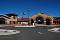
Entering Alamosa from the east
|
|||
|
|||
| Motto(s):
"Gateway to the Great Sand Dunes"
|
|||

Location of the City of Alamosa in Alamosa County, Colorado
|
|||

Alamosa, Colorado
Location in the United States

Alamosa, Colorado
Location in Colorado
|
|||
| Country | |||
| State | |||
| County | Alamosa County seat | ||
| Established | May 1878 | ||
| Incorporated | August 12, 1878 | ||
| Named for | The cottonwood trees along the Rio Grande | ||
| Government | |||
| • Type | Home rule municipality | ||
| Area | |||
| • Total | 7.97 sq mi (20.65 km2) | ||
| • Land | 7.90 sq mi (20.46 km2) | ||
| • Water | 0.07 sq mi (0.19 km2) | ||
| Elevation | 7,543 ft (2,299 m) | ||
| Population
(2020)
|
|||
| • Total | 9,806 | ||
| • Density | 184.0/sq mi (71.03/km2) | ||
| • Demonym | Alamosan | ||
| Time zone | UTC−07:00 (MST) | ||
| • Summer (DST) | UTC−06:00 (MDT) | ||
| ZIP code |
81101, 81102
|
||
| Area code(s) | 719 | ||
| FIPS code | 08-01090 | ||
| GNIS ID | 2409673 | ||
| Highways |
|
||

Alamosa is a city in Colorado, United States. It is the main city of Alamosa County. Alamosa is located along the Rio Grande river.
In 2020, about 9,806 people lived in the city. Alamosa is the main business hub for the San Luis Valley in south-central Colorado. It is also home to Adams State University.
Contents
History of Alamosa
Alamosa got its first post office on March 12, 1878. It officially became a town on August 12, 1878. The Denver and Rio Grande Railroad built the town. It quickly became a major train hub.
For a few years, Alamosa was the end of the D&RG train line. In 1881, the tracks went further to Monte Vista. The railroad had large facilities in Alamosa for building and fixing trains. It also managed its smaller, narrow gauge train service from here. These tracks reached many places in southwest Colorado and northern New Mexico.
Today, Alamosa is a popular tourist town. Many fun places are nearby. These include the Great Sand Dunes National Park and Preserve, Colorado Gators Reptile Park, and the Rio Grande Scenic Railroad.
The city hosts several events. "Summer Fest on the Rio" happens in early June. The "Early Iron" car show is held over Labor Day weekend. "Weekends on the Rio" takes place on various Sundays in the summer.
The name "Alamosa" comes from a Spanish word. It means "of cottonwood". This is because of the many cottonwood trees along the Rio Grande river and throughout the town.
Geography and Location
Alamosa is located where U.S. Route 160 and U.S. Route 285 meet. In 2020, the city covered about 7.67 square miles (19.87 square kilometers). A small part of this area is water.
The city sits along the Rio Grande in the San Luis Valley. This area has some of the highest farming land in the United States. Alamosa is about 7,544 feet (2,299 meters) above sea level. Some mountain peaks nearby are over 14,000 feet (4,267 meters) tall. These tall peaks are part of the Sangre de Cristo Range.
Alamosa is known as the "gateway city" to the amazing Great Sand Dunes National Park and Preserve.
Alamosa's Climate
Alamosa has a cold desert climate. This means it has long, cold winters and warm summers. The weather is dry all year.
The average temperature in January is about 16.3°F (-8.7°C). In July, it's about 64.6°F (18.1°C). The city gets only about 7.31 inches (186 mm) of rain each year. July, August, and September are the wettest months. Because it's so dry, Alamosa usually gets about 27.6 inches (70 cm) of snow per year.
The high altitude and dry air cause big temperature changes between day and night. This difference is about 35.4°F (19.7°C) on average. Alamosa has many days each year where the temperature drops to 32°F (0°C) or lower. It also has about 46 nights a year where the temperature is 0°F (-18°C) or colder.
On July 10, 2020, Alamosa had a unique weather day. The temperature dropped to a record low of 37°F (3°C). But less than 12 hours later, it reached a record high of 92°F (33°C).
| Climate data for Alamosa, Colorado, 1991–2020 normals, extremes 1906–present | |||||||||||||
|---|---|---|---|---|---|---|---|---|---|---|---|---|---|
| Month | Jan | Feb | Mar | Apr | May | Jun | Jul | Aug | Sep | Oct | Nov | Dec | Year |
| Record high °F (°C) | 63 (17) |
66 (19) |
76 (24) |
82 (28) |
90 (32) |
95 (35) |
96 (36) |
91 (33) |
89 (32) |
81 (27) |
71 (22) |
63 (17) |
96 (36) |
| Mean maximum °F (°C) | 48.7 (9.3) |
53.7 (12.1) |
67.0 (19.4) |
73.2 (22.9) |
81.4 (27.4) |
89.2 (31.8) |
90.0 (32.2) |
87.1 (30.6) |
83.2 (28.4) |
75.4 (24.1) |
63.0 (17.2) |
50.5 (10.3) |
91.0 (32.8) |
| Mean daily maximum °F (°C) | 34.8 (1.6) |
41.2 (5.1) |
52.7 (11.5) |
60.2 (15.7) |
69.8 (21.0) |
80.2 (26.8) |
83.3 (28.5) |
80.5 (26.9) |
74.4 (23.6) |
62.8 (17.1) |
48.5 (9.2) |
35.4 (1.9) |
60.3 (15.7) |
| Daily mean °F (°C) | 16.8 (−8.4) |
24.3 (−4.3) |
35.2 (1.8) |
42.6 (5.9) |
51.7 (10.9) |
60.6 (15.9) |
65.3 (18.5) |
63.2 (17.3) |
55.9 (13.3) |
43.8 (6.6) |
30.3 (−0.9) |
18.1 (−7.7) |
42.3 (5.7) |
| Mean daily minimum °F (°C) | −1.1 (−18.4) |
7.4 (−13.7) |
17.6 (−8.0) |
25.0 (−3.9) |
33.6 (0.9) |
40.9 (4.9) |
47.3 (8.5) |
45.8 (7.7) |
37.3 (2.9) |
24.8 (−4.0) |
12.1 (−11.1) |
0.8 (−17.3) |
24.3 (−4.3) |
| Mean minimum °F (°C) | −17.6 (−27.6) |
−11.8 (−24.3) |
1.2 (−17.1) |
10.9 (−11.7) |
21.1 (−6.1) |
30.7 (−0.7) |
38.5 (3.6) |
36.9 (2.7) |
24.4 (−4.2) |
8.2 (−13.2) |
−5.0 (−20.6) |
−15.0 (−26.1) |
−21.6 (−29.8) |
| Record low °F (°C) | −50 (−46) |
−35 (−37) |
−20 (−29) |
−6 (−21) |
11 (−12) |
23 (−5) |
28 (−2) |
29 (−2) |
15 (−9) |
−9 (−23) |
−30 (−34) |
−42 (−41) |
−50 (−46) |
| Average precipitation inches (mm) | 0.32 (8.1) |
0.28 (7.1) |
0.51 (13) |
0.57 (14) |
0.60 (15) |
0.43 (11) |
1.04 (26) |
1.29 (33) |
0.98 (25) |
0.65 (17) |
0.37 (9.4) |
0.35 (8.9) |
7.39 (187.5) |
| Average snowfall inches (cm) | 4.5 (11) |
4.0 (10) |
4.3 (11) |
3.6 (9.1) |
0.9 (2.3) |
0.0 (0.0) |
0.0 (0.0) |
0.0 (0.0) |
0.0 (0.0) |
1.9 (4.8) |
3.5 (8.9) |
4.7 (12) |
27.4 (69.1) |
| Average precipitation days (≥ 0.01 in) | 3.8 | 3.9 | 4.7 | 4.9 | 5.6 | 4.1 | 8.4 | 9.9 | 6.5 | 4.7 | 3.7 | 4.3 | 64.5 |
| Average snowy days (≥ 0.1 in) | 3.8 | 3.7 | 3.1 | 2.5 | 0.8 | 0.0 | 0.0 | 0.0 | 0.1 | 0.9 | 2.5 | 4.0 | 21.4 |
| Source: NOAA | |||||||||||||
Population of Alamosa
| Historical population | |||
|---|---|---|---|
| Census | Pop. | %± | |
| 1880 | 802 | — | |
| 1890 | 973 | 21.3% | |
| 1900 | 1,141 | 17.3% | |
| 1910 | 3,013 | 164.1% | |
| 1920 | 3,171 | 5.2% | |
| 1930 | 5,107 | 61.1% | |
| 1940 | 5,613 | 9.9% | |
| 1950 | 5,354 | −4.6% | |
| 1960 | 6,205 | 15.9% | |
| 1970 | 6,985 | 12.6% | |
| 1980 | 6,830 | −2.2% | |
| 1990 | 7,579 | 11.0% | |
| 2000 | 7,960 | 5.0% | |
| 2010 | 8,780 | 10.3% | |
| 2020 | 9,806 | 11.7% | |
| U.S. Decennial Census | |||
2020 Census Information
In 2020, the 2020 United States Census counted 9,806 people living in Alamosa. There were 3,828 households and 1,935 families.
Here's a look at the different groups of people in Alamosa:
| Race | Number | Percent |
|---|---|---|
| White | 3,834 | 39.1% |
| Black or African American | 193 | 1.97% |
| Native American | 151 | 1.54% |
| Asian | 121 | 1.23% |
| Pacific Islander | 17 | 0.17% |
| Other/Mixed | 274 | 2.79% |
| Hispanic or Latino | 5,216 | 53.19% |
Population in 2014
In 2014, Alamosa had about 9,531 people. There were 2,974 households. About 32% of these households had children under 18. About 40.5% were married couples.
The average age of people in Alamosa was 28 years. About 24.4% of the population was under 18. About 21.8% were between 18 and 24.
The average income for a household was about $29,593. About 25% of the population lived below the poverty line. This included 30.4% of those under 18.
Education in Alamosa
Alamosa has its own public school system, the Alamosa School District RE-11J. This district includes:
- Alamosa Elementary School
- Ortega Middle School
- Alamosa High School
Adams State University is also in Alamosa. It was started in 1921 to train teachers. Today, it offers many different college programs. These include teaching, art, history, and business. Many courses are available online.
In 2015, Adams State University had its highest number of students ever, with 3,701. The university is about 7,800 feet (2,377 meters) above sea level. This high altitude is great for athletes, especially runners. The school also added a cycling program in 2014.
The schools in Alamosa were once part of a legal case about school segregation. This case was called Maestas vs. George H. Shone.
City Services and Transport
Transportation in Alamosa

The Rio Grande River flows through Alamosa. There are two car bridges, one walking bridge, and one train bridge over the river in town.
For cars, U.S. Highway 160 runs east and west. U.S. Highway 285 and State Highway 17 run north and south.
Alamosa is served by the Colorado Pacific Rio Grande Railroad. It is also part of Colorado's Bustang bus network. The local airport is San Luis Valley Regional Airport.

Local Facilities
Alamosa is the main shopping area for the San Luis Valley. It has many national and local stores. You can find several fast food restaurants here. There are also two medical clinics and a regional hospital, San Luis Valley Regional Medical Center.
Trinidad State College has a campus in Alamosa. It offers two-year degrees in subjects like gunsmithing, aquaculture, cosmetology, welding, and nursing. It also has traditional classes like English, physics, and chemistry.
Notable People from Alamosa
Many interesting people have connections to Alamosa:
- Billy Adams (1861–1954) — He was the mayor of Alamosa. He also served as the governor of Colorado from 1927 to 1933.
- Garrey Carruthers (1939–) — He was the governor of New Mexico from 1987 to 1991.
- Camille Herron (1981–) — A professional ultramarathon runner. She holds World Records in long-distance running.
- Michael Johnson (1944–2017) — A singer, guitarist, and recording artist.
- Carlos F. Lucero (1940–) — A judge for the U.S. District Court of Appeals.
- Alice Ivers Tubbs (1851–1930) — A famous gambler from the old frontier days, known as "Poker Alice."
Images for kids
-
Alamosa City Hall

See also
 In Spanish: Alamosa (Colorado) para niños
