
List of counties in Colorado facts for kids
The U.S. State of Colorado is divided into 64 areas called counties. Think of them like smaller sections of the state, each with its own local government. Two of these, the City and County of Denver (which is also the state capital) and the City and County of Broomfield, have special combined city and county governments.
Counties are very important in Colorado because there are no smaller government areas like townships. This means counties handle many local services for people.
El Paso County is the most populated county in Colorado, with over 730,000 people in 2020. On the other hand, San Juan County has the fewest people, with only about 700 residents.
When it comes to size, Las Animas County is the largest, covering about 4,773 square miles (12,369 km²). The City and County of Broomfield is the smallest, at about 34 square miles (87 km²).
The City and County of Denver is the most crowded county, with many people living close together. Hinsdale County is the least crowded, with very few people per square mile.
Mount Elbert, the highest mountain in Colorado and the entire Rocky Mountains, is located in Lake County. It stands at 14,440 feet (4,401.2 meters) tall! The lowest point in Colorado is where the Arikaree River leaves Yuma County and flows into Kansas, at 3,317 feet (1,011 meters) elevation. This is actually the highest "lowest point" of any state in the U.S.!
Contents
How Colorado Counties Were Formed
The story of Colorado's counties began a long time ago.
Early Days of Colorado's Counties
On November 1, 1861, when Colorado was still a Territory, 17 original counties were created. These included Arapahoe, Boulder, Clear Creek, Costilla, Douglas, El Paso, Fremont, Gilpin, Guadalupe, Huerfano, Jefferson, Lake, Larimer, Park, Pueblo, Summit, and Weld. Just six days later, Guadalupe County was renamed Conejos County.
More counties were added over the years. Las Animas was the first new county, formed in 1866. By the time Colorado officially became a state on August 1, 1876, it had 26 counties.
Growing Number of Counties
After Colorado became a state, even more counties were created. For example, Routt and Ouray counties were formed in 1877. In 1879, Chaffee County was created.
Between 1881 and 1889, many more counties were added, like Dolores, Pitkin, Montrose, Mesa, Garfield, Eagle, Delta, San Miguel, Archuleta, Washington, Logan, Morgan, Yuma, Cheyenne, Otero, Rio Blanco, Phillips, Sedgwick, Kiowa, Kit Carson, Lincoln, Prowers, Baca, and Montezuma. This brought the total number of counties to 55.
By 1900, Mineral and Teller counties were added. A big change happened in 1902 when Arapahoe County was split into Adams and South Arapahoe Counties. Also, Denver became its own combined city and county.
By 1912, Jackson, Moffat, and Crowley counties were created, and Alamosa followed in 1913. The most recent change was in 2001, when Broomfield became a combined city and county, bringing the total to 64 counties.
List of Colorado Counties
You can find a full list of all 64 Colorado counties and their details in the table below. This table shows where each county is located, its county seat (the main town where the government is), when it was created, what it was formed from, and how it got its name. It also includes population and area information.
| County |
FIPS code | County seat | Est. | Formed from | Etymology | Population | Area | Map |
|---|---|---|---|---|---|---|---|---|
| Adams County | 001 | Brighton | Nov 15, 1902 | Split from Arapahoe County. | Named in honor of Alva Adams, a former Governor of Colorado. | 533,365 | 1,182.29 sq mi (3,062 km2) |
 |
| Alamosa County | 003 | Alamosa | Mar 8, 1913 | Split from Costilla County and Conejos County. | Named for the cottonwood trees that grow there. Alamosa is Spanish for cottonwood grove. | 16,655 | 723.21 sq mi (1,873 km2) |
 |
| Arapahoe County | 005 | Littleton | Nov 1, 1861 | One of the 17 original counties of the Territory of Colorado. | Named for the Arapaho Nation of Native Americans. | 656,061 | 804.41 sq mi (2,083 km2) |
 |
| Archuleta County | 007 | Pagosa Springs | Apr 14, 1885 | Split from Conejos County. | Named for Colorado State Senator Antonio D. Archuleta and his father. | 14,189 | 1,354.53 sq mi (3,508 km2) |
 |
| Baca County | 009 | Springfield | Apr 16, 1889 | Split from Las Animas County. | Named for pioneer and legislator Felipe Baca. | 3,344 | 2,558.48 sq mi (6,626 km2) |
 |
| Bent County | 011 | Las Animas | Feb 11, 1870 | Split from Huerfano County and tribal land. | Named for frontier trader William Bent. | 5,681 | 1,541.07 sq mi (3,991 km2) |
 |
| Boulder County | 013 | Boulder | Nov 1, 1861 | One of the 17 original counties of the Territory of Colorado. | Named for the many granite boulders along Boulder Creek. | 326,831 | 740.48 sq mi (1,918 km2) |
 |
| City and County of Broomfield | 014 | Broomfield | Nov 15, 2001 | Formed from parts of Boulder, Adams, Jefferson, and Weld counties. | Named for the broom corn that used to grow in the area. | 76,860 | 33.57 sq mi (87 km2) |
 |
| Chaffee County | 015 | Salida | Feb 10, 1879 | Split from Carbonate County. | Named for Jerome Bunty Chaffee, one of Colorado's first U.S. Senators. | 20,617 | 1,014.12 sq mi (2,627 km2) |
 |
| Cheyenne County | 017 | Cheyenne Wells | Mar 25, 1889 | Split from Elbert and Bent counties. | Named for the Cheyenne Nation of Native Americans. | 1,727 | 1,781.90 sq mi (4,615 km2) |
 |
| Clear Creek County | 019 | Georgetown | Nov 1, 1861 | One of the 17 original counties of the Territory of Colorado. | Named for Clear Creek which starts in the county. | 9,147 | 396.53 sq mi (1,027 km2) |
 |
| Conejos County | 021 | Conejos | Nov 1, 1861 | Originally Guadalupe County, renamed after six days. | Named for the cottontail rabbits in the area. Conejos is Spanish for rabbits. | 7,521 | 1,290.22 sq mi (3,342 km2) |
 |
| Costilla County | 023 | San Luis | Nov 1, 1861 | One of the 17 original counties of the Territory of Colorado. | Named for the Costilla River. Costilla is Spanish for little rib or furring timber. | 3,628 | 1,229.38 sq mi (3,184 km2) |
 |
| Crowley County | 025 | Ordway | May 29, 1911 | Split from Otero County. | Named for Colorado State Senator John H. Crowley. | 5,636 | 800.27 sq mi (2,073 km2) |
 |
| Custer County | 027 | Westcliffe | Mar 9, 1877 | Split from Fremont County. | Named in memory of George Armstrong Custer, a U.S. Army colonel. | 5,534 | 739.24 sq mi (1,915 km2) |
 |
| Delta County | 029 | Delta | Feb 11, 1883 | Split from Gunnison County. | Named for the town of Delta, located at the delta of the Uncompahgre River. | 31,746 | 1,149.44 sq mi (2,977 km2) |
 |
| City and County of Denver | 031 | Denver | Dec 1, 1902 | Formed from parts of Arapahoe and Adams counties. | Named to honor James W. Denver, a former Governor of the Territory of Kansas. | 716,577 | 155.66 sq mi (403 km2) |
 |
| Dolores County | 033 | Dove Creek | Mar 4, 1881 | Split from Ouray County. | Named for the Dolores River, which means River of our Lady of Sorrows in Spanish. | 2,513 | 1,076.93 sq mi (2,789 km2) |
 |
| Douglas County | 035 | Castle Rock | Nov 1, 1861 | One of the 17 original counties of the Territory of Colorado. | Named for Stephen Arnold Douglas, a U.S. Senator from Illinois. | 383,906 | 842.30 sq mi (2,182 km2) |
 |
| Eagle County | 037 | Eagle | Feb 11, 1883 | Split from Summit County. | Named for the Eagle River which starts in the county. | 54,381 | 1,700.76 sq mi (4,405 km2) |
 |
| El Paso County | 041 | Colorado Springs | Nov 1, 1861 | One of the 17 original counties of the Territory of Colorado. | Named for Ute Pass. El Paso means the pass in Spanish. | 744,215 | 2,128.60 sq mi (5,513 km2) |
 |
| Elbert County | 039 | Kiowa | Feb 2, 1874 | Split from Douglas County. | Named for Samuel Hitt Elbert, a former Governor of the Territory of Colorado. | 28,806 | 1,849.08 sq mi (4,789 km2) |
 |
| Fremont County | 043 | Cañon City | Nov 1, 1861 | One of the 17 original counties of the Territory of Colorado. | Named for John Charles Frémont, an explorer and U.S. Army general. | 50,318 | 1,533.09 sq mi (3,971 km2) |
 |
| Garfield County | 045 | Glenwood Springs | Feb 10, 1883 | Split from Summit County. | Named for James Abram Garfield, the twentieth President of the United States. | 62,707 | 2,958.23 sq mi (7,662 km2) |
 |
| Gilpin County | 047 | Central City | Nov 1, 1861 | One of the 17 original counties of the Territory of Colorado. | Named for William Gilpin, the first Governor of the Territory of Colorado. | 5,926 | 150.15 sq mi (389 km2) |
 |
| Grand County | 049 | Hot Sulphur Springs | Feb 2, 1874 | Split from Summit County. | Named for the Grand River (now the Colorado River) which starts in the county. | 15,935 | 1,868.53 sq mi (4,839 km2) |
 |
| Gunnison County | 051 | Gunnison | Mar 9, 1877 | Split from Lake County. | Named for John Williams Gunnison, a U.S. Army captain who explored the region. | 17,321 | 3,259.22 sq mi (8,441 km2) |
 |
| Hinsdale County | 053 | Lake City | Feb 10, 1874 | Split from Lake, Conejos, and Costilla counties. | Named for George Aaron Hinsdale, a Lieutenant Governor of the Territory of Colorado. | 765 | 1,123.35 sq mi (2,909 km2) |
 |
| Huerfano County | 055 | Walsenburg | Nov 1, 1861 | One of the 17 original counties of the Territory of Colorado. | Named for Huerfano Butte, a solitary volcanic rock. Huérfano is Spanish for orphan. | 7,055 | 1,592.37 sq mi (4,124 km2) |
 |
| Jackson County | 057 | Walden | May 5, 1909 | Split from Larimer County. | Named for Andrew Jackson (1767–1845), the seventh President of the United States. | 1,309 | 1,619.75 sq mi (4,195 km2) |
 |
| Jefferson County | 059 | Golden | Nov 1, 1861 | One of the 17 original counties of the Territory of Colorado. | Named for Thomas Jefferson (1743–1826), who wrote the Declaration of Independence. | 576,366 | 772.85 sq mi (2,002 km2) |
 |
| Kiowa County | 061 | Eads | Apr 11, 1889 | Split from Bent County. | Named for the Kiowa Nation of Native Americans. | 1,384 | 1,785.90 sq mi (4,625 km2) |
 |
| Kit Carson County | 063 | Burlington | Apr 11, 1889 | Split from Elbert County. | Named for Christopher Houston "Kit" Carson, a famous frontier scout. | 6,994 | 2,162.43 sq mi (5,601 km2) |
 |
| La Plata County | 067 | Durango | Feb 10, 1874 | Split from Lake and Conejos counties. | Named for the many silver deposits in the area. La plata is Spanish for the silver. | 56,407 | 1,700.44 sq mi (4,404 km2) |
 |
| Lake County | 065 | Leadville | Nov 1, 1861 | One of the 17 original counties of the Territory of Colorado. | Named for the Twin Lakes in the county. | 7,365 | 383.55 sq mi (993 km2) |
 |
| Larimer County | 069 | Fort Collins | Nov 1, 1861 | One of the 17 original counties of the Territory of Colorado. | Named for William Larimer, a pioneer entrepreneur. | 370,771 | 2,631.75 sq mi (6,816 km2) |
 |
| Las Animas County | 071 | Trinidad | Feb 9, 1866 | Split from Huerfano County. | Named for the Purgatoire River, which means River of the Souls in Purgatory in Spanish. | 14,348 | 4,773.27 sq mi (12,363 km2) |
 |
| Lincoln County | 073 | Hugo | Apr 11, 1889 | Split from Elbert and Bent counties. | Named for Abraham Lincoln (1809–1865), the sixteenth President of the United States. | 5,480 | 2,585.21 sq mi (6,696 km2) |
 |
| Logan County | 075 | Sterling | Feb 25, 1887 | Split from Weld County. | Named for John Alexander Logan, a U.S. Army general and U.S. Senator from Illinois. | 20,619 | 1,845.31 sq mi (4,779 km2) |
 |
| Mesa County | 077 | Grand Junction | Feb 14, 1883 | Split from Gunnison County. | Named for the mesa (flat-topped hill) formations common in the area. | 159,681 | 3,345.69 sq mi (8,665 km2) |
 |
| Mineral County | 079 | Creede | Mar 27, 1893 | Split from Hinsdale, Rio Grande, and Saguache counties. | Named for the many mineral deposits found in the area. | 944 | 878.16 sq mi (2,274 km2) |
 |
| Moffat County | 081 | Craig | Feb 27, 1911 | Split from Routt County. | Named for railroad pioneer David H. Moffat. | 13,327 | 4,755.86 sq mi (12,318 km2) |
 |
| Montezuma County | 083 | Cortez | Apr 16, 1889 | Split from La Plata County. | Named for Aztec leader Moctezuma II. | 26,531 | 2,035.80 sq mi (5,273 km2) |
 |
| Montrose County | 085 | Montrose | Feb 11, 1883 | Split from Gunnison County. | Named for the town of Montrose, possibly from a novel called A Legend of Montrose. | 44,156 | 2,246.43 sq mi (5,818 km2) |
 |
| Morgan County | 087 | Fort Morgan | Feb 19, 1889 | Split from Weld County. | Named for old Fort Morgan, which was named for U.S. Army Colonel Christopher A. Morgan. | 29,524 | 1,293.83 sq mi (3,351 km2) |
 |
| Otero County | 089 | La Junta | Mar 25, 1889 | Split from Bent County. | Named for Miguel A. Otero of the Otero family. | 18,136 | 1,267.66 sq mi (3,283 km2) |
 |
| Ouray County | 091 | Ouray | Jan 18, 1877 | Split from Hinsdale and Lake counties. | Named for Ouray, a Ute Native American leader. | 5,176 | 542.30 sq mi (1,405 km2) |
 |
| Park County | 093 | Fairplay | Nov 1, 1861 | One of the 17 original counties of the Territory of Colorado. | Named for South Park, a large valley in the county. | 18,117 | 2,209.36 sq mi (5,722 km2) |
 |
| Phillips County | 095 | Holyoke | Mar 27, 1889 | Split from Logan County. | Named for R.O. Phillips, who sold farmsteads in the area. | 4,476 | 688.30 sq mi (1,783 km2) |
 |
| Pitkin County | 097 | Aspen | Feb 23, 1881 | Split from Gunnison County. | Named for Frederick Walker Pitkin, a former Governor of Colorado. | 16,640 | 970.37 sq mi (2,513 km2) |
 |
| Prowers County | 099 | Lamar | Apr 11, 1889 | Split from Bent County. | Named for John W. Prowers, a pioneer of the Arkansas River valley. | 11,751 | 1,645.37 sq mi (4,261 km2) |
 |
| Pueblo County | 101 | Pueblo | Nov 1, 1861 | One of the 17 original counties of the Territory of Colorado. | Named for the historic town of Pueblo. Pueblo is Spanish for village or people. | 169,422 | 2,396.77 sq mi (6,208 km2) |
 |
| Rio Blanco County | 103 | Meeker | Mar 25, 1889 | Split from Garfield County. | Named for the White River, which was originally called Rio Blanco in Spanish. | 6,569 | 3,226.24 sq mi (8,356 km2) |
 |
| Rio Grande County | 105 | Del Norte | Feb 10, 1874 | Split from Costilla and Conejos counties. | Named for the Rio Grande, a major river that flows through the area. | 11,188 | 913.10 sq mi (2,365 km2) |
 |
| Routt County | 107 | Steamboat Springs | Jan 29, 1877 | Split from Grand County. | Named for John Long Routt, the first Governor of the State of Colorado. | 25,064 | 2,362.11 sq mi (6,118 km2) |
 |
| Saguache County | 109 | Saguache | Dec 29, 1866 | Split from Lake and Costilla counties. | Named from a Ute language word meaning "sand dunes". | 6,688 | 3,168.32 sq mi (8,206 km2) |
 |
| San Juan County | 111 | Silverton | Jan 31, 1876 | Split from Lake County. | Named for the San Juan River and San Juan Mountains, named for Saint John the Evangelist. | 802 | 388.99 sq mi (1,007 km2) |
 |
| San Miguel County | 113 | Telluride | Mar 2, 1883 | Split from San Juan County. | Named for the San Miguel River and San Miguel Mountains, named for Saint Michael the Archangel. | 7,868 | 1,290.76 sq mi (3,343 km2) |
 |
| Sedgwick County | 115 | Julesburg | Apr 9, 1889 | Split from Logan County. | Named for Fort Sedgwick, which was named for U.S. Army General John Sedgwick. | 2,299 | 548.83 sq mi (1,421 km2) |
 |
| Summit County | 117 | Breckenridge | Nov 1, 1861 | One of the 17 original counties of the Territory of Colorado. | Named for the many high mountain summits in the area. | 30,465 | 618.92 sq mi (1,603 km2) |
 |
| Teller County | 119 | Cripple Creek | Mar 23, 1899 | Split from El Paso and Fremont counties. | Named for Henry Moore Teller, a U.S. Senator from Colorado. | 24,617 | 558.58 sq mi (1,447 km2) |
 |
| Washington County | 121 | Akron | Feb 9, 1887 | Split from Weld County. | Named for George Washington (1732–1799), the first President of the United States. | 4,855 | 2,522.90 sq mi (6,534 km2) |
 |
| Weld County | 123 | Greeley | Nov 1, 1861 | One of the 17 original counties of the Territory of Colorado. | Named for Lewis Ledyard Weld, the first Secretary of the Territory of Colorado. | 359,442 | 4,013.84 sq mi (10,396 km2) |
 |
| Yuma County | 125 | Wray | Mar 15, 1889 | Split from Washington County. | Named for the Quechan (Yuma) Nation of Native Americans. | 9,862 | 2,369.61 sq mi (6,137 km2) |
 |
Population of Colorado Counties in 2023
The United States Census Bureau provides population estimates for Colorado counties. As of July 1, 2023:
- El Paso County is still the most populated county, with an estimated 744,215 residents.
- Hinsdale County is now the least populated, with only 765 residents.
- Five of Colorado's 64 counties have more than 500,000 people.
- 12 counties have fewer than 5,000 people.
Highest Points in Colorado Counties
Colorado is known for its tall mountains!
- 20 counties have areas higher than 14,000 feet (4,267 meters).
- 32 counties have areas higher than 13,000 feet (3,962 meters).
- 42 counties have areas higher than 10,000 feet (3,048 meters).
- All 64 Colorado counties have at least one point higher than 4,116 feet (1,255 meters).
Average Elevation of Colorado Counties
The average height above sea level (mean elevation) is also very high in Colorado.
- 4 counties have an average elevation above 11,000 feet (3,353 meters).
- 22 counties have an average elevation above 10,000 feet (3,048 meters).
- 32 counties have an average elevation above 9,000 feet (2,743 meters).
- All 64 counties have an average elevation above 3,880 feet (1,183 meters).
The following 13 Colorado counties have the highest average elevation of any county in the United States:
| Rank | County | Average elevation | High point | Highest elevation | Low point | Lowest elevation | Elevation range |
|---|---|---|---|---|---|---|---|
| 1 | Lake County | 11,702.5 ft (3,567 m) | Mount Elbert | 14,440 ft (4,401 m) | Arkansas River | 8,965 ft (2,732 m) | 5,475 ft (1,669 m) |
| 2 | Hinsdale County | 11,300 ft (3,444 m) | Uncompahgre Peak | 14,315 ft (4,363 m) | Lake Fork Gunnison River | 8,285 ft (2,525 m) | 6,030 ft (1,838 m) |
| 3 | Mineral County | 11,116 ft (3,388 m) | Phoenix Peak | 13,902 ft (4,237 m) | Rio Grande | 8,330 ft (2,539 m) | 5,572 ft (1,700 m) |
| 4 | San Juan County | 11,085 ft (3,379 m) | Vermilion Peak | 13,900 ft (4,237 m) | Animas River | 8,270 ft (2,521 m) | 5,630 ft (1,716 m) |
| 5 | Summit County | 10,935.5 ft (3,333 m) | Grays Peak | 14,276 ft (4,351 m) | Blue River | 7,595 ft (2,315 m) | 6,681 ft (2,036 m) |
| 6 | Alamosa County | 10,928.5 ft (3,331 m) | Blanca Peak | 14,351 ft (4,374 m) | Rio Grande | 7,506 ft (2,288 m) | 6,845 ft (2,086 m) |
| 7 | Saguache County | 10,915 ft (3,327 m) | Crestone Peak | 14,300 ft (4,359 m) | San Luis Creek | 7,530 ft (2,295 m) | 6,770 ft (2,063 m) |
| 8 | Costilla County | 10,865.5 ft (3,312 m) | Blanca Peak | 14,351 ft (4,374 m) | Rio Grande | 7,380 ft (2,249 m) | 6,971 ft (2,125 m) |
| 9 | Park County | 10,705.5 ft (3,263 m) | Mount Lincoln | 14,293 ft (4,357 m) | South Platte River | 7,118 ft (2,170 m) | 7,175 ft (2,187 m) |
| 10 | Chaffee County | 10,661 ft (3,249 m) | Mount Harvard | 14,427 ft (4,397 m) | Arkansas River | 6,895 ft (2,102 m) | 7,532 ft (2,296 m) |
| 11 | Clear Creek County | 10,608 ft (3,233 m) | Grays Peak | 14,276 ft (4,351 m) | Clear Creek | 6,940 ft (2,115 m) | 7,336 ft (2,236 m) |
| 12 | Rio Grande County | 10,402 ft (3,171 m) | Bennett Peak | 13,209 ft (4,026 m) | Rock Creek | 7,595 ft (2,315 m) | 5,614 ft (1,711 m) |
| 13 | Jackson County | 10,353 ft (3,156 m) | Clark Peak | 12,956 ft (3,949 m) | North Platte River | 7,750 ft (2,362 m) | 5,206 ft (1,587 m) |
Interesting Facts About Colorado Counties
Here are some cool facts about Colorado's counties:
- Costilla County was the first area in what is now Colorado to be settled by Europeans, back in 1851.
- Arapahoe County, created in 1855, was the first county made only within the area of present-day Colorado.
- On November 1, 1861, the Territory of Colorado created its first 17 counties.
- Of those 17 original counties, only Gilpin County and Clear Creek County still have almost the same borders today.
- Guadaloupe County was renamed after only six days in 1861.
- Las Animas County was the first new county created after the original 17, in 1866.
- Greenwood County lasted the longest as a former county, from 1870 to 1874.
- In 1876, San Juan County was the last county created by the Colorado Territory.
- Ouray County was the first county created by the new State of Colorado in 1877.
- Carbonate County existed for only two days in 1879 before being dissolved!
- The City and County of Broomfield became the newest Colorado county in 2001, bringing the total to 64.
County Distinctions
- El Paso County and the City and County of Denver are among the 100 most populated counties in the entire United States.
- On the other hand, San Juan County, Hinsdale County, Mineral County, Jackson County, Kiowa County, and Cheyenne County are among the 100 least populated counties in the U.S.
- Jefferson County shares borders with ten other counties, more than any other Colorado county.
- Delta County and the City and County of Denver each border only three other counties, the fewest in Colorado.
- Weld County has the most towns and cities (31) within its borders.
- The following nine counties have only their county seat as an incorporated town or city:
- Only Conejos County has a county seat that is not an incorporated town or city.
- The City and County of Denver and the City and County of Broomfield are the only two Colorado counties with areas completely surrounded by another county (called enclaves).
- Arapahoe County, Boulder County, and Jefferson County are the only three Colorado counties with separate pieces of land not connected to their main area (called exclaves).
- Pitkin and Weld are the only "home rule" counties, meaning they have more power to govern themselves.
Images for kids
- The ten most populous Colorado counties
-
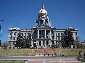
2. The Colorado State Capitol in the City and County of Denver
-
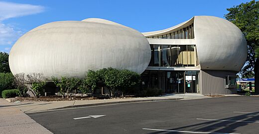
3. A bank building in Arapahoe County, Colorado
-
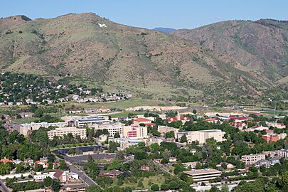
4. The Colorado School of Mines in Jefferson County, Colorado
-
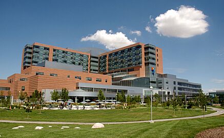
5. The Anschutz Medical Campus in Adams County, Colorado
-
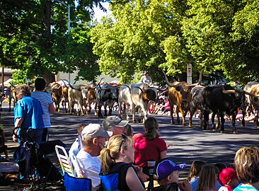
8. The Greeley Stampede Parade in Weld County, Colorado
-
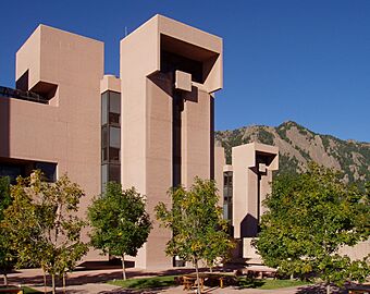
9. The National Center for Atmospheric Research in Boulder County, Colorado
-
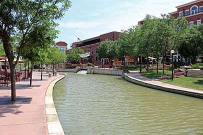
10. The Historic Arkansas Riverwalk in Pueblo County, Colorado


.jpg)

.jpg)


See also
 In Spanish: Anexo:Condados de Colorado para niños
