San Juan County, Colorado facts for kids
Quick facts for kids
San Juan County
|
|
|---|---|

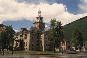
The San Juan County Courthouse in Silverton
|
|

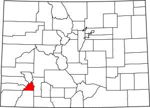
Location within the U.S. state of Colorado
|
|
 Colorado's location within the U.S. |
|
| Country | |
| State | |
| Founded | January 31, 1876 |
| Named for | San Juan River |
| Seat | Silverton |
| Largest town | Silverton |
| Area | |
| • Total | 388 sq mi (1,000 km2) |
| • Land | 387 sq mi (1,000 km2) |
| • Water | 0.8 sq mi (2 km2) 0.2%% |
| Population
(2020)
|
|
| • Total | 705 |
| • Density | 1.8/sq mi (0.7/km2) |
| Time zone | UTC−7 (Mountain) |
| • Summer (DST) | UTC−6 (MDT) |
| Congressional district | 3rd |
San Juan County is a place in the state of Colorado, USA. In 2020, only 705 people lived there. This makes it the county with the fewest people in Colorado.
The main town and only official city in the county is Silverton. The county's name comes from a Spanish name for "Saint John." Spanish explorers gave this name to a river and the mountains nearby.
San Juan County is very high up! It has the highest average elevation of any county in the United States. It even has two of the highest houses in the country, located over 11,900 feet high.
History of San Juan County
Long ago, the Anasazi people explored this area. Later, the Utes lived and hunted in the San Juan Mountains during the summer. Some people think Spanish explorers and fur traders also visited in the 1600s and 1700s.
Early Settlers and Gold Rush
People started to settle here permanently around 1860. This was near the end of the Colorado Gold Rush. A group of gold seekers, led by Charles Baker, came to the San Juan Mountains looking for gold.
In 1873, the Brunot Agreement was made with the Ute people. They traded a large area of land for money each year. After this, several mining camps were built. These camps grew into the towns of Howardsville, Eureka, and Silverton. San Juan County was officially formed on January 31, 1876.
Mining Boom and the Sunnyside Mine
The area became very busy after George Howard and R. J. McNutt found a lot of silver. This was at the Sunnyside silver vein, near the Eureka mining camp. Then, gold was found in 1882. This helped the county do better than other mining towns during a tough economic time in 1893.
The Sunnyside Mine became one of Colorado's longest-running and most successful mines.
Labor and Mine Closures
In 1903, mining companies in the San Juan Mountains formed a group called the San Juan District Mining Association. This happened because miners wanted an eight-hour workday. Most Colorado voters had agreed to this idea. However, the mining companies did not want to shorten hours or raise wages. This led to a difficult strike.
The Sunnyside mine closed after the 1929 stock market crash. But it reopened in 1959 and found gold again in 1973. The county's economy was badly hurt in 1992 when the mine and its processing plant closed for good. This meant over a third of the county's workers lost their jobs.
Geography
San Juan County covers about 388 square miles. Most of this is land, with a very small amount of water. It is one of the smallest counties in Colorado by size.
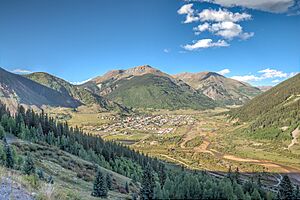
The county is in the middle of the San Juan Mountains of Colorado. It has the highest average elevation of any county in the United States, at 11,240 feet. However, none of Colorado's tallest mountains, called "fourteeners" (mountains over 14,000 feet), are in San Juan County.
Neighboring Counties
- Ouray County – north
- Hinsdale County – east
- La Plata County – south
- Montezuma County – southwest
- Dolores County – west
- San Miguel County – northwest
Main Roads

Protected Natural Areas
- Durango-Silverton Narrow-Gauge Railroad National Historic District
- Rio Grande National Forest
- San Juan National Forest
- Shenandoah-Dives (Mayflower) Mill
- Silverton National Historic District
- Uncompahgre National Forest
- Weminuche Wilderness
Trails and Scenic Routes
- Alpine Loop National Back Country Byway
- Colorado Trail
- Continental Divide National Scenic Trail
- San Juan Skyway National Scenic Byway
People of San Juan County
| Historical population | |||
|---|---|---|---|
| Census | Pop. | %± | |
| 1880 | 1,087 | — | |
| 1890 | 1,572 | 44.6% | |
| 1900 | 2,342 | 49.0% | |
| 1910 | 3,063 | 30.8% | |
| 1920 | 1,700 | −44.5% | |
| 1930 | 1,935 | 13.8% | |
| 1940 | 1,439 | −25.6% | |
| 1950 | 1,471 | 2.2% | |
| 1960 | 849 | −42.3% | |
| 1970 | 831 | −2.1% | |
| 1980 | 833 | 0.2% | |
| 1990 | 745 | −10.6% | |
| 2000 | 558 | −25.1% | |
| 2010 | 699 | 25.3% | |
| 2020 | 705 | 0.9% | |
| 2023 (est.) | 802 | 14.7% | |
| U.S. Decennial Census 1790–1960 1900–1990 1990–2000 2010–2020 |
|||
In 2000, 558 people lived in San Juan County. There were 269 households, which are groups of people living together. About 24% of households had children under 18. Many households were married couples.
The average age of people in the county was 44 years old. About 20% of the population was under 18.
San Juan County is special because walking is the most common way people get to work. In 2013, about 33% of residents walked to their jobs. Other people drove, carpooled, or bicycled.
As of 2006, the county had one local school. It taught 53 students from kindergarten through 12th grade.
Communities
Town
Unincorporated communities
Former communities
- Animas Forks (a restored ghost town)
- Eureka (a ghost town)
See also
 In Spanish: Condado de San Juan (Colorado) para niños
 | Laphonza Butler |
 | Daisy Bates |
 | Elizabeth Piper Ensley |

