Eureka, Colorado facts for kids
Quick facts for kids
Eureka
|
|
|---|---|
|
Mining ghost town
|
|

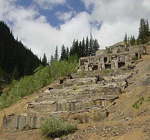
Remains of the Sunnyside Mill in Eureka, in May 2018
|
|
| Country | United States |
| State | Colorado |
| County | San Juan |
| Elevation | 9,863 ft (3,006 m) |
| Time zone | UTC-7 (Mountain (MST)) |
| • Summer (DST) | UTC-6 (MDT) |
| GNIS feature ID | 187402 |
Eureka is a former mining town located in San Juan County, Colorado. It sits along the Animas River, between the towns of Silverton and Animas Forks. The town's name, "Eureka," comes from a Greek word meaning "I have found it!" The Eureka post office served the area from 1875 until 1942. Today, Eureka is considered a ghost town.
History of Eureka
In 1860, a group of prospectors led by Charles Baker discovered traces of gold in the San Juan Mountains. This gold was "placer gold," meaning it was found in riverbeds. However, the Ute Tribe had been given this land by a US treaty. They made the prospectors leave in 1861.
Miners Return to Eureka
The prospectors came back in 1871. This time, they found "lode gold" in a place called Little Giant vein near Silverton, Colorado. Lode gold is found in veins within rocks. After a new agreement, the Brunot Treaty, was signed on September 13, 1873, the miners were allowed to stay. The Ute Tribe gave up about 4 million acres of land. In return, they received $25,000 each year.
The Sunnyside Mill
The first mill in Eureka closed down for reasons that are not known today. To replace it, a large mill called the Gold Prince Mill was taken apart. It was moved from Animas Forks to Eureka and rebuilt. This new mill became known as the Sunnyside Mill.
In 1896, Eureka became connected to the Denver and Rio Grande Railroad. This happened through the Silverton Northern Railroad. This connection helped the town grow steadily. Eureka was not a "boomtown," which means it did not grow very quickly and then suddenly disappear.
Eureka's Decline
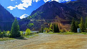
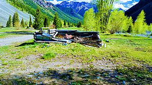
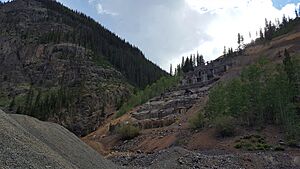
However, Eureka began to decline quickly after 1939. This was when the Sunnyside Mill closed for good. Today, you can still see the old gravel roads where the town once stood. There is also a lot of debris scattered around the area. The only building that is still standing and has been fixed up is the old Eureka jail. You can also see the foundations of the Sunnyside Mill and parts of other old buildings.
Geography
Eureka is located at an elevation of about 9,863 feet (3,006 meters) above sea level.
 | Kyle Baker |
 | Joseph Yoakum |
 | Laura Wheeler Waring |
 | Henry Ossawa Tanner |


