Dolores County, Colorado facts for kids
Quick facts for kids
Dolores County
|
||
|---|---|---|
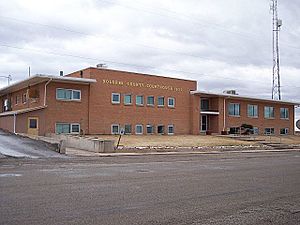
Dolores County Courthouse in Dove Creek
|
||
|
||
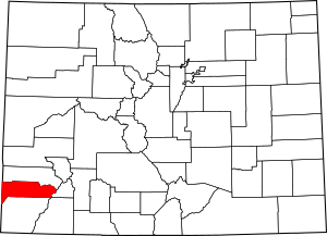
Location within the U.S. state of Colorado
|
||
 Colorado's location within the U.S. |
||
| Country | ||
| State | ||
| Founded | February 19, 1881 | |
| Named for | Dolores River | |
| Seat | Dove Creek | |
| Largest town | Dove Creek | |
| Area | ||
| • Total | 1,068 sq mi (2,770 km2) | |
| • Land | 1,067 sq mi (2,760 km2) | |
| • Water | 1.0 sq mi (3 km2) 0.1%% | |
| Population
(2020)
|
||
| • Total | 2,326 | |
| • Density | 2.1779/sq mi (0.8409/km2) | |
| Time zone | UTC−7 (Mountain) | |
| • Summer (DST) | UTC−6 (MDT) | |
| Congressional district | 3rd | |
Dolores County is a county in the state of Colorado, United States. In 2020, about 2,326 people lived there. The main town and county seat is Dove Creek.
Contents
History of Dolores County
Ancient Times and Native Americans
People have lived in the area of Dolores County for a very long time. Scientists think humans were here as early as 2500 B.C. Between the years 900 and 1300 AD, the western parts of Dolores County had many people. Archaeologists have found villages with hundreds of rooms. Some guess that up to 10,000 people lived here then.
However, these people either left or died out around the 1300s. This happened after a long dry period and big changes in their society. For many centuries after that, the county was mostly home to nomads. These were groups of people who moved from place to place. The Ute and Navajo Indians were among them.
Dolores County has many ancient ruins and sites left by the Anasazi people. The Anasazi Heritage Center reported in 1989 that the county had at least 816 known archaeological sites. Many more have been found since then.
Early Explorers and Trails
In 1776, a famous journey called the Dominguez-Escalante Trail passed through the area. This trip aimed to find a land route between Santa Fe, New Mexico, and Monterey, California. The explorers camped near Dove Creek in the western part of the county. Later, the Old Spanish Trail also went through this western area.
Mining and Railroads
In the early 1830s, trappers from Europe began working in the mountains of eastern Dolores County. Gold was found in the county in 1866. But major mining only started after 1878. This was when the land was taken from the Ute people.
Big discoveries of silver near Rico in 1879 helped the area grow. The Rio Grande Southern Railroad was built through the county between 1890 and 1892. This railroad connected towns like Durango, Telluride, and Ridgway. It served the eastern part of Dolores County until 1952. The western part of the county has never had a railroad.
Rico was at its busiest in 1892. More than 5,000 people lived in the mining area then. This was three times more than the entire county's population today! But the 1893 Silver Panic (a time when silver prices dropped sharply) hit the town hard. By 1900, only 811 people lived there. The mountainous part of Dolores County saw many ups and downs during the 20th century. In 1974, Rico's population was very low, with only about 45 people. Since then, the town has grown. It is now a place where people live and travel to Telluride for work. Its population is now almost 300.
Farming and Modern Times
Dove Creek was a stopping point on the Old Spanish Trail in the mid-1800s. Caravans and travelers used it when moving between Santa Fe, Salt Lake City, and California. In the 1870s, the western part of the county was used for raising cattle. But too many cattle ate the grass, and fires were stopped. This allowed plants like sagebrush and juniper to spread.
Starting in 1914, many people began to settle and farm the land. They grew crops like pinto beans and winter wheat without irrigation. Today, this type of farming is still important to the county's economy. In the 1980s, the Dolores Project brought irrigation to the area. This project built McPhee Reservoir nearby. This changed the county's history and population.
Dolores County was officially created on February 19, 1881. The Colorado legislature formed it from parts of Ouray County. It was named after the Dolores River. The river starts in the county and flows through the Dolores Canyon. Its full Spanish name was Rio de Nuestra Señora de los Dolores, meaning "River of our Lady of Sorrows." This name was given by Father Silvestre Vélez de Escalante in 1776.
The first county courthouse was in Rico. It was a small log cabin. A stone and brick courthouse was built in 1883. In 1946, the county seat moved to Dove Creek. The current courthouse there was built in 1957. The old courthouse in Rico is now the town hall and a library branch.
Geography of Dolores County
Dolores County covers about 1,068 square miles. Most of this (1,067 square miles) is land. Only a tiny part (1.0 square mile) is water.
Like other counties in Colorado that border Utah, Dolores County has two very different geographic areas. To travel between them, you usually have to leave the county.
The western part of the county is lower in elevation, about 6,500 to 7,500 feet high. It is mostly flat but has deep canyons, including the Dolores River Canyon. This area is used for farming, both with and without irrigation. It is famous for growing different kinds of beans, including pinto beans.
The central part of the county has higher grasslands with forests, hills, and ravines. This area is used for raising livestock.
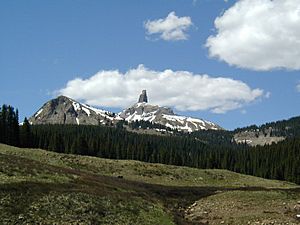
The eastern part of the county is in the high peaks of the San Juan Mountains. This area is around the old mining town of Rico. It is very high, from 9,000 to 14,000 feet. There is almost no farming here, except for some cattle grazing in the San Juan National Forest. Rico is becoming a place where people live and travel to the wealthier town of Telluride in San Miguel County for work.
Only 38% of the county's land is privately owned. Most of this private land is in the far western part (for farming) and the central part (for grazing). The U.S. Government owns 50% of the county. This land is managed by the US Forest Service as part of San Juan National Forest. Another 10% is managed by the Bureau of Land Management, including parts of Canyon of the Ancients National Monument. The State of Colorado owns 2% of the county, mainly for wildlife areas.
Neighboring Counties
- San Miguel County, Colorado - north
- San Juan County, Colorado - east
- Montezuma County, Colorado - south
- La Plata County, Colorado - southeast
- San Juan County, Utah - west
Main Roads
 U.S. Highway 491
 State Highway 141
 State Highway 145
Population Information
| Historical population | |||
|---|---|---|---|
| Census | Pop. | %± | |
| 1890 | 1,498 | — | |
| 1900 | 1,134 | −24.3% | |
| 1910 | 642 | −43.4% | |
| 1920 | 1,243 | 93.6% | |
| 1930 | 1,412 | 13.6% | |
| 1940 | 1,958 | 38.7% | |
| 1950 | 1,966 | 0.4% | |
| 1960 | 2,196 | 11.7% | |
| 1970 | 1,641 | −25.3% | |
| 1980 | 1,658 | 1.0% | |
| 1990 | 1,504 | −9.3% | |
| 2000 | 1,844 | 22.6% | |
| 2010 | 2,064 | 11.9% | |
| 2020 | 2,326 | 12.7% | |
| 2023 (est.) | 2,513 | 21.8% | |
| U.S. Decennial Census 1790-1960 1900-1990 1990-2000 2010-2020 |
|||
In 2000, Dolores County had 1,844 people living there. There were 785 households and 541 families. About 2 people lived in each square mile.
Most people in the county were White (95.28%). There were also small numbers of Native American (1.95%), Asian (0.38%), Black (0.05%), and Pacific Islander (0.05%) people. About 3.85% of the population was Hispanic or Latino.
About 24.50% of households had children under 18. Most households (57.70%) were married couples. The average household had 2.35 people. The average family had 2.82 people.
The population was spread out by age. About 21.90% were under 18. About 17.10% were 65 or older. The average age was 42 years old.
The average income for a household in the county was $32,196. For families, it was $38,000. About 13.10% of the population lived below the poverty line. This included 9.80% of those under 18 and 18.30% of those 65 or older.
Many people who live in Dolores County travel to other counties for work. They often go to San Miguel County (Telluride) or Montezuma County (Cortez).
Communities
Towns
Unincorporated Communities
Protected Natural Areas
- Calico National Recreation Trail
- Canyons of the Ancients National Monument (part)
- Lizard Head Wilderness
- Old Spanish National Historic Trail
- San Juan National Forest
Transportation
Dolores County does not have any active railroads today. The Rio Grande Southern Railroad stopped running in 1952.
The western part of the county is served by US 491. This road connects to Cortez, Colorado, and Monticello, Utah. State Highway 141 also serves this area, connecting to Nucla, Colorado.
The eastern part of the county uses State Highway 145. This road connects to Dolores, Colorado, and Telluride, Colorado.
The central part of the county is connected by the Norwood Road. This road goes to Dolores, Colorado, and Norwood, Colorado. The three parts of the county are only connected to each other by gravel roads. These roads are often slow to drive on.
The only airport in the county is the privately owned Dove Creek Airport. It is a small airport for general aviation. The closest airports with commercial flights are Cortez Municipal Airport and San Juan (UT) County Airport.
Bicycle Routes
- Great Parks Bicycle Route
- Western Express Bicycle Route
Scenic Drive
- San Juan Skyway National Scenic Byway
See also
 In Spanish: Condado de Dolores para niños
 | Georgia Louise Harris Brown |
 | Julian Abele |
 | Norma Merrick Sklarek |
 | William Sidney Pittman |


