Domínguez–Escalante expedition facts for kids
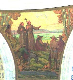
The Domínguez–Escalante expedition was a journey of Spanish explorers in 1776. Two Franciscan priests, Atanasio Domínguez and Silvestre Vélez de Escalante, led the trip. Their main goal was to find a land route from Santa Fe, New Mexico, to a Catholic mission in Monterey, California.
Domínguez, Vélez de Escalante, and their mapmaker, Bernardo de Miera y Pacheco, traveled with ten other men. They explored many parts of the Western United States, including areas in what are now Colorado, Utah, and Arizona. Along the way, three Native American guides from the Timpanogos tribe (Ute people) helped them.
The land was very tough, and the group faced many challenges. They had to return to Santa Fe before reaching California. However, the maps and notes from their journey were very helpful for future travelers. The route they explored later became an early path for the Old Spanish Trail, a trade route connecting Santa Fe to the Pacific Coast.
Contents
The Explorers
Atanasio Domínguez
Fray Francisco Atanasio Domínguez was born in Mexico City around 1740. He joined the Franciscan order when he was 17. In 1776, he arrived in Santa Fe, which was then part of Mexico. His job was to check on the missions there and explore a new land route to Monterey, California.
Silvestre Vélez de Escalante
Fray Francisco Silvestre Vélez de Escalante was born in Spain around 1750. He also became a Franciscan at 17. In 1774, he came to New Mexico. In 1776, Domínguez asked him to join the expedition to California. Vélez de Escalante was known for his detailed journal, where he wrote about his travels. He died in 1780 at the age of 30.
Many places are named after Escalante, like the Escalante Desert, Escalante River, the town of Escalante, and Grand Staircase–Escalante National Monument.
Bernardo Miera y Pacheco
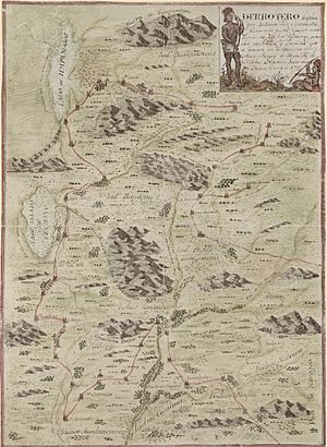
Bernardo de Miera y Pacheco was a talented man. He was an army engineer, a merchant, and an artist. Most importantly for the expedition, he was a skilled mapmaker. His maps and reports from the journey in 1778 were very important for understanding the areas they explored. He also created artwork, including paintings and statues for churches.
Timpanog Ute Guides
Fathers Domínguez and Escalante were helped by three Native American guides from the Timpanogos/Ute tribe:
- Silvestre: Named after Silvestre Escalante, he was the main Native guide from Colorado to Utah. Because he was well-known among his and other Ute tribes, the explorers could travel safely.
- Joaquín: A 12-year-old boy, he joined the expedition with Silvestre. After leaving Silvestre's village, near present-day Provo, Utah, Joaquín helped the explorers on their way back to Santa Fe. He was later baptized into the Catholic Church.
- José María: Named after Joseph and Mary from the Bible, he also joined the expedition in Silvestre's village. Like Joaquín, José María was a boy, probably around 12 years old. He did not finish the journey to Santa Fe. He returned to his village after seeing one of the servants treated badly.
Other Team Members
Other men who started the expedition in Santa Fe included:
- Don Juan Pedro Cisneros, a local leader from Zuñi Pueblo.
- Don Joaquín Lain, a citizen of Santa Fe.
- Lorenzo Olivares from El Paso.
- Andrés Muñiz from Bernalillo, New Mexico, who was an interpreter for the Ute language.
- Lucrecio Muñiz, Andrés's brother.
- Juan de Aguilar from Santa Clara, New Mexico.
- Simon Lucero, a servant to Don Pedro Cisneros.
The Journey
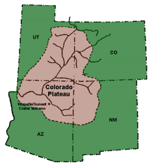
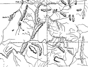
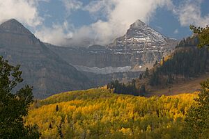
The Domínguez–Escalante expedition began in 1776. Its main goal was to find a route across the mostly unknown lands between Santa Fe, New Mexico, and the Spanish missions in California, like the one in Monterey. On July 29, 1776, Domínguez, Escalante, and their mapmaker Miera set out from Santa Fe.
The first part of their journey followed a route taken by another explorer, Juan Rivera, years earlier. Three Timpanogos guides led them through Colorado and Utah. These Spanish explorers were the first Europeans to travel through much of the Colorado Plateau into Utah, and then back through Arizona to New Mexico. During their trip, they wrote down details about the route. They also described the "lush, mountainous land filled with game and timber, strange ruins of stone cities and villages, and rivers showing signs of precious metals."
The Route Taken
New Mexico
Santa Rosa de Abiquiú, July 30 Their first stop was at the Santa Clara pueblo, north of Santa Fe. From there, they traveled to the pueblo of Santa Rosa de Abiquiú. They stayed there for a day to rest and pray. Then, they continued north and northwest to an area near present-day Dulce, New Mexico.
Colorado
Mesa Verde, August 10 From Dulce, they entered what is now Colorado. They passed through towns like Arboles, Ignacio, and Durango. They camped near the La Plata Mountains, close to the current Mesa Verde National Park.
Escalante wrote in his journal about the challenges they faced. Father Domínguez felt sick, and it rained a lot, making the ground muddy. They had to keep moving despite the bad weather. They camped by the Mancos River. The river was named manco, meaning "one-handed" or "crippled," after one of the men hurt his hand there.
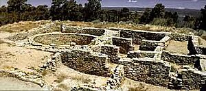
Escalante and Domínguez Pueblos, August 13 Near present-day Dolores, Escalante and Domínguez found and recorded ancient Anasazi ruins. They were the first Europeans to do so. Two of these sites, Escalante Pueblo and Domínguez Pueblos, are named after them.
Escalante noted that the area had good water, pasture, and wood. The men traveled north, crossing the Dolores River many times. They met two Native American men, "Felipe" and "Juan Domingo," who joined their group. The land became drier and harder to travel through. They looked for Utes to help guide them.
Nucla, August 23 Northeast of Nucla, the group met a Ute tribe member. They continued through the Uncompahgre National Forest and met a Ute chief near Montrose. They learned about Timpanogo men in the area and traveled northwest to Olathe, crossing the Gunnison River near Hotchkiss.
Bowie, September 1–2 Near Bowie, they met eighty Ute men on horses. Many were from the village Escalante and Domínguez wanted to visit. Father Domínguez spoke to the chief and his sons. The Ute men warned them about the Comanche tribe and suggested they turn back. The explorers decided to continue, trusting in God. The interpreter, Andrés Muñiz, and his brother traded for guns, which was against the expedition's rules.
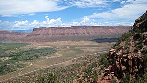
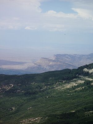
They arranged for "Silvestre" and a boy named "Joaquín" to be their guides. They traveled through areas like the Grand Mesa National Forest. They crossed the Colorado River at Una. Silvestre showed them a very steep hill with loose rocks, which was difficult to climb. From the top of a high ridge, Silvestre pointed to the lands of the Comanche and to his own people's homes in the Utah Lake Valley.
Rangely, September 10 After traveling through the Cañon Pintado, the expedition entered Rio Blanco County, Colorado. They crossed the White River just east of Rangely. The land became flatter here. They followed a bison trail that led in their desired direction.
Utah
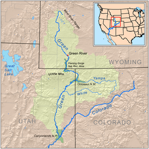
Yampa Plateau, September 11 Their food was running low, so a few men hunted and killed a bison on the Yampa Plateau in Uintah County, Utah. Next, they reached the Green River near Jensen, Utah. They described the area as having wide meadows perfect for farming. One of the men, Lain, carved his name and the year 1776 into a cottonwood tree.
Heading southwest from Jensen, they saw fresh horse tracks, which they thought belonged to Comanche warriors. They camped at Horseshoe Bend on the Green River and then went west to Myton, where they found old pueblo ruins. They continued west, camping near Duchesne and Fruitland. Their route from Jensen to Soldier Springs was similar to today's U.S. Highway 40.
Uinta National Forest, September 20 The expedition traveled west through the Uinta National Forest. They faced difficult conditions: cold weather, strong winds, and tricky terrain. The ground was soft, causing horses to sink, and there were thick bushes and narrow passages. The guide "Silvestre" often went ahead, eager to reach his home.
On September 22, they saw smoke signals from the mountains. Silvestre said they were from his people hunting. The explorers sent back smoke signals to show they were friendly. Silvestre then spoke loudly in his language, telling any nearby Native Americans that they were peaceful.
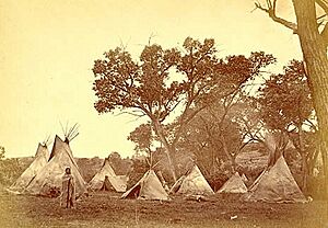
Utah Lake, September 23 Silvestre and Joaquín dressed up with woolen cloth and red ribbon before entering their village. They traveled out of the canyon into a meadow and entered the Utah Lake Valley. They called the lake the Lake of the Timpanogos Tribe. They saw many smoke plumes and burnt meadows, which made them think the Timpanog Utes believed they were Comanches or other enemies.
After camping near Spanish Fork, a small group, including Silvestre, Joaquín, Muñiz, and Domínguez, went ahead to a Native American village on the Provo River. Men came out with weapons, but when they recognized Silvestre, they welcomed the explorers warmly. They met the tribal leader, Chief Turunianchi. The Native Americans were surprised the explorers had traveled safely through Comanche land.
Domínguez explained their visit and asked for another guide to find Father Garces. Joaquín and a boy they named "José María" agreed to continue the journey. The fathers gave gifts to the tribe and received a lot of dried fish for their travels. The tribe also offered their land for other Spaniards to build homes if they wished to return.
Escalante described the Utah Lake Valley as a good place for settlement. The weather was pleasant, and there were four rivers, large meadows for farming, and plenty of fish, birds, and animals for hunting. There was also wood for homes and fires, and good pasture for horses. Because of the many fish, the Timpanogos were called "fish-eaters." The expedition heard about Salt Lake Valley and its salty lake but did not go there.
Payson, September 26 The group left Silvestre's village on September 25 and traveled southwest. They camped near Springville, Payson, and Scipio. This route is similar to today's Interstate Highway 15. They met several friendly Native American groups. Some of these men had thick beards and looked more like Spanish men than Native Americans. These tribes were kind and helpful, and like Silvestre's tribe, they encouraged the Spaniards to return.
After Scipio, they struggled to find good pasture and drinking water. Sometimes, the only water they found was salty, which made the horses sick. Pastureland became very scarce. To make things worse, "José María" left one morning to return to his village. He was upset by how one of the servants was treated.
Beaver River Valley, October 5 A cold wind brought heavy snow, hail, and rain, stopping their travel for several days. Conditions were very uncomfortable, and they had no wood for a fire. When they tried to travel, the horses got stuck or fell in the snow and mud. Domínguez and Escalante thought about the dangers of continuing to California. All the mountains they needed to cross were covered in snow. They worried their last guide, "Joaquín," might leave them too.
They decided that their missionary goals had been met, as they had invitations to return for future settlements. So, instead of heading west, they decided to go south and return to Santa Fe. Heading south, they had better luck. The ground was easier for the horses, and they camped near Milford. There, melted snow formed a pool of water, and there was pasture for the horses. This was the end of the territory of their friends, the long-bearded Utes.
They met members of another Native American tribe who were very suspicious. To lead the explorers away, the chief and another man guided them from near Kanarraville to Pintura, where the guides quietly left them. They continued south towards Toquerville. Although some days had been very hot, they found mild weather, green meadows, and an area where a Native American tribe grew corn. Near Hurricane, the land became sandy, making travel hard for the horses. They camped near the Arizona border.
Arizona
Mojave Desert, northwestern Arizona, October 16 The expedition wanted to go south to the Colorado River. But eight Native American men told them that the river was surrounded by a very deep canyon (the Grand Canyon) and was hard to reach. With no food left, they sacrificed one of their horses for food. The next day, they searched for water. Miera was sick and could barely speak. Near Diamond Butte, they met five Native Americans, called Yubuincariris. These people showed them to a good water source and traded wild sheep, prickly pear, and grass seeds for some goods. The Native Americans also shared information about other tribes. They didn't know about Monterey but had heard of Father Garces.
Paria River, October 22 The expedition continued to face problems with illness, lack of water, and supplies as they traveled east across what is now Arizona. They sometimes went north into Utah. They made many stops along the Paria River canyons and plateau, near Wahweap and Glen Canyon.
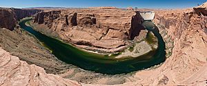
Crossing of the Fathers, Colorado River, October 26 – November 7 Local Native Americans guided them to the site of present-day Lees Ferry, but it was too difficult to cross. They were then led to a second crossing point on the Colorado River. Here, they carved steps into the canyon wall to cross. This crossing, called the Crossing of the Fathers, is now underwater beneath Lake Powell.
Northeastern Arizona, November 8–12 While crossing northeastern Arizona, the group faced snowy, cold weather, little food or water, and difficulty finding a good path. Their journal describes these hardships, but the record of their exact route is unclear because they were focused on survival. However, in 1884, a member of a U.S. Geological Survey team found a large sandstone rock with a Spanish name and the date "1776" carved into it. In 1995, the Palace of the Governors in Santa Fe found this same rock, confirming it was a site visited by the Domínguez–Escalante expedition, likely on November 12, 1776.
Pueblo of Oraybi, November 16 Finally, the group reached a Hopi (Moqui) pueblo called Oraybi, on the Third Mesa. There, they were given shelter, food, and supplies.
Return to New Mexico
Northwestern New Mexico and Santa Fe, November 17 – January 2, 1777 Continuing their journey through northwestern New Mexico, the group finally arrived back in Santa Fe on January 2, 1777.
Old Spanish Trail
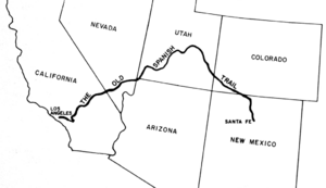
The maps and information from the expedition were very useful for future travel. Their route from Santa Fe to the Salt Lake Valley became the first part of a path later known as the Old Spanish Trail.
See also
 In Spanish: Expedición de Domínguez y Escalante para niños
 | Kyle Baker |
 | Joseph Yoakum |
 | Laura Wheeler Waring |
 | Henry Ossawa Tanner |


