Escalante River facts for kids

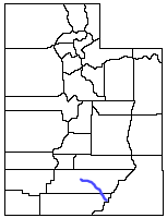
The Escalante River is a river in Utah that flows into the Colorado River. Think of it as a smaller stream that feeds into a much bigger river. It starts when two smaller streams, Upper Valley and Birch Creeks, join together near the town of Escalante, Utah. From there, it flows southeast for about 90 miles (145 km) until it reaches Lake Powell.
The land around the Escalante River includes tall, forested mountains like the Aquarius Plateau, the eastern side of the Kaiparowits Plateau, and the dry desert north of Lake Powell. This river was the last one of its size to be explored and mapped in the 48 connected states of the U.S. On average, about 146 cubic feet (4.1 cubic meters) of water flow through it every second.
Discovering the Escalante River

The Escalante River was first mapped and given its name by Almon Thompson in 1872. He was part of an important trip led by John Wesley Powell, who explored the Colorado River.
The river was named after Silvestre Vélez de Escalante. He was a Franciscan missionary, which means he was a religious person who traveled to new places to share his beliefs. In 1776, Escalante and his Spanish leader, Francisco Atanasio Domínguez, began a journey from Santa Fe, New Mexico. They were trying to reach Monterey, California. During this trip, known as the Domínguez–Escalante expedition, Escalante and his group passed near the Grand Canyon. They were also the first known Europeans to enter what is now Utah.
Exploring the River's Canyons
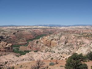
Most of the Escalante River flows through winding canyons made of sandstone. These canyons and the smaller ones that lead into them are a key part of the Grand Staircase–Escalante National Monument. This amazing area is a very popular spot for people who love hiking and backpacking.
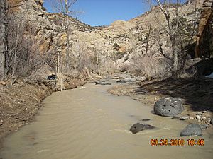
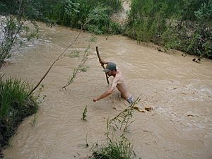
For most of the year, the Escalante River is a small stream. You can easily step across it or walk through the shallow water. But during spring when snow melts, or in summer when there are heavy rainstorms (called monsoons), the river can become a very strong, muddy flood. It can be ten to one hundred times bigger than usual!
Sometimes, when the water is just right, people can use kayaks or canoes to travel down the river. Larger boats like rafts are usually too big. However, timing is very important. If the water is too high or too low, it can be impossible to travel, and people might get stuck. Also, at the end of the trip, boaters often have to carry their boats several hundred feet up a steep path.
See also
 In Spanish: Río Escalante (Estados Unidos) para niños
 | William L. Dawson |
 | W. E. B. Du Bois |
 | Harry Belafonte |


