
Hurricane, Utah facts for kids
Quick facts for kids
City of Hurricane
|
|
|---|---|

Hurricane, Utah in July 2009
|
|

Location in Washington County and the state of Utah
|
|
| Country | United States |
| State | Utah |
| County | Washington |
| Area | |
| • Total | 53.63 sq mi (138.90 km2) |
| • Land | 52.76 sq mi (136.64 km2) |
| • Water | 0.88 sq mi (2.27 km2) |
| Elevation | 3,258 ft (993 m) |
| Population
(2020)
|
|
| • Total | 20,036 |
| • Density | 361.55/sq mi (139.60/km2) |
| Time zone | UTC-7 (Mountain (MST)) |
| • Summer (DST) | UTC-6 (MDT) |
| ZIP code |
84737
|
| Area code(s) | 435 |
| FIPS code | 49-37170 |
| GNIS feature ID | 2410082 |
Hurricane (pronounced "HER-ih-kun") is a city in Washington County, Utah, United States. In 2020, about 20,036 people lived there. The Hurricane valley is the eastern part of the St. George area. It is also close to Zion National Park. Hurricane is famous for its old peach and pecan farms, wide-open spaces, and green fields.
Contents
History of Hurricane
Hurricane was first settled in 1896. It got its name after a strong whirlwind blew the top off a buggy. Erastus Snow was riding in the buggy at the time. He said, "Well, that was a Hurricane. We'll name this 'Hurricane Hill'."
Local people often say "Her-ah-kun," which sounds like how early settlers from Liverpool, England, might have said it. The town was part of a plan by Brigham Young, a leader of The Church of Jesus Christ of Latter-day Saints. This plan, called the "Cotton Mission," aimed to grow crops in southern Utah. Hurricane was known for its small farms growing peaches, pecans, and pistachio nuts. The town even had a large peach and apricot orchard for the LDS Church.
In 1992, an earthquake hit the area. It damaged three houses and other important services. The damage cost about $1 million.
Fun Places to Visit
Hurricane has many fun places for kids and families.
- There are several parks, including a special park for dogs.
- You can find a city pool and a big community center.
- There are also golf courses, two lakes for recreation, and a small airport.
- The Hurricane Valley Heritage Park Museum is a great place to learn about the town's past. You can find it at the corner of State Street and Main.
The Hurricane Canal Trail
The Hurricane Canal was very important to the Hurricane Valley for about 80 years. It took 11 years to build (from 1893 to 1904), mostly by hand using picks and shovels. Since 1985, the canal has been empty. In 2000, groups worked together to save the canal. They got money and volunteers to build a trail. This trail honors the hard work of the early settlers who built the canal.
A monument at the start of the trail tells the canal's story. Much of the trail follows the actual west bank of the canal. "Canal riders" used to ride this bank every day to check for leaks. The trail offers great views of Hurricane and La Verkin. It ends before reaching the Virgin River Gorge, about five miles from where the canal used to start.
Sand Hollow State Park
Sand Hollow State Park is in the southern part of Hurricane. It has a large lake that is 1,322 acres big. There are many places to camp and trails for off-roading. The park has sandy beaches where you can drive off-road vehicles (OHVs). You can also go through a tunnel to Sand Mountain, which has popular sand dunes. You can get to Sand Hollow from Utah State Route 9 or State Route 7.
Quail Creek State Park
Quail Creek State Park has a 600-acre lake and a campground. The lake gets some of its water from Quail Creek. It's a great spot for fishing, boating, kayaking, and paddle-boarding. You can reach this park from State Route 9 or Old Highway 91.
The Virgin River
The Virgin River forms almost all of Hurricane's northern border. It flows through the city's Confluence Park. The river crosses State Route 9 in two places. It helps provide water to Hurricane and most of Washington County.
Geography of Hurricane
Hurricane covers an area of about 31.5 square miles. Most of this area, about 31.1 square miles, is land. The rest, about 0.4 square miles, is water.
How to Get Around Hurricane
Major Roads
Interstate 15 is a big highway that forms part of Hurricane's northwest border. It has two exits that connect to Hurricane. I-15 is the main way to get to nearby St. George. It also connects Hurricane to Salt Lake City, which is 290 miles north, and Las Vegas, which is 138 miles south.
Utah State Route 9 starts in Hurricane. It goes east through the city and is known as State Street. SR-9 connects Hurricane to Zion National Park and to U.S. Route 89. It is also Hurricane's main road to I-15.
Utah State Route 59 ends in Hurricane. It connects Hurricane to nearby Hildale. It also indirectly links Hurricane to Kanab and Lake Powell through Arizona.
Utah State Route 7, also called Southern Parkway, is still being built. When finished, it will start near Hurricane's business area. It will provide access to Washington and South St. George.
Hurricane Municipal Airport
Hurricane Municipal Airport is in the south of Hurricane. It is the city's only public airport. It has one runway and is only for small personal planes.
People in Hurricane
| Historical population | |||
|---|---|---|---|
| Census | Pop. | %± | |
| 1910 | 336 | — | |
| 1920 | 1,021 | 203.9% | |
| 1930 | 1,197 | 17.2% | |
| 1940 | 1,524 | 27.3% | |
| 1950 | 1,271 | −16.6% | |
| 1960 | 1,251 | −1.6% | |
| 1970 | 1,408 | 12.5% | |
| 1980 | 2,660 | 88.9% | |
| 1990 | 3,915 | 47.2% | |
| 2000 | 8,250 | 110.7% | |
| 2010 | 13,748 | 66.6% | |
| 2019 (est.) | 19,074 | 38.7% | |
| U.S. Decennial Census | |||
In 2010, there were 13,748 people living in Hurricane. About 91.3% of the people were White. Other groups included African American, Native American, Asian, and Pacific Islander people. About 2.72% of the population was Hispanic or Latino.
Many families live in Hurricane. About 34.1% of homes had children under 18. The average household had about 2.87 people. The average family had about 3.32 people.
The median age in Hurricane was 33.8 years old. This means half the people were younger than 33.8 and half were older.
Economy and Jobs


State Street is the main road in Hurricane. It is also known as Utah SR-9. The shopping area from 100 East to 400 West is a historic district. Efforts are being made to preserve its old buildings. Three of the city's larger homes are listed on the National Register of Historic Places.
Hurricane is located on Utah State Route 9, between Interstate 15 and Zion National Park. Because of this, the city has many motels, restaurants, and shops. These businesses serve the millions of tourists who visit Zion National Park each year. Hurricane also benefits from visitors going to Lake Powell and the North Rim of Grand Canyon National Park. These places can be reached using Utah State Route 59, which crosses State Route 9 in Hurricane.
The Hurricane area is a popular spot for mountain biking in Southwestern Utah. It is close to famous trails like Gooseberry Mesa, J.E.M, and Little Creek.
Old U.S. Highway 91 has many distribution centers. The biggest is the Walmart Distribution Center, which employs about 700 people. Other companies like Orgill, Pepsi-Cola, and BlvdHome also have distribution centers there.
Schools in Hurricane
Hurricane is part of the Washington County School District.
- It has one high school, Hurricane High School. This school serves grades 10–12. Students from nearby towns like La Verkin, Toquerville, and Springdale also attend.
- There are two elementary schools.
- There is an intermediate school for grades 6–7.
- There is a middle school for grades 8–9.
- Valley Academy is a charter school for grades K-8.
Famous People from Hurricane
- Oliver DeMille, an author and teacher.
- Derral Eves, who helped start the TV series The Chosen.
- Don Leo Jonathan, a famous wrestler.
- James Judd, a politician and businessman.
- Bradley Last, a politician in the Utah House of Representatives.
- W. Paul Reeve, a historian and professor.
- Donald L. Staheli, a business leader.
- Herb Wilkinson, an All-American basketball player.
- Sylvan Wittwer, a scientist who studied plants.
Images for kids
-
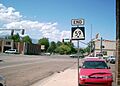
State Street and Main Street
-
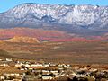
Sunrise over Hurricane
See also
 In Spanish: Hurricane (Utah) para niños
