Zion National Park facts for kids
Quick facts for kids Zion National Park |
|
|---|---|
|
IUCN Category II (National Park)
|
|
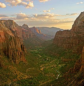
Zion Canyon from Angels Landing at sunset
|
|
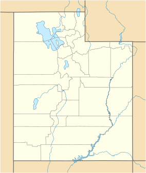
| Location | Washington, Kane, and Iron counties, Utah, United States |
| Nearest city | Springdale (south), Orderville (east) and Cedar City near Kolob Canyons entrance |
| Area | 146,597 acres (229.058 sq mi; 59,326 ha; 593.26 km2) |
| Established | November 19, 1919 |
| Visitors | 4,692,417 (in 2022) |
| Governing body | National Park Service |
| Website | Zion National Park |
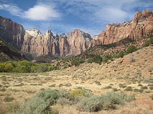
Zion National Park is a beautiful national park in southwestern Utah, close to the town of Springdale. It sits where three different natural areas meet: the Colorado Plateau, the Great Basin, and the Mojave Desert. This special location gives the park unique landforms and many different kinds of plants and animals. You can find 289 types of birds, 75 kinds of mammals (like 19 types of bats), and 32 types of reptiles here. These animals live in four main areas: the desert, wet areas near rivers (called riparian zones), woodlands, and coniferous forests.
Zion National Park is full of amazing sights, including mountains, deep canyons, tall buttes, flat-topped mesas, huge rock towers (monoliths), rivers, narrow slot canyons, and natural rock natural arches. The lowest point in the park is 3,666 feet (1,117 meters) at Coalpits Wash. The highest point is Horse Ranch Mountain at 8,726 feet (2,660 meters). A very famous part of the park is Zion Canyon, which is 15 miles (24 km) long and up to 2,640 feet (800 meters) deep. The canyon walls are made of reddish and tan-colored Navajo Sandstone. The North Fork of the Virgin River carved out this amazing canyon over time.
People have lived in this area for about 8,000 years. The first groups were Native Americans, like the Basketmakers, who were semi-nomadic. Later, other groups like the Virgin Anasazi and Parowan Fremont settled here. By 1300 CE, these groups moved away. Then, the Southern Paiute tribes came to live in the area. Mormons arrived in 1858 and started settling in the early 1860s.
Contents
How Zion National Park Got Its Name
In 1909, President William Howard Taft created the Mukuntuweap National Monument to protect the canyon. In 1918, the head of the new National Park Service, Horace Albright, suggested making the monument bigger and changing its name to Zion National Monument. "Zion" is a word used by the Mormons.
Some people at the time thought that Spanish and Native American names might stop visitors from coming. They believed a new name like Zion would be more appealing. On November 19, 1919, the U.S. Congress officially made it Zion National Park. President Woodrow Wilson signed the act. Later, in 1937, the Kolob section became a separate monument. But in 1956, it was added to Zion National Park. In 2009, 85% of the park was made a special wilderness area. This means it is kept as wild as possible.
The rocks and land of Zion and Kolob canyons show 150 million years of history. During this time, the area was covered by warm, shallow seas, rivers, lakes, huge deserts, and dry coastal lands. About 13 million years ago, the land started to lift up. This created the Colorado Plateau, raising the region about 10,000 feet (3,000 meters).
Why Zion Park is Important
Zion National Park has a special purpose. It aims to protect the amazing landforms, like Zion Canyon. It also protects the many deep, colorful sandstone canyons. These were formed by incredible erosion processes. The park also keeps its wild nature safe and protects its beautiful rivers. It guards signs of human history and supports scientific research. Most importantly, it helps people enjoy and learn about nature.
Exploring Zion's Geography
The park is in southwestern Utah. It sits where three major land areas meet: the Colorado Plateau, the Great Basin, and the Mojave Desert. The northern part of the park is called the Kolob Canyons section. You can get there from Interstate 15.
Horse Ranch Mountain is the highest point at 8,726 feet (2,660 meters). The lowest point is Coal Pits Wash at 3,666 feet (1,117 meters). This means there's a big difference in height of about 5,100 feet (1,550 meters) in the park.
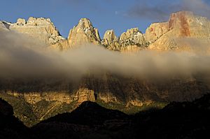
The road into Zion Canyon is 6 miles (10 km) long. It ends at the Temple of Sinawava, named after the coyote god of the Paiute Indians. The canyon gets very narrow here. A hiking trail leads to the start of The Narrows. This is a gorge only 20 feet (6 meters) wide but up to 2,000 feet (600 meters) tall. From early April to late October, you ride a free shuttle bus on the Zion Canyon road. Other roads in Zion are open to private cars all year.
The east side of the park has the Zion-Mount Carmel Highway. This road goes through the Zion–Mount Carmel Tunnel. It ends at US 89. On this side, you can see Checkerboard Mesa and The East Temple.
The Kolob Terrace area is northwest of Zion Canyon. Here you'll find a slot canyon called The Subway. You can also get amazing views from Lava Point. The Kolob Canyons section is even further northwest, near Cedar City. It has Tucupit Point and Kolob Arch, which is one of the world's longest natural arches.
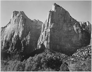
Other famous spots in Zion Canyon include Angels Landing, The Great White Throne, the Court of the Patriarchs, The Sentinel, The West Temple, Towers of the Virgin, the Altar of Sacrifice, The Watchman, Weeping Rock, and the Emerald Pools.
Weather in Zion
Spring weather can change quickly. It might be stormy and wet, or warm and sunny. March usually has the most rain. Spring wildflowers bloom from April to June. Fall days are often clear and mild, with cool nights. Summer days are hot, usually 95 to 110°F (35 to 43°C). But nights are cooler, around 65 to 70°F (18 to 21°C). Thunderstorms are common from mid-July to mid-September. These storms can create waterfalls and flash floods.
Autumn colors start in September in the higher areas. In Zion Canyon, the leaves usually change color in late October. Winter in Zion Canyon is mild. Winter storms bring rain or light snow to the canyon. Higher elevations get more snow. Clear winter days can be warm, up to 60°F (16°C). Nights are often 20 to 40°F (-7 to 4°C). Roads can get icy during winter storms. Most Zion roads are plowed, but Kolob Terrace Road closes when it snows a lot. Winter driving conditions last from November to March.
A Look at Zion's History
Experts divide Zion's human history into three main periods. Each period shows different ways people lived and used tools.
Early People: The Archaic Period
The first people arrived in the Zion area about 8,000 years ago. These family groups moved around to hunt and gather plants and seeds. About 2,000 years ago, some groups started growing corn and other crops. This meant they stayed in one place more often. Later groups built permanent villages called pueblos. This time is called the Archaic period, and it lasted until about 500 CE.
Archaeologists have found baskets, nets made of rope, and sandals made from yucca fibers from this time. The tools they used included stone knives, drills, and dart points. These dart points were attached to wooden shafts and thrown using devices called atlatls.
Around 300 CE, some of these groups became the Basketmakers. They were an early branch of the seminomadic Anasazi. Basketmaker sites have storage pits lined with grass or stone. They also had shallow, partly underground homes called pithouses. They hunted and gathered food, and also grew some crops. Locally gathered pine nuts were an important food and trade item.
Later Native American Groups: The Protohistoric Period
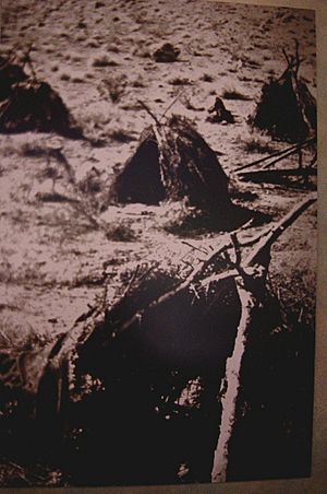
Both the Virgin Anasazi and the Parowan Fremont groups left southwestern Utah by about 1300 CE. Long dry periods in the 11th and 12th centuries, along with big floods, might have made it impossible to grow crops in this dry area.
The groups who came after them were cousins of the Virgin Anasazi, who spoke Numic languages. These included the Southern Paiute and Ute tribes. These new groups moved seasonally up and down valleys to find wild seeds and animals. Some, especially the Southern Paiute, also planted corn, sunflowers, and squash to add to their food supply. These groups, who stayed in one place more, made brown pottery for storing food and cooking.
European Exploration and Settlement
The Historic period began in the late 1700s. Spanish priests Silvestre Vélez de Escalante and Francisco Atanasio Domínguez explored southern Utah. They passed near what is now the Kolob Canyons Visitor Center in 1776. They were the first Europeans known to visit the area. In 1825, a fur trapper named Jedediah Smith explored some of the downstream areas.
In 1847, Mormon farmers from the Salt Lake area were the first Europeans to settle the Virgin River region. By 1851, Mormons settled the Parowan and Cedar City areas. They used the Kolob Canyons for timber and for grazing their cattle, sheep, and horses. They also looked for minerals and used Kolob water to water their crops. Mormon settlers named the area Kolob, which in their scripture means a heavenly place near God.

By 1858, settlements had spread south. That year, a Southern Paiute guide led a young Mormon missionary, Nephi Johnson, into the upper Virgin River area and Zion Canyon. Johnson wrote a good report about the area's farming potential. He returned later to start the town of Virgin. In 1861 or 1862, Joseph Black visited Zion Canyon and was very impressed by its beauty.
Isaac Behunin settled the floor of Zion Canyon in 1863. He farmed corn, tobacco, and fruit trees. The Behunin family lived in Zion Canyon near where Zion Lodge is today during the summer. They spent winters in Springdale. Behunin is said to have named the area Zion. This refers to a peaceful place mentioned in the Bible. Two more families settled Zion Canyon in the next few years. They brought cattle and other animals. Farming continued in the canyon until Zion became a Monument in 1909.
The Powell Geographic Expedition of 1869 explored the area after their first trip through the Grand Canyon. John Wesley Powell visited Zion Canyon in 1872. He named it Mukuntuweap, thinking that was the Paiute name. Photographers John K. Hillers and James Fennemore first visited Zion Canyon and the Kolob Plateau in 1872. Hillers returned in 1873 to take more photos. He described wading through the canyon for four days and almost freezing to death to get his pictures.
Protecting the Park and Welcoming Visitors
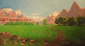
Paintings of the canyon by Frederick S. Dellenbaugh were shown at the Saint Louis World's Fair in 1904. A good article about the park appeared in Scribner's Magazine the next year. These paintings, photos, and reports led President William Howard Taft to create Mukuntuweap National Monument on July 31, 1909. In 1917, the head of the new National Park Service visited. He suggested changing the name to Zion, which the local Mormon community used. The United States Congress added more land and made it Zion National Park on November 19, 1919. A separate Zion National Monument (the Kolob Canyons area) was created in 1937. It was added to the main park in 1956.
It was hard to travel to the area before it was a national park. It was far away, had no places to stay, and no good roads. Old wagon roads were improved for cars around 1910. The road into Zion Canyon was built in 1917.
Cars could reach Zion Canyon by summer 1917. The first place for visitors to stay, called Wylie Camp, was a tent camp. In 1923, the Utah Parks Company bought Wylie Camp. They offered ten-day train and bus tours to Zion, nearby Bryce Canyon, and the Grand Canyon. The Zion Lodge was built in 1925 where the tent camp used to be. Architect Gilbert Stanley Underwood designed the lodge in a rustic style.
Improving Roads and Trails
Work on the Zion Mount Carmel Highway began in 1927. This road would connect Springdale to the east side of the park. It opened in 1930, and park visits greatly increased. The most famous part of the Zion – Mount Carmel Highway is its 1.1-mile (1.8 km) tunnel. This tunnel has six large windows cut through the huge sandstone cliff.
In 1896, a local rancher named John Winder improved a Native American path. This path later became the East Rim Trail. In 1900, David Flanigan used this trail to build a system of cables. These cables lowered lumber into Zion Canyon from Cable Mountain. More than 200,000 board feet (470 cubic meters) of lumber were lowered by 1906. The car road was extended to the Temple of Sinawava. A trail was built from there to the start of The Narrows. The Angel's Landing Trail was built in 1926. Two bridges were built over the Virgin River. The Civilian Conservation Corps built more trails in the 1930s.
Recent Park Events
Zion National Park has been in many movies. These include The Deadwood Coach (1924) and Butch Cassidy and the Sundance Kid (1969).
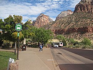
The Zion Canyon Scenic Drive helps visitors get around Zion Canyon. In the 1990s, too many cars caused traffic jams. So, in 2000, a public transportation system started using shuttle buses. Zion also has two electric trams. From early April to late October, private cars are not allowed on the scenic drive. Visitors must use the shuttle buses.
On April 12, 1995, heavy rains caused a landslide. This blocked the Virgin River in Zion Canyon. The river quickly washed away part of the only exit road. This trapped 450 guests and employees at the Zion Lodge. A temporary one-lane road was built in 24 hours to help people leave. A more stable temporary road was finished in May 1995 for summer visitors. A permanent road was built in 1996.
The Zion–Mount Carmel Highway is open all year. Very large vehicles need a special permit to use it. They can only go through the tunnel during the day, as traffic has to be one-way for them. The 5-mile (8 km) Kolob Canyons Road leads to the Kolob Canyons section. This road often closes in winter.
In March 2009, President Barack Obama signed a law. It protected 124,406 acres (50,345 ha) of park land as the Zion Wilderness. This is about 85% of the park.
In September 2015, flooding trapped seven people in Keyhole Canyon. This is a slot canyon in the park. A flash flood killed all seven people. Their bodies were found after a search that lasted several days.
In 2017, some scenes from the TV show Extinct were filmed in the park.
On March 25, 2020, the park campgrounds closed to help stop the spread of COVID-19.
Zion's Amazing Geology

Zion National Park has nine different rock layers that you can see. These layers are part of a huge group of rocks called the Grand Staircase. Together, these layers show about 150 million years of Earth's history. During this time, the area was covered by different environments:
- Warm, shallow seas (like the Kaibab and Moenkopi formations)
- Streams, ponds, and lakes (like the Chinle, Moenave, and Kayenta formations)
- A huge desert (like the Navajo and Temple Cap formations)
- Dry areas near the coast (like the Carmel Formation)
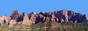
The whole region, called the Colorado Plateaus, slowly lifted up. This raised these rock layers more than 10,000 feet (3,000 meters) higher than where they first formed. This made the rivers flow faster.
The fast-moving rivers used cracks in the rocks to cut deeper. Eventually, all the younger rock layers were removed. Deep gorges were cut into the plateaus. Zion Canyon was carved by the North Fork of the Virgin River this way. Later, lava flows and cinder cones covered parts of the area.
Heavy water flow during wet seasons does most of the carving in the main canyon. These floods carry away millions of tons of rock and sediment each year. The Virgin River cuts its canyon faster than its smaller streams (tributaries) can cut theirs. So, these smaller streams end in waterfalls where they meet the Virgin River. This is called a hanging valley. The valley between the peaks of the Twin Brothers is a good example.
Zion's Diverse Biology
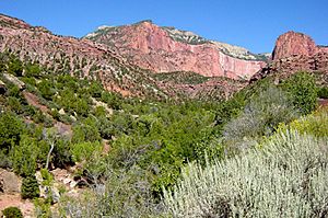
Zion and Kolob canyons are where the Great Basin, Mojave Desert, and Colorado Plateau meet. This, along with the different types of land (canyons and mesas), different soils, and varying water amounts, creates many different places for plants and animals to live. The park is home to 289 types of birds, 79 mammals, 28 reptiles, 7 fish, and 6 amphibian species. These living things make their homes in one or more of the four main life zones in the park: desert, riparian (riverbank), woodland, and coniferous forest.
Desert Life
Desert conditions are found on canyon bottoms and rocky ledges away from rivers. Common plants here include sagebrush, prickly pear cactus, and rabbitbrush. You can also see sacred datura and Indian paintbrush. Utah penstemon and golden aster also grow here. Milkvetch and prince's plume grow in areas with special soils rich in selenium.
During the day, you might see mule deer, rock squirrels, pinyon jays, and whiptail and collared lizards. At night, Desert cottontails, jackrabbits, and Merriam's kangaroo rats come out. The main predators are cougars, bobcats, coyotes, badgers, gray foxes, and ring-tail cats.
Forest and Mountain Life
Cooler conditions are found on mid-level slopes, from 3,900 to 5,500 feet (1,200 to 1,700 meters). Here, you'll find small forests of pinyon pine and juniper. They grow with shrubs like manzanita, cliffrose, serviceberry, scrub oak, and yucca. Higher up, on the mesas and cliffs above 6,000 feet (1,800 meters), there are stands of ponderosa pine, Gambel oak, Rocky Mountain Douglas-fir, White fir, manzanita, and aspen trees.
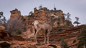
You might see Golden eagles, red-tailed hawks, peregrine falcons, and white-throated swifts flying overhead. Desert bighorn sheep were brought back to the park in 1973. California condors were also reintroduced nearby. In 2014, the first successful condor breeding in the park was confirmed. Nineteen types of bats also live in the area.
Riparian Zone Life
Along the rivers and streams, you'll find plants like Boxelder, Fremont cottonwood, maple, and willow trees. Animals that live in these wet areas include bank beavers, flannel-mouth suckers (a type of fish), gnatcatchers, dippers (birds), canyon wrens, the virgin spinedace (another fish), and water striders (insects).
Fun Activities in Zion
Park rangers at the visitor centers in Zion Canyon and Kolob Canyons can help you plan your visit. You can go on guided horseback riding trips, nature walks, and evening programs from late March to early November. The Junior Ranger Program is for children aged 4 and up. It runs all year at the Nature Center, Human History Museum, and visitor centers. A bookstore at the Zion Canyon visitor center sells books, maps, and souvenirs. The Grotto in Zion Canyon, the visitor center, and the viewpoint at the end of Kolob Canyons Road have picnic areas.
Hiking Trails
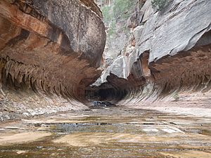
Zion Canyon has seven trails. These hikes can take from half an hour (Weeping Rock) to 4 hours (Angels Landing). In the Kolob Canyons section, near Cedar City, two popular trails are Taylor Creek (4 hours round trip) and Kolob Arch (8 hours round trip).
Hiking up into The Narrows from the Temple of Sinawava is popular in summer. But you need a permit to hike beyond Big Springs. The entire Narrows hike from Chamberlain's Ranch is 16 miles (26 km) long. It usually takes 12 hours of hard hiking. A shorter way to enter The Narrows is through Orderville Canyon. Both Orderville and the full Narrows require a special permit to enter the backcountry. You are not allowed to enter the Parunuweap Canyon section of the park downstream of Labyrinth Falls. Other popular backcountry trails include the West Rim and LaVerkin Creek.
The more wild parts of Zion include the Kolob Terrace and the Kolob Canyons. A network of trails, totaling 50 miles (80 km), connects the northwest corner of the park (Lee Pass Trailhead) to its southeast section (East Rim Trailhead). This route is known as the Zion Traverse. It offers backpackers a diverse experience of the park.
Zion is a great place for rock climbing. Some popular routes are Spaceshot, Moonlight Buttress, Prodigal Son, Ashtar Command, and Touchstone.
Camping and Places to Stay
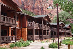
You can stay inside the park at Zion Lodge. It is located halfway through Zion Canyon. More places to stay are available just outside the park in Springdale.
Zion has three campgrounds. South and Watchman campgrounds are at the far southern end of the park. There's also a simple campground at Lava Point, located off Kolob Terrace Road in the middle of the park. If you want to camp overnight in the backcountry, you will need a permit.
Images for kids
See also
 In Spanish: Parque nacional Zion para niños
 | Janet Taylor Pickett |
 | Synthia Saint James |
 | Howardena Pindell |
 | Faith Ringgold |


