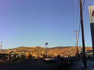
Cedar City, Utah facts for kids
Quick facts for kids
Cedar City, Utah
|
||
|---|---|---|
|
City
|
||
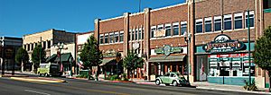
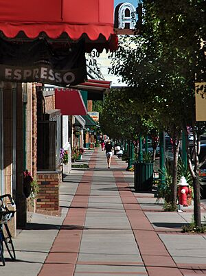
Main Street in September 2005
|
||
|
||
| Nickname(s):
Festival City USA
|
||
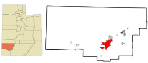
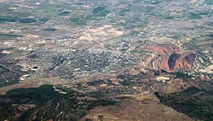
Location in Iron County and the state of Utah
|
||
| Country | United States | |
| State | Utah | |
| County | Iron | |
| Founded | November 11, 1851 | |
| Incorporated | February 18, 1868 | |
| Named for | Juniper ("cedar") trees | |
| Area | ||
| • Total | 35.94 sq mi (93.10 km2) | |
| • Land | 35.86 sq mi (92.89 km2) | |
| • Water | 0.08 sq mi (0.21 km2) | |
| Elevation | 5,670 ft (1,730 m) | |
| Population
(2020)
|
||
| • Total | 35,235 | |
| • Density | 982.57/sq mi (379.32/km2) | |
| Time zone | UTC−7 (Mountain (MST)) | |
| • Summer (DST) | UTC−6 (MDT) | |
| ZIP codes |
84720-84721
|
|
| Area code(s) | 435 | |
| FIPS code | 49-11320 | |
| GNIS feature ID | 2409415 | |
Cedar City is a big city in Iron County, Utah, United States. It's about 250 miles (400 km) south of Salt Lake City and 170 miles (270 km) north of Las Vegas. You can find it right on Interstate 15.
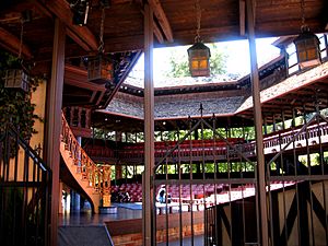
Cedar City is home to Southern Utah University. It's also famous for fun events like the Utah Shakespeare Festival and the Utah Summer Games. In 2020, about 35,235 people lived there. This was a big jump from 28,857 people in 2010!
Contents
History of Cedar City
The area around Cedar City has a long history. People lived here even before recorded history. You can see their rock art at Parowan Gap. The Southern Paiute people lived here when explorers like the Domínguez–Escalante expedition arrived in 1776. Later, in 1826, a fur trader named Jedediah Smith explored the area.
Founding the City
Cedar City was started in late 1851 by Mormon pioneers. They came from Parowan, Utah, to build a place to make iron. The spot was called "Fort Cedar" or "Cedar City." It was chosen because it was close to iron deposits and coal. The city was named after the many local trees, which are actually junipers, not true cedars.
On November 11, 1851, two groups of men, led by Henry Lunt, arrived during a snowstorm. This date is when the city officially began. In 1855, the city moved to a new spot. This new place was closer to the iron works and safer from floods.
Ironworks and Growth
An iron furnace worked from 1852 to 1855. It made about 25 tons of iron. Cedar City officially became a city on February 18, 1868.
The ironworks closed in 1858, but mining continued until the 1980s. In 1923, a railroad came to Cedar City. This made the city a popular stop for tourists visiting nearby national parks. These parks include Bryce Canyon National Park, Zion National Park, and Grand Canyon National Park.
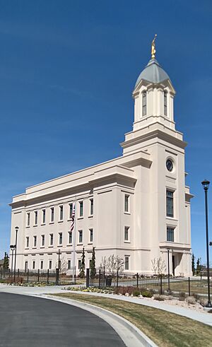
Today, Cedar City is still a hub for tourism, business, education, and the arts. The city has grown a lot since the late 1980s. On December 10, 2017, the Church of Jesus Christ of Latter-day Saints opened its Cedar City Utah Temple.
Geography and Climate
Cedar City is in the southeast part of the Great Basin. It's about 20 miles (32 km) north of the Mojave Desert. The city is high up, at about 5,846 feet (1,782 meters) above sea level. This makes its weather a bit cooler than nearby St. George, Utah.
The city covers about 20.1 square miles (52.1 square kilometers) of land. In some older parts of the city, people use an irrigation system. This system uses water from Coal Creek to water lawns and gardens.
Weather in Cedar City
Cedar City is in a high desert valley called Cedar Valley. It has a typical semi-arid climate. This means it's usually dry, but it can get a lot of snow. For example, in January 1949, it snowed almost 37 inches (94 cm)!
| Climate data for Cedar City, Utah, 1991–2020 normals, extremes 1948–present | |||||||||||||
|---|---|---|---|---|---|---|---|---|---|---|---|---|---|
| Month | Jan | Feb | Mar | Apr | May | Jun | Jul | Aug | Sep | Oct | Nov | Dec | Year |
| Record high °F (°C) | 70 (21) |
73 (23) |
81 (27) |
86 (30) |
96 (36) |
102 (39) |
105 (41) |
101 (38) |
99 (37) |
89 (32) |
76 (24) |
68 (20) |
105 (41) |
| Mean maximum °F (°C) | 56.6 (13.7) |
61.8 (16.6) |
70.5 (21.4) |
77.4 (25.2) |
86.2 (30.1) |
95.1 (35.1) |
98.9 (37.2) |
95.7 (35.4) |
90.2 (32.3) |
80.8 (27.1) |
69.0 (20.6) |
58.2 (14.6) |
99.3 (37.4) |
| Mean daily maximum °F (°C) | 42.8 (6.0) |
47.4 (8.6) |
56.2 (13.4) |
62.6 (17.0) |
73.1 (22.8) |
84.7 (29.3) |
91.0 (32.8) |
88.5 (31.4) |
80.6 (27.0) |
67.1 (19.5) |
53.4 (11.9) |
42.1 (5.6) |
65.8 (18.8) |
| Daily mean °F (°C) | 30.4 (−0.9) |
34.3 (1.3) |
41.5 (5.3) |
47.2 (8.4) |
56.4 (13.6) |
66.6 (19.2) |
74.0 (23.3) |
72.1 (22.3) |
63.1 (17.3) |
50.5 (10.3) |
38.5 (3.6) |
29.2 (−1.6) |
50.3 (10.2) |
| Mean daily minimum °F (°C) | 18.0 (−7.8) |
21.3 (−5.9) |
26.8 (−2.9) |
31.9 (−0.1) |
39.7 (4.3) |
48.5 (9.2) |
57.1 (13.9) |
55.6 (13.1) |
45.5 (7.5) |
33.9 (1.1) |
23.6 (−4.7) |
16.3 (−8.7) |
34.9 (1.6) |
| Mean minimum °F (°C) | −2.1 (−18.9) |
3.6 (−15.8) |
13.0 (−10.6) |
19.4 (−7.0) |
26.5 (−3.1) |
35.3 (1.8) |
47.5 (8.6) |
46.2 (7.9) |
32.0 (0.0) |
19.7 (−6.8) |
6.5 (−14.2) |
−2.5 (−19.2) |
−7.5 (−21.9) |
| Record low °F (°C) | −26 (−32) |
−24 (−31) |
−1 (−18) |
6 (−14) |
16 (−9) |
27 (−3) |
40 (4) |
35 (2) |
23 (−5) |
−7 (−22) |
−12 (−24) |
−23 (−31) |
−26 (−32) |
| Average precipitation inches (mm) | 0.82 (21) |
0.98 (25) |
1.23 (31) |
1.01 (26) |
0.94 (24) |
0.48 (12) |
1.02 (26) |
0.86 (22) |
0.75 (19) |
1.23 (31) |
0.84 (21) |
0.88 (22) |
11.04 (280) |
| Average snowfall inches (cm) | 8.7 (22) |
9.0 (23) |
8.6 (22) |
4.9 (12) |
0.9 (2.3) |
0.2 (0.51) |
0.0 (0.0) |
0.0 (0.0) |
0.1 (0.25) |
2.1 (5.3) |
6.7 (17) |
6.6 (17) |
47.8 (121.36) |
| Average precipitation days (≥ 0.01 in) | 6.0 | 7.0 | 7.4 | 7.0 | 5.8 | 2.6 | 6.2 | 5.9 | 4.7 | 5.3 | 5.1 | 6.3 | 69.3 |
| Average snowy days (≥ 0.1 in) | 5.2 | 4.7 | 4.8 | 2.9 | 0.8 | 0.2 | 0.0 | 0.0 | 0.2 | 1.1 | 3.6 | 4.1 | 27.6 |
| Source 1: NOAA (snow/snow days 1981–2010) | |||||||||||||
| Source 2: National Weather Service | |||||||||||||
People of Cedar City
Here's how Cedar City's population has grown over the years:
| Historical population | |||
|---|---|---|---|
| Census | Pop. | %± | |
| 1860 | 301 | — | |
| 1870 | 517 | 71.8% | |
| 1880 | 691 | 33.7% | |
| 1890 | 967 | 39.9% | |
| 1900 | 1,425 | 47.4% | |
| 1910 | 1,705 | 19.6% | |
| 1920 | 2,462 | 44.4% | |
| 1930 | 3,615 | 46.8% | |
| 1940 | 4,695 | 29.9% | |
| 1950 | 6,106 | 30.1% | |
| 1960 | 7,543 | 23.5% | |
| 1970 | 8,946 | 18.6% | |
| 1980 | 10,972 | 22.6% | |
| 1990 | 13,443 | 22.5% | |
| 2000 | 20,527 | 52.7% | |
| 2010 | 28,857 | 40.6% | |
| 2020 | 35,235 | 22.1% | |
| U.S. Decennial Census | |||
In 2000, there were 20,527 people living in Cedar City. Most people were White (92.06%). About 4.14% of the population was Hispanic or Latino.
Many households had children under 18 (39.0%). The average household had about 3 people. The average family had about 3.37 people. The median age in the city was 23 years old. This means half the people were younger than 23, and half were older.
Education in Cedar City
The schools in Cedar City are part of the Iron County School District.
Cedar City has two high schools:
- Cedar High School
- Canyon View High School
It is also home to Southern Utah University, a large college.
Economy and Jobs
Cedar City's economy relies on a few main things. These include small factories, tourism, Southern Utah University, and building new homes.
Here are some of the biggest employers in Cedar City (based on 2019 data):
| Employer | Number of Employees |
| Southern Utah University | 2000-2999 |
| Iron County School District (Public Education) | 1000-1999 |
| Intermountain Healthcare | 500-1500 |
| Cedar City Corporation (Government Services) | 250-499 |
| Genpak (Packaging Manufacturing) | 250-499 |
| Federal Government (Government Services) | 250-499 |
| State of Utah (Government Services) | 250-499 |
| Walmart | 250-499 |
Getting Around Cedar City
Interstate 15 is a major highway that connects Cedar City to other places. It goes to St. George, Utah (50 miles away) and Las Vegas (170 miles away) to the south. To the north, it connects to Interstate 70 (75 miles away) and Salt Lake City (250 miles away).
Cedar City also has good connections to other big cities. Los Angeles is about 439 miles (707 km) southwest. San Diego is about 500 miles (805 km) southwest. Phoenix, Arizona is about 465 miles (748 km) south. Denver is about 580 miles (933 km) northeast.
A train line from the Union Pacific Railroad serves businesses on the west side of the city. The Cedar City Regional Airport offers flights through Delta Connection. Cedar City also has its own local bus system to help people get around.
Famous People from Cedar City
Many interesting people have connections to Cedar City:
- Christine Cavanaugh (1963–2014) – A voice actress known for Dexter's Laboratory and Rugrats.
- Ally Condie – An author who wrote the popular Matched series. She was born in Cedar City.
- Riley Griffiths – A teenage actor famous for his role in the 2011 movie Super 8. He was born here.
- Mike Leavitt – A former governor of Utah and a former head of the U.S. Environmental Protection Agency. He was born and went to school in Cedar City.
- L. E. Modesitt Jr. – A science fiction and fantasy author who lives in Cedar City.
- Del Parson – An artist known for his paintings of Jesus Christ. He lives in Cedar City.
- Helen Foster Snow – A journalist who reported from China in the 1930s.
- Mitch Talbot – A professional baseball player who pitched in Major League Baseball. He was born in Cedar City.
See also
 In Spanish: Cedar City (Utah) para niños
 | Precious Adams |
 | Lauren Anderson |
 | Janet Collins |


