
Las Vegas facts for kids
Quick facts for kids
Las Vegas
|
|||
|---|---|---|---|
|
World Market Center
Lou Ruvo Center for Brain Health
Clark County Government Center
|
|||
|
|||
| Etymology: from Spanish las vegas, meaning 'the meadows' | |||
| Nicknames:
"Vegas", "Sin City", "City of Lights", "The Gambling Capital of the World", "The Entertainment Capital of the World", "Capital of Second Chances", "The Marriage Capital of the World", "The Silver City", "America's Playground"
|
|||

Las Vegas
Location in Nevada

Las Vegas
Location in the United States
|
|||
| Country | United States | ||
| State | Nevada | ||
| County | Clark | ||
| Founded | May 15, 1905 | ||
| Incorporated | March 16, 1911 | ||
| Government | |||
| • Type | Council–manager | ||
| Area | |||
| • City | 141.91 sq mi (367.53 km2) | ||
| • Land | 141.85 sq mi (367.40 km2) | ||
| • Water | 0.05 sq mi (0.14 km2) | ||
| • Urban | 540 sq mi (1,400 km2) | ||
| • Metro | 1,580 sq mi (4,100 km2) | ||
| Elevation | 2,001 ft (610 m) | ||
| Population
(2020)
|
|||
| • City | 641,903 | ||
| • Rank | 75th in North America 24th in the United States 1st in Nevada |
||
| • Density | 4,525.16/sq mi (1,747.17/km2) | ||
| • Urban | 2,196,623 (US: 21st) | ||
| • Urban density | 5,046.3/sq mi (1,948.4/km2) | ||
| • Metro | 2,265,461 (US: 29th) | ||
| Demonym(s) | Las Vegan | ||
| GDP | |||
| • Metro | 0.728 billion (2022) | ||
| Time zone | UTC−08:00 (PST) | ||
| • Summer (DST) | UTC−07:00 (PDT) | ||
| ZIP Codes |
89044, 89054, 891xx
|
||
| Area code(s) | 702 & 725 | ||
| FIPS code | 32-40000 | ||
| GNIS feature ID | 847388 | ||


.jpg)


Las Vegas, often called Vegas, is the biggest city in the state of Nevada. It is also the main city of Clark County. The area around Las Vegas is the largest in the Mojave Desert. It is also the second largest in the Southwestern United States.
Las Vegas is famous around the world as a major resort city. People know it for its fun activities like shopping, great food, and shows. Many of these places are in downtown Las Vegas and on the Las Vegas Strip. The Las Vegas Valley is a key center for money, business, and culture in Nevada. In 2020, about 641,903 people lived in the city. The larger metropolitan area had over 2.2 million residents. This makes it the 24th most populated city in the United States.
The city calls itself "the Entertainment Capital of the World". It is known for its fancy and very large hotels. Over 40.8 million people visit Las Vegas each year. This makes it one of the most visited cities in the United States. It is also a top place for business meetings. Las Vegas has more AAA Five Diamond hotels than any other city.
Las Vegas was started in 1905 and became an official city in 1911. Its population has grown a lot since the 1960s. Between 1990 and 2000, the number of people living there almost doubled. When people say "Las Vegas," they often mean the areas outside the city too. This includes the famous Strip, which is actually in nearby towns called Paradise and Winchester.
Contents
- What Does "Las Vegas" Mean?
- A Brief Look at Las Vegas History
- Las Vegas Geography and Climate
- Who Lives in Las Vegas?
- Las Vegas Economy and Attractions
- Culture and Arts in Las Vegas
- Sports in Las Vegas
- Parks and Recreation in Las Vegas
- Education in Las Vegas
- Media in Las Vegas
- Getting Around Las Vegas
- Images for kids
- See also
What Does "Las Vegas" Mean?
The name Las Vegas comes from Spanish. It means "the meadows." This is because the area used to have lots of wild grasses. It also had fresh spring water, which was important for travelers heading west. People often just call the city "Vegas."
A Brief Look at Las Vegas History

People have lived in the Las Vegas area for a very long time. Nomadic Paleo-Indians were here 10,000 years ago. They left behind rock carvings. Later, Ancient Puebloan and Paiute tribes lived here for at least 2,000 years.
A young Mexican scout named Rafael Rivera was the first non-Native American to find the valley in 1829. Later, John C. Frémont arrived in 1844. His writings helped bring pioneers to the area. Fremont Street in downtown Las Vegas is named after him.
In 1855, members of the Church of Jesus Christ of Latter-day Saints built a fort here. It was a halfway point between Salt Lake City and Los Angeles. The fort was later left empty. You can still see parts of this Old Mormon Fort today.
Las Vegas officially became a city in 1905. This happened when land next to the Union Pacific Railroad tracks was sold. In 1911, Las Vegas was officially made a city.

The year 1931 was very important for Las Vegas. Nevada made casino gambling legal that year. It also made it easier for people to get a divorce. Also, work began on the nearby Hoover Dam. Many construction workers moved to Las Vegas. This helped the city avoid money problems during the Great Depression. The dam was finished in 1935.
In 1941, the Las Vegas Army Airfield was built. It was renamed Nellis Air Force Base in 1950. It is now home to the United States Air Force Thunderbirds, a famous flying team.
After World War II, Las Vegas became known for its fancy hotels, casinos, and big-name shows.

In 1951, nuclear weapons testing started at the Nevada Test Site. This was about 65 miles northwest of Las Vegas. The city was even called the "Atomic City" then. People in Las Vegas could see the mushroom clouds. This continued until 1963. After that, nuclear tests had to be done underground.
In 1955, the Moulin Rouge Hotel opened. It was the first hotel and casino in Las Vegas that allowed people of all races.

During the 1960s, big companies and rich business people like Howard Hughes bought and built hotels and casinos. Gambling started to be called "gaming." This made it seem like a more serious business.
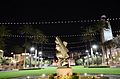
In 1995, the Fremont Street Experience opened in downtown Las Vegas. This covered area is five blocks long. It has 12.5 million LED lights and powerful sound. Shows happen every hour from dusk until midnight.
Many new projects opened in 2012. This year was called "The Year of Downtown." These projects included the Smith Center for the Performing Arts, the DISCOVERY Children's Museum, the Mob Museum, and the Neon Museum. A new City Hall also opened. The old City Hall building became the headquarters for Zappos.com.
Las Vegas Geography and Climate

Las Vegas is in Clark County. It sits in a valley on the floor of the Mojave Desert. Mountains surround the city. The land is mostly rocky and dry. It has desert plants and animals. Sometimes, there are sudden, heavy floods. But the city has built good drainage systems to help with this.
The city is about 2,030 feet above sea level. The nearby mountains are much taller, over 10,000 feet high. These mountains block moisture from reaching the city. Las Vegas covers about 135.86 square miles. Most of this is land.
Nevada is the third most active state for earthquakes in the U.S. Experts believe there is a 10–20% chance of a strong earthquake near Las Vegas in the next 50 years.
Las Vegas has many lawns, trees, and green areas. Because water is limited, people are encouraged to use xeriscapes. This means using plants that need less water. There are also rules about when people can water their yards.
Las Vegas Weather Patterns
.jpg)
Las Vegas has a hot desert climate. This is typical for the Mojave Desert. Summers are very long and extremely hot. Spring and fall are warm. Winters are short with mild days and cool nights.
The city gets a lot of sunshine all year. On average, there are 310 sunny days each year. It is sunny for 86% of all daylight hours. Rain is rare, with only about 4.2 inches per year. It rains on about 26 days each year. Las Vegas is one of the sunniest, driest, and least humid places in North America.
Summer months (June to September) are extremely hot. But the air is very dry, which makes it feel a bit better. July is the hottest month. The average high temperature is 104.5°F. On average, 137 days a year reach 90°F or higher. About 78 days reach 100°F or higher. And 10 days reach 110°F or higher. Even at night, temperatures often stay above 80°F in summer.
Sometimes, the North American Monsoon brings clouds, thunderstorms, and more humidity. This happens between July and August. In summer, the temperature can change a lot between day and night. Nighttime lows are often 30°F or more cooler than daytime highs.
Las Vegas winters are short and mild. It is sunny in all seasons. December is the coolest month, with an average high of 56.9°F. Winter nights are clear and cool, with temperatures around 40°F. Las Vegas has cooler winters than other desert areas because it is higher up. Temperatures rarely drop below 25°F.
Most rain falls in winter. February is the wettest month, but it only averages four rainy days. Snow in the city is rare, but the mountains around Las Vegas get snow every winter. The city had some snow on February 18, 2019, and December 25, 2015. The most snow ever recorded in Las Vegas was 12 inches in 1909.
The highest temperature ever recorded in Las Vegas was 117°F. This happened several times, most recently on July 10, 2021. The lowest temperature was 8°F, recorded in 1937 and 1963.
Because of concerns about climate change and a drought in 2002, people in Las Vegas have reduced their water use.
| Climate data for Harry Reid International Airport (Paradise, Nevada), 1991–2020 normals, extremes 1937–present | |||||||||||||
|---|---|---|---|---|---|---|---|---|---|---|---|---|---|
| Month | Jan | Feb | Mar | Apr | May | Jun | Jul | Aug | Sep | Oct | Nov | Dec | Year |
| Record high °F (°C) | 77 (25) |
87 (31) |
92 (33) |
99 (37) |
109 (43) |
117 (47) |
117 (47) |
116 (47) |
114 (46) |
103 (39) |
87 (31) |
78 (26) |
117 (47) |
| Mean maximum °F (°C) | 68.7 (20.4) |
74.2 (23.4) |
84.3 (29.1) |
93.6 (34.2) |
101.8 (38.8) |
110.1 (43.4) |
112.9 (44.9) |
110.3 (43.5) |
105.0 (40.6) |
94.6 (34.8) |
80.5 (26.9) |
67.9 (19.9) |
113.6 (45.3) |
| Mean daily maximum °F (°C) | 58.5 (14.7) |
62.9 (17.2) |
71.1 (21.7) |
78.5 (25.8) |
88.5 (31.4) |
99.4 (37.4) |
104.5 (40.3) |
102.8 (39.3) |
94.9 (34.9) |
81.2 (27.3) |
67.1 (19.5) |
56.9 (13.8) |
80.5 (26.9) |
| Daily mean °F (°C) | 49.5 (9.7) |
53.5 (11.9) |
60.8 (16.0) |
67.7 (19.8) |
77.3 (25.2) |
87.6 (30.9) |
93.2 (34.0) |
91.7 (33.2) |
83.6 (28.7) |
70.4 (21.3) |
57.2 (14.0) |
48.2 (9.0) |
70.1 (21.2) |
| Mean daily minimum °F (°C) | 40.5 (4.7) |
44.1 (6.7) |
50.5 (10.3) |
56.9 (13.8) |
66.1 (18.9) |
75.8 (24.3) |
82.0 (27.8) |
80.6 (27.0) |
72.4 (22.4) |
59.6 (15.3) |
47.3 (8.5) |
39.6 (4.2) |
59.6 (15.3) |
| Mean minimum °F (°C) | 29.8 (−1.2) |
32.9 (0.5) |
38.7 (3.7) |
45.2 (7.3) |
52.8 (11.6) |
62.2 (16.8) |
72.9 (22.7) |
70.8 (21.6) |
60.8 (16.0) |
47.4 (8.6) |
35.2 (1.8) |
29.0 (−1.7) |
27.4 (−2.6) |
| Record low °F (°C) | 8 (−13) |
16 (−9) |
19 (−7) |
31 (−1) |
38 (3) |
48 (9) |
56 (13) |
54 (12) |
43 (6) |
26 (−3) |
15 (−9) |
11 (−12) |
8 (−13) |
| Average precipitation inches (mm) | 0.56 (14) |
0.80 (20) |
0.42 (11) |
0.20 (5.1) |
0.07 (1.8) |
0.04 (1.0) |
0.38 (9.7) |
0.32 (8.1) |
0.32 (8.1) |
0.32 (8.1) |
0.30 (7.6) |
0.45 (11) |
4.18 (106) |
| Average snowfall inches (cm) | 0.0 (0.0) |
0.0 (0.0) |
0.0 (0.0) |
0.0 (0.0) |
0.0 (0.0) |
0.0 (0.0) |
0.0 (0.0) |
0.0 (0.0) |
0.0 (0.0) |
0.0 (0.0) |
0.0 (0.0) |
0.2 (0.51) |
0.2 (0.51) |
| Average precipitation days (≥ 0.01 in) | 3.1 | 4.1 | 2.8 | 1.6 | 1.1 | 0.4 | 2.5 | 2.2 | 1.8 | 1.7 | 1.5 | 3.0 | 25.8 |
| Average snowy days (≥ 0.1 in) | 0.0 | 0.1 | 0.0 | 0.0 | 0.0 | 0.0 | 0.0 | 0.0 | 0.0 | 0.0 | 0.0 | 0.1 | 0.2 |
| Average relative humidity (%) | 45.1 | 39.6 | 33.1 | 25.0 | 21.3 | 16.5 | 21.1 | 25.6 | 25.0 | 28.8 | 37.2 | 45.0 | 30.3 |
| Average dew point °F (°C) | 22.1 (−5.5) |
23.7 (−4.6) |
23.9 (−4.5) |
24.1 (−4.4) |
28.2 (−2.1) |
30.9 (−0.6) |
40.6 (4.8) |
44.1 (6.7) |
37.0 (2.8) |
30.4 (−0.9) |
25.3 (−3.7) |
22.3 (−5.4) |
29.4 (−1.5) |
| Mean monthly sunshine hours | 245.2 | 246.7 | 314.6 | 346.1 | 388.1 | 401.7 | 390.9 | 368.5 | 337.1 | 304.4 | 246.0 | 236.0 | 3,825.3 |
| Percent possible sunshine | 79 | 81 | 85 | 88 | 89 | 92 | 88 | 88 | 91 | 87 | 80 | 78 | 86 |
| Source: NOAA (relative humidity, dew point and sun 1961–1990) | |||||||||||||
Communities Near Las Vegas
Many towns and communities are close to Las Vegas. Some are officially part of a city, and some are not.
- Boulder City
- Henderson
- North Las Vegas
- Paradise
- Summerlin (also a neighborhood)
- Winchester
Las Vegas Neighborhoods
Las Vegas has several distinct neighborhoods.
Who Lives in Las Vegas?
| Historical population | |||
|---|---|---|---|
| Census | Pop. | %± | |
| 1900 | 25 | — | |
| 1910 | 800 | 3,100.0% | |
| 1920 | 2,304 | 188.0% | |
| 1930 | 5,165 | 124.2% | |
| 1940 | 8,422 | 63.1% | |
| 1950 | 24,624 | 192.4% | |
| 1960 | 64,405 | 161.6% | |
| 1970 | 125,787 | 95.3% | |
| 1980 | 164,674 | 30.9% | |
| 1990 | 258,295 | 56.9% | |
| 2000 | 478,434 | 85.2% | |
| 2010 | 583,756 | 22.0% | |
| 2020 | 641,903 | 10.0% | |
| 2022 (est.) | 656,274 | 12.4% | |
| source: 2010–2010 |
|||
In 2020, the U.S. Census counted 641,903 people living in Las Vegas. The city is very diverse. Many different groups of people live here.
- In 2020, about 40.4% of residents were White (not Hispanic).
- About 12.3% were Black or African American.
- About 7.0% were Asian.
- About 33.3% of residents were Hispanic or Latino. This group includes people of any race.
The number of people living in Las Vegas has grown a lot. The city's population nearly doubled between 1990 and 2000.
Las Vegas Economy and Attractions
The main parts of Las Vegas's economy are tourism, entertainment, and conventions. These also support the shopping and restaurant businesses.
Popular Tourist Spots

The biggest attractions in Las Vegas are its hotels and casinos. But new types of attractions have also appeared recently.
Most casinos in the downtown area are on Fremont Street. The STRAT Hotel, Casino & Skypod is one of the few exceptions. The Fremont Street Experience is a popular spot downtown. It has a huge canopy with lights and sound shows.
Downtown Las Vegas Casinos
The Golden Gate Hotel and Casino is the oldest hotel and casino in Las Vegas. It opened in 1906. Other well-known downtown casinos include Binion's Horseshoe (now Binion's Gambling Hall and Hotel) and the Four Queens.
Many downtown casinos have been updated. These include the Golden Nugget Las Vegas, The D Las Vegas, and the Downtown Grand Las Vegas. In 2020, Circa Resort & Casino opened. It was the first new hotel-casino on Fremont Street since 1980.
The Las Vegas Strip

The main area for entertainment is the Las Vegas Strip. It is actually outside the city limits. It is in the nearby towns of Paradise and Winchester. Some of the biggest hotels and casinos in the world are located here.
Welcome Signs of Las Vegas


In 1959, the famous Welcome to Fabulous Las Vegas sign was put up. It is 25 feet tall and stands at the south end of the Strip. A smaller copy of this sign was placed inside the city in 2002.
In 2018, the city added new neon arches. These "Gateway Arches" are 80 feet tall. They are blue during the day and light up with many colors at night. Two giant neon showgirls, 50 feet tall, were added nearby in 2022.
City Growth and Development
When The Mirage opened in 1989, it led to many new resorts being built on the Strip. This caused fewer tourists to visit downtown Las Vegas. But many new projects have helped bring visitors back to the downtown area.
City leaders have worked to bring new types of businesses to Las Vegas. They want to attract health, high-tech, and other companies. Nevada does not have state taxes for people or businesses. This has helped these efforts.
The Fremont Street Experience, built in 1995, has been very popular. It helped bring tourists back downtown.
The city bought 61 acres of land in 1995. The goal was to create more attractions downtown. In 2004, plans for Symphony Park were announced. This area would have homes and offices.
Today, Symphony Park is home to the Cleveland Clinic Lou Ruvo Center for Brain Health (opened 2010). It also has The Smith Center for the Performing Arts (opened 2012) and the DISCOVERY Children's Museum (opened 2013).
.jpg)
The World Market Center Las Vegas opened in 2005. It has three large buildings with over 5 million square feet of space. Trade shows for furniture are held here twice a year.
The Las Vegas North Premium Outlets is also nearby. It has 175 stores after a recent expansion.
City offices moved to a new City Hall in 2013. The old City Hall building is now the main office for the online store Zappos.com. The CEO of Zappos, Tony Hsieh, helped fund a project to improve downtown. This project helped open Las Vegas's first independent bookstore.
Other Businesses in Las Vegas
Many new businesses have moved to Las Vegas. Zappos.com, an online shoe and clothing store, moved its headquarters here. Allegiant Air, a low-cost airline, started in 1997. Its main hub is at Harry Reid International Airport. Its headquarters are in nearby Summerlin.
Culture and Arts in Las Vegas

Las Vegas has several museums.
- The Neon Museum shows historical signs from old Las Vegas.
- The Mob Museum tells the story of organized crime.
- The Las Vegas Natural History Museum
- The DISCOVERY Children's Museum
- The Nevada State Museum
- The Old Las Vegas Mormon Fort State Historic Park
The city has a large Downtown Arts District. It has many art galleries and events. "First Friday" is a monthly event that celebrates art, music, and food. It takes place in a part of downtown called 18b, The Las Vegas Arts District.
The Las Vegas Academy of International Studies, Performing and Visual Arts is a special high school. It has won a Grammy award. The Smith Center for the Performing Arts hosts Broadway shows and other performances.
Las Vegas is known as the "Gambling Capital of the World." It has the most land-based casinos in the world.
Sports in Las Vegas

Las Vegas is home to three major professional sports teams:
- The National Hockey League (NHL)'s Vegas Golden Knights. They started playing in 2017 at T-Mobile Arena.
- The National Football League (NFL)'s Las Vegas Raiders. They moved from Oakland, California, in 2020 and play at Allegiant Stadium.
- The Women's National Basketball Association (WNBA)'s Las Vegas Aces. They play at the Mandalay Bay Events Center.
The Oakland Athletics baseball team will also move to Las Vegas by 2028.
There are also minor league sports teams in Las Vegas.
- The Las Vegas Aviators baseball team plays at Las Vegas Ballpark.
- The Las Vegas Lights FC soccer team plays at Cashman Field.
The Ultimate Fighting Championship (UFC) is based in Las Vegas. They often hold fights in the city.
Major Professional Sports Teams
| Team | Sport | League | Venue (capacity) | Established | Titles |
|---|---|---|---|---|---|
| Las Vegas Raiders | Football | NFL | Allegiant Stadium (65,000) | 2020 | 3 |
| Vegas Golden Knights | Ice hockey | NHL | T-Mobile Arena (17,500) | 2017 | 1 |
| Las Vegas Aces | Women's basketball | WNBA | Michelob Ultra Arena (12,000) | 2018 | 2 |
Minor Professional Sports Teams
| Team | Sport | League | Venue (capacity) | Established | Titles |
|---|---|---|---|---|---|
| Las Vegas Aviators | Baseball | MiLB (AAA-PCL) | Las Vegas Ballpark (10,000) | 1983 | 2 |
| Henderson Silver Knights | Ice hockey | AHL | Lee's Family Forum (5,567) | 2020 | 0 |
| Las Vegas Lights FC | Soccer | USLC | Cashman Field (9,334) | 2018 | 0 |
| Vegas Knight Hawks | Indoor football | IFL | Lee's Family Forum (6,019) | 2021 | 0 |
| Las Vegas Desert Dogs | Box lacrosse | NLL | Michelob Ultra Arena (12,000) | 0 |
College Sports Teams
| School | Team | League | Division | Primary Conference |
|---|---|---|---|---|
| University of Nevada, Las Vegas (UNLV) | UNLV Rebels | NCAA | NCAA Division I | Mountain West |
| College of Southern Nevada (CSN) | CSN Coyotes | NJCAA | NJCAA Division I | Scenic West |
Parks and Recreation in Las Vegas

Las Vegas has 68 parks. The city owns the land for four golf courses. It is also in charge of 123 playgrounds, 23 softball fields, and 44 soccer fields. There are 10 dog parks, six community centers, and six swimming pools.
Education in Las Vegas
Schools for Kids and Teens
public education for younger students is handled by the Clark County School District. This is the fifth largest school district in the country. In 2013–2014, it had over 314,000 students.
Colleges and Universities
The University of Nevada, Las Vegas (UNLV) is the main university in Southern Nevada. It is known for its research. UNLV has a medical school and the only law school in Nevada. Its main campus is near the Las Vegas Strip.
The College of Southern Nevada is a community college. It has one of the largest student numbers in the United States. Other schools include Nevada State College and the Desert Research Institute.
Media in Las Vegas
Newspapers in Las Vegas

- Las Vegas Review-Journal is the biggest daily newspaper in the area. It started in 1909. It is the largest newspaper in Nevada. It is also one of the top 25 newspapers in the U.S. by how many copies it sells.
- Las Vegas Sun is another daily newspaper. It is printed inside the Review-Journal. It started in 1950.
- Las Vegas Weekly is a free newspaper. It covers arts, entertainment, and news in Las Vegas.
TV and Radio Stations
Las Vegas has 22 television stations and 46 radio stations.
- Radio stations in Las Vegas
- Television stations in Las Vegas
Magazines in Las Vegas
- Desert Companion
- Las Vegas Weekly
- Luxury Las Vegas
Getting Around Las Vegas

RTC Transit runs public buses throughout Las Vegas and nearby areas. You can also travel to and from Las Vegas by bus with companies like Greyhound.
Amtrak trains no longer serve Las Vegas directly. But you can take a bus service that connects to Amtrak trains in California. A new high-speed rail project, Brightline West, is planned. It will connect Las Vegas to Southern California by train.
The Las Vegas Monorail runs along the Strip. It was built by a private company.
.jpg)

Harry Reid International Airport handles flights into Las Vegas. It serves both international and domestic flights. Smaller airports are used for private planes.
Most streets in Las Vegas are set up in a grid pattern. Major roads include Interstate 15 and Interstate 11/U.S. Route 95. I-15 connects Las Vegas to Los Angeles and Salt Lake City. I-11 and US 95 connect the city to other parts of Nevada. A beltway (a highway that goes around the city) helps drivers get around.
Images for kids
-
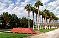
The entrance to the community of Summerlin.
-
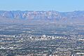
Downtown Las Vegas with Red Rock Canyon in the background.
-
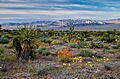
Spring flowers at the Red Rock Canyon National Conservation Area in the Las Vegas area.
-

A view of the Las Vegas Valley looking north from the Stratosphere Tower.
-
Symphony Park in Downtown Las Vegas.


.jpg)

See also
 In Spanish: Las Vegas para niños
