Interstate 15 in Nevada facts for kids
Quick facts for kids
Interstate 15 |
||||
|---|---|---|---|---|
| Las Vegas Freeway | ||||
|
I-15 highlighted in red
|
||||
| Route information | ||||
| Maintained by NDOT | ||||
| Length | 123.762 mi (199.176 km) | |||
| Existed | June 29, 1956–present | |||
| Major junctions | ||||
| South end | ||||
|
||||
| North end | ||||
| Location | ||||
| Counties: | Clark | |||
| Highway system | ||||
| Main route of the Interstate Highway System Main • Auxiliary • Business Nevada highways
|
||||
Interstate 15 (I-15) is a major highway in the U.S. state of Nevada. It starts in Primm, goes through the famous city of Las Vegas, and then crosses into Arizona near Mesquite. This important road runs entirely within Clark County. It was built over older routes like U.S. Route 91 and the Arrowhead Trail, eventually replacing them.
The entire I-15 route in Nevada is also known as the Las Vegas Freeway.
Contents
Driving the Las Vegas Freeway

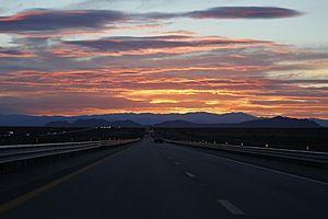
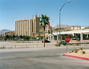
When drivers come from California, I-15 takes them down through the Ivanpah Valley and past Ivanpah Dry Lake. The highway officially enters Nevada at Primm, which is the first exit. After Primm, I-15 travels north through the desert. There aren't many places to stop for services along this part of the road.
The highway then reaches the busy Las Vegas area. This happens when you pass the exit for State Route 146 (also called Saint Rose Parkway).
Special Lanes in Las Vegas
Between Silverado Ranch Boulevard and U.S. Route 95, I-15 has special lanes called HOV lanes. These lanes are for cars with more than one person inside. They are checked by the police 24 hours a day, 7 days a week. Nevada is the only state that does this!
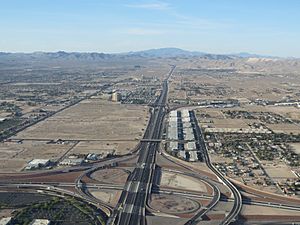
I-15 connects with I-215 at a big interchange. This connection helps drivers get to Henderson and Harry Reid International Airport. When it was built, people nicknamed this interchange the Son of Spaghetti Bowl.
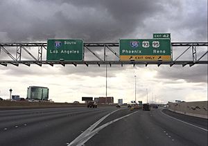
I-15 runs along the west side of the famous Las Vegas Strip. It also passes just west of downtown Las Vegas. Here, it meets I-11 and U.S. Route 95 at a very busy interchange known as the "Spaghetti Bowl".
After this, I-15 goes into North Las Vegas. It generally runs next to Las Vegas Boulevard, which used to be the old U.S. Route 91. The highway leaves the Las Vegas area near the northern connection with the Clark County 215 beltway.
Leaving Las Vegas
Once I-15 leaves North Las Vegas, it heads northeast. It crosses the Muddy River near Glendale and then climbs up onto the Mormon Mesa. When it reaches Mesquite, the freeway crosses the Arizona state line. It then goes through a small part of Arizona, including the amazing Virgin River Gorge, before entering Utah.
History of I-15

The path that I-15 follows today has been important for travel for a long time.
Early Roads and Trails
- Arrowhead Trail: As early as 1914, cars were traveling through southern Nevada on the Arrowhead Trail. This road connected Los Angeles and Salt Lake City.
- State Route 6: In 1919, Nevada created State Route 6. It followed the Arrowhead Trail from the Arizona border near Mesquite, through Las Vegas, to Jean.
- U.S. Route 91: In 1926, U.S. Route 91 (US 91) was planned to follow State Route 6. It went from Primm, through Las Vegas (along what is now Las Vegas Boulevard), and then northeast towards Salt Lake City. By 1929, much of this route was ready for cars.
- Other Overlaps: Later, other highways shared parts of this route. US 466 joined US 91 from California to downtown Las Vegas until 1971. Also, US 93 was extended in 1936 to share the road with US 91 from Glendale to downtown Las Vegas.
Building the Interstate
- New US 91 Path: In 1955, a new path for US 91 was finished. This new path went around Bunkerville and Mesquite, which is where I-15 would later be built. The old path through Bunkerville is now State Route 170.
- Interstate Begins: The Federal Aid Highway Act of 1956 helped build better roads. The first part of I-15 opened by 1960. It stretched from the California state line to just north of Sloan.
- More Sections Open: By 1963, the new freeway reached the south end of the Las Vegas Valley. More than 20 miles south of Glendale were also finished. By 1967, almost all of I-15 was built along the old US 91 route, except for parts of Las Vegas and near Mesquite.
- Completion: The last parts of I-15 were finished in 1974. These were in North Las Vegas and near the Arizona state line. Once I-15 was complete, the old US 91 highway was no longer needed and its name was removed in 1974.
Modern Improvements
- Call Boxes: In the mid-2000s, the Nevada Department of Transportation (NDOT) added call boxes every mile between Las Vegas and the California state line. These are for drivers who have car trouble and no cell phone service.
- Wider Roads: This was part of a bigger project to make this part of the freeway wider, adding a third lane in each direction.
- Las Vegas Expansion: In August 2011, I-15 in southern Las Vegas was made much bigger. This added a lot more space for cars, increasing capacity by 30 to 85 percent! They even used a special drill rig called Big Stan for the work.
The Future of I-15
Because I-15 gets very busy, there are plans to make it even wider. The California Department of Transportation (Caltrans) and NDOT want to add more lanes in both directions. This would be from U.S. Route 395 in Hesperia and I-40 in Barstow all the way to I-215 in Enterprise.
Also, in 2020, a company called Brightline made a deal to use the land next to I-15 for 50 years. They plan to build a Brightline West high-speed rail service that will connect Victor Valley and the Las Vegas Valley. Imagine a super-fast train running alongside the highway!
See also
 In Spanish: Interestatal 15 en Nevada para niños
 | James Van Der Zee |
 | Alma Thomas |
 | Ellis Wilson |
 | Margaret Taylor-Burroughs |


