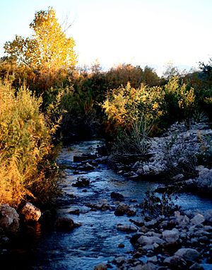
Muddy River (Nevada) facts for kids
The Muddy River is a short river in southern Nevada, United States. It used to be called the Moapa River. This river flows through Clark County. It is found in the Mojave Desert. The river is about 60 miles (97 km) north of Las Vegas.
Contents
River's Path
The Muddy River is about 32 miles (51 km) long. It starts from many warm springs in the Moapa Valley. Then, it flows into Lake Mead. It joins the northern part of the lake near Overton, Nevada. Before the Hoover Dam was built, the Muddy River flowed into the Virgin River.
Near the town of Glendale, the Muddy River collects water from the Meadow Valley Wash. This creates the main water system for southeastern Nevada.
Protecting Wildlife
The Moapa Valley area is home to many rare animals and plants. Some of these are fish, tiny water creatures, birds, and different plants. Three types of fish that are in danger of disappearing live here. These are the Moapa dace (Moapa coriacea), the Virgin River chub (Gila seminuda), and the White River springfish (Crenichthys baileyi moapae). You can find these fish in the springs that feed the Muddy River. These springs are called the Muddy Springs.
The U.S. Fish and Wildlife Service created the Moapa National Wildlife Refuge. This special area is at the Warm Springs Natural Area. It is part of the Desert National Wildlife Refuge Complex. Other groups are also working to protect these fragile homes. The Southern Nevada Water Authority (SNWA) and environmental groups are helping to save these species.
River's History
For many centuries, the Paiute people lived in this area. The Mojave people lived to the south. The word "Moapa" comes from the Southern Paiute language. It means "muddy." The river was officially called "Moapa River" for a while. But local people often used the translated name, "Muddy River." This name became official in 1960.
Old Spanish Trail
The Old Spanish Trail was a path for trading. It used to follow the Virgin River all the way to the Colorado River. In 1844, an explorer named John C. Frémont found a new shortcut. This new path avoided the Colorado River. It went between Resting Springs in California and the Virgin River Valley. This path crossed the Muddy River near where Glendale is today.
Early Travelers
In 1847, Mormon pioneers made a wagon road along this trail. They traveled from Salt Lake City to Los Angeles. Later, people called "Forty-niners" used this path. These were people going to California for the Gold Rush in 1849. They wanted to avoid the winter snows in the Sierra Nevada Mountains. Wagon trains of Mormon settlers also used this route. They were going to settle in San Bernardino in 1852. By 1855, this trail became a busy route for moving goods. It was used in southern Nevada into the 1900s.
Mormon Settlements
Mormon settlers started several towns near the Muddy River in 1864. One town was St. Thomas. By 1938, this town was underwater because of Lake Mead. But when the water level is low, you can still see some of the old town's ruins. Some Paiute people fought to protect their homeland.
The Mormon settlers left the area in 1871. This was due to the harsh weather, dry periods, and a tax disagreement with Nevada. Many of these settlers returned in the 1880s. Today, many people who follow the LDS faith still live there.
 | Emma Amos |
 | Edward Mitchell Bannister |
 | Larry D. Alexander |
 | Ernie Barnes |


