
List of United States cities by population facts for kids
This article lists the most populated cities and towns in the United States. The United States Census Bureau defines an "incorporated place" as a city, town, village, borough, or municipality. Sometimes, a few special "census-designated places" (CDPs) are also included.
A consolidated city-county is a type of government that includes a whole county's population. However, some of these include many smaller towns. This list only shows the part of these big areas that aren't already part of another town.
This list focuses only on the population inside a city's official borders. It doesn't include people living in nearby suburbs or other areas that are part of a larger city region but not officially part of the city itself. That's why you might see different rankings if you look at lists of U.S. urban areas or metropolitan areas.
Contents
Biggest Cities in the U.S.
This table shows the 333 biggest cities in the United States (not including U.S. territories). These cities each had at least 100,000 people as of July 1, 2022, based on estimates from the U.S. Census Bureau. Five states don't have any cities with over 100,000 people: Delaware, Maine, Vermont, West Virginia, and Wyoming.
The table tells you:
- The city's rank by population (how many people lived there) on July 1, 2022.
- The city's name.
- The state where the city is located.
- The city's population on July 1, 2022.
- The city's population on April 1, 2020 (from the official 2020 census).
- How much the city's population changed between April 1, 2020, and July 1, 2022.
- The city's land area (how much space it covers) on January 1, 2020.
- How many people lived per square mile (population density) on April 1, 2020.
- The city's latitude and longitude coordinates (its exact location on a map).

| State capital | |
| State largest city | |
| State capital and largest city | |
| Federal capital |
| City | ST | 2022 estimate |
2020 census |
Change | 2020 land area | 2020 density | Location | ||
|---|---|---|---|---|---|---|---|---|---|
| mi2 | km2 | / mi2 | / km2 | ||||||
| New York | NY | 8,335,897 | 8,804,190 | −5.32% | 300.5 | 778.3 | 29,298 | 11,312 | 40°40′N 73°56′W / 40.66°N 73.94°W |
| Los Angeles | CA | 3,822,238 | 3,898,747 | −1.96% | 469.5 | 1,216.0 | 8,304 | 3,206 | 34°01′N 118°25′W / 34.02°N 118.41°W |
| Chicago | IL | 2,665,039 | 2,746,388 | −2.96% | 227.7 | 589.7 | 12,061 | 4,657 | 41°50′N 87°41′W / 41.84°N 87.68°W |
| Houston | TX | 2,302,878 | 2,304,580 | −0.07% | 640.4 | 1,658.6 | 3,599 | 1,390 | 29°47′N 95°23′W / 29.79°N 95.39°W |
| Phoenix | AZ | 1,644,409 | 1,608,139 | +2.26% | 518.0 | 1,341.6 | 3,105 | 1,199 | 33°34′N 112°05′W / 33.57°N 112.09°W |
| Philadelphia | PA | 1,567,258 | 1,603,797 | −2.28% | 134.4 | 348.1 | 11,933 | 4,607 | 40°01′N 75°08′W / 40.01°N 75.13°W |
| San Antonio | TX | 1,472,909 | 1,434,625 | +2.67% | 498.8 | 1,291.9 | 2,876 | 1,110 | 29°28′N 98°31′W / 29.46°N 98.52°W |
| San Diego | CA | 1,381,162 | 1,386,932 | −0.42% | 325.9 | 844.1 | 4,256 | 1,643 | 32°49′N 117°08′W / 32.81°N 117.14°W |
| Dallas | TX | 1,299,544 | 1,304,379 | −0.37% | 339.6 | 879.6 | 3,841 | 1,483 | 32°47′N 96°46′W / 32.79°N 96.77°W |
| Austin | TX | 974,447 | 961,855 | +1.31% | 319.9 | 828.5 | 3,007 | 1,161 | 30°18′N 97°45′W / 30.30°N 97.75°W |
| Jacksonville | FL | 971,319 | 949,611 | +2.29% | 747.3 | 1,935.5 | 1,271 | 491 | 30°20′N 81°40′W / 30.34°N 81.66°W |
| San Jose | CA | 971,233 | 1,013,240 | −4.15% | 178.3 | 461.8 | 5,683 | 2,194 | 37°18′N 121°49′W / 37.30°N 121.81°W |
| Fort Worth | TX | 956,709 | 918,915 | +4.11% | 347.3 | 899.5 | 2,646 | 1,022 | 32°47′N 97°21′W / 32.78°N 97.35°W |
| Columbus | OH | 907,971 | 905,748 | +0.25% | 220.0 | 569.8 | 4,117 | 1,590 | 39°59′N 82°59′W / 39.99°N 82.99°W |
| Charlotte | NC | 897,720 | 874,579 | +2.65% | 308.3 | 798.5 | 2,837 | 1,095 | 35°13′N 80°50′W / 35.21°N 80.83°W |
| Indianapolis | IN | 880,621 | 887,642 | −0.79% | 361.6 | 936.5 | 2,455 | 948 | 39°47′N 86°09′W / 39.78°N 86.15°W |
| San Francisco | CA | 808,437 | 873,965 | −7.50% | 46.9 | 121.5 | 18,635 | 7,195 | 37°44′N 123°02′W / 37.73°N 123.03°W |
| Seattle | WA | 749,256 | 737,015 | +1.66% | 83.8 | 217.0 | 8,795 | 3,396 | 47°37′N 122°21′W / 47.62°N 122.35°W |
| Denver | CO | 713,252 | 715,522 | −0.32% | 153.1 | 396.5 | 4,674 | 1,805 | 39°46′N 104°53′W / 39.76°N 104.88°W |
| Oklahoma City | OK | 694,800 | 681,054 | +2.02% | 606.2 | 1,570.1 | 1,123 | 434 | 35°28′N 97°31′W / 35.47°N 97.51°W |
| Nashville | TN | 683,622 | 689,447 | −0.84% | 475.8 | 1,232.3 | 1,449 | 559 | 36°10′N 86°47′W / 36.17°N 86.79°W |
| El Paso | TX | 677,456 | 678,815 | −0.20% | 258.4 | 669.3 | 2,627 | 1,014 | 31°51′N 106°26′W / 31.85°N 106.43°W |
| Washington | DC | 671,803 | 689,545 | −2.57% | 61.1 | 158.2 | 11,286 | 4,358 | 38°54′N 77°01′W / 38.90°N 77.02°W |
| Las Vegas | NV | 656,274 | 641,903 | +2.24% | 141.8 | 367.3 | 4,527 | 1,748 | 36°14′N 115°16′W / 36.23°N 115.26°W |
| Boston | MA | 650,706 | 675,647 | −3.69% | 48.3 | 125.1 | 13,989 | 5,401 | 42°20′N 71°01′W / 42.34°N 71.02°W |
| Portland | OR | 635,067 | 652,503 | −2.67% | 133.5 | 345.8 | 4,888 | 1,887 | 45°32′N 122°39′W / 45.54°N 122.65°W |
| Louisville | KY | 624,444 | 633,045 | −1.36% | 324.9 | 841.5 | 1,948 | 752 | 38°10′N 85°39′W / 38.17°N 85.65°W |
| Memphis | TN | 621,056 | 633,104 | −1.90% | 297.0 | 769.2 | 2,132 | 823 | 35°07′N 89°58′W / 35.11°N 89.97°W |
| Detroit | MI | 620,376 | 639,111 | −2.93% | 138.7 | 359.2 | 4,608 | 1,779 | 42°23′N 83°06′W / 42.38°N 83.10°W |
| Baltimore | MD | 569,931 | 585,708 | −2.69% | 80.9 | 209.5 | 7,240 | 2,800 | 39°18′N 76°37′W / 39.30°N 76.61°W |
| Milwaukee | WI | 563,305 | 577,222 | −2.41% | 96.2 | 249.2 | 6,000 | 2,300 | 43°04′N 87°58′W / 43.06°N 87.97°W |
| Albuquerque | NM | 561,008 | 564,559 | −0.63% | 187.3 | 485.1 | 3,014 | 1,164 | 35°06′N 106°39′W / 35.10°N 106.65°W |
| Tucson | AZ | 546,574 | 542,629 | +0.73% | 241.0 | 624.2 | 2,252 | 870 | 32°09′N 110°52′W / 32.15°N 110.87°W |
| Fresno | CA | 545,567 | 542,107 | +0.64% | 115.2 | 298.4 | 4,706 | 1,817 | 36°47′N 119°47′W / 36.78°N 119.79°W |
| Sacramento | CA | 528,001 | 524,943 | +0.58% | 98.6 | 255.4 | 5,324 | 2,056 | 38°34′N 121°28′W / 38.57°N 121.47°W |
| Mesa | AZ | 512,498 | 504,258 | +1.63% | 138.7 | 359.2 | 3,636 | 1,404 | 33°24′N 111°43′W / 33.40°N 111.72°W |
| Kansas City | MO | 509,297 | 508,090 | +0.24% | 314.7 | 815.1 | 1,615 | 624 | 39°07′N 94°34′W / 39.12°N 94.56°W |
| Atlanta | GA | 499,127 | 498,715 | +0.08% | 135.3 | 350.4 | 3,686 | 1,423 | 33°46′N 84°25′W / 33.76°N 84.42°W |
| Colorado Springs | CO | 486,248 | 478,961 | +1.52% | 195.4 | 506.1 | 2,451 | 946 | 38°52′N 104°46′W / 38.87°N 104.76°W |
| Omaha | NE | 485,153 | 486,051 | −0.18% | 141.6 | 366.7 | 3,433 | 1,325 | 41°16′N 96°03′W / 41.26°N 96.05°W |
| Raleigh | NC | 476,587 | 467,665 | +1.91% | 147.1 | 381.0 | 3,179 | 1,227 | 35°50′N 78°38′W / 35.83°N 78.64°W |
| Virginia Beach | VA | 455,618 | 459,470 | −0.84% | 244.7 | 633.8 | 1,878 | 725 | 36°47′N 76°02′W / 36.78°N 76.03°W |
| Long Beach | CA | 451,307 | 466,742 | −3.31% | 50.7 | 131.3 | 9,206 | 3,554 | 33°47′N 118°10′W / 33.78°N 118.17°W |
| Miami | FL | 449,514 | 442,241 | +1.64% | 36.0 | 93.2 | 12,284 | 4,743 | 25°47′N 80°13′W / 25.78°N 80.21°W |
| Oakland | CA | 430,553 | 440,646 | −2.29% | 55.9 | 144.8 | 7,883 | 3,044 | 37°46′N 122°14′W / 37.77°N 122.23°W |
| Minneapolis | MN | 425,096 | 429,954 | −1.13% | 54.0 | 139.9 | 7,962 | 3,074 | 44°58′N 93°16′W / 44.96°N 93.27°W |
| Tulsa | OK | 411,867 | 413,066 | −0.29% | 197.5 | 511.5 | 2,091 | 807 | 36°08′N 95°54′W / 36.13°N 95.90°W |
| Bakersfield | CA | 410,647 | 403,455 | +1.78% | 149.8 | 388.0 | 2,693 | 1,040 | 35°21′N 119°02′W / 35.35°N 119.04°W |
| Tampa | FL | 398,173 | 384,959 | +3.43% | 114.0 | 295.3 | 3,377 | 1,304 | 27°58′N 82°28′W / 27.97°N 82.47°W |
| Wichita | KS | 396,192 | 397,532 | −0.34% | 162.0 | 419.6 | 2,454 | 947 | 37°41′N 97°21′W / 37.69°N 97.35°W |
| Arlington | TX | 394,602 | 394,266 | +0.09% | 95.9 | 248.4 | 4,111 | 1,587 | 32°42′N 97°07′W / 32.70°N 97.12°W |
| Aurora | CO | 393,537 | 386,261 | +1.88% | 160.1 | 414.7 | 2,413 | 932 | 39°42′N 104°43′W / 39.70°N 104.72°W |
| New Orleans | LA | 369,749 | 383,997 | −3.71% | 169.5 | 439.0 | 2,265 | 875 | 30°03′N 89°56′W / 30.05°N 89.93°W |
| Cleveland | OH | 361,607 | 372,624 | −2.96% | 77.7 | 201.2 | 4,796 | 1,852 | 41°29′N 81°41′W / 41.48°N 81.68°W |
| Anaheim | CA | 344,461 | 346,824 | −0.68% | 50.3 | 130.3 | 6,895 | 2,662 | 33°52′N 117°46′W / 33.86°N 117.76°W |
| Honolulu | HI | 343,421 | 350,964 | −2.15% | 60.5 | 156.7 | 5,801 | 2,240 | 21°19′N 157°51′W / 21.32°N 157.85°W |
| Henderson | NV | 331,415 | 317,610 | +4.35% | 106.2 | 275.1 | 2,991 | 1,155 | 36°01′N 115°02′W / 36.01°N 115.04°W |
| Stockton | CA | 321,819 | 320,804 | +0.32% | 62.2 | 161.1 | 5,158 | 1,992 | 37°59′N 121°19′W / 37.98°N 121.31°W |
| Riverside | CA | 320,764 | 314,998 | +1.83% | 81.2 | 210.3 | 3,879 | 1,498 | 33°56′N 117°23′W / 33.94°N 117.39°W |
| Lexington | KY | 320,347 | 322,570 | −0.69% | 283.6 | 734.5 | 1,137 | 439 | 38°02′N 84°28′W / 38.04°N 84.46°W |
| Corpus Christi | TX | 316,239 | 317,863 | −0.51% | 162.2 | 420.1 | 1,960 | 760 | 27°45′N 97°10′W / 27.75°N 97.17°W |
| Orlando | FL | 316,081 | 307,573 | +2.77% | 110.6 | 286.5 | 2,781 | 1,074 | 28°25′N 81°15′W / 28.41°N 81.25°W |
| Irvine | CA | 313,685 | 307,670 | +1.96% | 65.6 | 169.9 | 4,690 | 1,810 | 33°41′N 117°46′W / 33.68°N 117.77°W |
| Cincinnati | OH | 309,513 | 309,317 | +0.06% | 77.8 | 201.5 | 3,976 | 1,535 | 39°08′N 84°31′W / 39.14°N 84.51°W |
| Santa Ana | CA | 308,189 | 310,227 | −0.66% | 27.3 | 70.7 | 11,364 | 4,388 | 33°44′N 117°53′W / 33.74°N 117.88°W |
| Newark | NJ | 305,344 | 311,549 | −1.99% | 24.1 | 62.4 | 12,927 | 4,991 | 40°43′N 74°10′W / 40.72°N 74.17°W |
| Saint Paul | MN | 303,176 | 311,527 | −2.68% | 52.0 | 134.7 | 5,991 | 2,313 | 44°57′N 93°06′W / 44.95°N 93.10°W |
| Pittsburgh | PA | 302,898 | 302,971 | −0.02% | 55.4 | 143.5 | 5,469 | 2,112 | 40°26′N 79°59′W / 40.44°N 79.98°W |
| Greensboro | NC | 301,115 | 299,035 | +0.70% | 129.6 | 335.7 | 2,307 | 891 | 36°06′N 79°50′W / 36.10°N 79.83°W |
| Lincoln | NE | 292,627 | 291,082 | +0.53% | 97.7 | 253.0 | 2,979 | 1,150 | 40°49′N 96°41′W / 40.81°N 96.68°W |
| Durham | NC | 291,928 | 283,506 | +2.97% | 112.8 | 292.2 | 2,513 | 970 | 35°59′N 78°54′W / 35.98°N 78.90°W |
| Plano | TX | 289,547 | 285,494 | +1.42% | 71.7 | 185.7 | 3,982 | 1,537 | 33°03′N 96°45′W / 33.05°N 96.75°W |
| Anchorage | AK | 287,145 | 291,247 | −1.41% | 1,706.8 | 4,420.6 | 171 | 66 | 61°10′N 149°17′W / 61.17°N 149.28°W |
| Jersey City | NJ | 286,670 | 292,449 | −1.98% | 14.7 | 38.1 | 19,894 | 7,681 | 40°43′N 74°04′W / 40.71°N 74.06°W |
| St. Louis | MO | 286,578 | 301,578 | −4.97% | 61.7 | 159.8 | 4,888 | 1,887 | 38°38′N 90°14′W / 38.64°N 90.24°W |
| Chandler | AZ | 280,711 | 275,987 | +1.71% | 65.3 | 169.1 | 4,226 | 1,632 | 33°17′N 111°51′W / 33.28°N 111.85°W |
| North Las Vegas | NV | 280,543 | 262,527 | +6.86% | 101.3 | 262.4 | 2,592 | 1,001 | 36°17′N 115°05′W / 36.28°N 115.09°W |
| Chula Vista | CA | 279,170 | 275,487 | +1.34% | 49.6 | 128.5 | 5,554 | 2,144 | 32°38′N 117°01′W / 32.63°N 117.02°W |
| Buffalo | NY | 276,486 | 278,349 | −0.67% | 40.4 | 104.6 | 6,890 | 2,660 | 42°53′N 78°52′W / 42.89°N 78.86°W |
| Gilbert | AZ | 275,346 | 267,918 | +2.77% | 68.6 | 177.7 | 3,906 | 1,508 | 33°19′N 111°44′W / 33.31°N 111.74°W |
| Reno | NV | 273,448 | 264,165 | +3.51% | 108.8 | 281.8 | 2,428 | 937 | 39°33′N 119°51′W / 39.55°N 119.85°W |
| Madison | WI | 272,903 | 269,840 | +1.14% | 79.6 | 206.2 | 3,390 | 1,310 | 43°05′N 89°26′W / 43.09°N 89.43°W |
| Fort Wayne | IN | 267,927 | 263,886 | +1.53% | 110.7 | 286.7 | 2,384 | 920 | 41°05′N 85°08′W / 41.09°N 85.14°W |
| Toledo | OH | 266,301 | 270,871 | −1.69% | 80.5 | 208.5 | 3,365 | 1,299 | 41°40′N 83°35′W / 41.66°N 83.58°W |
| Lubbock | TX | 263,930 | 257,141 | +2.64% | 134.6 | 348.6 | 1,910 | 740 | 33°34′N 101°53′W / 33.57°N 101.89°W |
| St. Petersburg | FL | 261,256 | 258,308 | +1.14% | 61.8 | 160.1 | 4,180 | 1,610 | 27°46′N 82°38′W / 27.77°N 82.64°W |
| Laredo | TX | 256,187 | 255,205 | +0.38% | 106.5 | 275.8 | 2,396 | 925 | 27°34′N 99°29′W / 27.56°N 99.49°W |
| Irving | TX | 254,715 | 256,684 | −0.77% | 67.0 | 173.5 | 3,831 | 1,479 | 32°52′N 96°58′W / 32.86°N 96.97°W |
| Chesapeake | VA | 252,488 | 249,422 | +1.23% | 338.5 | 876.7 | 737 | 285 | 36°41′N 76°18′W / 36.68°N 76.30°W |
| Glendale | AZ | 252,136 | 248,325 | +1.53% | 61.6 | 159.5 | 4,031 | 1,556 | 33°32′N 112°11′W / 33.53°N 112.19°W |
| Winston-Salem | NC | 251,350 | 249,545 | +0.72% | 132.7 | 343.7 | 1,881 | 726 | 36°06′N 80°16′W / 36.10°N 80.26°W |
| Scottsdale | AZ | 243,050 | 241,361 | +0.70% | 184.0 | 476.6 | 1,312 | 507 | 33°41′N 111°52′W / 33.68°N 111.86°W |
| Garland | TX | 240,854 | 246,018 | −2.10% | 57.1 | 147.9 | 4,309 | 1,664 | 32°55′N 96°38′W / 32.91°N 96.63°W |
| Boise | ID | 236,634 | 235,684 | +0.40% | 84.0 | 217.6 | 2,806 | 1,083 | 43°36′N 116°14′W / 43.60°N 116.23°W |
| Norfolk | VA | 232,995 | 238,005 | −2.10% | 53.3 | 138.0 | 4,465 | 1,724 | 36°55′N 76°14′W / 36.92°N 76.24°W |
| Port St. Lucie | FL | 231,790 | 204,851 | +13.15% | 119.2 | 308.7 | 1,719 | 664 | 27°17′N 80°23′W / 27.28°N 80.39°W |
| Spokane | WA | 230,160 | 228,989 | +0.51% | 68.8 | 178.2 | 3,328 | 1,285 | 47°40′N 117°26′W / 47.67°N 117.43°W |
| Richmond | VA | 229,395 | 226,610 | +1.23% | 59.9 | 155.1 | 3,783 | 1,461 | 37°32′N 77°29′W / 37.53°N 77.48°W |
| Fremont | CA | 223,871 | 230,504 | −2.88% | 78.3 | 202.8 | 2,944 | 1,137 | 37°29′N 121°56′W / 37.49°N 121.94°W |
| Huntsville | AL | 221,933 | 215,006 | +3.22% | 218.1 | 564.9 | 986 | 381 | 34°47′N 86°32′W / 34.78°N 86.53°W |
| Tacoma | WA | 221,776 | 219,346 | +1.11% | 49.7 | 128.7 | 4,413 | 1,704 | 47°15′N 122°28′W / 47.25°N 122.46°W |
| Baton Rouge | LA | 221,453 | 227,470 | −2.65% | 86.3 | 223.5 | 2,636 | 1,018 | 30°26′N 91°08′W / 30.44°N 91.13°W |
| Santa Clarita | CA | 221,345 | 228,673 | −3.20% | 70.8 | 183.4 | 3,230 | 1,250 | 34°25′N 118°29′W / 34.41°N 118.49°W |
| San Bernardino | CA | 220,328 | 222,101 | −0.80% | 62.1 | 160.8 | 3,577 | 1,381 | 34°08′N 117°17′W / 34.14°N 117.29°W |
| Hialeah | FL | 220,292 | 223,109 | −1.26% | 21.6 | 55.9 | 10,329 | 3,988 | 25°52′N 80°18′W / 25.87°N 80.30°W |
| Frisco | TX | 219,587 | 200,509 | +9.51% | 68.6 | 177.7 | 2,923 | 1,129 | 33°10′N 96°49′W / 33.16°N 96.82°W |
| Modesto | CA | 218,069 | 218,464 | −0.18% | 43.0 | 111.4 | 5,081 | 1,962 | 37°38′N 121°00′W / 37.64°N 121.00°W |
| Cape Coral | FL | 216,992 | 194,016 | +11.84% | 106.0 | 274.5 | 1,830 | 710 | 26°39′N 81°59′W / 26.65°N 81.99°W |
| Fontana | CA | 212,475 | 208,393 | +1.96% | 43.1 | 111.6 | 4,835 | 1,867 | 34°07′N 117°28′W / 34.11°N 117.46°W |
| Moreno Valley | CA | 211,924 | 208,634 | +1.58% | 51.3 | 132.9 | 4,067 | 1,570 | 33°55′N 117°13′W / 33.92°N 117.21°W |
| Des Moines | IA | 211,034 | 214,133 | −1.45% | 88.2 | 228.4 | 2,428 | 937 | 41°34′N 93°37′W / 41.57°N 93.61°W |
| Rochester | NY | 209,352 | 211,328 | −0.94% | 35.8 | 92.7 | 5,903 | 2,279 | 43°10′N 77°37′W / 43.17°N 77.62°W |
| Fayetteville | NC | 208,873 | 208,501 | +0.18% | 148.3 | 384.1 | 1,406 | 543 | 35°05′N 78°58′W / 35.08°N 78.97°W |
| Yonkers | NY | 208,121 | 211,569 | −1.63% | 18.0 | 46.6 | 11,754 | 4,538 | 40°57′N 73°52′W / 40.95°N 73.87°W |
| McKinney | TX | 207,507 | 195,308 | +6.25% | 67.0 | 173.5 | 2,915 | 1,125 | 33°12′N 96°40′W / 33.20°N 96.66°W |
| Worcester | MA | 205,319 | 206,518 | −0.58% | 37.4 | 96.9 | 5,522 | 2,132 | 42°16′N 71°49′W / 42.27°N 71.81°W |
| Salt Lake City | UT | 204,657 | 199,723 | +2.47% | 110.3 | 285.7 | 1,811 | 699 | 40°47′N 111°56′W / 40.78°N 111.93°W |
| Little Rock | AR | 202,864 | 202,591 | +0.13% | 120.0 | 310.8 | 1,688 | 652 | 34°43′N 92°22′W / 34.72°N 92.36°W |
| Columbus | GA | 202,616 | 206,922 | −2.08% | 216.5 | 560.7 | 956 | 369 | 32°31′N 84°52′W / 32.51°N 84.87°W |
| Augusta | GA | 202,096 | 202,081 | +0.01% | 302.3 | 783.0 | 668 | 258 | 33°22′N 82°04′W / 33.37°N 82.07°W |
| Sioux Falls | SD | 202,078 | 192,517 | +4.97% | 79.1 | 204.9 | 2,434 | 940 | 43°32′N 96°44′W / 43.54°N 96.73°W |
| Grand Prairie | TX | 201,843 | 196,100 | +2.93% | 72.6 | 188.0 | 2,701 | 1,043 | 32°41′N 97°01′W / 32.69°N 97.02°W |
| Tallahassee | FL | 201,731 | 196,169 | +2.84% | 100.9 | 261.3 | 1,944 | 751 | 30°28′N 84°15′W / 30.46°N 84.25°W |
| Amarillo | TX | 201,291 | 200,393 | +0.45% | 102.3 | 265.0 | 1,959 | 756 | 35°12′N 101°50′W / 35.20°N 101.83°W |
| Oxnard | CA | 200,415 | 202,063 | −0.82% | 26.5 | 68.6 | 7,625 | 2,944 | 34°12′N 119°13′W / 34.20°N 119.21°W |
| Peoria | AZ | 197,866 | 190,985 | +3.60% | 176.1 | 456.1 | 1,085 | 419 | 33°47′N 112°19′W / 33.79°N 112.31°W |
| Overland Park | KS | 197,726 | 197,238 | +0.25% | 75.2 | 194.8 | 2,623 | 1,013 | 38°53′N 94°41′W / 38.89°N 94.69°W |
| Montgomery | AL | 196,986 | 200,603 | −1.80% | 159.9 | 414.1 | 1,255 | 485 | 32°21′N 86°16′W / 32.35°N 86.27°W |
| Birmingham | AL | 196,910 | 200,733 | −1.90% | 147.0 | 380.7 | 1,366 | 527 | 33°32′N 86°48′W / 33.53°N 86.80°W |
| Grand Rapids | MI | 196,908 | 198,917 | −1.01% | 44.8 | 116.0 | 4,440 | 1,710 | 42°58′N 85°40′W / 42.96°N 85.66°W |
| Knoxville | TN | 195,889 | 190,740 | +2.70% | 98.7 | 255.6 | 1,933 | 746 | 35°58′N 83°57′W / 35.97°N 83.95°W |
| Vancouver | WA | 194,512 | 190,915 | +1.88% | 48.7 | 126.1 | 3,920 | 1,510 | 45°38′N 122°36′W / 45.64°N 122.60°W |
| Huntington Beach | CA | 194,310 | 198,711 | −2.21% | 27.0 | 69.9 | 7,360 | 2,840 | 33°42′N 118°00′W / 33.70°N 118.00°W |
| Providence | RI | 189,563 | 190,934 | −0.72% | 18.4 | 47.7 | 10,377 | 4,007 | 41°49′N 71°25′W / 41.82°N 71.42°W |
| Brownsville | TX | 189,382 | 186,738 | +1.42% | 131.5 | 340.6 | 1,420 | 550 | 26°00′N 97°27′W / 26.00°N 97.45°W |
| Glendale | CA | 189,221 | 196,543 | −3.73% | 30.5 | 79.0 | 6,444 | 2,488 | 34°11′N 118°15′W / 34.18°N 118.25°W |
| Akron | OH | 188,509 | 190,469 | −1.03% | 61.9 | 160.3 | 3,077 | 1,188 | 41°05′N 81°31′W / 41.08°N 81.52°W |
| Tempe | AZ | 185,950 | 180,587 | +2.97% | 39.9 | 103.3 | 4,526 | 1,747 | 33°23′N 111°56′W / 33.39°N 111.93°W |
| Newport News | VA | 184,306 | 186,247 | −1.04% | 69.0 | 178.7 | 2,699 | 1,042 | 37°05′N 76°31′W / 37.08°N 76.52°W |
| Chattanooga | TN | 184,086 | 181,099 | +1.65% | 142.4 | 368.8 | 1,272 | 491 | 35°04′N 85°15′W / 35.07°N 85.25°W |
| Mobile | AL | 183,289 | 187,041 | −2.01% | 139.5 | 361.3 | 1,341 | 518 | 30°40′N 88°06′W / 30.67°N 88.10°W |
| Fort Lauderdale | FL | 183,146 | 182,760 | +0.21% | 34.6 | 89.6 | 5,282 | 2,039 | 26°08′N 80°09′W / 26.14°N 80.15°W |
| Cary | NC | 180,388 | 174,721 | +3.24% | 59.2 | 153.3 | 2,951 | 1,139 | 35°47′N 78°49′W / 35.78°N 78.82°W |
| Shreveport | LA | 180,153 | 187,593 | −3.97% | 107.8 | 279.2 | 1,740 | 670 | 32°28′N 93°47′W / 32.47°N 93.79°W |
| Ontario | CA | 179,061 | 175,265 | +2.17% | 50.0 | 129.5 | 3,505 | 1,353 | 34°02′N 117°36′W / 34.04°N 117.60°W |
| Eugene | OR | 177,923 | 176,654 | +0.72% | 44.2 | 114.5 | 3,997 | 1,543 | 44°04′N 123°07′W / 44.06°N 123.12°W |
| Aurora | IL | 177,866 | 180,542 | −1.48% | 45.0 | 116.5 | 4,012 | 1,549 | 41°46′N 88°17′W / 41.76°N 88.29°W |
| Elk Grove | CA | 177,558 | 176,124 | +0.81% | 42.0 | 108.8 | 4,193 | 1,619 | 38°25′N 121°23′W / 38.41°N 121.38°W |
| Salem | OR | 177,487 | 175,535 | +1.11% | 48.8 | 126.4 | 3,597 | 1,389 | 44°55′N 123°01′W / 44.92°N 123.02°W |
| Santa Rosa | CA | 177,181 | 178,127 | −0.53% | 42.5 | 110.1 | 4,191 | 1,618 | 38°27′N 122°43′W / 38.45°N 122.71°W |
| Clarksville | TN | 176,974 | 166,722 | +6.15% | 99.4 | 257.4 | 1,677 | 647 | 36°34′N 87°21′W / 36.57°N 87.35°W |
| Rancho Cucamonga | CA | 176,336 | 174,453 | +1.08% | 40.1 | 103.9 | 4,350 | 1,680 | 34°07′N 117°34′W / 34.12°N 117.56°W |
| Oceanside | CA | 172,199 | 174,068 | −1.07% | 41.3 | 107.0 | 4,215 | 1,627 | 33°13′N 117°19′W / 33.22°N 117.31°W |
| Springfield | MO | 170,067 | 169,176 | +0.53% | 82.4 | 213.4 | 2,053 | 793 | 37°11′N 93°17′W / 37.19°N 93.29°W |
| Pembroke Pines | FL | 169,876 | 171,178 | −0.76% | 32.7 | 84.7 | 5,235 | 2,021 | 26°01′N 80°20′W / 26.01°N 80.34°W |
| Garden Grove | CA | 169,254 | 171,949 | −1.57% | 18.0 | 46.6 | 9,553 | 3,688 | 33°47′N 117°58′W / 33.78°N 117.96°W |
| Fort Collins | CO | 169,249 | 169,810 | −0.33% | 57.2 | 148.1 | 2,969 | 1,146 | 40°33′N 105°04′W / 40.55°N 105.06°W |
| Lancaster | CA | 169,185 | 173,516 | −2.50% | 94.3 | 244.2 | 1,840 | 710 | 34°41′N 118°11′W / 34.69°N 118.18°W |
| Palmdale | CA | 163,463 | 169,450 | −3.53% | 106.1 | 274.8 | 1,597 | 617 | 34°35′N 118°07′W / 34.59°N 118.11°W |
| Murfreesboro | TN | 162,398 | 152,769 | +6.30% | 62.9 | 162.9 | 2,429 | 938 | 35°51′N 86°25′W / 35.85°N 86.42°W |
| Salinas | CA | 161,020 | 163,542 | −1.54% | 23.5 | 60.9 | 6,959 | 2,687 | 36°41′N 121°38′W / 36.69°N 121.63°W |
| Corona | CA | 159,567 | 157,136 | +1.55% | 39.9 | 103.3 | 3,938 | 1,520 | 33°52′N 117°34′W / 33.86°N 117.57°W |
| Killeen | TX | 159,172 | 153,095 | +3.97% | 54.8 | 141.9 | 2,794 | 1,079 | 31°05′N 97°44′W / 31.08°N 97.73°W |
| Hayward | CA | 156,754 | 162,954 | −3.80% | 45.8 | 118.6 | 3,558 | 1,374 | 37°38′N 122°06′W / 37.63°N 122.10°W |
| Paterson | NJ | 156,661 | 159,732 | −1.92% | 8.4 | 21.8 | 19,016 | 7,342 | 40°55′N 74°10′W / 40.91°N 74.16°W |
| Macon | GA | 156,197 | 157,346 | −0.73% | 249.4 | 645.9 | 631 | 244 | 32°49′N 83°41′W / 32.81°N 83.69°W |
| Lakewood | CO | 156,120 | 155,984 | +0.09% | 43.5 | 112.7 | 3,586 | 1,385 | 39°42′N 105°07′W / 39.70°N 105.12°W |
| Alexandria | VA | 155,525 | 159,467 | −2.47% | 14.9 | 38.6 | 10,702 | 4,132 | 38°49′N 77°05′W / 38.82°N 77.08°W |
| Roseville | CA | 154,817 | 147,773 | +4.77% | 44.1 | 114.2 | 3,351 | 1,294 | 38°46′N 121°19′W / 38.77°N 121.32°W |
| Surprise | AZ | 154,198 | 143,148 | +7.72% | 110.3 | 285.7 | 1,298 | 501 | 33°40′N 112°27′W / 33.67°N 112.45°W |
| Springfield | MA | 154,064 | 155,929 | −1.20% | 31.9 | 82.6 | 4,888 | 1,887 | 42°07′N 72°32′W / 42.12°N 72.54°W |
| Charleston | SC | 153,672 | 150,227 | +2.29% | 114.8 | 297.3 | 1,309 | 505 | 32°50′N 79°58′W / 32.83°N 79.97°W |
| Kansas City | KS | 153,345 | 156,607 | −2.08% | 124.7 | 323.0 | 1,256 | 485 | 39°07′N 94°44′W / 39.12°N 94.74°W |
| Sunnyvale | CA | 153,091 | 155,805 | −1.74% | 22.1 | 57.2 | 7,050 | 2,720 | 37°23′N 122°02′W / 37.39°N 122.03°W |
| Bellevue | WA | 152,767 | 151,854 | +0.60% | 33.5 | 86.8 | 4,533 | 1,750 | 47°36′N 122°10′W / 47.60°N 122.16°W |
| Hollywood | FL | 152,650 | 153,067 | −0.27% | 27.3 | 70.7 | 5,607 | 2,165 | 26°02′N 80°10′W / 26.03°N 80.16°W |
| Denton | TX | 150,353 | 139,869 | +7.50% | 96.4 | 249.7 | 1,451 | 560 | 33°13′N 97°08′W / 33.22°N 97.14°W |
| Escondido | CA | 150,270 | 151,038 | −0.51% | 37.3 | 96.6 | 4,049 | 1,563 | 33°08′N 117°04′W / 33.13°N 117.07°W |
| Joliet | IL | 150,033 | 150,362 | −0.22% | 64.5 | 167.1 | 2,331 | 900 | 41°31′N 88°09′W / 41.52°N 88.15°W |
| Naperville | IL | 149,936 | 149,540 | +0.26% | 39.1 | 101.3 | 3,825 | 1,477 | 41°45′N 88°10′W / 41.75°N 88.16°W |
| Bridgeport | CT | 148,377 | 148,654 | −0.19% | 16.1 | 41.7 | 9,233 | 3,565 | 41°11′N 73°12′W / 41.19°N 73.20°W |
| Savannah | GA | 148,004 | 147,780 | +0.15% | 106.8 | 276.6 | 1,384 | 534 | 32°00′N 81°09′W / 32.00°N 81.15°W |
| Mesquite | TX | 147,899 | 150,108 | −1.47% | 48.5 | 125.6 | 3,095 | 1,195 | 32°46′N 96°35′W / 32.76°N 96.59°W |
| Pasadena | TX | 147,662 | 151,950 | −2.82% | 43.7 | 113.2 | 3,477 | 1,342
29°39′N 95°09′W / 29.65°N 95.15°W |
|
| Rockford | IL | 146,713 | 148,655 | −1.31% | 64.5 | 167.1 | 2,305 | 890 | 42°16′N 89°04′W / 42.26°N 89.06°W |
| Pomona | CA | 146,017 | 151,713 | −3.75% | 23.0 | 59.6 | 6,596 | 2,547 | 34°04′N 117°46′W / 34.06°N 117.76°W |
| Jackson | MS | 145,995 | 153,701 | −5.01% | 111.7 | 289.3 | 1,376 | 531 | 32°19′N 90°13′W / 32.32°N 90.21°W |
| Olathe | KS | 145,616 | 141,290 | +3.06% | 61.9 | 160.3 | 2,283 | 881 | 38°53′N 94°49′W / 38.88°N 94.82°W |
| Gainesville | FL | 145,214 | 141,085 | +2.93% | 63.2 | 163.7 | 2,232 | 862 | 29°41′N 82°21′W / 29.68°N 82.35°W |
| McAllen | TX | 144,579 | 142,210 | +1.67% | 62.3 | 161.4 | 2,283 | 881 | 26°13′N 98°15′W / 26.22°N 98.25°W |
| Syracuse | NY | 144,451 | 148,620 | −2.81% | 25.1 | 65.0 | 5,921 | 2,286 | 43°02′N 76°08′W / 43.04°N 76.14°W |
| Waco | TX | 143,984 | 138,486 | +3.97% | 88.7 | 229.7 | 1,561 | 603 | 31°34′N 97°11′W / 31.56°N 97.19°W |
| Visalia | CA | 143,966 | 141,384 | +1.83% | 37.9 | 98.2 | 3,730 | 1,440 | 36°20′N 119°20′W / 36.33°N 119.33°W |
| Thornton | CO | 143,282 | 141,867 | +1.00% | 35.9 | 93.0 | 3,952 | 1,526 | 39°55′N 104°56′W / 39.92°N 104.94°W |
| Torrance | CA | 141,126 | 147,067 | −4.04% | 20.5 | 53.1 | 7,174 | 2,770 | 33°50′N 118°22′W / 33.83°N 118.36°W |
| Fullerton | CA | 140,541 | 143,617 | −2.14% | 22.4 | 58.0 | 6,411 | 2,475 | 33°53′N 117°56′W / 33.89°N 117.93°W |
| Columbia | SC | 139,698 | 136,632 | +2.24% | 136.8 | 354.3 | 999 | 386 | 34°02′N 80°55′W / 34.04°N 80.91°W |
| Lakewood | NJ | 139,506 | 135,158 | +3.22% | 24.7 | 64.0 | 5,472 | 2,113 | 40°05′N 74°12′W / 40.08°N 74.20°W |
| New Haven | CT | 138,915 | 134,023 | +3.65% | 18.7 | 48.4 | 7,167 | 2,767 | 41°19′N 72°55′W / 41.31°N 72.92°W |
| Hampton | VA | 138,037 | 137,148 | +0.65% | 51.5 | 133.4 | 2,663 | 1,028 | 37°03′N 76°18′W / 37.05°N 76.30°W |
| Miramar | FL | 137,228 | 134,721 | +1.86% | 28.9 | 74.9 | 4,662 | 1,800 | 25°58′N 80°20′W / 25.97°N 80.34°W |
| Victorville | CA | 137,221 | 134,810 | +1.79% | 73.7 | 190.9 | 1,829 | 706 | 34°32′N 117°21′W / 34.53°N 117.35°W |
| Warren | MI | 137,107 | 139,387 | −1.64% | 34.4 | 89.1 | 4,052 | 1,564 | 42°29′N 83°02′W / 42.49°N 83.03°W |
| West Valley City | UT | 136,650 | 140,230 | −2.55% | 35.8 | 92.7 | 3,917 | 1,512 | 40°41′N 112°01′W / 40.69°N 112.01°W |
| Cedar Rapids | IA | 136,429 | 137,710 | −0.93% | 72.1 | 186.7 | 1,910 | 740 | 41°58′N 91°41′W / 41.97°N 91.68°W |
| Stamford | CT | 136,188 | 135,470 | +0.53% | 37.6 | 97.4 | 3,603 | 1,391 | 41°05′N 73°33′W / 41.08°N 73.55°W |
| Orange | CA | 136,178 | 139,911 | −2.67% | 25.7 | 66.6 | 5,444 | 2,102 | 33°47′N 117°52′W / 33.79°N 117.86°W |
| Dayton | OH | 135,944 | 137,644 | −1.24% | 55.8 | 144.5 | 2,467 | 953 | 39°47′N 84°12′W / 39.78°N 84.20°W |
| Midland | TX | 134,444 | 132,524 | +1.45% | 75.5 | 195.5 | 1,755 | 678 | 32°01′N 102°07′W / 32.02°N 102.11°W |
| Kent | WA | 134,392 | 136,588 | −1.61% | 33.8 | 87.5 | 4,041 | 1,560 | 47°23′N 122°13′W / 47.39°N 122.21°W |
| Elizabeth | NJ | 134,283 | 137,298 | −2.20% | 12.3 | 31.9 | 11,162 | 4,310 | 40°40′N 74°11′W / 40.67°N 74.19°W |
| Pasadena | CA | 134,211 | 138,699 | −3.24% | 23.0 | 59.6 | 6,030 | 2,330 | 34°10′N 118°08′W / 34.16°N 118.14°W |
| Carrollton | TX | 133,820 | 133,434 | +0.29% | 36.7 | 95.1 | 3,636 | 1,404 | 32°59′N 96°54′W / 32.99°N 96.90°W |
| Coral Springs | FL | 133,369 | 134,394 | −0.76% | 22.9 | 59.3 | 5,869 | 2,266 | 26°16′N 80°16′W / 26.27°N 80.26°W |
| Sterling Heights | MI | 132,567 | 134,346 | −1.32% | 36.4 | 94.3 | 3,691 | 1,425 | 42°35′N 83°02′W / 42.58°N 83.03°W |
| Fargo | ND | 131,444 | 125,990 | +4.33% | 49.8 | 129.0 | 2,530 | 980 | 46°52′N 96°50′W / 46.86°N 96.83°W |
| Lewisville | TX | 131,215 | 111,822 | +17.34% | 37.0 | 95.8 | 3,022 | 1,167 | 33°03′N 96°59′W / 33.05°N 96.98°W |
| Meridian | ID | 129,736 | 117,635 | +10.29% | 35.1 | 90.9 | 3,351 | 1,294 | 43°37′N 116°24′W / 43.61°N 116.40°W |
| Norman | OK | 129,627 | 128,026 | +1.25% | 178.8 | 463.1 | 716 | 276 | 35°14′N 97°21′W / 35.24°N 97.35°W |
| Palm Bay | FL | 129,234 | 119,760 | +7.91% | 86.4 | 223.8 | 1,386 | 535 | 27°58′N 80°40′W / 27.96°N 80.66°W |
| Athens | GA | 128,561 | 127,315 | +0.98% | 116.3 | 301.2 | 1,095 | 423 | 33°57′N 83°22′W / 33.95°N 83.37°W |
| Columbia | MO | 128,555 | 126,254 | +1.82% | 66.5 | 172.2 | 1,899 | 733 | 38°57′N 92°20′W / 38.95°N 92.33°W |
| Abilene | TX | 127,385 | 125,182 | +1.76% | 106.7 | 276.4 | 1,173 | 453 | 32°27′N 99°44′W / 32.45°N 99.74°W |
| Pearland | TX | 126,949 | 125,828 | +0.89% | 48.7 | 126.1 | 2,584 | 998 | 29°34′N 95°19′W / 29.56°N 95.32°W |
| Santa Clara | CA | 126,930 | 127,647 | −0.56% | 18.3 | 47.4 | 6,975 | 2,693 | 37°22′N 121°58′W / 37.36°N 121.97°W |
| Round Rock | TX | 126,697 | 119,468 | +6.05% | 37.6 | 97.4 | 3,177 | 1,227 | 30°32′N 97°40′W / 30.53°N 97.66°W |
| Topeka | KS | 125,449 | 126,587 | −0.90% | 61.4 | 159.0 | 2,062 | 796 | 39°02′N 95°41′W / 39.03°N 95.69°W |
| Allentown | PA | 125,094 | 125,845 | −0.60% | 17.6 | 45.6 | 7,150 | 2,760 | 40°35′N 75°29′W / 40.59°N 75.48°W |
| Clovis | CA | 124,556 | 120,124 | +3.69% | 25.4 | 65.8 | 4,729 | 1,826 | 36°50′N 119°41′W / 36.83°N 119.68°W |
| Simi Valley | CA | 124,398 | 126,356 | −1.55% | 41.5 | 107.5 | 3,045 | 1,176 | 34°16′N 118°45′W / 34.27°N 118.75°W |
| College Station | TX | 124,319 | 120,511 | +3.16% | 51.2 | 132.6 | 2,354 | 909 | 30°35′N 96°18′W / 30.59°N 96.30°W |
| Thousand Oaks | CA | 124,265 | 126,966 | −2.13% | 55.3 | 143.2 | 2,296 | 886 | 34°11′N 118°52′W / 34.19°N 118.87°W |
| Vallejo | CA | 123,564 | 126,090 | −2.00% | 30.4 | 78.7 | 4,148 | 1,602 | 38°07′N 122°16′W / 38.11°N 122.26°W |
| Concord | CA | 122,625 | 125,410 | −2.22% | 30.6 | 79.3 | 4,098 | 1,582 | 37°58′N 122°00′W / 37.97°N 122.00°W |
| Rochester | MN | 121,878 | 121,395 | +0.40% | 55.5 | 143.7 | 2,187 | 844 | 44°01′N 92°29′W / 44.02°N 92.48°W |
| Arvada | CO | 121,581 | 124,402 | −2.27% | 38.9 | 100.8 | 3,198 | 1,235 | 39°50′N 105°09′W / 39.83°N 105.15°W |
| Lafayette | LA | 121,389 | 121,374 | +0.01% | 55.8 | 144.5 | 2,175 | 840 | 30°13′N 92°02′W / 30.21°N 92.03°W |
| Independence | MO | 121,202 | 123,011 | −1.47% | 78.0 | 202.0 | 1,577 | 609 | 39°05′N 94°21′W / 39.09°N 94.35°W |
| West Palm Beach | FL | 120,932 | 117,415 | +3.00% | 53.8 | 139.3 | 2,182 | 842 | 26°45′N 80°08′W / 26.75°N 80.13°W |
| Hartford | CT | 120,686 | 121,054 | −0.30% | 17.4 | 45.1 | 6,957 | 2,686 | 41°46′N 72°41′W / 41.77°N 72.68°W |
| Wilmington | NC | 120,324 | 115,451 | +4.22% | 51.4 | 133.1 | 2,246 | 867 | 34°13′N 77°53′W / 34.21°N 77.89°W |
| Lakeland | FL | 120,071 | 112,641 | +6.60% | 66.2 | 171.5 | 1,702 | 657 | 28°04′N 81°57′W / 28.06°N 81.95°W |
| Billings | MT | 119,960 | 117,116 | +2.43% | 44.8 | 116.0 | 2,614 | 1,009 | 45°47′N 108°33′W / 45.79°N 108.55°W |
| Ann Arbor | MI | 119,875 | 123,851 | −3.21% | 28.2 | 73.0 | 4,392 | 1,696 | 42°17′N 83°44′W / 42.28°N 83.73°W |
| Fairfield | CA | 119,338 | 119,881 | −0.45% | 41.6 | 107.7 | 2,882 | 1,113 | 38°16′N 122°02′W / 38.26°N 122.03°W |
| Berkeley | CA | 118,950 | 124,321 | −4.32% | 10.4 | 26.9 | 11,954 | 4,615 | 37°52′N 122°18′W / 37.87°N 122.30°W |
| Richardson | TX | 118,802 | 119,469 | −0.56% | 28.6 | 74.1 | 4,177 | 1,613 | 32°58′N 96°43′W / 32.97°N 96.71°W |
| North Charleston | SC | 118,608 | 114,852 | +3.27% | 77.6 | 201.0 | 1,480 | 570 | 32°55′N 80°04′W / 32.92°N 80.07°W |
| Cambridge | MA | 118,488 | 118,403 | +0.07% | 6.4 | 16.6 | 18,500 | 7,100 | 42°23′N 71°07′W / 42.38°N 71.12°W |
| Broken Arrow | OK | 117,911 | 113,540 | +3.85% | 63.0 | 163.2 | 1,802 | 696 | 36°02′N 95°47′W / 36.04°N 95.78°W |
| Clearwater | FL | 117,027 | 117,292 | −0.23% | 26.1 | 67.6 | 4,494 | 1,735 | 27°59′N 82°46′W / 27.98°N 82.77°W |
| West Jordan | UT | 116,664 | 116,961 | −0.25% | 32.3 | 83.7 | 3,621 | 1,398 | 40°36′N 112°00′W / 40.60°N 112.00°W |
| Evansville | IN | 115,749 | 117,298 | −1.32% | 47.4 | 122.8 | 2,475 | 956 | 37°59′N 87°32′W / 37.99°N 87.53°W |
| League City | TX | 115,418 | 114,392 | +0.90% | 51.3 | 132.9 | 2,230 | 860 | 29°29′N 95°07′W / 29.49°N 95.11°W |
| Antioch | CA | 115,264 | 115,291 | −0.02% | 29.2 | 75.6 | 3,948 | 1,524 | 37°59′N 121°48′W / 37.98°N 121.80°W |
| Manchester | NH | 115,141 | 115,644 | −0.43% | 33.1 | 85.7 | 3,494 | 1,349 | 42°59′N 71°26′W / 42.98°N 71.44°W |
| High Point | NC | 115,067 | 114,059 | +0.88% | 56.4 | 146.1 | 2,022 | 781 | 35°59′N 79°59′W / 35.99°N 79.99°W |
| Waterbury | CT | 115,016 | 114,403 | +0.54% | 28.5 | 73.8 | 4,014 | 1,550 | 41°34′N 73°02′W / 41.56°N 73.04°W |
| Westminster | CO | 114,533 | 116,317 | −1.53% | 31.6 | 81.8 | 3,681 | 1,421 | 39°53′N 105°04′W / 39.88°N 105.06°W |
| Richmond | CA | 114,301 | 116,448 | −1.84% | 30.1 | 78.0 | 3,869 | 1,494 | 37°57′N 122°22′W / 37.95°N 122.36°W |
| Carlsbad | CA | 114,160 | 114,746 | −0.51% | 37.8 | 97.9 | 3,036 | 1,172 | 33°08′N 117°17′W / 33.13°N 117.28°W |
| Las Cruces | NM | 113,888 | 111,385 | +2.25% | 76.9 | 199.2 | 1,448 | 559 | 32°20′N 106°47′W / 32.33°N 106.79°W |
| Murrieta | CA | 113,783 | 110,949 | +2.55% | 33.6 | 87.0 | 3,302 | 1,275 | 33°34′N 117°11′W / 33.57°N 117.19°W |
| Lowell | MA | 113,608 | 115,554 | −1.68% | 13.6 | 35.2 | 8,497 | 3,281 | 42°38′N 71°19′W / 42.64°N 71.32°W |
| Provo | UT | 113,523 | 115,162 | −1.42% | 41.7 | 108.0 | 2,762 | 1,066 | 40°15′N 111°39′W / 40.25°N 111.65°W |
| Springfield | IL | 113,273 | 114,394 | −0.98% | 61.1 | 158.2 | 1,872 | 723 | 39°47′N 89°38′W / 39.79°N 89.64°W |
| Elgin | IL | 113,177 | 114,797 | −1.41% | 38.0 | 98.4 | 3,021 | 1,166 | 42°02′N 88°20′W / 42.04°N 88.33°W |
| Odessa | TX | 112,906 | 114,428 | −1.33% | 51.1 | 132.3 | 2,239 | 864 | 31°53′N 102°21′W / 31.88°N 102.35°W |
| Lansing | MI | 112,537 | 112,644 | −0.09% | 39.1 | 101.3 | 2,881 | 1,112 | 42°43′N 84°34′W / 42.71°N 84.56°W |
| Pompano Beach | FL | 112,302 | 112,046 | +0.23% | 24.0 | 62.2 | 4,669 | 1,803 | 26°14′N 80°08′W / 26.24°N 80.13°W |
| Beaumont | TX | 112,089 | 115,282 | −2.77% | 82.5 | 213.7 | 1,397 | 539 | 30°05′N 94°09′W / 30.08°N 94.15°W |
| Temecula | CA | 111,752 | 110,003 | +1.59% | 37.3 | 96.6 | 2,949 | 1,139 | 33°29′N 117°08′W / 33.49°N 117.13°W |
| Gresham | OR | 111,621 | 114,247 | −2.30% | 23.5 | 60.9 | 4,862 | 1,877 | 45°30′N 122°26′W / 45.50°N 122.44°W |
| Allen | TX | 111,551 | 104,627 | +6.62% | 26.4 | 68.4 | 3,963 | 1,530 | 33°07′N 96°40′W / 33.11°N 96.67°W |
| Pueblo | CO | 111,456 | 111,876 | −0.38% | 55.4 | 143.5 | 2,019 | 780 | 38°16′N 104°37′W / 38.27°N 104.61°W |
| Everett | WA | 111,337 | 110,629 | +0.64% | 33.2 | 86.0 | 3,332 | 1,286 | 47°57′N 122°11′W / 47.95°N 122.19°W |
| South Fulton | GA | 111,158 | 107,436 | +3.46% | 85.2 | 220.7 | 1,261 | 487 | 33°40′N 84°34′W / 33.66°N 84.57°W |
| Peoria | IL | 111,021 | 113,150 | −1.88% | 48.0 | 124.3 | 2,357 | 910 | 40°45′N 89°37′W / 40.75°N 89.62°W |
| Nampa | ID | 110,951 | 100,200 | +10.73% | 33.5 | 86.8 | 2,991 | 1,155 | 43°35′N 116°34′W / 43.58°N 116.56°W |
| Tuscaloosa | AL | 110,602 | 99,600 | +11.05% | 61.9 | 160.3 | 1,609 | 621 | 33°14′N 87°32′W / 33.23°N 87.53°W |
| Miami Gardens | FL | 110,497 | 111,640 | −1.02% | 18.2 | 47.1 | 6,134 | 2,368 | 25°57′N 80°14′W / 25.95°N 80.24°W |
| Santa Maria | CA | 110,125 | 109,707 | +0.38% | 22.8 | 59.1 | 4,812 | 1,858 | 34°56′N 120°26′W / 34.93°N 120.44°W |
| Downey | CA | 109,934 | 114,355 | −3.87% | 12.4 | 32.1 | 9,222 | 3,561 | 33°56′N 118°08′W / 33.94°N 118.13°W |
| Concord | NC | 109,896 | 105,240 | +4.42% | 63.5 | 164.5 | 1,657 | 640 | 35°23′N 80°38′W / 35.39°N 80.64°W |
| Ventura | CA | 109,527 | 110,763 | −1.12% | 21.9 | 56.7 | 5,058 | 1,953 | 34°16′N 119°15′W / 34.27°N 119.25°W |
| Costa Mesa | CA | 109,521 | 111,918 | −2.14% | 15.8 | 40.9 | 7,083 | 2,735 | 33°40′N 117°55′W / 33.67°N 117.91°W |
| Sugar Land | TX | 109,414 | 111,026 | −1.45% | 40.5 | 104.9 | 2,741 | 1,058 | 29°35′N 95°38′W / 29.59°N 95.63°W |
| Menifee | CA | 109,399 | 102,527 | +6.70% | 46.5 | 120.4 | 2,205 | 851 | 33°41′N 117°11′W / 33.69°N 117.18°W |
| Tyler | TX | 109,286 | 105,995 | +3.10% | 57.5 | 148.9 | 1,843 | 712 | 32°19′N 95°19′W / 32.32°N 95.31°W |
| Sparks | NV | 109,226 | 108,445 | +0.72% | 36.4 | 94.3 | 2,979 | 1,150 | 39°34′N 119°43′W / 39.57°N 119.72°W |
| Greeley | CO | 109,209 | 108,795 | +0.38% | 48.9 | 126.7 | 2,225 | 859 | 40°25′N 104°46′W / 40.41°N 104.77°W |
| Rio Rancho | NM | 108,082 | 104,046 | +3.88% | 103.4 | 267.8 | 1,006 | 388 | 35°17′N 106°42′W / 35.29°N 106.70°W |
| Sandy Springs | GA | 107,763 | 108,080 | −0.29% | 37.7 | 97.6 | 2,867 | 1,107 | 33°56′N 84°22′W / 33.93°N 84.37°W |
| Dearborn | MI | 107,710 | 109,976 | −2.06% | 24.2 | 62.7 | 4,544 | 1,754 | 42°19′N 83°13′W / 42.31°N 83.21°W |
| Jurupa Valley | CA | 107,609 | 105,053 | +2.43% | 42.9 | 111.1 | 2,449 | 946 | 34°00′N 117°28′W / 34.00°N 117.47°W |
| Edison | NJ | 107,361 | 107,588 | −0.21% | 30.1 | 78.0 | 3,574 | 1,380 | 40°30′N 74°21′W / 40.50°N 74.35°W |
| Spokane Valley | WA | 107,325 | 102,976 | +4.22% | 37.7 | 97.6 | 2,731 | 1,054 | 47°40′N 117°14′W / 47.66°N 117.23°W |
| Hillsboro | OR | 107,299 | 106,447 | +0.80% | 25.7 | 66.6 | 4,142 | 1,599 | 45°32′N 122°56′W / 45.53°N 122.94°W |
| Davie | FL | 106,513 | 105,691 | +0.78% | 34.9 | 90.4 | 3,028 | 1,169 | 26°05′N 80°17′W / 26.08°N 80.28°W |
| Green Bay | WI | 106,095 | 107,395 | −1.21% | 45.5 | 117.8 | 2,360 | 910 | 44°31′N 87°59′W / 44.52°N 87.99°W |
| Centennial | CO | 105,865 | 108,418 | −2.35% | 29.7 | 76.9 | 3,650 | 1,410 | 39°35′N 104°52′W / 39.59°N 104.87°W |
| Buckeye | AZ | 105,567 | 91,502 | +15.37% | 393.0 | 1,017.9 | 233 | 90 | 33°26′N 112°38′W / 33.43°N 112.64°W |
| Boulder | CO | 105,485 | 108,250 | −2.55% | 26.3 | 68.1 | 4,116 | 1,589 | 40°01′N 105°15′W / 40.02°N 105.25°W |
| Goodyear | AZ | 105,406 | 95,294 | +10.61% | 191.3 | 495.5 | 498 | 192 | 33°15′N 112°22′W / 33.25°N 112.37°W |
| El Monte | CA | 105,312 | 109,450 | −3.78% | 9.6 | 24.9 | 11,401 | 4,402 | 34°04′N 118°02′W / 34.07°N 118.03°W |
| West Covina | CA | 105,013 | 109,501 | −4.10% | 16.0 | 41.4 | 6,844 | 2,642 | 34°04′N 117°55′W / 34.06°N 117.91°W |
| Brockton | MA | 104,826 | 105,643 | −0.77% | 21.3 | 55.2 | 4,960 | 1,920 | 42°05′N 71°01′W / 42.08°N 71.02°W |
| New Braunfels | TX | 104,707 | 90,403 | +15.82% | 45.2 | 117.1 | 2,000 | 770 | 29°42′N 98°07′W / 29.70°N 98.12°W |
| El Cajon | CA | 104,414 | 106,215 | −1.70% | 14.5 | 37.6 | 7,325 | 2,828 | 32°48′N 116°58′W / 32.80°N 116.96°W |
| Edinburg | TX | 104,294 | 100,243 | +4.04% | 44.7 | 115.8 | 2,243 | 866 | 26°19′N 98°10′W / 26.32°N 98.16°W |
| Renton | WA | 104,047 | 106,785 | −2.56% | 23.5 | 60.9 | 4,544 | 1,754 | 47°29′N 122°11′W / 47.48°N 122.19°W |
| Burbank | CA | 103,920 | 107,337 | −3.18% | 17.3 | 44.8 | 6,204 | 2,395 | 34°11′N 118°20′W / 34.19°N 118.33°W |
| Inglewood | CA | 103,621 | 107,762 | −3.84% | 9.1 | 23.6 | 11,842 | 4,572 | 33°58′N 118°20′W / 33.96°N 118.34°W |
| Rialto | CA | 103,545 | 104,026 | −0.46% | 24.1 | 62.4 | 4,316 | 1,666 | 34°07′N 117°23′W / 34.12°N 117.39°W |
| Lee's Summit | MO | 103,465 | 101,108 | +2.33% | 63.9 | 165.5 | 1,582 | 611 | 38°55′N 94°23′W / 38.92°N 94.38°W |
| Bend | OR | 103,254 | 99,178 | +4.11% | 33.6 | 87.0 | 2,952 | 1,140 | 44°04′N 121°19′W / 44.06°N 121.31°W |
| Woodbridge | NJ | 103,229 | 103,639 | −0.40% | 23.3 | 60.3 | 4,448 | 1,717 | 40°34′N 74°17′W / 40.56°N 74.29°W |
| South Bend | IN | 103,110 | 103,453 | −0.33% | 42.0 | 108.8 | 2,463 | 951 | 41°41′N 86°16′W / 41.68°N 86.27°W |
| Wichita Falls | TX | 102,664 | 102,316 | +0.34% | 72.0 | 186.5 | 1,421 | 549 | 33°55′N 98°32′W / 33.91°N 98.53°W |
| St. George | UT | 102,519 | 95,342 | +7.53% | 78.5 | 203.3 | 1,215 | 469 | 37°05′N 113°34′W / 37.08°N 113.56°W |
| Fishers | IN | 101,966 | 98,977 | +3.02% | 35.6 | 92.2 | 2,780 | 1,070 | 39°58′N 85°58′W / 39.96°N 85.97°W |
| Carmel | IN | 101,964 | 99,757 | +2.21% | 49.1 | 127.2 | 2,032 | 785 | 39°58′N 86°09′W / 39.97°N 86.15°W |
| Vacaville | CA | 101,918 | 102,386 | −0.46% | 29.9 | 77.4 | 3,424 | 1,322 | 38°22′N 121°58′W / 38.36°N 121.97°W |
| Quincy | MA | 101,727 | 101,636 | +0.09% | 16.6 | 43.0 | 6,123 | 2,364 | 42°16′N 71°01′W / 42.26°N 71.01°W |
| Conroe | TX | 101,405 | 89,956 | +12.73% | 72.0 | 186.5 | 1,249 | 482 | 30°19′N 95°29′W / 30.32°N 95.49°W |
| Chico | CA | 101,299 | 101,475 | −0.17% | 34.1 | 88.3 | 2,976 | 1,149 | 39°46′N 121°49′W / 39.76°N 121.82°W |
| San Mateo | CA | 100,984 | 105,661 | −4.43% | 12.1 | 31.3 | 8,732 | 3,371 | 37°34′N 122°19′W / 37.56°N 122.31°W |
| Lynn | MA | 100,891 | 101,253 | −0.36% | 10.7 | 27.7 | 9,463 | 3,654 | 42°28′N 70°58′W / 42.47°N 70.96°W |
| Albany | NY | 100,826 | 99,224 | +1.61% | 21.4 | 55.4 | 4,637 | 1,790 | 42°40′N 73°48′W / 42.67°N 73.80°W |
| Hesperia | CA | 100,744 | 99,818 | +0.93% | 72.7 | 188.3 | 1,373 | 530 | 34°24′N 117°19′W / 34.40°N 117.32°W |
| New Bedford | MA | 100,682 | 101,079 | −0.39% | 20.0 | 51.8 | 5,054 | 1,951 | 41°40′N 70°56′W / 41.66°N 70.94°W |
| Davenport | IA | 100,486 | 101,724 | −1.22% | 63.8 | 165.2 | 1,594 | 615 | 41°34′N 90°36′W / 41.56°N 90.60°W |
| Daly City | CA | 100,007 | 104,901 | −4.67% | 7.6 | 19.7 | 13,803 | 5,329 | 37°41′N 122°28′W / 37.69°N 122.47°W |
How Cities Are Grouped by Size
In 2020, all the cities with over 100,000 people had a total population of 96,598,047. This means about 29.14% of the entire U.S. population (not counting territories) lived in these big cities. These cities covered a total land area of about 29,588 square miles. On average, each of these cities had about 301,765 people, with about 4,151 people living per square mile.
| Population | Number of municipal governments |
|---|---|
| 1,000,000+ | 9 |
| 700,000–999,999 | 10 |
| 500,000–699,999 | 18 |
| 400,000–499,999 | 11 |
| 300,000–399,999 | 21 |
| 200,000–299,999 | 56 |
| 100,000–199,999 | 208 |
| Total | 333 |
| State | Number of listed cities |
|---|---|
| CA | 75 |
| TX | 42 |
| FL | 22 |
| AZ, CO | 12 |
| NC | 10 |
| MA, WA | 9 |
| GA, IL | 8 |
| MI, NJ, VA | 7 |
| MO, IN, NY, OH, OR, TN | 6 |
| AL, CT, KS, NV, UT | 5 |
| LA, OK | 4 |
| IA, ID, MN, NM, PA, SC, WI | 3 |
| KY, NE | 2 |
| AK, AR, DC, HI, MD, MS, MT, ND, NH, RI, SD | 1 |
| DE, ME, VT, WV, WY | 0 |
Gallery
-
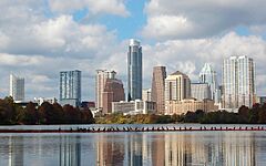
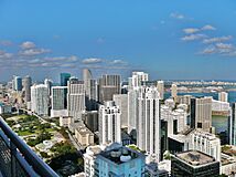
10. Austin, Texas
-
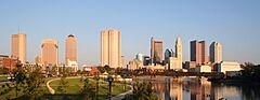
14. Columbus, Ohio
-
19. Denver, Colorado
-
22. El Paso, Texas
-

26. Portland, Oregon
-
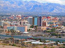
33. Tucson, Arizona
-
36. Mesa, Arizona
-
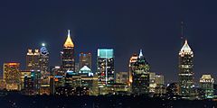
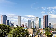
38. Atlanta, Georgia
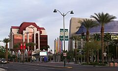
-
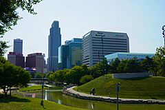
40. Omaha, Nebraska
-
44. Miami, Florida
-
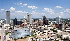
47. Tulsa, Oklahoma
-
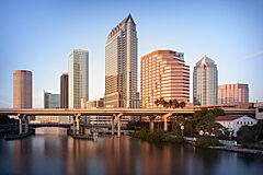
49. Tampa, Florida
-
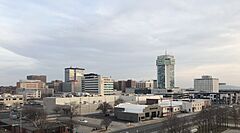
50. Wichita, Kansas


.jpg)


.jpg)

.jpg)


.jpg)


.jpg)


Cities in Puerto Rico

This table lists the five main areas (called municipios) in Puerto Rico that had over 100,000 people on July 1, 2022. This information comes from the United States Census Bureau.
If Puerto Rico were included in the main U.S. list, San Juan would be the 57th largest city in the country.
The table below shows:
- The area's rank by population on July 1, 2022.
- The name of the municipio.
- The population on July 1, 2022.
- The population on April 1, 2020.
- How much the population changed from 2020 to 2022.
- The land area on January 1, 2020.
- How many people lived per square mile (population density) on April 1, 2020.
- The area's latitude and longitude coordinates.
| Municipio | 2022 estimate | 2020 census | Change | 2020 land area | 2020 density | Location | ||
|---|---|---|---|---|---|---|---|---|
| San Juan | 334,776 | 342,259 | −2.19% | 39.8 sq mi | 103.1 km2 | 8,599/sq mi | 3,320/km2 | 18°24′N 66°04′W / 18.40°N 66.06°W |
| Bayamón | 181,577 | 185,187 | −1.95% | 27.0 sq mi | 69.9 km2 | 6,859/sq mi | 2,648/km2 | 18°23′N 66°10′W / 18.38°N 66.16°W |
| Carolina | 151,571 | 154,815 | −2.10% | 20.7 sq mi | 53.6 km2 | 7,479/sq mi | 2,888/km2 | 18°25′N 65°59′W / 18.41°N 65.98°W |
| Ponce | 132,138 | 137,491 | −3.89% | 28.4 sq mi | 73.6 km2 | 4,841/sq mi | 1,869/km2 | 18°00′N 66°37′W / 18.00°N 66.62°W |
| Caguas | 125,136 | 127,244 | −1.66% | 10.9 sq mi | 28.2 km2 | 11,674/sq mi | 4,507/km2 | 18°14′N 66°02′W / 18.23°N 66.04°W |
Other U.S. Areas
As of 2023, four other U.S. territories do not have any cities with at least 100,000 people. These are American Samoa, Guam, the Northern Mariana Islands, and the U.S. Virgin Islands.
Populous Unincorporated Areas
This table lists U.S. areas called "census-designated places" (CDPs) that had populations of at least 100,000 in the 2020 census. A CDP is a group of people identified by the United States Census Bureau for counting purposes.
CDPs are like cities, towns, or villages in how they look, but they don't have their own separate local government. The Census Bureau does not provide yearly population estimates for CDPs, unlike official cities.
The table below shows:
- The name of the census-designated place.
- The state it's in.
- The population on April 1, 2020.
- The population on April 1, 2010.
- How much the population changed from 2010 to 2020.
- The land area on January 1, 2020.
- How many people lived per square mile (population density) on April 1, 2020.
- The area's latitude and longitude coordinates.
| Census- designated place |
ST | 2020 census | 2010 census | Change | 2020 land area | 2020 density | Location | ||
|---|---|---|---|---|---|---|---|---|---|
| Arlington | VA | 238,643 | 207,627 | +14.94% | 26.0 sq mi | 67.340 km2 | 9,179/sq mi | 3,544/km2 | 38°53′N 77°06′W / 38.88°N 77.10°W |
| Enterprise | NV | 221,831 | 108,481 | +104.49% | 66.0 sq mi | 170.939 km2 | 3,361/sq mi | 1,298/km2 | 36°01′N 115°14′W / 36.01°N 115.23°W |
| Spring Valley | NV | 215,597 | 178,395 | +20.85% | 35.5 sq mi | 91.945 km2 | 6,073/sq mi | 2,345/km2 | 36°06′N 115°16′W / 36.10°N 115.26°W |
| Sunrise Manor | NV | 205,618 | 189,372 | +8.58% | 33.7 sq mi | 87.283 km2 | 6,101/sq mi | 2,356/km2 | 36°11′N 115°03′W / 36.18°N 115.05°W |
| Paradise | NV | 191,238 | 223,167 | −14.31% | 42.4 sq mi | 109.815 km2 | 4,510/sq mi | 1,740/km2 | 36°05′N 115°08′W / 36.09°N 115.14°W |
| Metairie | LA | 143,507 | 138,481 | +3.63% | 23.3 sq mi | 60.347 km2 | 6,159/sq mi | 2,378/km2 | 30°00′N 90°11′W / 30.00°N 90.18°W |
| East Los Angeles | CA | 118,786 | 126,496 | −6.10% | 7.5 sq mi | 19.425 km2 | 15,838/sq mi | 6,115/km2 | 34°02′N 118°10′W / 34.03°N 118.17°W |
| Brandon | FL | 114,626 | 103,483 | +10.77% | 33.1 sq mi | 85.729 km2 | 3,463/sq mi | 1,337/km2 | 27°56′N 82°18′W / 27.94°N 82.30°W |
| The Woodlands | TX | 114,436 | 93,847 | +21.94% | 43.3 sq mi | 112.146 km2 | 2,643/sq mi | 1,020/km2 | 30°10′N 95°31′W / 30.17°N 95.51°W |
| Lehigh Acres | FL | 114,287 | 86,784 | +31.69% | 92.7 sq mi | 240.092 km2 | 1,233/sq mi | 476/km2 | 26°37′N 81°38′W / 26.61°N 81.64°W |
| Spring Hill | FL | 113,568 | 98,621 | +15.16% | 59.9 sq mi | 155.140 km2 | 1,896/sq mi | 732/km2 | 28°29′N 82°32′W / 28.48°N 82.53°W |
| Riverview | FL | 107,396 | 71,050 | +51.16% | 46.2 sq mi | 119.657 km2 | 2,325/sq mi | 898/km2 | 27°49′N 82°18′W / 27.82°N 82.30°W |
| Columbia | MD | 104,681 | 99,615 | +5.09% | 31.9 sq mi | 82.621 km2 | 3,282/sq mi | 1,267/km2 | 39°12′N 76°52′W / 39.20°N 76.86°W |
| Highlands Ranch | CO | 103,444 | 96,713 | +6.96% | 24.3 sq mi | 62.937 km2 | 4,257/sq mi | 1,644/km2 | 39°32′N 104°58′W / 39.54°N 104.97°W |
Cities That Used to Be Bigger
This table lists U.S. cities that once had over 100,000 people but have since seen their populations drop below that number. Some cities also became part of a neighboring city.
| City | ST | 2022 estimate |
Peak population |
% decline from peak |
Peak year |
|
|---|---|---|---|---|---|---|
| Allegheny | PA | NA | 129,896 | NA | 1907 | |
| Brooklyn | NY | NA | 806,343 | NA | 1898 | |
| Camden | NJ | 70,996 | 124,555 | −43.00% | 1950 | |
| Canton | OH | 69,671 | 116,912 | −40.41% | 1950 | |
| Citrus Heights | CA | 86,433 | 107,439 | −19.55% | 1990 | |
| Clinton Township | MI | 99,448 | 100,513 | −1.06% | 2020 | |
| Duluth | MN | 86,619 | 107,312 | −19.28% | 1960 | |
| Erie | PA | 93,511 | 138,440 | −32.45% | 1960 | |
| Fall River | MA | 93,682 | 120,485 | −22.25% | 1920 | |
| Federal Way | WA | 97,863 | 101,030 | −3.13% | 2020 | |
| Flint | MI | 79,854 | 196,940 | −59.45% | 1960 | |
| Gary | IN | 67,972 | 178,320 | −61.88% | 1960 | |
| Hammond | IN | 76,575 | 111,698 | −31.44% | 1960 | |
| Livonia | MI | 93,779 | 110,109 | −14.83% | 1970 | |
| Longmont | CO | 98,687 | 100,758 | −2.06% | 2021 | |
| Niagara Falls | NY | 47,993 | 102,394 | −53.13% | 1960 | |
| Norwalk | CA | 98,537 | 105,549 | −6.64% | 2010 | |
| Parma | OH | 79,358 | 100,216 | −20.81% | 1970 | |
| Portsmouth | VA | 97,029 | 114,773 | −15.46% | 1960 | |
| Reading | PA | 94,858 | 111,171 | −14.67% | 1930 | |
| Roanoke | VA | 97,847 | 100,220 | −2.37% | 1980 | |
| Scranton | PA | 75,848 | 143,333 | −47.08% | 1930 | |
| Somerville | MA | 79,762 | 103,908 | −23.24% | 1930 | |
| St. Joseph | MO | 70,656 | 102,979 | −31.39% | 1900 | |
| Trenton | NJ | 89,661 | 128,009 | −29.96% | 1950 | |
| Utica | NY | 64,081 | 101,740 | −37.01% | 1930 | |
| Wilmington | DE | 71,569 | 112,504 | −36.39% | 1940 | |
| Youngstown | OH | 59,144 | 170,002 | −65.21% | 1930 |
Where are the Biggest Cities?
See also
 In Spanish: Anexo:Ciudades de Estados Unidos por población para niños
- Demographics of the United States
- Largest cities in the United States by population by decade
- List of largest cities – (world)
- List of largest cities of U.S. states and territories by population
- List of United States cities by area
- List of United States cities by population density
- United States Census Bureau
- List of U.S. states and territories by population
