Wilmington, Delaware facts for kids
Quick facts for kids
Wilmington, Delaware
Paxahakink / Pakehakink (Unami)
|
|||
|---|---|---|---|
|
|
|||
|
|||
| Etymology: Named after Spencer Compton, Earl of Wilmington | |||
| Nickname(s):
Corporate Capital of the World, Chemical Capital of the World
|
|||
| Motto(s):
In the middle of it all
|
|||
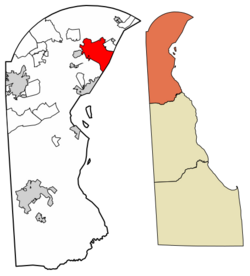
Location within New Castle County
|
|||
| Country | United States | ||
| State | Delaware | ||
| County | New Castle | ||
| Founded at The Rocks, Swedes' Landing, Fort Christina, Kristinehamn settlement | March 1638 | ||
| Incorporated as Willingtown | 1731 | ||
| Borough Charter as Wilmington | 1739 | ||
| City Charter | March 7, 1832 | ||
| Named for | Spencer Compton, 1st Earl of Wilmington | ||
| Government | |||
| • Type | Council-mayor | ||
| Area | |||
| • City | 17.19 sq mi (44.52 km2) | ||
| • Land | 10.89 sq mi (28.22 km2) | ||
| • Water | 6.29 sq mi (16.30 km2) | ||
| • Urban
- Northern NCCo.DE
|
213.35 sq mi (552.58 km2) | ||
| • Metro
- Wilmington/Newark Statistical Division, DE-MD-NJ
|
1,103.86 sq mi (2,859 km2) | ||
| Elevation | 92 ft (28 m) | ||
| Highest elevation
- Mount Salem Hill, Rockford Park
|
330 ft (100 m) | ||
| Population
(2020)
|
|||
| • City | 70,898 (within city limits) | ||
| • Density | 6,510.38/sq mi (2,512.48/km2) | ||
| • Urban
- Northern NCCo.DE
|
484,926 (US: 87th) | ||
| • Urban density | 2,272.91/sq mi (877.57/km2) | ||
| • Metro | 723,993 (US: 82nd)(Wilmington Metropolitan Division DE-MD-NJ Delaware statistical areas | ||
| • Metro density | 655.87/sq mi (253.23/km2) | ||
| Time zone | UTC−5 (EST) | ||
| • Summer (DST) | UTC−4 (EDT) | ||
| ZIP Codes |
19801-19810, 19850, 19880, 19884-19886, 19890-19899
|
||
| Area code(s) | 302 | ||
| FIPS code | 10-77580 | ||
| GNIS feature ID | 214862 | ||
| Airport | Wilmington Airport | ||
| Major highways | |||
| Commuter rail | |||
| Website | wilmingtonde.gov | ||
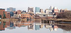
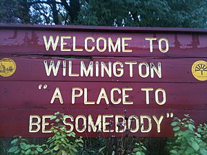
Wilmington (Lenape: Paxahakink / Pakehakink) is the largest city in Delaware. It was built where Fort Christina once stood, which was the first Swedish settlement in North America. The city is located where the Christina River and Brandywine Creek meet, close to where the Christina River flows into the Delaware River. Wilmington is the main city of New Castle County. It is also a key city in the Delaware Valley area, which is part of the larger Philadelphia metropolitan area. The city was named by Thomas Penn after his friend Spencer Compton, who was the prime minister at the time.
In 2020, Wilmington had a population of 70,898 people. The larger Delaware Valley area, which includes Wilmington, Philadelphia, and other cities, had a population of over 6.2 million people in 2020. This makes it one of the largest metropolitan areas in the United States.
Contents
- History of Wilmington
- Wilmington's Geography
- Wilmington's Population
- Wilmington's Neighborhoods
- Images for kids
- Wilmington's Economy
- Arts and Culture in Wilmington
- Media in Wilmington
- Transportation in Wilmington
- Infrastructure and Utilities
- Sports and Recreation in Wilmington
- Education in Wilmington
- Places to Visit in Wilmington
- Sister Cities
- Notable People from Wilmington
- See also
History of Wilmington
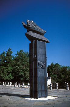
Wilmington was built on the site of Fort Christina and the settlement called Kristinehamn. These were the first Swedish settlements in North America. The city also includes other old Swedish areas like Timber Island and Sidoland.
Before Europeans arrived, the Lenape people lived here. Their chief was Mattahorn. They called the area "Maax-waas Unk," meaning "Bear Place." This was because of the Maax-waas Hanna, or Bear River, which is now the Christina River.
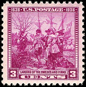
In March 1638, settlers from the Swedish South Company arrived. They were led by Peter Minuit on ships called the Fogel Grip and Kalmar Nyckel. They bought the land from Chief Mattahorn. They built Fort Christina at the mouth of the river, which the Swedes renamed the Christina River after Queen Christina of Sweden. This area was also known as "The Rocks." It became the main base for the New Sweden colony. Dr. Timothy Stidham, a doctor from Sweden, was an important person in early Wilmington. He arrived in 1654 and was the first doctor in Delaware.
Colonel Johan Printz was a key Swedish governor from 1643 to 1653. Later, in 1654, Johan Rising took over. He captured a Dutch fort nearby, but then the Dutch, led by Peter Stuyvesant, took control of all the Swedish forts in 1655. This ended Swedish rule in North America.
In 1664, the British took over. After some wars between the Dutch and English, the area became stable under British rule. Quaker communities, led by William Penn, had a strong influence. In 1739, King George II granted a charter. This changed the name from Willington (after Thomas Willing, who planned the city's streets) to Wilmington. It was likely named after British Prime Minister Spencer Compton.
During the American Revolutionary War, British troops occupied Wilmington in 1777. This happened after the Battle of Brandywine. They stayed until 1778.
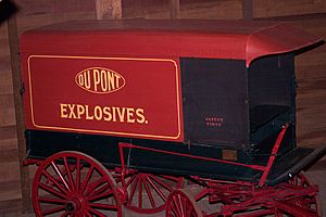
In 1800, Eleuthère Irénée du Pont, a French immigrant, came to the United States. He knew how to make gunpowder. By 1802, he started making it in a mill on the Brandywine River. His company, DuPont, became a major supplier to the U.S. military. This area was later added to Wilmington.
Wilmington grew a lot during the American Civil War. Delaware was a "border state," meaning it had divided loyalties. The war created a huge demand for goods from Wilmington. These included ships, railroad cars, gunpowder, and shoes.
By 1868, Wilmington was making more iron ships than the rest of the country combined. It was also a top producer of gunpowder and carriages. Because of this success, the city expanded westward. New homes were built on tree-lined streets. This growth was helped by the first horsecar line, which started in 1864.
In the late 1800s, Wilmington developed its first park system. William Poole Bancroft, a successful businessman, helped create Rockford Park and Brandywine Park.
Both World Wars boosted the city's industries. Shipyards, steel factories, and chemical companies worked non-stop. Other factories made cars, leather goods, and clothing. Many minorities moved to Wilmington for jobs. This sometimes caused tensions, like the Wilmington, Delaware race riot of 1919.
After the wars, people started moving to the suburbs. In the 1950s, more people lived in North Wilmington and commuted to the city. This was made easier by new roads and Interstate 95. I-95 cut through some neighborhoods, causing the city's population to shrink. Old housing blocks were torn down in the 1950s and 1960s for urban renewal projects.
The Wilmington riot of 1968 happened after the assassination of Martin Luther King Jr. The National Guard was sent to the city. They stayed until January 1969, which was reportedly the longest occupation of an American city by state forces.
In the 1980s, jobs and office buildings increased. This was because of new laws in 1981 that made it easier for banks to operate in Delaware. Today, many large banks like Bank of America and Capital One have offices in Wilmington. These often handle credit card operations.
Wilmington's Geography
Wilmington covers about 17 square miles (44 square kilometers). About 10.9 square miles (28.2 square kilometers) is land, and 6.2 square miles (16.3 square kilometers) is water.
The city is located where the Christina and Delaware rivers meet. This is about 33 miles (53 kilometers) southwest of Philadelphia. The Wilmington Train Station is served by Amtrak and SEPTA. Major highways like I-95 and I-495 pass through the city. The Delaware Memorial Bridge, south of the city, connects Delaware and New Jersey.
Wilmington is on the Fall Line. This is where the hilly Piedmont Plateau meets the flat Atlantic Coastal Plain. East of Market Street, the land is flat and low. West of Market Street, the land is rocky and hilly. These different land types affected how the city grew. The hilly west side was popular for homes because it had better air and fewer mosquitoes.
Climate and Weather
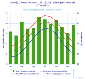
Wilmington has a warm temperate climate with hot, humid summers and cool to cold winters. Rain and snow are spread throughout the year. In July, the average temperature is about 76.8°F (24.9°C). Temperatures can reach 90°F (32°C) or higher about 21 days a year. Summer thunderstorms are common.
In January, the average temperature is about 32.4°F (0.2°C). Snowfall is light to moderate, with an average of 20.2 inches (51.3 cm) per year. Temperatures have ranged from -15°F (-26°C) to 107°F (42°C). However, temperatures above 100°F (38°C) or below 0°F (-18°C) are rare.
| Climate data for Wilmington, Delaware (New Castle County Airport), 1991–2020 normals, extremes 1894–present | |||||||||||||
|---|---|---|---|---|---|---|---|---|---|---|---|---|---|
| Month | Jan | Feb | Mar | Apr | May | Jun | Jul | Aug | Sep | Oct | Nov | Dec | Year |
| Record high °F (°C) | 75 (24) |
78 (26) |
86 (30) |
97 (36) |
98 (37) |
102 (39) |
103 (39) |
107 (42) |
100 (38) |
98 (37) |
85 (29) |
75 (24) |
107 (42) |
| Mean maximum °F (°C) | 63.1 (17.3) |
63.8 (17.7) |
73.8 (23.2) |
83.3 (28.5) |
89.1 (31.7) |
93.5 (34.2) |
95.8 (35.4) |
93.8 (34.3) |
89.7 (32.1) |
82.6 (28.1) |
72.3 (22.4) |
64.2 (17.9) |
96.9 (36.1) |
| Mean daily maximum °F (°C) | 41.4 (5.2) |
44.1 (6.7) |
52.5 (11.4) |
64.2 (17.9) |
73.5 (23.1) |
82.2 (27.9) |
86.8 (30.4) |
84.9 (29.4) |
78.5 (25.8) |
67.0 (19.4) |
55.9 (13.3) |
46.0 (7.8) |
64.8 (18.2) |
| Daily mean °F (°C) | 33.5 (0.8) |
35.5 (1.9) |
43.2 (6.2) |
53.9 (12.2) |
63.5 (17.5) |
72.6 (22.6) |
77.6 (25.3) |
75.8 (24.3) |
68.9 (20.5) |
57.2 (14.0) |
46.6 (8.1) |
38.2 (3.4) |
55.5 (13.1) |
| Mean daily minimum °F (°C) | 25.6 (−3.6) |
27.0 (−2.8) |
33.9 (1.1) |
43.5 (6.4) |
53.4 (11.9) |
63.0 (17.2) |
68.3 (20.2) |
66.6 (19.2) |
59.3 (15.2) |
47.3 (8.5) |
37.4 (3.0) |
30.3 (−0.9) |
46.3 (7.9) |
| Mean minimum °F (°C) | 9.7 (−12.4) |
12.0 (−11.1) |
18.9 (−7.3) |
30.2 (−1.0) |
39.2 (4.0) |
49.9 (9.9) |
58.3 (14.6) |
56.0 (13.3) |
45.1 (7.3) |
33.4 (0.8) |
23.3 (−4.8) |
16.4 (−8.7) |
7.4 (−13.7) |
| Record low °F (°C) | −14 (−26) |
−15 (−26) |
2 (−17) |
11 (−12) |
30 (−1) |
40 (4) |
48 (9) |
43 (6) |
32 (0) |
23 (−5) |
11 (−12) |
−7 (−22) |
−15 (−26) |
| Average precipitation inches (mm) | 3.23 (82) |
2.83 (72) |
4.16 (106) |
3.51 (89) |
3.57 (91) |
4.67 (119) |
4.41 (112) |
3.98 (101) |
4.38 (111) |
3.68 (93) |
3.06 (78) |
3.85 (98) |
45.33 (1,151) |
| Average snowfall inches (cm) | 6.1 (15) |
7.8 (20) |
3.1 (7.9) |
0.1 (0.25) |
0.0 (0.0) |
0.0 (0.0) |
0.0 (0.0) |
0.0 (0.0) |
0.0 (0.0) |
0.0 (0.0) |
0.2 (0.51) |
2.9 (7.4) |
20.2 (51) |
| Average precipitation days (≥ 0.01 in) | 10.8 | 10.0 | 11.2 | 11.1 | 11.7 | 11.0 | 10.0 | 8.9 | 8.8 | 8.9 | 8.8 | 10.6 | 121.8 |
| Average snowy days (≥ 0.1 in) | 3.5 | 3.5 | 1.7 | 0.1 | 0.0 | 0.0 | 0.0 | 0.0 | 0.0 | 0.0 | 0.2 | 1.7 | 10.7 |
| Source: NOAA | |||||||||||||
Wilmington's Population
| Historical population | |||
|---|---|---|---|
| Census | Pop. | %± | |
| 1820 | 5,268 | — | |
| 1830 | 6,628 | 25.8% | |
| 1840 | 8,367 | 26.2% | |
| 1850 | 13,979 | 67.1% | |
| 1860 | 21,258 | 52.1% | |
| 1870 | 30,841 | 45.1% | |
| 1880 | 42,478 | 37.7% | |
| 1890 | 61,431 | 44.6% | |
| 1900 | 76,508 | 24.5% | |
| 1910 | 87,411 | 14.3% | |
| 1920 | 110,168 | 26.0% | |
| 1930 | 106,597 | −3.2% | |
| 1940 | 112,504 | 5.5% | |
| 1950 | 110,356 | −1.9% | |
| 1960 | 95,827 | −13.2% | |
| 1970 | 80,386 | −16.1% | |
| 1980 | 70,195 | −12.7% | |
| 1990 | 71,529 | 1.9% | |
| 2000 | 72,664 | 1.6% | |
| 2010 | 70,851 | −2.5% | |
| 2020 | 70,898 | 0.1% | |
| U.S. Decennial Census | |||
In 2020, Wilmington had 70,898 people. There were 31,754 households and 13,572 families living in the city.
Population Details from 2010
In 2010, there were 70,851 people in Wilmington. The population density was about 6,497 people per square mile.
The city's population was made up of different groups:
- 58.0% African American
- 32.6% White
- 0.4% Native American
- 1.0% Asian
- 5.4% from other races
- 2.6% from two or more races.
About 12.4% of the population was Hispanic or Latino. In 2010, 27.9% of the population was non-Hispanic White, which was a decrease from 40.5% in 1990.
The average household had 2.36 people, and the average family had 3.18 people. About 24.4% of the population was under 18 years old. The median age was 34.3 years.
In 2010, the average income for a household was $32,884. The average income for a family was $37,352. About 27.6% of the population lived below the poverty line.
Wilmington's Neighborhoods
Wilmington has many different neighborhoods. Here are some of them:
North of the Brandywine River
- Baynard Village
- Brandywine Hills – This neighborhood started in the 1930s. Its streets are named after famous writers like Byron and Emerson.
- Brandywine Village
- Eastlawn
- Eastlake
- Gander Hill – This is where the Howard R. Young Correctional Institution is located.
- Harlan
- Ninth Ward – This area has many homes owned by the people who live in them. It's a stable, working-class neighborhood.
- Prices Run
- Riverside–11th Street Bridge
- Triangle – Homes here were built in the 1920s. The streets form a loose triangle shape.
East of I-95
- Center City (Downtown)
- East Side
- Justison Landing
- LOMA
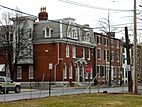
- Midtown Brandywine – Located by the Brandywine River, this area has homes from the late 1800s. It includes Brandywine Park and "The Little Church."
- Quaker Hill – This historic area was founded by Quakers in the 1700s. The Wilmington Friends House and its cemetery are here. Abolitionist Thomas Garrett is buried here.
- Riverfront – This area used to be for shipbuilding. Now it has been redeveloped with shops, restaurants, and the Wilmington Blue Rocks' baseball stadium.
- Southbridge
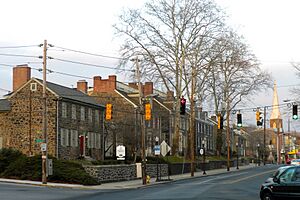
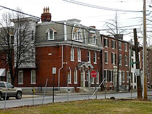
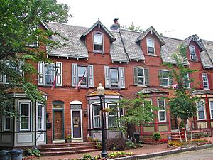
- Trinity Vicinity – This neighborhood is near Trinity Church and I-95. It has many row homes from the late 1800s. It's now a historic district.
- Upper East Side (East Brandywine)
- West Center City
- 11th St. Bridge
West of I-95
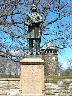
- Bayard Square
- Browntown – This area was first settled by Polish immigrants. It still has a strong Polish community.
- Canby Park – Named after Henry and William Marriott Canby. Canby Park Estates is next to the park.
- Cool Spring & Tilton Park – Home to two Catholic schools, Ursuline Academy and Padua Academy. It also has the Holy Trinity Greek Orthodox Church, which hosts a Greek festival.
- Delaware Avenue
- The Flats – This neighborhood was built in 1901 to provide affordable homes for working-class people. It is mostly a minority community.
- Forty Acres – This historic Irish neighborhood was once farmland. It's centered around St. Ann's Roman Catholic Church.
- Greenhill
- Happy Valley – A small group of old row houses and newer townhouses near Brandywine Park.
- Hedgeville
- The Highlands – Developed in the 1800s for wealthier residents. It has many detailed houses in different styles.
- Hilltop – This area has been very diverse since the late 1800s. It is now home to many Hispanic residents.
- Little Italy – This neighborhood is centered around Union and Lincoln streets. It has kept its Italian roots and hosts an annual Italian Festival.
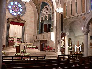
- St. Elizabeth Area – This area is centered around the St. Elizabeth Parish, a historic Catholic church built in 1908.
- Trolley Square – This area was settled in the 1860s when the city's trolley line extended here. The Trolley Square shopping complex is built where the old trolley depot used to be.
- Wawaset
- Wawaset Heights
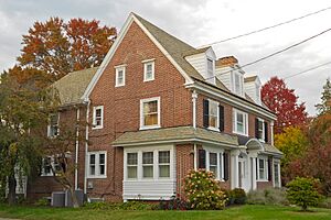
- Wawaset Park – Built by the DuPont Company in 1918 for its employees. It was designed to have a mix of single and attached homes. It's now on the Register of Historic Places.
- West Hill
- Westmoreland – Homes built in the 1950s as part of the suburban growth after World War II.
- Union Park Gardens
Historic Districts and Conservation District
Wilmington has nine historic districts and one conservation district. These areas are protected because of their historical importance.
Images for kids
-
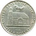
Old Swedes Church depicted on the 1937 Delaware Tercentenary half dollar coin
Wilmington's Economy
Wilmington's economy is strong because it is the largest city in Delaware. Delaware has laws that make it easy for businesses to set up here. It also has a fair legal system. The Wilmington Station helps the economy by bringing many people to the city.
Wilmington is a major center for the credit card industry. This happened because of laws passed in 1981 by former Governor Pierre S. du Pont IV. These laws removed limits on interest rates that banks could charge. Many big credit card companies like Barclays Bank of Delaware and Capital One 360 have their main offices in Wilmington. Wilmington Trust is also headquartered here.
Delaware also has laws that protect companies from hostile takeovers. This makes Delaware a popular place for companies to officially register.
Other important industries in Wilmington include insurance, retail banking, and legal services. E.I. du Pont de Nemours and Company, a large chemical company, is based here. Science and technology companies like Incyte and Chemours also have a presence. More than half of the publicly traded companies in the U.S. are officially registered in Delaware.
Delaware's Court of Chancery helps solve business disputes quickly and fairly. This court is known for its expert judges. The United States Bankruptcy Court in Wilmington is also very busy because so many companies are registered in Delaware.
Top Employers in Wilmington
Here are some of the largest employers in Wilmington:
| # | Employer | # of Employees |
|---|---|---|
| 1 | State of Delaware | 14,199 |
| 2 | ChristianaCare | 11,308 |
| 3 | University of Delaware | 4,493 |
| 4 | Amazon (DE Fulfillment Centers) | 4,300 |
| 5 | Nemours (Nemours Children's Hospital, Delaware) | 3,795 |
| 6 | DuPont Company | 3,500 |
| 7 | AstraZeneca Pharmaceuticals LP | 2,500 |
| 8 | YMCA of Delaware | 2,469 |
| 9 | Christina School District | 2,390 |
| 10 | Red Clay School District | 2,200 |
| 11 | Delaware Technical Community College | 2,100 |
| 12 | New Castle County Government | 2,000 |
| 13 | M&T Bank (Wilmington Trust Corp.) | 1,900 |
| 14 | Brandywine School District | 1,472 |
| 15 | Siemens Healthcare Diagnostics | 1,410 |
| 16 | Connections Community Support | 1,200 |
| 17 | St. Francis Healthcare | 1,200 |
| 18 | Delaware State University | 1,009 |
| 19 | The Chemours Company | 1,000 |
| 20 | Wilmington VA Medical Center | 980 |
| 21 | Delmarva Power | 898 |
| 22 | AAA | 890 |
| 23 | Blackrock Capital Management, Inc. | 834 |
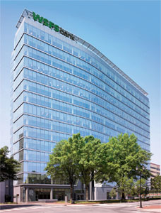
| 24 | WSFS Bank | 801 |
Arts and Culture in Wilmington
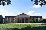
Wilmington has many museums, art galleries, and gardens. It also hosts many ethnic festivals and other events throughout the year. The Delaware Art Museum is famous for its American art and English Pre-Raphaelite art.
Ethnic Festivals
Wilmington has a diverse population, and this is celebrated with several festivals each spring and summer.
- Italian Festival: This popular event is run by St. Anthony of Padua Catholic Church. It closes down six blocks in June for Italian music, food, and carnival rides.
- Greek Festival: Organized by Holy Trinity Greek Orthodox Church, this event features Greek crafts, food, drinks, and music.
- Polish Festival: St. Hedwig's Catholic Church hosts this festival with Polish food and entertainment.
- Haneef's African Festival: This festival celebrates the heritage of the African American community.
- Big August Quarterly: Since 1814, this event has celebrated African American religious freedom.
- IndiaFest: Hosted by the Indo American Association of Delaware.
- Hispanic Week: This festival celebrates Hispanic culture with a parade, Latin music, and food.
Music Festivals
- Clifford Brown Jazz Festival: A week-long outdoor jazz festival held every summer in Rodney Square.
- Peoples' Festival: An annual tribute to Bob Marley, who once lived in Wilmington. It features reggae and world beat music.
- Riverfront Blues Festival: A three-day blues music festival held every August at Tubman-Garrett Riverfront Park.
Holiday Events
- Christmas Tree Lighting: An annual ceremony at Rockwood Museum and Park.
- The Nutcracker: Performed by the Wilmington Ballet at the Playhouse at the Hotel DuPont.
- Memorial Day Parade: Wilmington's Memorial Day parade is the oldest continuous parade in the country.
Wilmington Riverfront
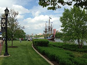
In the 1990s, the city started a project to improve the Wilmington Riverfront. This area used to be a shipyard. The Delaware Theatre Company helped start this movement. The Daniel S. Frawley Stadium, home to the Wilmington Blue Rocks baseball team, also helped. The Chase Center on the Riverfront is now the city's convention center. The Wilmington Rowing Center is also located here.
Development continues along the Riverfront. New luxury apartment buildings have been built. Shops, restaurants, and a Riverfront Market have also opened along the 1.2-mile (1.9 km) Riverwalk.
Media in Wilmington
Radio and Television
The Wilmington area has several radio stations. Many radio stations from Philadelphia also reach Wilmington. Wilmington is part of the Philadelphia television market. Three TV stations are licensed to Wilmington: WPPX, WDPN-TV, and WHYY-TV.
Newspaper
- The News Journal: Founded in 1785 as the Delaware Gazette. It is a daily newspaper.
- WilmToday: Started in 2016, it covers local news and events in Wilmington.
Transportation in Wilmington
Highways
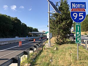
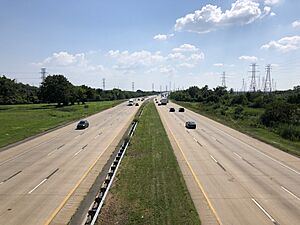
Interstate 95 divides Wilmington into eastern and western parts. It connects the city to major areas in the Northeast. Interstate 495 is a bypass on the east side of the city. Interstate 295 is south of the city and crosses into New Jersey on the Delaware Memorial Bridge.
Several U.S. Routes and Delaware Routes also serve Wilmington. The city's streets are laid out in a grid pattern. North-south streets are named, and east-west streets are numbered. There are 34 red light cameras in the city. Parking is available at meters, lots, and garages.
Railroads
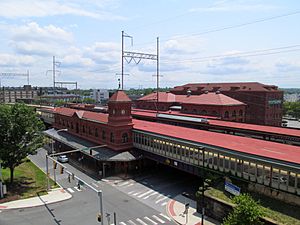
Wilmington is served by the Joseph R. Biden Jr. Wilmington Rail Station. Amtrak trains run frequently between Boston and Washington, D.C. SEPTA Regional Rail provides local commuter service to Philadelphia. Amtrak also has a large maintenance shop and training facility in Wilmington.
Two freight railroads, CSX and Norfolk Southern, also serve the city. They have major freight yards nearby.
Buses
DART First State operates public bus service in Wilmington and the surrounding areas. It also offers inter-county service to Dover. Many bus routes use the Wilmington Transit Center and Rodney Square. Greyhound Lines offers interstate bus service from the Wilmington Bus Station at the train station.
Airports
Wilmington Airport (ILG) is a few miles south of downtown. It has scheduled passenger service by Avelo Airlines. It is also a base for the Delaware Army and Air National Guard. The closest major international airport is Philadelphia International Airport (PHL).
Seaport
Wilmington has the Port of Wilmington. This is a modern deepwater port that handles over 400 vessels each year. It imports and exports about 5 million tons of cargo annually. The port mostly handles international imports of fruits, vegetables, cars, steel, and bulk products.
Infrastructure and Utilities
Delmarva Power provides electricity and natural gas to Wilmington. The city's Department of Public Works provides water and sewer services. Water comes from the Hoopes Reservoir and the Brandywine Creek. The city also handles trash collection and recycling.
Sports and Recreation in Wilmington
Sports Teams
| Club | Sport | League | Venue | Founded | Championships |
|---|---|---|---|---|---|
| Delaware Blue Coats | Basketball | NBA G League | Chase Fieldhouse | 2013 | (1) 2023 |
| Wilmington Blue Rocks | Baseball | MiLB (High-A East) | Frawley Stadium | 1993 | (5) 1994, 1996, 1998, 1999, 2019 |
| Delaware Black Foxes | Rugby league | USARL | Eden Park Stadium | 2015 | None |
| Bearfight FC of Wilmington | Soccer | United States Adult Soccer Association | Traveling Team | 2013 | None |
| Wilmington Rugby Football Union | Rugby Union | USA Rugby | Alapocas Run | 1974 | None |
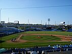
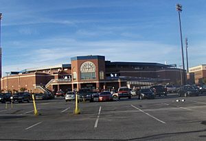
The Wilmington Blue Rocks are a Minor League Baseball team. They play at Daniel S. Frawley Stadium. The stadium is also home to the Delaware Sports Museum and Hall of Fame.
The Delaware Black Foxes are a USA Rugby League team based in the city. Bearfight FC of Wilmington is a soccer team that represents Delaware in the Lamar Hunt U.S. Open Cup.
Outdoor Activities
The Wilmington State Parks include four parks: Brandywine Park (with the Brandywine Zoo and Baynard Stadium), Alapocas Woods Natural Area, H. Fletcher Brown Park, and Rockford Park. Entry to the parks is free, but there is a fee for the zoo. The parks are open year-round. The city also manages 55 other parks and recreation spots.
Running Events
- Delaware Distance Classic: A 15K road race held in October.
- Caesar Rodney Half Marathon: A 13.1-mile (21.0975 km) road race held every March. It attracts over 1,000 runners. The race starts and ends at Rodney Square.
- Run for the Buds: A half marathon and 5K run/walk held at Rockford Park in October. It raises money for people with intellectual disabilities.
Cycling
The Wilmington Grand Prix is an annual bike race. It is one of the top criterium-style races in the country. The event includes a street festival, time trials, and races for both amateur and professional cyclists.
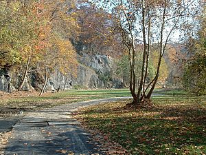
The East Coast Greenway also passes through Wilmington. This scenic path includes hills, forests, and paved sections through downtown.
Golf
- Wilmington Country Club: A private golf course just outside the city.
- Ed "Porky" Oliver Golf Club: A public golf course within the city.
- Rock Manor: A public golf course just outside the city.
Tennis
The Delcastle Tennis Center is a tennis facility located in Wilmington.
Education in Wilmington
Schools for Kids
Public Schools
Wilmington is served by several school districts: Brandywine, Christina, Red Clay, and Colonial. The New Castle County Vocational-Technical School District operates Howard High School of Technology in the city.
As of 2020, Wilmington does not have traditional public high schools within its city limits. Most high school students from Wilmington attend schools in the suburbs.
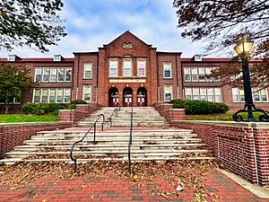
Wilmington also has several charter schools. These include the Charter School of Wilmington, Great Oaks Charter School, and Kuumba Academy Charter School. Cab Calloway School of the Arts is a magnet school that focuses on performing arts. The Charter School of Wilmington and Cab Calloway School of the Arts are in the old Wilmington High School building.
Historically, schools in Wilmington were segregated. Wilmington High School and P.S. du Pont High School were for white children. Howard High School was for black children. In 1954, the Brown v. Board of Education ruling made segregation illegal. Later, in 1976, a court decision led to students being bused between city and suburban schools to create more diverse schools. Today, the school districts are mixed, including both city and suburban areas.
Some people in Wilmington want to bring a comprehensive high school back to the city. This school would likely have a majority African-American student body.
Private Schools
Wilmington has many private elementary and secondary schools. These include Salesianum School, Serviam Girls Academy, Ursuline Academy, Tower Hill School, St. Elizabeth High School, and Padua Academy. A large percentage of students in the Wilmington area attend private schools.
Colleges and Universities
Several colleges and universities have campuses in Wilmington:
- Delaware College of Art & Design
- Delaware State University – Wilmington Campus
- Delaware Technical & Community College – Wilmington Campus
- Goldey-Beacom College
- University of Delaware – Wilmington Campus and Downtown Building
- Wilmington University – Wilmington Campus
- Widener University Delaware Law School
Places to Visit in Wilmington
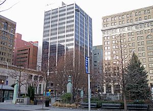
- Brandywine Zoo
- Delaware Art Museum
- Delaware Center for the Contemporary Arts
- Delaware Center for Horticulture
- Delaware Children's Museum
- Delaware Children's Theatre
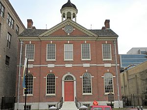
- Delaware Historical Society
- Delaware Sports Museum and Hall of Fame
- Delaware Theatre Company
- DuPont Playhouse
- Frank Furness Railroad District (buildings designed by Frank Furness)
- Fort Christina State Park
- Grand Opera House
- Kalmar Nyckel Foundation & Tall Ship
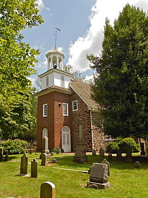
- Holy Trinity (Old Swedes') Church
- Riverfront Market
- Rockford Tower
- Rodney Square
- Wilmington and Brandywine Cemetery
- Wilmington Blue Rocks (baseball team)
- Wilmington Drama League
- The Wilmington Library
- Wilmington Riverfront
- Wilmington State Parks, including Brandywine Park
Sister Cities
Wilmington has "sister city" relationships with several cities around the world:
- Fulda, Germany
- Kalmar, Sweden
- Olevano sul Tusciano, Salerno, Campania, Italy
- Osogbo, Nigeria
- Watford, Hertfordshire, England, United Kingdom
Partner City
- Nemours, Seine-et-Marne, Île-de-France, France
Notable People from Wilmington
Many famous people have come from Wilmington. You can find a full list at List of people from Wilmington, Delaware.
See also
 In Spanish: Wilmington (Delaware) para niños
 | Delilah Pierce |
 | Gordon Parks |
 | Augusta Savage |
 | Charles Ethan Porter |


