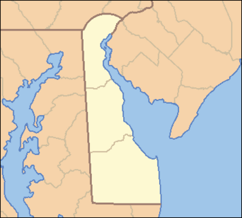
List of counties in Delaware facts for kids
Quick facts for kids Counties of Delaware |
|
|---|---|
| Location | State of Delaware |
| Number | 3 |
| Populations | 189,789 (Kent) – 578,592 (New Castle) |
| Areas | 494 square miles (1,280 km2) (New Castle) – 1,196 square miles (3,100 km2) (Sussex) |
| Government | County government |
| Subdivisions | Municipality |
The U.S. state of Delaware has three main areas called counties. This is the fewest number of counties in any state in the United States. These counties are New Castle, Kent, and Sussex. The borders of these counties were first set up based on old court districts.
Contents
How Delaware's Counties Are Governed
Each county in Delaware has a group of elected people who make decisions. In New Castle and Sussex counties, this group is called the County Council. In Kent County, it's known as the Levy Court.
These county governments can collect taxes and borrow money. They also manage things like trash collection, water supply, and sewage systems. They decide how land can be used for building and development.
In many other states, counties handle things like courts and police. But in Delaware, these jobs are mostly done by the state government. This means the state government has a lot of power.
Long ago, counties were split into smaller areas called "hundreds." These "hundreds" were used for collecting taxes and for voting. But since the 1960s, they are not used for government tasks anymore. Today, their only official use is in describing land for property sales.
A Look Back: History of Delaware's Counties
After England took control in 1664, all the land west of the Delaware River and Delaware Bay was part of the New York Colony. It was managed from the town of New Castle.
In 1673, the Dutch briefly took back the colony. They created new court areas around Upland and Whorekill. Whorekill is now the town of Lewes. The court at New Castle managed the middle part of the colony.
How New Castle County Started
The area managed by the New Castle court became New Castle County. The main town for the county stayed at New Castle until 1881. Then, it moved to Wilmington.
How Kent and Sussex Counties Started
In 1680, the Whorekill District was split into two new areas: Deale County and St. Jones County. Lewes became the main town for Deale County. Deale County was later renamed Sussex County.
The old Upland District was named after a Swedish settlement. In 1682, it was renamed Chester County. Chester County is now part of Pennsylvania.
Border Disputes and New County Seats
Lord Baltimore, who owned Maryland, claimed all of what is now Delaware. He tried to set up a county called Durham County, Maryland, in the northern part. But this county never really existed.
The southern parts of Sussex County were claimed by Maryland for a while. These areas were not officially part of Delaware until 1767. That's when the Mason-Dixon Survey set the final border.
In 1791, Sussex County grew bigger to the south and west. Because of this, its main town moved to Georgetown. The main town for St. Jones County (which became Kent County in 1681) is Dover.
After the year 2000, some people suggested creating a fourth county. It would be called "Appoquinimink County" and would be carved out of New Castle County. The idea was to stop strict building rules on undeveloped farmland. This new county would include all land south of the C&D Canal, with Middletown as its proposed main town.
Delaware's Counties List
The table below shows the three counties of Delaware. It includes their FIPS code, which is a special number used by the U.S. government to identify each county. The FIPS code links to census data for that county.
| County |
FIPS code | County seat | Est. | History | Etymology | Population | Area | Map |
|---|---|---|---|---|---|---|---|---|
| Kent County | 001 | Dover | 1680 | Created from Whorekill (Hoarkill) District. Formerly known as St. Jones County. | named in 1682 by William Penn for the English county of Kent | 189,789 | 800 sq mi (2,072 km2) |
 |
| New Castle County | 003 | Wilmington | 1664 | Original County (Formally New Amstel) | named in 1673 by Dutch Governor Anthony Colve for the town of New Castle, Delaware as an Anglicization of Nieuw Amstel. | 578,592 | 494 sq mi (1,279 km2) |
 |
| Sussex County | 005 | Georgetown | 1664 | Created from Whorekill (Hoarkill) District. Formerly known as Deale County | named in 1682 by William Penn for the English county of Sussex, which was his home county | 263,509 | 1,196 sq mi (3,098 km2) |
 |
See also

- In Spanish: Anexo:Condados de Delaware para niños
 | Kyle Baker |
 | Joseph Yoakum |
 | Laura Wheeler Waring |
 | Henry Ossawa Tanner |


