Maryland facts for kids
Quick facts for kids
Maryland
|
|||
|---|---|---|---|
|
|||
| Nicknames:
"Old Line State", "Free State", "Little America", "America in Miniature"
|
|||
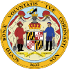
Motto(s):
|
|||
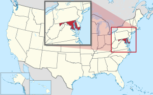
Location of Maryland within the United States
|
|||
| Country | United States | ||
| Before statehood | Province of Maryland | ||
| Admitted to the Union | April 28, 1788 (7th) | ||
| Capital | Annapolis | ||
| Largest city | Baltimore | ||
| Largest county or equivalent | Montgomery | ||
| Largest metro and urban areas |
|
||
| Legislature | General Assembly | ||
| • Upper house | Senate | ||
| • Lower house | House of Delegates | ||
| Judiciary | Supreme Court of Maryland | ||
| U.S. senators |
|
||
| U.S. House delegation |
|
||
| Area | |||
| • Total | 12,407 sq mi (32,133 km2) | ||
| • Land | 9,776 sq mi (25,314 km2) | ||
| • Water | 2,633 sq mi (6,819 km2) 21% | ||
| Area rank | 42nd | ||
| Dimensions | |||
| • Length | 250 mi (400 km) | ||
| • Width | 100 mi (200 km) | ||
| Elevation | 350 ft (110 m) | ||
| Highest elevation | 3,360 ft (1,024 m) | ||
| Lowest elevation | 0 ft (0 m) | ||
| Population
(2024)
|
|||
| • Total | |||
| • Rank | 18th | ||
| • Density | 632/sq mi (244/km2) | ||
| • Density rank | 5th | ||
| • Median household income | $98,700 (2023) | ||
| • Income rank | 3rd | ||
| Demonym(s) | Marylander | ||
| Language | |||
| • Official language | None (English, de facto) | ||
| Time zone | UTC−05:00 (Eastern) | ||
| • Summer (DST) | UTC−04:00 (EDT) | ||
| USPS abbreviation |
MD
|
||
| ISO 3166 code | US-MD | ||
| Traditional abbreviation | Md. | ||
| Latitude | 37° 53′ N to 39° 43′ N | ||
| Longitude | 75° 03′ W to 79° 29′ W | ||
| Song | None. Formerly: "Maryland, My Maryland" by James Ryder Randall (1861), (adopted 1939, repealed 2021) |
|---|---|
| Dance | Square dance |
| Bird | Baltimore oriole |
| Fish | Rock fish |
| Flower | Black-eyed Susan |
| Tree | White oak |
| Insect | Baltimore checkerspot butterfly |
| Sport |
Maryland is a state in the Mid-Atlantic region of the United States. It shares borders with Virginia to the south, West Virginia to the west, Pennsylvania to the north, and Delaware and the Atlantic Ocean to the east. The nation's capital, Washington, D.C., is also to its southwest.
Maryland is one of the smallest states by land area, ranking ninth. However, it is the fifth most densely populated state. Its capital city is Annapolis, and its largest city is Baltimore.
Europeans first explored Maryland's coast in the 1500s. Before that, various Native American tribes, mostly the Algonquian peoples, lived there. Maryland was one of the original Thirteen Colonies. It was founded by George Calvert, who wanted to create a safe place for Catholics. King Charles I of England named the colony after his wife, Henrietta Maria of France.
In 1649, Maryland passed a law called the Maryland Toleration Act, which promoted religious freedom. The state's early economy relied on plantations, especially for growing tobacco. This led to many indentured servants and enslaved Africans being brought to the colony. Maryland played important roles in the American Revolutionary War. Even though it was a state where slavery was allowed, Maryland stayed with the Union during the American Civil War. Its location near Washington D.C. made it very important strategically. After the Civil War, Maryland grew during the Industrial Revolution, thanks to its ports and railroads.
Since the 1940s, Maryland's population has grown a lot. It is now one of the most crowded U.S. states. Maryland has a very diverse economy, including manufacturing, healthcare, and technology. It is also one of the most multicultural states. Many people from Africa, Asia, Central America, and the Caribbean live here. Maryland's important role in U.S. history means it has many historic landmarks.
The state has different landscapes. Western Maryland has parts of the Appalachian Mountains. The central area has rolling hills, and the eastern side includes a large part of the Chesapeake Bay. Because of its varied geography, Maryland is sometimes called America in Miniature. Its culture and history mix elements from the Mid-Atlantic, Northeastern, and Southern parts of the country.
Contents
Maryland's Story: A Look Back
Early Days: The 1600s
How Maryland Began
George Calvert, also known as the 1st Baron Baltimore, wanted to start a colony. He asked King Charles I of England for land between Massachusetts and Virginia. After George Calvert passed away, his son, Cecilius Calvert, received the official charter on June 20, 1632.
The new "Maryland Colony" was named to honor Henrietta Maria of France, King Charles I's wife. Lord Baltimore first thought of naming it "Crescentia," meaning "land of growth." But the King suggested "Terra Mariae," which means "Mary Land," and that name was chosen.
The first capital of Maryland was St. Mary's City. This city was located on the north side of the Potomac River. The county around it was the first one created in the colony.
Lord Baltimore's first settlers arrived in March 1634. His younger brother, Leonard Calvert, was the first governor. They made their first permanent home at St. Mary's City. They bought the land from the local Native American chief, who wanted to trade with them. St. Mary's was Maryland's capital for 60 years, until 1695. More settlers came, and their tobacco crops made the colony profitable.
Religious Challenges for Catholics
Maryland was founded as a safe place for Roman Catholics from England. However, Catholics were still a minority in Maryland, making up less than 10% of the population.
In 1642, some Puritans moved from Virginia to Maryland. They founded a settlement called Providence, which is now Annapolis. A disagreement over Kent Island led to fighting. In 1644, a Puritan named William Claiborne took Kent Island. His friend, Richard Ingle, took over St. Mary's. They used religion to gain support. The two years from 1644 to 1646 were called "The Plundering Time." During this time, Jesuit priests were captured and sent back to England.
In 1646, Leonard Calvert returned with troops and took back St. Mary's City. In 1649, the government passed the "Act concerning Religion." This law gave religious freedom to all Christians who believed in the Trinity.
In 1650, the Puritans rebelled again. They removed Catholics from the legislature. Religious conflict returned. The Puritan government banned both Catholicism and Anglicanism. Mobs burned down Catholic churches in southern Maryland. This Puritan rule lasted until 1658. Then, the Calvert family regained control and brought back the Toleration Act.
After England's Glorious Revolution in 1688, Maryland made Catholicism illegal. In 1704, the Maryland General Assembly passed laws against Catholics. They could not run schools. They also limited how much property religious groups could own. This situation continued until after the American Revolutionary War. Wealthy Catholic landowners built secret chapels on their properties to practice their faith.
Solving Border Disputes (1681–1760)
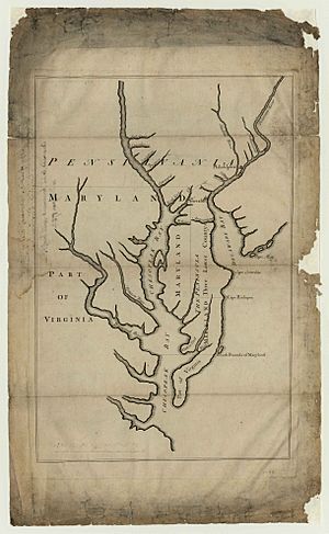
Maryland's original charter gave it land north of the Potomac River up to the 40th parallel. But King Charles II of England later gave a charter for Pennsylvania. This new grant said Pennsylvania's southern border was the same as Maryland's northern border, the 40th parallel. The problem was that the King and William Penn thought the 40th parallel would be near New Castle, Delaware. Instead, it was north of Philadelphia, where Penn wanted to build his capital.
Talks began in 1681 to fix this. A compromise was suggested in 1682. But Penn then received more land, which is now Delaware. Penn argued that Maryland's charter only applied to unsettled lands. Dutch settlements in Delaware were there before Maryland's charter. The dispute lasted for almost 100 years. It was continued by the families of William Penn and Lord Baltimore.
The border dispute with Pennsylvania led to a conflict called Cresap's War in the 1730s. Fighting started in 1730 and grew worse. Maryland sent military forces in 1736, and Pennsylvania did the same in 1737. The fighting stopped in May 1738 when King George II stepped in. He made them negotiate a cease-fire. A temporary agreement had been made in 1732.
Negotiations continued until a final agreement was signed in 1760. This agreement set the border between Maryland and Pennsylvania. It became known as the Mason–Dixon line. Maryland's border with Delaware was based on a Transpeninsular Line and the Twelve-Mile Circle around New Castle.
The 1700s: Revolution and New Beginnings
Most early English colonists came to Maryland as indentured servants. They worked for several years to pay for their trip. At first, there wasn't a clear difference between indentured servants and enslaved Africans. Both white and Black laborers often lived and worked together.
Many free Black families moved to Delaware, where land was cheaper. As fewer indentured laborers came from England, Maryland planters brought in more enslaved people. Racial divisions became stronger.
Maryland was one of the Thirteen Colonies that rebelled against British rule in the American Revolution. On February 2, 1781, Maryland was the last of the 13 states to approve the Articles of Confederation. This document created the United States as a united, independent nation. Maryland also became the seventh state to join the Union after approving the new federal Constitution in 1788.
In December 1790, Maryland gave land to the federal government. This land, chosen by President George Washington, became part of the new national capital, Washington, D.C.. This land came from Montgomery and Prince George's counties.
The 1800s: War and Growth
After the American Revolution, many Maryland planters freed their enslaved people. The number of free Black people in the Upper South grew a lot by 1810. Famous abolitionists Harriet Tubman and Frederick Douglass were born into slavery in Maryland during this time.
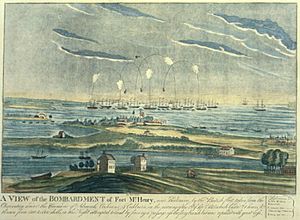
During the War of 1812, the British tried to capture Baltimore. The city was protected by Fort McHenry. While the fort was being bombed, Francis Scott Key wrote the song "The Star-Spangled Banner." This song later became the national anthem.
The National Road, later called U.S. Route 40, was approved in 1817. It was a federal highway from Baltimore to St. Louis. The Baltimore and Ohio Railroad (B&O) was the first railroad in the U.S. It opened its first section in 1830 between Baltimore and Ellicott City. In 1852, it was the first rail line to reach the Ohio River from the East Coast.
Maryland During the Civil War
Maryland remained with the Union during the American Civil War. This was partly due to its population and federal actions. In 1860, almost half of Maryland's African Americans were free.
To help ensure a pro-Union government, President Abraham Lincoln had some pro-slavery politicians arrested. This included the Mayor of Baltimore. He also suspended certain civil liberties and ordered cannons placed on Federal Hill overlooking Baltimore.
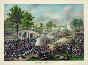
In April 1861, federal troops were attacked while marching through Baltimore. This event, known as the Baltimore riot of 1861, was the first bloodshed of the Civil War. About 85,000 Marylanders joined the Union army, while others joined the Confederate Army. The biggest battle in Maryland was the Battle of Antietam on September 17, 1862. It was one of the bloodiest battles of the war. Although it was a tactical draw, it was a major turning point for the Union.
After the Civil War
A new state constitution in 1864 ended slavery in Maryland. The state was then called a "Free State." After new laws gave voting rights to Black men, Maryland extended voting rights to non-white males in 1867.
The Democratic Party quickly regained power in Maryland. They replaced the 1864 Constitution with the Constitution of 1867. After the Reconstruction era ended in 1877, Democrats found ways to prevent Black people from voting. This included intimidation and later, new laws. However, Black people and immigrants fought against these efforts. Maryland's Black population was part of a Republican group elected to state government from 1896 to 1904.
Compared to other states, Black people in Maryland were better established before and after the Civil War. Many were free before the war and owned property. Half of the Black population lived in cities. Literacy was high among Black people. As Democrats tried to exclude them, voting campaigns helped educate Black voters on how to resist. However, white people did enforce racial segregation and Jim Crow laws. These laws lasted until the mid-1960s.
Baltimore grew a lot during the Industrial Revolution. Its seaport and good railroad connections attracted many European immigrants. Many factories were built in the Baltimore area after the Civil War. Businessmen like Johns Hopkins and Enoch Pratt founded important city institutions. These include a university, a library system, a music conservatory, and an art museum.
Cumberland was Maryland's second-largest city in the 1800s. Natural resources and railroads helped it become a major manufacturing center.
The 1900s: Modern Maryland
The Progressive Era in the late 1800s and early 1900s brought political changes. Laws were passed to make voting fairer. These included standard ballots and private voting booths. They also started primary elections to choose candidates. These changes made it harder for less educated people to vote. Black people fought against these efforts, with groups teaching voters.
Black people defeated three attempts to take away their voting rights. They formed alliances with immigrants to resist Democratic campaigns. Bills to remove voting rights in 1905, 1907, and 1911 were stopped. This was largely due to strong opposition from Black voters. Black people made up 20% of voters, and immigrants made up 15%. It was hard for the legislature to create laws that only hurt Black voters without also affecting immigrants.
The Progressive Era also improved working conditions. In 1902, Maryland regulated mines. It banned child labor for children under 12. It also made school attendance required. The state passed the nation's first workers' compensation law. This law was first overturned but was later rewritten and passed in 1910.
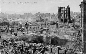
The Great Baltimore Fire of 1904 burned for over 30 hours. It destroyed 1,526 buildings across 70 city blocks. More than 1,231 firefighters worked to control the blaze.
When the U.S. entered World War I in 1917, new military bases were built. These included Camp Meade and the Aberdeen Proving Ground. Existing facilities like Fort McHenry were also greatly expanded.
In 1923, a congressman criticized Maryland for not passing Prohibition laws. In response, a newspaper editor called Maryland the "Free State." This nickname became popular.
Maryland's cities and rural areas had different experiences during the Great Depression. The "Bonus Army" marched through the state in 1932 on their way to Washington, D.C. Maryland started its first income tax in 1937 to fund schools and welfare.
Passenger and freight steamboat service, once very important on the Chesapeake Bay, ended in 1962.
Baltimore was a major war production center during World War II. Large operations included Bethlehem Steel's Fairfield Yard, which built ships. Glenn Martin was an aircraft manufacturer.
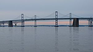
Maryland's population grew after World War II. Starting in the 1960s, suburbs grew around Washington, D.C., and Baltimore. The state began to feel more like the Mid-Atlantic region. Farmland was replaced by new communities. The Interstate Highway System was built, changing how people traveled. In 1952, the Chesapeake Bay Bridge connected the eastern and western parts of Maryland for the first time.
After WWII, Maryland's regions saw economic changes. Heavy manufacturing in Baltimore declined. In western Maryland, jobs in industry, railroads, and coal mining decreased. On the lower Eastern Shore, large farms and poultry operations became common. In Southern Maryland, tobacco farming almost disappeared due to new housing and a state program to buy out tobacco farms.
Baltimore started urban renewal projects in the 1960s. These projects aimed to bring people back to the city. Some projects led to the breakup of old neighborhoods. However, some older areas near the harbor were renovated and became popular.
Maryland's Geography and Nature
Maryland covers an area of about 12,407 square miles (32,133 square kilometers). It is the 42nd largest state and the 9th smallest. It is similar in size to Belgium.
What Maryland Looks Like
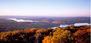
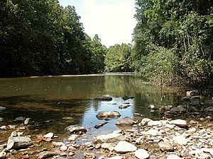

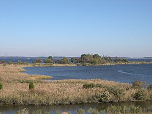
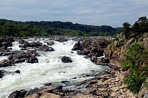
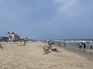
Maryland has many different types of land, which is why it's called America in Miniature. It has sandy dunes in the east with seagrass. There are also low marshlands with lots of wildlife near the Chesapeake Bay. In the Piedmont Region, you'll find rolling hills with oak forests. To the west, there are pine groves in the mountains.
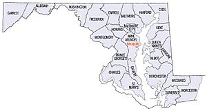
Maryland's northern border is with Pennsylvania. To the north and east is Delaware. The Atlantic Ocean is to its east. To the south and west, across the Potomac River, are West Virginia and Virginia. Washington, D.C. is in the middle of the border with Virginia. It sits on land that was once part of Maryland. The Chesapeake Bay almost cuts the state in half. The counties east of the bay are called the Eastern Shore.
Most of Maryland's waterways flow into the Chesapeake Bay. A tiny part of western Garrett County drains into the Mississippi River. The eastern part of Worcester County drains into Maryland's Atlantic coastal bays. A small part of the northeast corner drains into the Delaware River. The Chesapeake Bay is so important that some people want to change the state's nickname to the "Bay State."
The highest point in Maryland is Hoye Crest on Backbone Mountain. It is 3,360 feet (1024 meters) high. This is in the southwest corner of Garrett County. Near the town of Hancock, the state is very narrow. Less than 2 miles (3.2 km) separate its northern and southern borders.
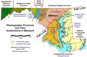
Parts of Maryland are in different geographic regions. The Delmarva Peninsula includes Maryland's Eastern Shore counties. Western Maryland is part of Appalachia. Much of the Baltimore–Washington area is in the Coastal Plain.
Maryland's Land and Rocks
Earthquakes are rare and small in Maryland. This is because the state is far from major earthquake zones. The 2011 Virginia earthquake was felt in Maryland. Buildings here are not designed for strong earthquakes, so they can be easily damaged.
Maryland has no natural lakes. All lakes in the state were built by people, mostly with dams.
Plants of Maryland
Maryland has many different plants. Enough rain falls each year to support various types of plants. These include seagrass and reeds. There are also huge white oak trees, which are the state tree. They can grow over 70 feet (21 meters) tall.
Around Chesapeake Bay and on the Delmarva Peninsula, you'll find forests typical of the southeastern Atlantic coast. Moving west, the central part of the state has a mix of northeastern and southeastern forests. The Appalachian Mountains in western Maryland have different types of forests.
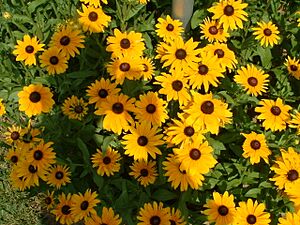
Many non-native plants are grown in Maryland. Some are for decoration, like the crape myrtle. Others are unique, like hardy palm trees in warmer areas. However, invasive plant species like kudzu and Japanese stiltgrass can harm native plants. Maryland's state flower, the black-eyed susan, grows widely across the state.
Animals of Maryland
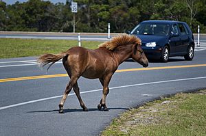
Maryland has a lot of white-tailed deer. This is especially true in the woody and mountainous western parts of the state. Sometimes, there are too many deer. Other mammals found here include black bears, bobcats, foxes, coyotes, raccoons, and otters.
There are wild (feral) horses on Assateague Island. People believe they are descendants of horses that escaped from Spanish shipwrecks. Every July, these horses are rounded up and swim across a shallow bay. They are then sold at Chincoteague, Virginia. This helps manage their population on the small island. The children's book Misty of Chincoteague made these ponies famous.
The Chesapeake Bay Retriever dog breed was developed for water sports and hunting in the Chesapeake area. It was the first retriever breed recognized by the American Kennel Club in 1878. The University of Maryland, Baltimore County uses it as their mascot.
Maryland's reptiles and amphibians include the diamondback terrapin turtle. This turtle is the mascot of the University of Maryland, College Park. The state bird is the Baltimore oriole, which is also the mascot of the MLB team, the Baltimore Orioles. Over 435 other bird species have been seen in Maryland.
The state insect is the Baltimore checkerspot butterfly.
Maryland's Environment
Maryland has joined with nearby states to improve the Chesapeake Bay. The bay's aquatic life and seafood industry are threatened by development and pollution. This pollution comes from fertilizers and farm animal waste.
In 2007, Forbes.com ranked Maryland as the fifth "Greenest" state. Maryland uses less toxic waste per person than most states. In April 2007, Maryland joined the Regional Greenhouse Gas Initiative (RGGI). This group works to reduce greenhouse gas emissions. In March 2017, Maryland became the first state with natural gas reserves to ban fracking.
Maryland's Climate

Maryland has many different climates. This is due to changes in elevation, how close it is to water, and protection from cold winds.
The eastern half of Maryland, including Ocean City and Annapolis, has a humid subtropical climate. This means it has hot, humid summers and cool to cold winters.
The Piedmont region, including northern Baltimore and Frederick, gets more snow. Temperatures below 10°F (–12°C) are less common here. From the Cumberland Valley westward, the climate becomes more humid continental climate.
In western Maryland, higher areas like Allegany and Garrett counties have a humid continental climate. This is because of their higher elevation.
Maryland gets a lot of rain, from 35 to 45 inches (890 to 1140 mm) annually. Most parts of the state receive 3.5 to 4.5 inches (89 to 114 mm) of rain each month. Average annual snowfall varies from 9 inches (23 cm) near the coast to over 100 inches (250 cm) in the western mountains.
Because it's on the Atlantic Coast, Maryland can be affected by tropical cyclones. However, the Delmarva Peninsula and North Carolina's outer banks offer protection. Major hurricanes are rare. Maryland usually gets the weaker remnants of tropical storms. The state averages 30–40 days of thunderstorms a year and about six tornado strikes annually.
| City | Jan | Feb | Mar | Apr | May | Jun | Jul | Aug | Sep | Oct | Nov | Dec |
|---|---|---|---|---|---|---|---|---|---|---|---|---|
| Oakland | 34°F 16°F |
38°F 17°F |
48°F 25°F |
59°F 34°F |
68°F 45°F |
75°F 53°F |
79°F 58°F |
78°F 56°F |
71°F 49°F |
62°F 37°F |
50°F 28°F |
39°F 21°F |
| Cumberland | 41°F 22°F |
46°F 24°F |
56°F 32°F |
68°F 41°F |
77°F 51°F |
85°F 60°F |
89°F 65°F |
87°F 63°F |
80°F 55°F |
69°F 43°F |
57°F 34°F |
45°F 26°F |
| Hagerstown | 39°F 22°F |
42°F 23°F |
52°F 30°F |
63°F 39°F |
72°F 50°F |
81°F 59°F |
85°F 64°F |
83°F 62°F |
76°F 54°F |
65°F 43°F |
54°F 34°F |
43°F 26°F |
| Frederick | 42°F 26°F |
47°F 28°F |
56°F 35°F |
68°F 45°F |
77°F 54°F |
85°F 63°F |
89°F 68°F |
87°F 66°F |
80°F 59°F |
68°F 47°F |
56°F 38°F |
45°F 30°F |
| Baltimore | 42°F 29°F |
46°F 31°F |
54°F 39°F |
65°F 48°F |
75°F 57°F |
85°F 67°F |
90°F 72°F |
87°F 71°F |
80°F 64°F |
68°F 52°F |
58°F 43°F |
46°F 33°F |
| Elkton | 42°F 24°F |
46°F 26°F |
55°F 32°F |
67°F 42°F |
76°F 51°F |
85°F 61°F |
88°F 66°F |
87°F 65°F |
80°F 57°F |
69°F 45°F |
58°F 36°F |
46°F 28°F |
| Ocean City | 45°F 28°F |
46°F 29°F |
53°F 35°F |
61°F 44°F |
70°F 53°F |
79°F 63°F |
84°F 68°F |
82°F 67°F |
77°F 60°F |
68°F 51°F |
58°F 39°F |
49°F 32°F |
| Waldorf | 44°F 26°F |
49°F 28°F |
58°F 35°F |
68°F 43°F |
75°F 53°F |
81°F 62°F |
85°F 67°F |
83°F 65°F |
78°F 59°F |
68°F 47°F |
59°F 38°F |
48°F 30°F |
| Point Lookout State Park | 47°F 29°F |
51°F 31°F |
60°F 38°F |
70°F 46°F |
78°F 55°F |
86°F 64°F |
89°F 69°F |
87°F 67°F |
81°F 60°F |
71°F 49°F |
61°F 41°F |
50°F 32°F |
| ' | ||||||||||||
Cities and Metro Areas
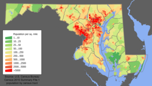
Most people in Maryland live in the central part of the state. This includes the Baltimore metropolitan area and Washington metropolitan area. These areas are part of the larger Baltimore–Washington metropolitan area. The largest number of people live in and around Baltimore, Maryland's biggest city, and the suburbs of Washington, D.C.. Historically, many Maryland cities grew along the Fall Line. This is where rivers have rapids and waterfalls. Annapolis, the state capital, is an exception. It is on the Severn River, near where it flows into the Chesapeake Bay.
The Eastern Shore has fewer people and is more rural. The same is true for western Maryland. The two westernmost counties, Allegany and Garrett, are mountainous and have few residents. They look more like West Virginia and Appalachia. Both eastern and western Maryland have important regional cities. These include Ocean City and Salisbury on the Eastern Shore. In Western Maryland, there are cities like Cumberland and Frostburg. Southern Maryland is still somewhat rural. However, suburban growth from Washington, D.C., has increased since the 1960s. Important towns there include Lexington Park and Waldorf.
| Rank | Name | Pop. |
|---|---|---|
| 1 | Baltimore | 585,708 |
| 2 | Columbia | 104,681 |
| 3 | Germantown | 91,249 |
| 4 | Waldorf | 81,410 |
| 5 | Silver Spring | 81,015 |
| 6 | Frederick | 78,171 |
| 7 | Ellicott City | 75,947 |
| 8 | Glen Burnie | 72,891 |
| 9 | Gaithersburg | 69,657 |
| 10 | Bethesda | 68,056 |
How Maryland is Governed
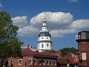
Maryland's government follows its own state constitution. Like other U.S. states, Maryland has power over matters within its borders. This power is limited by the Constitution of the United States.
Power in Maryland is split into three parts: the executive, legislative, and judicial branches. The Maryland General Assembly makes the laws. It has two parts: the Maryland House of Delegates and the Maryland Senate. Maryland's governor has a lot of power over the state budget. Many of Maryland's counties also have a lot of independence.
Most government work happens in Annapolis, the state capital. However, some government offices are in Baltimore. Elections for governor and most state offices are held every four years, during midterm election years.
The judicial branch includes the Maryland District Court, which is in every county and Baltimore City. There are also 24 Maryland Circuit Courts. These courts handle major civil and criminal cases. The appeals court is the Appellate Court of Maryland. The highest court is the Supreme Court of Maryland. The justices of the Supreme Court of Maryland wear unique red robes.
Maryland's People
| Historical population | |||
|---|---|---|---|
| Census | Pop. | %± | |
| 1790 | 319,728 | — | |
| 1800 | 341,548 | 6.8% | |
| 1810 | 380,546 | 11.4% | |
| 1820 | 407,350 | 7.0% | |
| 1830 | 447,040 | 9.7% | |
| 1840 | 470,019 | 5.1% | |
| 1850 | 583,034 | 24.0% | |
| 1860 | 687,049 | 17.8% | |
| 1870 | 780,894 | 13.7% | |
| 1880 | 934,943 | 19.7% | |
| 1890 | 1,042,390 | 11.5% | |
| 1900 | 1,188,044 | 14.0% | |
| 1910 | 1,295,346 | 9.0% | |
| 1920 | 1,449,661 | 11.9% | |
| 1930 | 1,631,526 | 12.5% | |
| 1940 | 1,821,244 | 11.6% | |
| 1950 | 2,343,001 | 28.6% | |
| 1960 | 3,100,689 | 32.3% | |
| 1970 | 3,922,399 | 26.5% | |
| 1980 | 4,216,975 | 7.5% | |
| 1990 | 4,781,468 | 13.4% | |
| 2000 | 5,296,486 | 10.8% | |
| 2010 | 5,773,552 | 9.0% | |
| 2020 | 6,177,224 | 7.0% | |
| 2023 (est.) | 6,180,253 | 7.0% | |
| Source: 1910–2020 | |||
In the 2020 census, Maryland's population was 6,185,278 people. This was a 7.1% increase from the 2010 census. The U.S. Census Bureau estimated the population was 6,045,680 on July 1, 2019. This was a 4.71% increase from 2010.
Maryland's history as a border state means it has traits from both the Northern and Southern regions. Rural Western Maryland has an Appalachian culture. The Southern and Eastern Shore regions have a Southern culture. Central Maryland, around Baltimore and Washington, D.C., is more like the Northeast. The U.S. Census Bureau calls Maryland one of the South Atlantic States. However, other groups often link it with the Mid-Atlantic States and Northeast.
Languages and Backgrounds
Racial makeup of Maryland excluding Hispanics from racial categories (2019)
NH = Non-Hispanic White NH (49.82%) Black NH (29.75%) Asian NH (6.35%) Native American NH (0.25%) Pacific Islander NH (0.04%) Two or more races NH (2.85%) Other NH (0.31%) Hispanic Any Race (10.64%)
As of 2016, the most common languages spoken in Maryland, besides English, were Spanish (9%), Chinese (1.2%), and West African languages (1%). Other languages include French, Korean, and Tagalog.
| Racial composition | 1970 | 1990 | 2000 | 2010 | 2020 |
|---|---|---|---|---|---|
| White | 81.5% | 71.0% | 64.0% | 60.8% | 58.5% |
| Black | 17.8% | 24.9% | 27.9% | 29.8% | 31.1% |
| Asian | 0.5% | 2.9% | 4.0% | 5.5% | 6.7% |
| Native American | 0.1% | 0.3% | 0.3% | 0.3% | 0.6% |
| Other race | 0.1% | 0.9% | 1.8% | 3.6% | – |
| Two or more races | – | – | 2.0% | 2.9% | 2.9% |
| Non-Hispanic whites | 80.4% | 69.6% | 62.1% | 54.7% | 50.0% |

| Non-Hispanic White 40–50% 50–60% 60–70% 70–80% 80–90% 90%+ | Black or African American 50–60% 60–70% |
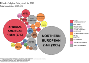
In 2019, non-Hispanic white Americans made up 49.8% of Maryland's population. This means Maryland is a "majority minority" state. 50.2% of Maryland's population is non-white or Hispanic/Latino. This is the highest percentage on the East Coast. Maryland's diversity comes from its large African American population and immigration. Many people come from Central America, Africa, the Caribbean, and Asia.
African Americans make up a large part of the state's population, 31.1% in 2020. Most are descendants of people brought to the area as enslaved people. Many African Americans live in Baltimore City, Prince George's County, and Charles County. Charles County and Prince George's County have some of the highest average household incomes for African Americans in the country.
Maryland has the highest percentage of residents born in Africa among all states. These include immigrants from Nigeria, Ethiopia, Cameroon, and Ghana. Maryland also has people from other African and Caribbean nations. Maryland's African immigrant population is often well-educated. They are mostly found in the suburbs of Baltimore and D.C. The Washington D.C. area has the largest population of Ethiopians outside of Ethiopia.
The top reported ancestries for Maryland residents are: German (15%), Irish (11%), and English (8%).
Irish American populations are found throughout the Baltimore area. They are also in the northern and eastern suburbs of Washington, D.C. Smaller, older Irish populations are in Southern Maryland. These communities still hold cultural festivals.
A large number of people on the Eastern Shore and in Southern Maryland are descendants of British Americans. The Eastern Shore was settled by Protestants. The southern counties were first settled by English Catholics. Western and northern Maryland have many German-American people.
Later European immigrants in the late 1800s and early 1900s settled in Baltimore. They were attracted by factory jobs. These groups were largely Jewish, Italian, Greek, and Polish. Many of them lived in Southeast Baltimore and influenced the city's culture. Maryland has a significant Jewish American presence. It has the fifth-highest percentage of Jewish residents in the country.
The number of European immigrants from Eastern Europe grew a lot between 1990 and 2010. After the Soviet Union broke up, many immigrants came to the U.S. 12% of them now live in Maryland.
Hispanic immigrants of the late 20th century settled in areas like Aspen Hill and Hyattsville. Maryland has the highest percentage of residents from Central America. Salvadorans are the largest Hispanic group in Maryland. The D.C. area has the highest percentage of Salvadorans of any American metro area. Other Hispanic groups include Mexicans, Guatemalans, and Hondurans. Maryland's Hispanic population is very diverse.
Caribbean Americans have a strong presence in Maryland. This includes Jamaican Americans, who make up 0.6% of the population. Maryland's current governor, Wes Moore, is the son of a Jamaican immigrant mother. Other Caribbean groups include Dominicans and Haitians. Caribbean Americans are mostly in Prince George's County and Baltimore.
Asian Americans are concentrated in the suburbs around Washington, D.C., and Baltimore. This is especially true in Howard County. There are Chinese American, Korean American, and Taiwanese American communities in Rockville and Gaithersburg. Chinese people are the second largest Asian American group. Maryland also has a large Korean American population. There is a Koreatown in Ellicott City.
Filipino Americans are the largest group of Southeast Asians. They form communities in Montgomery, Prince George's, and Charles counties. Other large groups include Vietnamese and Burmese. Maryland has a very large and diverse South Asian American population. Indian Americans are the largest Asian group in Maryland. They live throughout the state, especially in Montgomery and Howard counties. There are also large Pakistani American and Bangladeshi American communities. Maryland has one of the largest populations of Nepali Americans in the U.S.
Maryland attracts educated Asians and Africans for professional jobs. This makes it the state with the fifth-largest proportion of racial minorities.
In 2006, 645,744 people were counted as foreign-born. Most of these were from Latin America and Asia.
Religion in Maryland
| Religion in Maryland (2014) | ||||
|---|---|---|---|---|
| religion | percent | |||
| Protestant | 52% | |||
| None | 23% | |||
| Catholic | 15% | |||
| Jewish | 3% | |||
| Other faiths | 2% | |||
| Buddhist | 1% | |||
| Hindu | 1% | |||
| Islam | 1% | |||
| Mormon | 1% | |||
| Orthodox Christian | 1% | |||
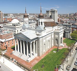
Maryland has a special place in American Catholic history. The English colony of Maryland was meant to be a safe place for English Catholics. Baltimore was home to the first Catholic bishop in the U.S. in 1789. Emmitsburg is where the first American-born saint, St. Elizabeth Ann Seton, lived and was buried. Georgetown University, the first Catholic University, was founded in 1789. The Basilica of the National Shrine of the Assumption of the Virgin Mary in Baltimore was the first Roman Catholic cathedral built in the U.S. Many Catholic immigrants came from Eastern and Southern Europe in the 1800s and 1900s.
Even with its Catholic history, the percentage of Catholics in Maryland is lower than the national average. Both Protestants and people with no religious affiliation are more numerous than Catholics.
In 2014, the Pew Research Center reported that 69% of Maryland's population identified as Christian. About 52% of adults are Protestants. Catholicism is the second largest Christian group, making up 15% of the population. Amish and Mennonite communities are found in St. Mary's, Garrett, and Cecil counties.
Judaism is the largest non-Christian religion in Maryland, with 241,000 followers. Jews are numerous in Montgomery County and northwest of Baltimore. The Seventh-day Adventist Church's world headquarters is in Silver Spring. The Ahmadiyya Muslims' national headquarters is also there.
Maryland's Economy
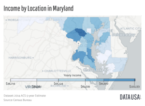
In 2016, Maryland's total economic output was $382.4 billion. Maryland also uses a "Genuine Progress Indicator" to measure well-being. This is different from just using economic growth. According to the U.S. Census Bureau, Maryland households are the wealthiest in the country. In 2013, the median household income was $72,483. Two of Maryland's counties, Howard and Montgomery, are among the wealthiest in the nation. Maryland also has the most millionaires per person. Its poverty rate of 7.8% is the lowest in the country.
Maryland's economy benefits from being close to the federal government in Washington, D.C.. There's a focus on technical and administrative jobs. These include defense, aerospace, and bio-research. Many government offices are in the Baltimore/Washington suburbs. Fort Meade is home to the Defense Information Systems Agency and the National Security Agency. Many colleges and medical research centers are also in the state. The Johns Hopkins University and its medical facilities are the largest employer in Baltimore. White-collar technical and administrative workers make up 25% of Maryland's workforce.
Manufacturing is diverse, with no single area dominating. It includes electronics, computer equipment, and chemicals. The steel industry, once very strong, still exists but faces challenges. During World War II, the Glenn Martin Company, an airplane factory, employed about 40,000 people.
Mining is mostly limited to coal in western Maryland. Historically, brownstone quarries were important. There used to be small gold-mining operations, but they no longer exist.
In 2022, top private employers included Johns Hopkins University Applied Physics Laboratory and Northrop Grumman.
Port of Baltimore
Transportation is a major service industry. It centers on the Port of Baltimore and its rail and trucking connections. In 2008, the port was 17th in the U.S. by tonnage. It handles many products, especially raw materials like iron ore and petroleum. These are often sent to factories in the Midwest. The port also receives many imported cars and is the number one auto port in the U.S.
Baltimore City is among the top 15 largest ports in the nation. The state is heavily industrialized. It has a growing economy and important technology centers. Its computer industries are very advanced. The federal government has invested a lot in the area. Maryland has several large military bases and many high-level government jobs.
The Chesapeake and Delaware Canal is a 14-mile (23 km) canal on the Eastern Shore. It connects the Delaware River to the Chesapeake Bay. It is especially important for the Port of Baltimore, carrying 40% of its ship traffic.
Fishing Industry
Maryland has a large food production sector. A big part of this is commercial fishing. This is mainly in the Chesapeake Bay, but also off the Atlantic coast. The biggest catches are blue crab, oysters, and striped bass. The Bay also has many waterfowl in its wildlife refuges. These birds support a tourism sector for sportsmen.
Agriculture in Maryland
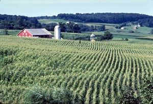
Maryland has large areas of fertile farmland. This is in its coastal and Piedmont regions. However, new housing developments are taking over some of this land. Farming focuses on dairy for nearby cities. It also grows special crops like cucumbers, watermelons, sweet corn, and tomatoes. The southern counties used to grow a lot of tobacco. This has greatly declined since the 1990s. There is also a large automated chicken-farming industry in the southeastern part of the state. Salisbury is home to Perdue Farms. Maryland's food-processing plants are the most important type of manufacturing by value.
Biotechnology and Research
Maryland is a major center for life sciences research. It has over 400 biotechnology companies. This makes it the fourth largest hub in this field in the United States.
Many important research institutions are in Maryland. These include the Johns Hopkins University and the Johns Hopkins Applied Physics Laboratory. There are also several campuses of the University System of Maryland. Government agencies like the Goddard Space Flight Center and the National Institutes of Health (NIH) are here. The Walter Reed National Military Medical Center and the federal Food and Drug Administration (FDA) are also located in Maryland.
Maryland is home to Emergent BioSolutions. This company makes and provides an anthrax vaccine to U.S. military personnel.
Tourism in Maryland
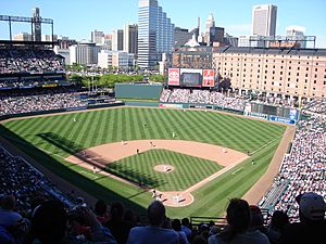
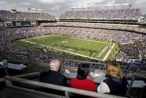
Tourism is popular in Maryland. Many visitors go to Baltimore, the beaches of the Eastern Shore, and the nature in western Maryland. In Baltimore, attractions include the Harborplace, the Baltimore Aquarium, and Fort McHenry. The Camden Yards baseball stadium is also a big draw. Ocean City on the Atlantic Coast is a popular beach spot. This has been especially true since the Chesapeake Bay Bridge was built in 1952.
The state capital of Annapolis has sites like the state capitol building and a historic district. Maryland also has many military history sites. These include places important to the American Civil War and the War of 1812. Other attractions are the historic towns along the Chesapeake Bay. One example is Saint Mary's, Maryland's first colonial settlement.
Getting Around Maryland
The Maryland Department of Transportation manages most transportation in the state. The Maryland Transportation Authority operates the state's eight toll facilities.
Roads and Highways
Maryland has several Interstate highways. I-95 runs through the state, including Baltimore. It also forms part of the Capital Beltway. I-68 connects western Maryland to I-70. I-70 runs from Pennsylvania to Baltimore, passing through Hagerstown and Frederick.
I-83 connects Baltimore to southern central Pennsylvania. Maryland also has a short section of I-81 near Hagerstown. I-97 is entirely within Anne Arundel County. It connects the Baltimore area to Annapolis. It is the shortest one- or two-digit interstate highway in the U.S.
There are also several auxiliary Interstate highways. These include two beltways around major cities. I-695 circles Baltimore. A part of I-495 circles Washington, D.C.. I-270 connects Frederick to Northern Virginia and Washington, D.C. It is a major commuter route and can be as wide as fourteen lanes. I-895 offers another route across Baltimore Harbor.
I-270 and the Capital Beltway used to have a lot of traffic. The Intercounty Connector (ICC; MD 200) has helped ease some of this congestion. I-595 is an unsigned highway. It runs with US 50/US 301. It connects Prince George's County and Washington, D.C., to Annapolis and the Eastern Shore via the Chesapeake Bay Bridge.
Maryland also has a state highway system. Major state highways include Routes 2, 4, 5, 32, 45, 97, 100, 210, 235, 295, 355, 404, and 650.
Airports in Maryland
Maryland's largest airport is Baltimore-Washington International Thurgood Marshall Airport, or BWI. It is named after Thurgood Marshall, the first African-American Supreme Court justice. The only other airports with commercial flights are in Hagerstown and Salisbury.
The Maryland suburbs of Washington, D.C., also use two other airports. These are Ronald Reagan Washington National Airport and Dulles International Airport. Both are in Northern Virginia. The College Park Airport is the nation's oldest, founded in 1909. It is still in use today.
Rail Travel
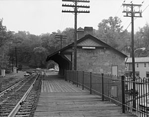
Amtrak trains serve several stations in Maryland. These include Penn Station in Baltimore, BWI Airport, and New Carrollton. The high-speed Acela Express also uses this route. Train service to Rockville and Cumberland is provided by Amtrak's Capitol Limited.
The WMATA's Metrorail and Metrobus systems serve Montgomery and Prince George's counties. They connect these areas to Washington, D.C. The Maryland Transit Administration (MTA Maryland) also provides transit services. These services are mostly in central Maryland. Baltimore's Light RailLink and Metro SubwayLink systems serve the city and its suburbs. The MTA also has a local bus service. The MTA's Commuter Bus system provides express service on longer routes.
The commuter rail service, called MARC, has three lines. All of them end at Washington Union Station. They serve Baltimore, Perryville, Frederick, and Martinsburg, West Virginia. Many suburban counties also have local bus systems. These connect to the larger MTA and WMATA/Metro services.
The MTA will also manage the Purple Line. This is a light rail line being built. It will connect different lines of the Washington Metro. It will also offer transfers to the MARC commuter rail system.
Freight rail transport is mainly handled by two large railroad companies. These are CSX Transportation and Norfolk Southern Railway. Major rail yards are in Baltimore and Cumberland. There is also an intermodal terminal in Baltimore. This terminal connects rail, truck, and marine transport.
Media in Maryland
A well-known newspaper in Maryland is The Baltimore Sun. Many people in the Washington metropolitan area read The Washington Post.
Most populated areas get TV and radio stations from either Baltimore or Washington, D.C.. The Eastern Shore mainly gets broadcasts from the Delmarva Peninsula. The northeastern part receives stations from both Baltimore and Philadelphia. Garrett County, which is mountainous, gets stations from Pittsburgh. People there need cable or satellite to watch TV. Maryland has a statewide PBS station called Maryland Public Television (MPT).
Education in Maryland
Schools for Kids and Teens
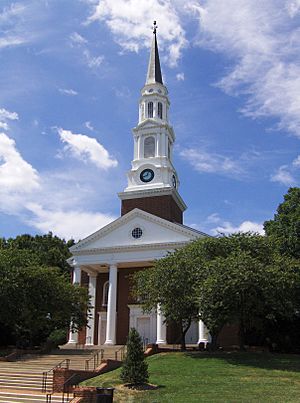
Education Week ranked Maryland #1 in its "Quality Counts" reports from 2009–2013. The College Board also ranked Maryland first for students passing Advanced Placement (AP) exams. Primary and secondary education is managed by the Maryland State Department of Education. Its main office is in Baltimore. The highest education official is the State Superintendent of Schools. This person is appointed by the State Board of Education.
Each county in Maryland has a local Board of Education. These boards run the public schools in their area. The education budget was $5.5 billion in 2009. This was about 40% of the state's general fund. In 2017, four Maryland school districts were among the top six for spending per student.
Maryland has many private schools. Many are connected to religious groups. These include parochial schools (Catholic), Quaker schools, and Jewish schools. In 2003, Maryland allowed publicly funded charter schools. These schools must be approved by their local Board of Education.
In 2008, Maryland led the country in the percentage of students passing Advanced Placement exams. 23.4% of students earned passing grades. Three Maryland high schools were ranked among the top 100 in the country in 2009. This was largely based on their AP test scores.
Colleges and Universities
Maryland has several old and famous private colleges and universities. The most well-known is Johns Hopkins University. It was founded in 1876 by Baltimore businessman Johns Hopkins.
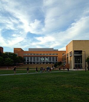
The first public university in the state is the University of Maryland, Baltimore. It was founded in 1807. It has the University of Maryland's only public health and law schools. These schools train most of the state's doctors, nurses, lawyers, and pharmacists. The main university and largest undergraduate school is the University of Maryland, College Park. It started as an agricultural college in 1856. Towson University, founded in 1866, is the state's second largest university.
In 1974, Maryland and seven other states worked to desegregate their state universities. Maryland's plans were approved.
Baltimore is home to the University of Maryland, Baltimore County and the Maryland Institute College of Art. Most public universities are part of the University System of Maryland. Two state-funded schools, Morgan State University and St. Mary's College of Maryland, are not part of this system. Two federally funded schools, the Uniformed Services University of the Health Sciences and the United States Naval Academy, are also separate. The University of Maryland Global Campus is the largest public university in Maryland. It is also one of the largest distance-learning schools in the world.
St. John's College in Annapolis and Washington College in Chestertown are private schools. They are the oldest colleges in the state. Other private schools include Mount St. Mary's University and Loyola University Maryland.
Public Libraries
Maryland's 24 public library systems offer education for everyone. They provide books and materials in all formats. They also offer research help and classes for all ages. Libraries host events like Summer Reading Clubs.
Maryland's library systems include:
- Anne Arundel County Public Library
- Baltimore County Public Library
- Cecil County Public Library
- Enoch Pratt Free Library
- Frederick County Public Library
- Harford County Public Library
- Howard County Public Library
- Montgomery County Public Libraries
- Prince George's County Memorial Library System
- St. Mary's County Public Library
Many library systems work with other schools in their areas.
Sports in Maryland
Maryland has many professional sports teams. Two National Football League (NFL) teams play in Maryland. These are the Baltimore Ravens in Baltimore and the Washington Commanders in Landover. The Baltimore Colts used to play in Baltimore from 1953 to 1983.
The Baltimore Orioles are the state's Major League Baseball team. The National Hockey League's Washington Capitals and the National Basketball Association's Washington Wizards used to play in Maryland. They moved to an arena in Washington, D.C., in 1997. The University of Maryland's team is the Maryland Terrapins.
Maryland is known for its talented athletes from the past. These include Cal Ripken Jr. and Babe Ruth. In 2012, The Baltimore Sun listed Maryland's top ten athletes. This list included Babe Ruth, Cal Ripken Jr., Johnny Unitas, and Michael Phelps.
Other professional sports teams in Maryland include minor league baseball teams. There is also the Baltimore Blast indoor soccer team. Maryland hosts one of horse racing's Triple Crown races, the Preakness Stakes. This race is held every spring at Pimlico Race Course in Baltimore.
Congressional Country Club has hosted major golf tournaments.
The official state sport of Maryland, since 1962, is jousting. The official team sport since 2004 is lacrosse. The National Lacrosse Hall of Fame is in Sparks, Maryland. In 2008, walking became the official state exercise. This was to encourage physical fitness. Maryland is the first state with an official state exercise.
Friendship Partners Around the World
Maryland has special relationships with many regions and countries worldwide.
 Bong and Maryland Counties, in Liberia
 Jalisco, Mexico (1996)
 Cross River and Ondo States, Nigeria
 Kwazulu-Natal, South Africa
 Medan Marelan, Indonesia
|
See also
 In Spanish: Maryland para niños
 | Delilah Pierce |
 | Gordon Parks |
 | Augusta Savage |
 | Charles Ethan Porter |


