Chesapeake Bay Bridge facts for kids
Quick facts for kids Chesapeake Bay Bridge |
|
|---|---|
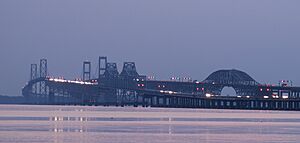
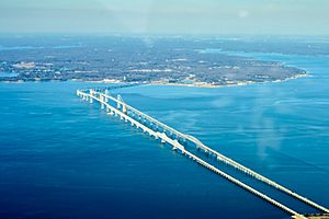
Both spans of the Chesapeake Bay Bridge in 2009
|
|
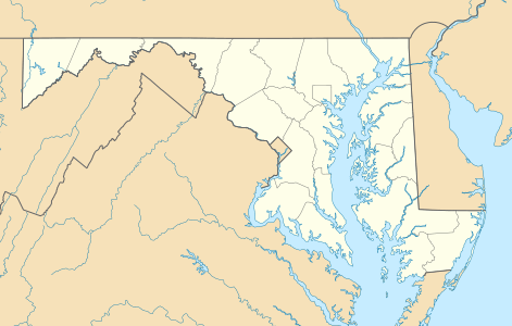
| Coordinates | 38°59′30″N 76°22′20″W / 38.99167°N 76.37222°W |
| Carries | 5 lanes of |
| Crosses | Chesapeake Bay |
| Locale | Anne Arundel and Queen Anne's Counties, Maryland |
| Official name | Gov. William Preston Lane Jr. Memorial Bridge |
| Other name(s) | "Bay Bridge" |
| Maintained by | Maryland Transportation Authority, State of Maryland |
| ID number | AAZ050 |
| Characteristics | |
| Design | Cantilever bridge (eastbound), Continuous truss bridge (westbound), and Suspension bridges (both spans) |
| Material | steel, concrete |
| Total length | 21,273 ft (6,484.0 m) (eastbound) 21,047 ft (6,415.1 m) (westbound) |
| Width | 28 ft (8.5 m) (eastbound) 38 ft (11.6 m) (westbound) |
| Height | 354 ft (107.9 m) (eastbound) 379 ft (115.5 m) (westbound) |
| Longest span | 1,600 ft (488 m) |
| Clearance below | 186 ft (56.7 m) |
| History | |
| Opened | July 30, 1952 (eastbound) June 28, 1973 (westbound) |
| Statistics | |
| Daily traffic | 61,000 |
| Toll | $6.00 (eastbound only) |
The Gov. William Preston Lane Jr. Memorial Bridge, often called the Chesapeake Bay Bridge or just the Bay Bridge, is a huge dual-span bridge in Maryland, USA. It stretches across the Chesapeake Bay, connecting the state's rural Eastern Shore with its busy Western Shore. The bridge links Stevensville and Sandy Point State Park near Annapolis.
The first part of the bridge opened in 1952. It was about 4 miles (6.4 km) long. At that time, it was the longest continuous over-water steel structure in the world. A second, parallel part was added in 1973. The bridge is named after William Preston Lane Jr., who was the 52nd Governor of Maryland. He helped start its construction in the late 1940s.
This bridge is a key part of U.S. Route 50 (US 50) and US 301. It connects the Baltimore–Washington Metropolitan Area to popular beach spots like Ocean City, Maryland and Rehoboth Beach, Delaware. It also offers an alternative route for travelers on Interstate 95. The bridge can get very busy, especially during holidays and summer.
Before the bridge, people used ferries to cross the bay. The bridge has helped Maryland's economy grow, especially in Queen Anne's County and Ocean City. There have been talks about building a third part of the bridge since 2004.
Contents
Bridge History
Early Ideas and Ferries
People might have thought about building a bridge across the Chesapeake Bay as early as the 1880s. The first known idea came in 1907. It suggested a crossing between Baltimore and Tolchester Beach. In 1927, local business people were allowed to fund a bridge there. Plans were made, but the project stopped after the Wall Street Crash of 1929. This crash led to the Great Depression in the 1930s.
Ferries were the main way to cross the bay from colonial times until the 1952 bridge was finished. The first ferry service went from Annapolis to Broad Creek on Kent Island. This is close to where the bridge is now. In 1919, the Claiborne–Annapolis Ferry Company started ferries between Annapolis and Claiborne.
In 1930, the ferry company added a new route from Annapolis to Matapeake. This was a much shorter trip. The state took over the ferries in 1941. Two years later, the ferry's western stop moved to Sandy Point. This made the cross-bay trip even shorter.
Building the First Span (1952)
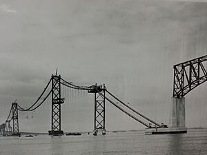
In 1938, the Maryland General Assembly first suggested a bridge at the Sandy Point–Kent Island spot. The law to build it passed, but World War II delayed construction. After the war, in 1947, Governor William Preston Lane Jr. helped pass a law to start building.
Work began in January 1949. After three and a half years, the bridge opened on July 30, 1952. It was the longest continuous over-water steel structure and the third longest bridge in the world. Before it opened, a parade of cars made the first official crossing. Governor Theodore McKeldin led the way. On November 9, 1967, the bridge was named the "William Preston Lane Jr. Memorial Bridge" to honor Governor Lane.
Adding the Second Span (1973)
By 1967, more and more cars were using the bridge. The Maryland General Assembly looked at three ideas for new crossings. One idea was to add another span to the existing bridge. This idea was chosen.
Construction of the new parallel span started in 1969. It was built north of the first bridge. This second span was finished on June 28, 1973.
From 1986 to 1988, the eastbound bridge deck was replaced. All traffic used the westbound span during this time. From 2006 to 2010, the westbound bridge deck was also replaced.
Important Events
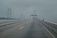
The Bay Bridge is known for its height and narrow lanes. It also has low guardrails and often experiences strong winds. Because of this, some people find it a bit scary to drive across.
The bridge has closed four times due to very bad weather.
- September 18, 2003: Closed during Hurricane Isabel due to high winds.
- August 27, 2011: Closed during Hurricane Irene when winds were over 55 miles per hour (89 km/h).
- October 29, 2012: Closed due to Hurricane Sandy.
- March 6, 2013: Closed again due to high winds during a nor'easter.
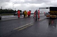
On August 10, 2008, a truck fell from the bridge after a crash. The driver died. This made people worry about the bridge's safety. However, the Maryland Transportation Authority (MDTA) said there were no major structural problems. They did find some rust in the barriers and fixed them right away.
On June 24, 2024, traffic on both parts of the bridge stopped for about 30 minutes. This happened when the cargo ship MV Dali passed underneath. The Dali was the ship that had crashed into Baltimore's Francis Scott Key Bridge in March 2024, causing it to collapse.
Bridge Details and How It Works
The two parts of the bridge are the longest fixed water crossing in Maryland. They are about 3.83 and 4.03 miles (6.16 and 6.49 km) long from shore to shore. The western end of the bridge is in Sandy Point State Park, near Annapolis. The eastern end is in Stevensville on Kent Island. The older span is 354 feet (108 m) high, and the newer span is 379 feet (116 m) high.
How the Bridge is Built
The two spans are built in similar ways, even though one has two lanes and the other has three. Both were designed by J. E. Greiner Company. Each span has:
- Two main sections over the bay's shipping channels:
- A 3,200-foot (975 m) long suspension section over the western channel. It has a clearance of 186 feet (56.7 m). This is high enough for large ships.
- A 690-foot (210 m) cantilever section over the eastern channel.
- Other sections made of steel and concrete beams closer to the shores.
- A curve near the western end. This curve helps the main sections cross the shipping channels at a 90-degree angle, as required by rules.
Controlling Traffic
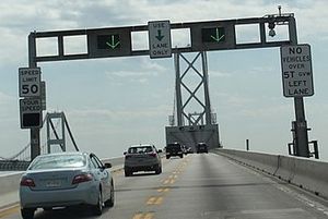
The bridge has five lanes, and traffic can be changed using overhead signals. Usually, the two lanes on the south span are for eastbound traffic (US 50/US 301). The three lanes on the north span are for westbound traffic. So, they are called the "eastbound span" and "westbound span."
However, this changes during busy times or incidents. For example, on weekends, one lane on the westbound span might be used for eastbound traffic to help beach-bound cars.
In 2006, pink markers were put on the eastbound span. These markers help drivers keep a safe distance from the car in front. This is part of the "Pace Your Space" campaign to prevent crashes and traffic jams.
In April 2013, safety changes were made for when traffic goes both ways on the westbound span. Signs, road markings, and rumble strips were updated. A buffer zone was added between lanes. This means drivers cannot switch lanes in that area. Two-way traffic can also happen on the eastbound span during roadwork or emergencies. When one span is closed for work, the other span will have two-way traffic.
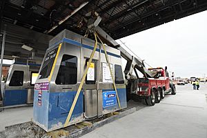
In January 2020, Governor Larry Hogan announced that tollbooths on the eastbound side were being removed. This was to prepare for all-electronic tolling. This means you pay tolls without stopping. The MDTA is also adding new lane signals and an automated gate system. This system will make it faster to set up two-way traffic. It will also reduce traffic jams.
The MDTA used to use cones and barrels to guide traffic. Now, illuminated road markings will show where lanes cross over. This means crews won't have to manually move cones. The MDTA does not allow two-way traffic in bad weather like heavy rain or high winds. If winds are over 55 miles per hour (89 km/h), all traffic might stop. When traffic goes both ways, the speed limit for that lane is 40 miles per hour (64 km/h), while other lanes stay at 50 miles per hour (80 km/h).
Tolls and Fees
The Maryland Transportation Authority (MDTA) operates the bridge. The toll for a two-axle vehicle going eastbound is $4.00. If you have a Maryland E-ZPass, it's $2.50.
Before April 1989, tolls were collected in both directions. Then, they were doubled and only collected going eastbound. In 2005, E-ZPass lanes were added.
All-electronic tolling started on May 12, 2020. You can pay with E-ZPass or Video Tolling. Video Tolling uses cameras to read your license plate.
Private companies now offer services to drive nervous drivers across the bridge.
Bay Bridge Walk and Run Events
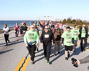
The bridge does not have sidewalks for walking. However, the Bay Bridge Walk and Governor's Bay Bridge Run used to let people cross on foot. These events usually happened on the first Sunday in May. The eastbound span was closed to cars, and two-way traffic used the westbound span. People started on Kent Island and walked or ran west towards the toll plaza. Buses helped transport participants.
The run was a 10K race held early in the morning before the walk. It was organized by a local running group. Money raised went to the Chesapeake Bay Trust to help the bay.
The first walk was in 1975. A Towson Boy Scout leader asked the governor if his troop could walk across. The annual walk was canceled many times, starting in 1980 due to bad weather. It was also canceled for security reasons and construction.
Because of frequent cancellations, the MDTA and Queen Anne's County hired a company to organize a professional 10K race. This race is called the "Across the Bay 10K." The first race was on November 9, 2014. It raises money for charities, including bay research and breast cancer research. In 2019, the race was held virtually because of bridge maintenance.
Bridge's Impact
The bridge has greatly changed both sides of the bay. It has helped communities on the Eastern Shore grow. When the bridge opened, and again when the second span was added, the Eastern Shore became easier to reach from Baltimore and Washington. This led to areas in southern Queen Anne's County becoming "bedroom communities" where people live and commute to work. Queen Anne's County is now part of the Baltimore–Washington Metropolitan Area.
The bridge also made it easier to get to Ocean City from the Western Shore. Ocean City has grown from a small town into a very large city during the summer months.
In 1948, because the bridge was almost finished, US 50 was extended to Ocean City. Over the years, US 50 was improved and widened to a four-lane divided highway. This included building the second Bay Bridge span in 1973.
Future Plans
In December 2004, a study predicted that traffic across the bridge would increase by 40% by 2025. The next year, a group was formed to look into building a new Chesapeake Bay crossing. They decided a bridge would be the best option. They looked at four possible locations for a new bridge.
In 2020, it was announced that 11 out of 14 possible sites for a third span were rejected. A study found that any new crossing would cost billions of dollars and have big environmental and economic effects.
Proposed additional spans of the Chesapeake Bay Bridge
|
||||||||||||
See also
 In Spanish: Puente de la Bahía de Chesapeake para niños
 | Jewel Prestage |
 | Ella Baker |
 | Fannie Lou Hamer |


