
Eastern Shore of Maryland facts for kids
Quick facts for kids
Eastern Shore of Maryland
|
|
|---|---|

The counties of the Eastern Shore of Maryland
|
|
| Country | United States |
| State | Maryland |
| Largest city | Salisbury |
| Counties | |
| Population
(2020 Census)
|
|
| • Total | 456,815 |
| Time zone | UTC−5 (EST) |
| • Summer (DST) | UTC−4 (EDT) |
The Eastern Shore of Maryland is a special part of the U.S. state of Maryland. It's mostly located on the east side of the large Chesapeake Bay. This area includes nine different counties. The Eastern Shore is also part of a bigger landmass called the Delmarva Peninsula, which Maryland shares with Delaware and Virginia.
In 2020, about 456,815 people lived here. That's about 7% of all the people in Maryland! This region is generally more conservative than the rest of the state. This means people here often vote for Republican candidates more than Democrats in big elections.
For a long time, the Eastern Shore has been a mostly rural area, meaning it has more farms and open spaces than big cities. Salisbury is the largest city on the Eastern Shore of Maryland. The economy here relies on three main things:
- Fishing: Especially catching shellfish like the blue crab along the coasts.
- Farming: There are many large chicken farms here.
- Tourism: Many people visit the Atlantic coast, especially the beach resort of Ocean City.
Because it's close to the coast and low to the ground, the Eastern Shore can be affected by strong weather. This includes hurricanes and bigger environmental issues like climate change and rising sea levels.
The region has a few important roads. The main way to get to other parts of Maryland is the Chesapeake Bay Bridge. This bridge carries U.S. Route 50 and U.S. Route 301. U.S. Route 13 connects the southern part of the Eastern Shore to Delaware in the north and Virginia in the south.
Contents
- Exploring the Eastern Shore's Geography
- A Look at the Eastern Shore's History
- Population and Politics
- What Drives the Eastern Shore's Economy?
- Environmental Challenges
- Getting Around: Transportation
- Talk of Becoming Its Own State
- Sports on the Shore
- Famous People from the Eastern Shore
- Towns and County Seats
- Images for kids
Exploring the Eastern Shore's Geography


The Eastern Shore of Maryland is made up of nine counties. These are Caroline, Cecil, Dorchester, Kent, Queen Anne's, Somerset, Talbot, Wicomico, and Worcester counties.
These counties are located on the eastern side of the Chesapeake Bay and the Susquehanna River. The Susquehanna River forms the western border of Cecil County with Harford County. To the east and north, the region borders Delaware along the Mason–Dixon line. The Atlantic Ocean is to the east, and Virginia's Eastern Shore is to the south. Together, Maryland's and Virginia's Eastern Shores, along with most of Delaware, form the Delmarva Peninsula.
The border with Virginia was a big disagreement among early settlers before 1668. Later, a line was drawn, but it wasn't well marked. The border we use today was set in 1877. It goes east from Watkins Point, then up the middle of the Pocomoke River.
Cecil County, like New Castle County, Delaware, is crossed by the Fall Line. This is a natural dividing line where the rocky highlands meet the flat, sandy Atlantic coastal plain. The Eastern Shore is part of this flat coastal plain.
The Chesapeake and Delaware Canal cuts across the land, connecting the Elk River to Port Penn, Delaware. This canal was built in 1829 and later made deeper to sea level. It actually separates the Delmarva Peninsula from the rest of the United States. People who live south of this canal consider that part of Maryland to be the Eastern Shore. People on the Eastern Shore often call the counties west of the Chesapeake Bay the Western Shore.
The north-south part of the Mason–Dixon line forms the border between Maryland and Delaware. This line was marked with stones every mile and "crownstones" every five miles. It was drawn in the 1760s to settle a long argument between the Penn and Calvert families about their colonial land.
A Look at the Eastern Shore's History

Early Settlements and County Formation
In 1629, William Claiborne was given land that was then part of the Colony of Virginia. He called it "Kent County." In 1631, he sailed north on the Chesapeake Bay to what is now Kent Island. There, he built a fortified settlement. This is thought to be the first English settlement in the Province of Maryland.
Over time, more counties were formed:
- 1642: Kent County was established, named after Kent in England.
- 1661: Talbot County was named for Lady Grace Talbot.
- 1666: Somerset County was named for Mary, Lady Somerset.
- 1669: Dorchester County was named for the Earl of Dorset.
- 1674: Cecil County was formed from parts of Baltimore and Kent counties.
- 1706: Queen Anne's County was created from parts of Talbot and Kent. It was named after Anne, Queen of Great Britain.
- 1742: Worcester County was named for the Earl of Worcester.
- 1773: Caroline County was formed from parts of Dorchester and Queen Anne's. It was named after Lady Caroline Eden.
- 1867: Wicomico County was the last county formed, created from Somerset and Worcester counties.
Changes in the 19th and 20th Centuries

Ocean City started on July 4, 1875, when the Atlantic Hotel opened on Assateague Island. Back then, Assateague Island was one long piece of land. But in August 1933, a big hurricane created the Ocean City Inlet. This inlet was made permanent with jetties by 1935, splitting Fenwick Island from Assateague Island.
Before the 1820s, it was easier to travel and trade between the Eastern Shore and Philadelphia than with Baltimore. But after 1813, steamboats made travel across the Chesapeake Bay to Baltimore much easier. By the 1880s, railroads connected the Eastern Shore to Philadelphia and even to Norfolk, Virginia. Today, some of these old railroad tracks are still used by smaller train companies.
For a long time, people crossed the Chesapeake Bay by ferryboat. But in 1952, the first Chesapeake Bay Bridge opened. This made it much easier to drive between the Eastern Shore and the rest of Maryland. A second bridge was added in 1973. Because of these bridges, Kent Island has become a place where people live and then drive to work in cities like Washington, D.C., Annapolis, and Baltimore.
In the late 1950s, people started selling land on Assateague Island for homes. However, a big storm in 1962 destroyed many houses and roads. After this, the state and federal governments decided to protect the area. They created the Assateague Island National Seashore and Assateague State Park to keep it natural instead of building more homes.
Population and Politics
The Eastern Shore covers a large part of Maryland's land. In 2020, its population was 456,815, which is about 7.4% of Maryland's total population. The biggest city in the region is Salisbury, and the county with the most people is Cecil.
The Eastern Shore tends to be more conservative than the more crowded areas of Maryland. Since the late 1900s, many white conservative voters here have supported the Republican Party. Republican candidates for governor have often won all nine counties on the Eastern Shore. However, in 2022, Democrat Wes Moore won Kent and Talbot counties, though the Republican candidate still won the Eastern Shore overall.
When it comes to presidential elections, the Eastern Shore also usually votes Republican. But Kent and Somerset counties have sometimes voted for Democratic presidents. Talbot County voted for Joe Biden in 2020, which was a change. Other counties like Queen Anne's, Caroline, Wicomico, and Worcester have voted Republican in every presidential election since 1964.
The Eastern Shore is part of Maryland's 1st Congressional district. This district has been represented by Republicans for many years.
What Drives the Eastern Shore's Economy?

Tourism and Fun
Ocean City is famous for its tall hotels and condos. It has a long boardwalk with carnival rides, games, restaurants, and shops.
Other popular places for tourists include St. Michaels, the old port town of Oxford, and Chestertown. Smith Island in the Chesapeake Bay is also a unique place to visit. Near Crisfield, you can find Janes Island State Park, which has camping and kayaking trails through marshlands. Cambridge is also popular because of the Blackwater National Wildlife Refuge and the Harriet Tubman National Park.
Fishing and Seafood
The town of Crisfield, located on the Chesapeake coast, is a major center for fishing, crabbing, and processing seafood.
Farming and Agriculture
Today, the main economic activities on the Eastern Shore are growing vegetables and grains, catching seafood, and raising chickens on a large scale. Perdue Farms, a big chicken company, started in Salisbury and still has its main office there. In colonial times, Tobacco was the most important crop. Later, farmers started growing a mix of different products, including grains.
Environmental Challenges
The Eastern Shore is part of the larger Chesapeake Bay watershed. This means it faces environmental issues common to the whole area, like pollution from farm runoff. But it's also very sensitive to climate change.
Because the land is low and has sandy soil, the region is especially affected by sea level rise and salt water intrusion (when saltwater moves into freshwater areas). Also, coastal buildings and roads are already being damaged by rising sea levels and strong storm surges from tropical storms and hurricanes.
The Eastern Shore's economy depends on fishing and farming, both of which are sensitive to changes in the climate.
Getting Around: Transportation

Many waterways are used for trade and boating, including the Atlantic Ocean, Chesapeake Bay, the Susquehanna River, and the Chesapeake and Delaware Canal.
There are three main ways to get to the Eastern Shore:
- The Chesapeake Bay Bridge is about 4.35 miles (7 km) long across the Chesapeake Bay. When it was built in 1952, it was the longest continuous steel structure over water. A second bridge was added next to it in 1973.
- U.S. Route 13
- Maryland Route 213
The two main highways on the Eastern Shore are U.S. Route 13 and U.S. Route 50, which meet in Salisbury.
Airports
Salisbury-Ocean City Wicomico Regional Airport in Salisbury is the only airport on the Delmarva Peninsula with commercial flights.
There are also airports for private planes:
- Bay Bridge Airport in Stevensville
- Cambridge-Dorchester Airport in Cambridge
- Crisfield Municipal Airport in Crisfield
- Easton Airport in Easton
- Ocean City Municipal Airport in Ocean City
Talk of Becoming Its Own State
The Eastern Shore has tried several times to become a separate state from Maryland. Ideas were discussed in Maryland's government in 1833–1835, 1852, and 1998. Some earlier ideas even imagined a state that included the entire Delmarva Peninsula. The 1998 idea suggested the new state could be called "Delmarva."
Sports on the Shore

The Delmarva Shorebirds are a minor league baseball team. They play Class A baseball in the South Atlantic League. Their home stadium is Arthur W. Perdue Stadium in Salisbury. They are connected with the Baltimore Orioles major league team.
Famous People from the Eastern Shore
Many notable people have come from the Eastern Shore:
- John Andrews, a clergyman from Cecil County.
- Frank "Home Run" Baker, a famous baseball player.
- John Barth, a fiction writer born in Cambridge, Dorchester County.
- Erin Burnett, a news anchor born in Mardela Springs, Wicomico County.
- William Claiborne, the first English settler in Maryland, who settled in Kent County.
- Frederick Douglass, a famous abolitionist born in Talbot County.
- Jimmie Foxx, a baseball player from Sudlersville, Queen Anne's County.
- Linda Hamilton, an actress born in Salisbury, Wicomico County.
- Frank Perdue, the founder of Perdue Farms, born in Salisbury, Wicomico County.
- Maggie Rogers, a singer from Easton, Talbot County.
- J. Millard Tawes, the 54th Governor of Maryland, born in Crisfield, Somerset County.
- Harriet Tubman, a brave abolitionist and conductor on the Underground Railroad.
- Harold Baines, a baseball player born in Talbot County.
- Paul Sarbanes, a former U.S. Senator born in Salisbury, Wicomico County.
Towns and County Seats
Here are the main towns that serve as county seats for each county:
- Denton – Caroline County
- Elkton – Cecil County
- Cambridge – Dorchester County
- Chestertown – Kent County
- Centreville – Queen Anne's County
- Princess Anne – Somerset County
- Easton – Talbot County
- Salisbury – Wicomico County
- Snow Hill – Worcester County
Images for kids
-
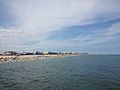
Ocean City, Maryland's beach, looking north from the pier
