
U.S. Route 50 in Maryland facts for kids
Quick facts for kids
|
|||||||
|---|---|---|---|---|---|---|---|
|
US 50 highlighted in red
|
|||||||
| Route information | |||||||
| Maintained by MDSHA and MDTA | |||||||
| Length | 149.67 mi (240.87 km) | ||||||
| Existed | 1926–present | ||||||
| Component highways |
|||||||
| Tourist routes |
|||||||
| Western section | |||||||
| Length | 9.17 mi (14.76 km) | ||||||
| West end | |||||||
| Major junctions |
|||||||
| East end | |||||||
| Eastern section | |||||||
| Length | 140.50 mi (226.11 km) | ||||||
| West end | |||||||
| Major junctions |
|
||||||
| East end | |||||||
| Location | |||||||
| Counties: | Garrett; Prince George's, Anne Arundel, Queen Anne's, Talbot, Dorchester, Wicomico, Worcester | ||||||
| Highway system | |||||||
| United States Numbered Highways List • Bannered • Divided • Replaced Maryland highway system
|
|||||||

U.S. Route 50 (US 50) is a very long road in the U.S. Highway system. It stretches over 3,000 miles (4,800 km) from Ocean City, Maryland on the Atlantic Ocean all the way to West Sacramento, California. In Maryland, US 50 is split into two parts.
The longer part is a main road connecting Washington, D.C. to Ocean City. Ocean City is where the highway officially ends on the East Coast. The other part of US 50 is much shorter. It goes through the southern tip of Garrett County for less than 10 miles (16 km). This section is part of the Northwestern Turnpike and enters West Virginia at both ends.
A famous part of US 50 in Maryland is the Chesapeake Bay Bridge. This huge bridge crosses the Chesapeake Bay. It connects the Baltimore–Washington metropolitan area to the Eastern Shore. This makes it easy for drivers to reach Ocean City and the beaches in Delaware.
Over the years, US 50 in Maryland has been greatly improved. For example, the John Hanson Highway was built. This part is also known as the secret Interstate 595 (I-595). The road was also extended to the Eastern Shore. This happened when the Chesapeake Bay Bridge was built, replacing an older road called US 213. Now, almost all of the eastern part of US 50 is a four-lane divided highway. Some older parts of US 50 are still used today, like US 50 Business in Salisbury. US 50 is still being improved on the Eastern Shore.
Contents
- Exploring US 50 in Maryland
- History of US 50 in Maryland
- Future Plans for US 50
- Junction List
- Related Roads
- Images for kids
Exploring US 50 in Maryland
US 50 in Maryland has two separate parts. Together, they cover about 149.67 miles (240.87 km).
Western Maryland Section
The western part is about 9.17 miles (14.76 km) long. It's a two-lane road that goes through mountains in Garrett County. This section enters West Virginia on both sides. It's a quiet, rural drive.
Eastern Maryland Section
The eastern part is much longer, about 140.50 miles (226.11 km). It starts at the Washington, D.C. border in Prince George's County. It ends at MD 528 and MD 378 in Ocean City. This section is a wide, multi-lane highway. Some parts are even like a super-fast freeway.
John Hanson Highway: A Busy Freeway
Between Washington, D.C., and Annapolis, US 50 is a freeway called the John Hanson Highway. This part is secretly named I-595. It starts near the I-95/I-495 (Capital Beltway) in New Carrollton. It ends at MD 70 in Annapolis. In Bowie, another major road, US 301, joins US 50 and I-595.
Blue Star Memorial Highway and the Bay Bridge
East of Annapolis, US 50 and US 301 become the Blue Star Memorial Highway. This freeway crosses the Chesapeake Bay on the amazing Chesapeake Bay Bridge. This bridge connects the western and eastern parts of Maryland. After the bridge, US 50 and US 301 go across Kent Island. Then, the freeway ends, and the two roads split in Queenstown.
Ocean Gateway: Through the Eastern Shore
From Queenstown, US 50 becomes a divided highway called Ocean Gateway. It goes through the countryside of the Eastern Shore. It passes through towns like Easton and Cambridge. In Cambridge, the road turns southeast. It continues through rural areas to Salisbury.
Salisbury Bypass and the Final Stretch
Near Salisbury, US 50 goes around the city on a freeway called the Salisbury Bypass. This bypass is also shared with US 13 for a bit. After Salisbury, US 50 becomes the Ocean Gateway again. It continues east to Ocean City.
US 50 is the main road for people traveling from the Baltimore–Washington Metropolitan Area to the Eastern Shore. It's especially busy in the summer. Many people use it to get to Ocean City or the Delaware Beaches. Because of this, it can get very crowded, especially on summer weekends. The road is also a special route for people to leave Ocean City during a hurricane.
Parts of US 50/I-595 have special lanes called HOV lanes. These lanes are for cars with two or more people. They are open 24 hours a day, unlike some other HOV lanes.
Garrett County Journey
US 50 enters Maryland from West Virginia in Garrett County. It follows an old road called the Northwestern Turnpike, now known as George Washington Highway. This two-lane road goes through farms and forests. It meets US 219 in Redhouse. After that, US 50 climbs Backbone Mountain. It then goes down the mountain and through more woods and fields. Finally, it reaches Gorman and crosses the North Branch Potomac River back into West Virginia.
Prince George's County Journey
_between_Maryland_State_Route_459_(Columbia_Park_Road)_and_Maryland_State_Route_202_(Landover_Road)_just_southeast_of_Cheverly_in_Prince_Georges_County,_Maryland.jpg)
After passing through West Virginia, Virginia, and Washington, D.C., US 50 comes back into Maryland. It enters Prince George's County as the John Hanson Highway. This is a six-lane freeway. It soon connects with the Baltimore-Washington Parkway (MD 295).
The freeway then narrows to four lanes. It runs near industrial areas and train tracks. In Cheverly, it has an exit for MD 459 and Columbia Park Road. This exit helps people get to the Cheverly station for the Washington Metro's Orange Line. The road then curves northeast, still near train tracks. It passes the MD 202 exit and continues through suburban areas. It widens to six lanes near Landover Hills and connects with MD 410.
The highway then goes over the train tracks. It has an exit for Garden City Drive and Ardwick Ardmore Road. This exit leads to the New Carrollton station, which serves Amtrak and Metro trains. After this, US 50 passes office buildings in New Carrollton. It then reaches a big interchange with I-95/I-495, also known as the Capital Beltway.
_at_Exit_13_(U.S._Route_301,_Maryland_State_Route_3,_Richmond,_Crofton)_in_Bowie,_Prince_George%27s_County,_Maryland.jpg)
At the I-95/I-495 interchange, US 50 becomes part of the Interstate Highway System. It's called I-595, but you won't see signs for it. This part is a ten-lane freeway. It has special HOV lanes for carpools, open all the time. The freeway passes near homes and businesses. It connects with MD 704 near Lanham. It then narrows to eight lanes, still with HOV lanes. It goes through wooded areas and over MD 193.
The road then crosses into Bowie and has an exit for MD 197. After this, US 50 curves east through neighborhoods. It then meets US 301 and MD 3. Here, the HOV lanes end. US 301 joins US 50 and I-595 on the freeway, which becomes six lanes wide. The road leaves Bowie and goes through woods, crossing the Patuxent River.
Anne Arundel County Journey
After crossing the Patuxent River, US 50/US 301 and I-595 enter Anne Arundel County. They continue through woods and fields. The road connects with MD 424 near Davidsonville. The freeway then goes over the South River.
It curves east near more homes. It then meets I-97, which goes north to Baltimore. After this, ramps for I-97 run next to US 50/US 301. They lead to MD 665, a short freeway into Annapolis. The highway then goes into Parole through a business area. It connects with MD 450, which leads to downtown Annapolis.
The freeway soon meets MD 2. At this point, MD 2 joins US 50/US 301 and I-595. The road goes northeast through woods. It then connects with MD 70, which also serves downtown Annapolis. Here, the secret I-595 name ends. US 50, US 301, and MD 2 continue on the John Hanson Highway.
_crossing_the_Chesapeake_Bay_from_Stevensville,_Queen_Anne%27s_County,_Maryland_to_Skidmore,_Anne_Arundel_County,_Maryland.jpg)
The road goes under MD 436 and near homes. Then, it crosses the Severn River on the Pearl Harbor Memorial Bridge. After the bridge, the road connects with Governor Ritchie Highway. Here, MD 2 leaves US 50/US 301 and goes north to Baltimore. MD 450 goes south into Annapolis, leading to the United States Naval Academy.
After this, US 50/US 301 become the Blue Star Memorial Highway. They pass south of Arnold. They connect with MD 648 and Bay Dale Drive. The freeway then goes through woods and curves east. It is joined by smaller roads called frontage roads. It connects with MD 179 near Cape St. Claire. More frontage roads run next to the freeway. It passes a shopping center and connects with Whitehall Road.
The road goes through more woods and homes. It turns southeast and connects with Oceanic Drive in Skidmore. This exit leads to Sandy Point State Park. After this, the road's care changes from the state to the Maryland Transportation Authority. It reaches a weigh station for trucks. From here, US 50/US 301 continue southeast onto the Chesapeake Bay Bridge. This bridge curves east over the Chesapeake Bay. It has two separate spans, one for eastbound traffic and one for westbound. The westbound span can even change direction to help with traffic!
Queen Anne's County Journey
.jpg)
After crossing the Chesapeake Bay Bridge, US 50/US 301 arrive on the Eastern Shore. They are on Kent Island in Queen Anne's County. There's a toll booth for eastbound traffic after the bridge. The road continues east as the Blue Star Memorial Highway, a six-lane freeway. The state highway administration takes over care of the road again.
The freeway connects with MD 8 and passes south of Stevensville. It goes through business areas. It has exits for Thompson Creek Road and Duke Street. US 50/US 301 then cross Cox Creek. They run between businesses and homes in Chester. There are exits for Cox Neck Road and Castle Marina Road (MD 18H). The road continues through commercial areas and under MD 18. It connects with MD 552 and Chester Station Road.
The freeway runs near woods and marshes. It has exits for South Piney Road and Piney Creek Road. It passes more businesses and connects with Dundee Avenue. Then, it crosses Piney Creek. US 50/US 301 reach an interchange with MD 18. They then cross the Kent Narrows on the Kent Narrows Bridge.
On the mainland, the road passes between marinas. It connects with Seward Marina Road (MD 835) and Kent Narrows Road (MD 835G). The road goes through marshland, then near homes and businesses. It connects with MD 18F and Jackson Creek Road (MD 18U) in Grasonville. US 50/US 301 continue past businesses. They connect with Chester River Beach Road (MD 18V). The freeway then goes through wooded areas. It has exits for Station Lane (MD 18I) and VFW Avenue (MD 18W).
The road curves northeast near homes and businesses. It has exits for Evans Avenue (MD 18Z), Hess Road (MD 18X), and Hissey Road (MD 835I). The route connects with Nesbit Road (MD 835K). This road leads to the University of Maryland Shore Emergency Center at Queenstown. US 50 and US 301 then split near Queenstown. US 301 continues northeast towards Delaware.

After splitting from US 301, US 50 heads east as the Ocean Gateway. This is a four-lane divided highway. It soon meets MD 18. The road runs near the Queenstown Premium Outlets. It then goes into wooded areas and farms. US 50 curves southeast and connects with MD 456. It continues through farms, woods, and homes. Farther southeast, it connects with MD 662, which goes to Wye Mills.
US 50 then goes past Chesapeake College. It meets MD 213, which goes to Wye Mills, US 301, and towns like Centreville. After this, the road curves southeast through farms and woods. It turns south and connects with MD 404. This road goes to Denton and the Delaware Beaches. This intersection has special parking lots for carpooling.
Talbot County Journey

After crossing MD 404, US 50 enters Talbot County. It continues south through open farmlands and woods. It meets different sections of MD 662. The road goes through farms, woods, homes, and businesses. It passes east of Longwoods. Farther south, it passes a golf course before entering Easton.
In Easton, US 50 runs close to MD 662. It connects with MD 309. The road then goes between MD 662 and the Easton Airport. It runs between homes and businesses. The middle part of US 50 widens. It connects with MD 322, which is a bypass around Easton. This road helps people get to towns like Oxford and St. Michaels.
After this, the road crosses an old railroad line. The middle part of US 50 narrows again. It passes through farms and businesses. The road widens to six lanes in eastern Easton. It connects with MD 328 and MD 331. The road then goes through homes and businesses, narrowing to four lanes. It passes Easton High School. US 50 goes through fields and businesses. It then meets the southern end of the MD 322 bypass.
At this point, the road leaves Easton. It goes south through farms, woods, and businesses. US 50 connects with MD 565. It continues south-southeast through farms, woods, homes, and businesses. Farther south, it curves south and enters Trappe. It goes through homes and businesses in the eastern part of town. At the south end of Trappe, US 50 meets Main Street.
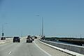
From here, the road leaves Trappe. It goes south through farms and woods. It curves southeast through rural land. US 50 turns south-southwest. It passes through fields and woods. It then reaches the Choptank River. Here, it connects with Marina Drive (MD 954A), which leads to a marina. US 50 crosses the wide Choptank River on the Senator Frederick C. Malkus Bridge. Next to the bridge is Bill Burton Fishing Pier State Park. This park uses parts of the old US 50 bridge for fishing.
Dorchester County Journey
.jpg)
After crossing the Choptank River, US 50 enters Cambridge in Dorchester County. It becomes Sunburst Highway, a six-lane divided road with many businesses. It goes east of the downtown area. The road curves southeast and connects with MD 343. It passes more businesses. It leaves Cambridge at the Woods Road intersection, where its name changes back to Ocean Gateway.
US 50 runs between a golf course and businesses. It connects with MD 16. MD 16 then joins US 50. The road continues east near businesses. It connects with MD 750, an old part of the route. Here, it narrows to four lanes. The road passes homes and businesses. It then meets the other end of MD 750. From here, Aireys Spur Road loops south. The road goes east through farms and businesses. MD 16 then leaves US 50, heading northeast on Mount Holly Road.
From here, US 50 continues east through farms, woods, homes, and businesses. It curves southeast and reaches Linkwood. Here, it passes businesses and crosses the Maryland and Delaware Railroad tracks. The road goes through more farms and woods. US 50 curves east, passing north of Salem. It continues through rural land. The road turns southeast. Farther southeast, it has an exit for Old Ocean Gateway, which goes into Vienna.
At this point, US 50 curves east into woods. It goes around Vienna to the north. The road connects with MD 331, which leads to Vienna. After this, the road goes over MD 331 and old railroad tracks. It then goes through fields and curves southeast. The route crosses the Nanticoke River on the Nanticoke River Memorial Bridge.
Wicomico County Journey
After crossing the Nanticoke River, US 50 enters Wicomico County. It goes through marshes and forests. It turns south. The road connects with Old Bradley Road (MD 731C). It also meets Marsh Road (MD 731A). US 50 curves southeast. It continues through farms, woods, homes, and businesses. It turns east, passing a picnic area.
The route enters Mardela Springs. It passes north of the town's homes. US 50 connects with MD 313. From here, the road leaves Mardela Springs. It goes through more rural land and farms. It curves southeast. US 50 connects with MD 347, which goes to Hebron. A short distance later, it meets MD 670, which also leads to Hebron. From here, the road goes through more rural areas with some homes and businesses.

US 50 has an exit for US 50 Bus., which goes into Salisbury. Here, US 50 becomes a four-lane freeway called the Salisbury Bypass. This bypass goes around Salisbury to the north and east. From here, the route continues east. It connects with Naylor Mill Road (US 50UA). After this, the freeway goes through woods and over the Wicomico River.
The road passes through a business park. It crosses the Delmarva Central Railroad tracks. It then has an exit for Northwood Drive. After this, US 50 connects with US 13 and US 13 Bus. at Salisbury Boulevard. Here, US 13 joins US 50 on the Salisbury Bypass. The two roads head east through farms and woods. The freeway curves south. It goes over more railroad tracks and MD 346. The road then connects with the eastern end of US 50 Bus. At this point, US 50 leaves the Salisbury Bypass and continues east as Ocean Gateway. US 13 continues south on the Salisbury Bypass.
US 50 continues east along Ocean Gateway. It's a four-lane divided highway with a wide middle section. It passes north of Arthur W. Perdue Stadium, where the Delmarva Shorebirds baseball team plays. The road connects with Hobbs Road and goes through business areas. It crosses Beaverdam Creek. It then passes north of Wor-Wic Community College. US 50 goes through forests, farms, and woods. It connects with Parsonsburg Road and Eastside Road (MD 992B).
The route continues east through rural land. It connects with MD 353, which goes north to Pittsville. The road goes through farms and woods. US 50 connects with MD 354, which goes north to Willards. From here, the route goes into wooded areas and crosses the Pocomoke River.
Worcester County Journey
After crossing the Pocomoke River, US 50 enters Worcester County. It goes through more wooded areas. It connects with MD 610, which goes north to Whaleyville. After this, the road curves southeast. It passes through farms and woods. The route has an exit for MD 90. This is a two-lane expressway that leads to the northern part of Ocean City.
From here, US 50 continues through rural land and open farms. It connects with MD 346. MD 346 runs close to US 50 until Caleb Road (MD 992F). There, MD 346 curves south-southeast towards Berlin. US 50 goes through farms and woods. It passes north of Berlin. The road connects with MD 818, which leads to Berlin. A short distance later, US 50 crosses railroad tracks. It then meets US 113 at a cloverleaf interchange.
After the US 113 interchange, US 50 goes through woods. It then runs between farms and businesses. It connects with the eastern end of MD 346. Here, the middle part of the road narrows. The road curves east-northeast. The route goes through more farms and businesses. It passes north of Stephen Decatur High School. It connects with MD 452. US 50 goes through farms, woods, and businesses. It runs close to MD 707.
The road curves east-southeast. MD 707 comes close again. It connects with MD 589 at Grays Corner. MD 589 goes north to the Ocean Downs casino and Ocean Pines. The route passes between a shopping center and a golf course. MD 707 ends near Riddle Lane (US 50WA). US 50 goes through woods and businesses. It curves east and then east-northeast. Other sections of MD 707 are nearby. US 50WB and US 50WC connect to MD 707. The road goes through wooded areas with homes and businesses. It then crosses Herring Creek.

After the creek, the route connects with another section of MD 707. This section goes southeast near the Ocean City visitor center. At this point, US 50 continues east into West Ocean City. It's lined with businesses. The road curves east-southeast. It connects with MD 611. This road goes south to the Ocean City Municipal Airport and Assateague Island.
After this, US 50 passes more businesses. It goes south of the Outlets Ocean City mall. It passes north of the West Ocean City Park and Ride. The route becomes a four-lane undivided road. It crosses the Sinepuxent Bay on the Harry W. Kelley Memorial Bridge. This is a bridge that can open to let boats pass. After crossing the bay, US 50 goes into downtown Ocean City. It passes near homes and businesses. It then reaches its eastern end.
Here, the route meets MD 528. MD 528 is a one-way southbound road called Philadelphia Avenue. This is where the westbound lanes of US 50 begin. Eastbound US 50 continues east on North Division Street, which is a one-way street. One block later, eastbound US 50 reaches its very end at MD 378. MD 378 is a one-way northbound road called Baltimore Avenue. This is just one block west of the Ocean City Boardwalk and the Atlantic Ocean.
If you head west on US 50 from Ocean City, a sign tells you the distance to the western end in Sacramento, California. It says 3,073 miles (4,946 km). This sign was put up in the early 1980s. The actual length of US 50 has changed a bit since then. It's now about 3,008 miles (4,841 km) long.
History of US 50 in Maryland
The part of US 50 in Garrett County hasn't changed much since it was created in 1926. However, the eastern part has changed a lot!
The Original Plan (1926)
Back in 1926, on the Western Shore, US 50 followed the road now known as MD 450. It ended in Annapolis, near St. Anne's Church. To get across the bay, you had to take a ferry. This ferry connected US 50 to what was then Maryland Route 17 on the Eastern Shore.
Reaching the Eastern Shore

Just before the Chesapeake Bay Bridge was finished, in 1948, US 50 was extended to Ocean City. This meant it used the existing ferry service to cross the bay. US 50 took over much of US 213 and parts of MD 404 on the Eastern Shore. Because US 50 now went to the Eastern Shore, US 213 north of US 50 was removed from the U.S. Highway system. It became the current MD 213 by the late 1970s. When the first two-lane part of the Bay Bridge was finished in 1952, it replaced the ferry.
The John Hanson Highway, named after John Hanson, was the first part of US 50 in Maryland to become a freeway. It was built soon after the Bay Bridge. The older road became MD 450. MD 450 was then extended a little to connect back to US 50.
Making it a Dual Highway
More and more people were driving to the beach because of the Chesapeake Bay Bridge. So, US 50 needed more upgrades. A very straight road was built through Talbot County. The old road became MD 662. In Salisbury, US 50 was moved from Main Street to Church Street. In Worcester County, the current road was built. At first, only the part east of US 113 in Berlin was a dual highway.
Then, in the mid-1960s, the four-lane part of US 50 was finished between Salisbury and Berlin. The old road east of East Main Street became MD 346. Church Street was given back to the city. The rest of US 50 on the Eastern Shore was also being made into a dual highway. This included adding another span to the Chesapeake Bay Bridge in 1973. This made the bridge five lanes wide, but not evenly.
In 1991, the last two-lane section of US 50 was in bad shape. So, a bypass was built around Vienna. This finished making the eastern part of US 50 a dual highway. The old drawbridge was taken down. Parts of the old road became MD 731. However, these names have changed over time, and MD 731 is no longer signed.
The 1990s also saw two extra lanes added to the John Hanson Highway in both directions. It was upgraded to be part of the Interstate Highway System, getting the I-595 name. But the I-595 signs were never put up. This was to avoid confusing drivers. So, the name is only used by road officials. The freeway part was extended from the Chesapeake Bay Bridge east to where US 50 and US 301 split in Queenstown. The US 50/US 301 part of the Blue Star Memorial Highway was mostly upgraded to a freeway in the late 1980s and early 1990s. Before that, it was just a divided highway with many local roads crossing it. After the upgrade, many of these crossings became special ramps.
The most recent big upgrade to US 50 happened in October 2002. The Salisbury Bypass was extended to go around the north side of the city. US 50 was moved onto this new bypass. The old road inside the city became the current US 50 Business.
Interstate 595: The Secret Highway
|
|
|
|---|---|
| Location: | New Carrollton – Annapolis |
| Length: | 19.97 mi (32.14 km) |
Interstate 595 (I-595) is a secret number for a part of the John Hanson Highway. This highway is also known as US 50 and US 301. It runs from I-495 (Capital Beltway) east of Washington, D.C., to Route 70 (Rowe Boulevard) at Annapolis, Maryland.
Building the John Hanson Highway
The John Hanson Highway, which is US 50's route between Washington, D.C., and Annapolis, was built in 1957. It went from New York Avenue outside Washington, D.C., to MD 2, the Ritchie Highway, north of Annapolis. It connected to the western side of the Chesapeake Bay Bridge. The highway had four lanes and connected to the Baltimore-Washington Parkway, I-495, and US 301 with full cloverleaf interchanges.
Improvements Over Time
|
|
|
|---|---|
| Location: | Parole |
| Length: | 3.44 mi (5.54 km) |
In the 1980s, there were plans to call the John Hanson Highway part of I-97. The section between I-97 and MD 70 was even planned to be called Interstate 197.
In the early 1980s, the I-595 number was suggested for a different road in Baltimore. But that road was never built.
Because more and more people were using the highway, and some intersections were dangerous, the highway was rebuilt between 1990 and 1995. It was made to meet Interstate standards. This project was paid for by canceling other Interstate Highway projects in Baltimore. At first, they thought about calling the rebuilt highway I-68. But when the National Freeway in western Maryland was finished in 1991, the Maryland State Highway Administration decided to call that road I-68 instead. So, the John Hanson Highway was given the I-595 name.
Why No Signs?
_at_Exit_11_(Maryland_State_Route_197-Collington_Road,_Bowie)_in_Bowie,_Prince_George%27s_County,_Maryland.jpg)
In 2001, a road historian asked the Maryland State Highway Administration (MDSHA) why I-595 wasn't signed. They replied that they didn't think putting up signs or showing it on a map would help drivers.
Sometimes in 2011, the MDSHA used the I-595 name on their traffic website. This seemed to depend on the person working at the time when reporting accidents. There was no official change in policy.
At almost 20 miles (32 km) long, I-595 is the longest Interstate Highway in the United States that doesn't have signs.
Future Plans for US 50
There are plans to upgrade US 50 in Queen Anne's County. The goal is to make it a full freeway. This freeway part would end at an interchange with Maryland Route 404 near the border of Queen Anne's and Talbot counties. These plans also include making MD 404 a dual highway across Maryland.
Junction List
| County | Location | Mile | Roads intersected | Notes | ||
|---|---|---|---|---|---|---|
| Garrett | | 0.00 | 0.00 | Western end of western US 50 in Maryland; West Virginia state line | ||
| Redhouse | 2.08 | 3.35 | ||||
| Gorman | 9.10 | 14.65 | Southern end of MD 560 | |||
| 9.17 | 14.76 | Eastern end of western US 50 in Maryland; West Virginia state line at North Branch Potomac River | ||||
| US 50 passes through West Virginia, Virginia, and Washington, D.C. | ||||||
| Prince George's | Cheverly | 0.00 | 0.00 | Western end of eastern US 50 in Maryland; District of Columbia boundary | ||
| 0.00 | 0.00 | West end of freeway | ||||
| 0.20 | 0.32 | Baltimore–Washington Parkway (MD 295 north) – Baltimore | Eastbound exit, westbound entrance; southern end of MD 295 | |||
| 0.50 | 0.80 | Split into exits for MD 201 north and MD 201 south | ||||
| 1.45 | 2.33 | Columbia Park Road – Cheverly | No exit westbound; Columbia Park Road is MD 459 | |||
| 2.80 | 4.51 | 3 | Split into exits 3A (north) and 3B (south) eastbound | |||
| Landover Hills | 4.10 | 6.60 | 5 | |||
| 4.52 | 7.27 | 6 | No exit eastbound; Garden City Drive is MD 950; Ardwick Ardmore Road is US 50PA | |||
| Lanham | 5.04 | 8.11 | 7 | I-95 / I-495 Exit 19; Split into exits 7A (south) and 7B (north) Western end of unsigned I-595 |
||
| 6.06 | 9.75 | 8 | ||||
| Bowie | 11.72 | 18.86 | 11 | |||
| 13.12 | 21.11 | 13 | Split into exits 13A (US 301), 13B (MD 3), and 13C (Belair Drive); west end of sharing road with US 301; southern end of MD 3 | |||
| Anne Arundel | | 16.54 | 26.62 | 16 | ||
| Parole | 21.32 | 34.31 | 21 | Southern end of I-97 | ||
| 22.38 | 36.02 | 22 | Western end of MD 665 | |||
| 23.04 | 37.08 | 23 | ||||
| 23.49 | 37.80 | 23A | No exit eastbound; west end of sharing road with MD 2 | |||
| 24.76 | 39.85 | 24 | Split into exits 24A (MD 70) and 24B (Bestgate Road) westbound; eastern end of unsigned I-595 | |||
| Severn River | 25.48– 26.03 |
41.01– 41.89 |
Severn River Bridge / Pearl Harbor Memorial Bridge | |||
| Arnold | 26.67 | 42.92 | 27 | Split into exits 27A (MD 450) and 27B (MD 2) westbound; east end of sharing road with MD 2 | ||
| 26.97 | 43.40 | Right-in/right-out interchange westbound; officially MD 648F | ||||
| 27.62 | 44.45 | 28 | Bay Dale Drive to Old Mill Bottom Road / Ferguson Road | |||
| Cape St. Claire | 29.15 | 46.91 | 29 | Split into exits 29A (Busch's Frontage Road) and 29B (Cape St. Claire Road) eastbound; Busch's Frontage Road and East College Parkway are MD 908A and MD 908B, respectively | ||
| 29.66 | 47.73 | 30 | Whitehall Road | Eastbound exit and entrance; Whitehall Road is MD 908C | ||
| 30.64 | 49.31 | 31 | Whitehall Road | Right-in/right-out interchange eastbound; Whitehall Road is MD 908C | ||
| Skidmore | 31.44 | 50.60 | 32 | Oceanic Drive – Sandy Point State Park | Oceanic Drive is MD 908D; last eastbound exit before toll | |
| Chesapeake Bay | 32.10– 36.16 |
51.66– 58.19 |
Chesapeake Bay Bridge / William Preston Lane Jr. Memorial Bridge | |||
| Queen Anne's | Stevensville | Chesapeake Bay Bridge Toll Gantry (eastbound, E-ZPass or Video Tolling) | ||||
| 37.22 | 59.90 | 37 | ||||
| 37.87 | 60.95 | 38A | Duke Street | Right-in/right-out interchange westbound | ||
| 37.89 | 60.98 | 38A | Thompson Creek Road | Right-in/right-out interchange eastbound | ||
| Chester | 38.86 | 62.54 | 38B | Services | Westbound exit and entrance; frontage road is US 50QC | |
| 38.98 | 62.73 | 39A | Cox Neck Road | Right-in/right-out interchange eastbound | ||
| 38.99 | 62.75 | 39A | Right-in/right-out interchange westbound; Castle Marina Road is MD 18H | |||
| 39.49 | 63.55 | 39B | Piney Creek Road | Right-in/right-out interchange westbound; Piney Creek Road is MD 18T; connector road is MD 552A (Chester Station Road) | ||
| 39.51 | 63.59 | 39B | Right-in/right-out interchange eastbound; northern end of MD 552 | |||
| 40.14 | 64.60 | 40A | South Piney Road | Right-in/right-out interchange eastbound | ||
| 40.17 | 64.65 | 40A | Piney Creek Road | Right-in/right-out interchange westbound | ||
| 40.52 | 65.21 | 40B | Dundee Avenue | Right-in/right-out interchange eastbound | ||
| Kent Narrows | 40.76 | 65.60 | 41 | Westbound ramps are with Piney Narrows Road | ||
| Kent Narrows | 41.04– 41.62 |
66.05– 66.98 |
Kent Narrows Bridge | |||
| Kent Narrows | 41.92 | 67.46 | 42 | Westbound right-in/right-out interchange with MD 835G (Kent Narrows Road); eastbound right-in/right-out interchange with MD 835 (Seward Marina Road) | ||
| Grasonville | 42.80 | 68.88 | 43A | Jackson Creek Road | Westbound right-in/right-out interchange; Jackson Creek Road is MD 18U | |
| 42.82 | 68.91 | 43A | Eastbound right-in/right-out interchange with unnamed MD 18F | |||
| 43.37 | 69.80 | 43B | Chester River Beach Road | No westbound exit; Chester River Beach road is MD 18V | ||
| 43.77 | 70.44 | 44A | VFW Avenue | Westbound right-in/right-out interchange; VFW Avenue is MD 18W | ||
| 43.78 | 70.46 | 44A | Station Lane | Eastbound right-in/right-out interchange; Station Lane is MD 18I | ||
| 44.13 | 71.02 | 44B | Winchester Creek Road | Westbound right-in/right-out interchange; Winchester Creek Road is MD 835H | ||
| 44.14 | 71.04 | 44B | Evans Avenue | Eastbound right-in/right-out interchange; Evans Avenue is MD 18Z | ||
| 44.47 | 71.57 | 45A | Hissey Road | Westbound right-in/right-out interchange; Hissey Road is MD 835I | ||
| 44.48 | 71.58 | 45A | Hess Road | Eastbound right-in/right-out interchange; Hess Road is MD 18X | ||
| 44.90 | 72.26 | 45B | Nesbit Road | Nesbit Road is MD 835K | ||
| Queenstown | 46.09 | 74.17 | 46 | Eastbound exit, westbound entrance; east end of sharing road with US 301 | ||
| 46.09 | 74.17 | East end of freeway | ||||
| 46.37 | 74.63 | Right-in/right-out intersections with MD 18B eastbound and MD 18S westbound, plus a turn from westbound US 50 to MD 18B; no direct access between MD 18B and MD 18S | ||||
| 47.72 | 76.80 | Southern end of MD 456 | ||||
| Wye Mills | 50.70 | 81.59 | Northern end of MD 662 | |||
| 51.57 | 82.99 | |||||
| Queen Anne's–Talbot county line |
53.05 | 85.38 | ||||
| Talbot | | 55.36 | 89.09 | Southern end of MD 662 | ||
| | 55.82 | 89.83 | Northern end of MD 662; officially MD 662B | |||
| | 57.68 | 92.83 | Old Skipton Road is MD 662B; Longwoods Road is MD 662C | |||
| Easton | 61.57 | 99.09 | Connector is unnamed MD 662D | |||
| 61.77 | 99.41 | Southern end of MD 309 | ||||
| 62.71 | 100.92 | Northern end of MD 322 | ||||
| 64.20 | 103.32 | Western end of MD 328 | ||||
| 64.54 | 103.87 | Northern end of MD 331 | ||||
| 66.87 | 107.62 | Southern end of MD 322; no access from southbound MD 322 to westbound US 50 | ||||
| | 67.70 | 108.95 | Northern end of MD 565 | |||
| Trappe | 72.97 | 117.43 | ||||
| Choptank River | 77.47– 79.11 |
124.68– 127.32 |
Frederick C. Malkus Memorial Bridge | |||
| Dorchester | Cambridge | 80.05 | 128.83 | Eastern end of MD 343; no direct access from eastbound MD 343 to westbound US 50 | ||
| 80.79 | 130.02 | West end of sharing road with MD 16 | ||||
| 81.20 | 130.68 | Western end of MD 750 | ||||
| 82.00 | 131.97 | Eastern end of MD 750 | ||||
| | 83.45 | 134.30 | East end of sharing road with MD 16; no direct access from westbound MD 16 to eastbound US 50 | |||
| Vienna | 93.47 | 150.43 | Old Ocean Gateway – Vienna | Eastbound exit and entrance | ||
| 94.58 | 152.21 | Partial cloverleaf interchange; southern end of MD 331 | ||||
| Nanticoke River | 95.14– 96.14 |
153.11– 154.72 |
Nanticoke River Memorial Bridge | |||
| Wicomico | Mardela Springs | 99.93 | 160.82 | Southern end of MD 313 | ||
| Hebron | 104.80 | 168.66 | Northern end of MD 347 | |||
| 105.96 | 170.53 | Eastern end of MD 670; no direct access from eastbound MD 670 to westbound US 50 | ||||
| | 107.88 | 173.62 | West end of freeway | |||
| | 107.88 | 173.62 | Eastbound exit, westbound entrance; western end of US 50 Bus. | |||
| | 108.59 | 174.76 | Naylor Mill Road | Diamond interchange; Naylor Mill Road is US 50UA | ||
| Salisbury | 110.86 | 178.41 | Northwood Drive | Eastbound exit, westbound entrance | ||
| 111.38 | 179.25 | Partial cloverleaf interchange with flyover; no access from northbound US 13 Bus. to westbound US 50; west end of sharing road with US 13; northern end of US 13 Bus. | ||||
| 114.46 | 184.21 | Partial cloverleaf interchange; east end of sharing road with US 13; eastern end of US 50 Bus. | ||||
| 114.46 | 184.21 | East end of freeway | ||||
| Pittsville | 120.83 | 194.46 | Southern end of MD 353 | |||
| Willards | 124.61 | 200.54 | ||||
| Worcester | Whaleyville | 126.94 | 204.29 | |||
| | 129.06 | 207.70 | Eastbound exit, westbound entrance; western end of MD 90 | |||
| Berlin | 131.06 | 210.92 | ||||
| 132.81 | 213.74 | |||||
| 133.14 | 214.27 | Cloverleaf interchange | ||||
| 133.97 | 215.60 | Eastern end of MD 346 | ||||
| 134.48 | 216.42 | Southern end of MD 452 | ||||
| | 135.74 | 218.45 | Southern end of MD 589 | |||
| West Ocean City | 138.21 | 222.43 | Western end of MD 707; officially MD 707A | |||
| 139.03 | 223.75 | Northern end of MD 611 | ||||
| Sinepuxent Bay | 139.89– 140.38 |
225.13– 225.92 |
Harry W. Kelley Memorial Bridge | |||
| Ocean City | 140.43 | 226.00 | Eastern end of westbound US 50 | |||
| 140.50 | 226.11 | Eastern end of eastbound US 50 | ||||
| 1.000 mi = 1.609 km; 1.000 km = 0.621 mi | ||||||
Related Roads
US 50 Business in Salisbury
|
|
|
|---|---|
| Location: | Salisbury, Maryland |
| Length: | 6.88 mi (11.07 km) |
| Existed: | 2002–present |
U.S. Route 50 Business (US 50 Bus.) is a shorter, local version of US 50 in Maryland. It runs for about 6.88 miles (11.07 km) in and around Salisbury. This road goes from US 50 on the northwest side of Salisbury to US 13 and US 50 on the east side.
US 50 Bus. is a four- to six-lane divided highway. It goes through the main part of Salisbury. Here, it crosses other roads like MD 349, US 13 Bus., and MD 346. The part of US 50 Bus. west of MD 349 was improved in the mid-1950s. The section between MD 349 and MD 346 was a new path for US 50 in the early 1960s. East of MD 346, US 50 Bus. is part of the road that was moved between Salisbury and Berlin in the mid-1960s. US 50 Bus. got its name in 2002 when the Salisbury Bypass was finished.
Other Small US 50 Roads
- US 50PA is a short, one-way road (0.21 miles or 0.34 km) in New Carrollton. It helps drivers get from Garden City Drive and the New Carrollton station to US 50.
- US 50QB is a short ramp (0.10 miles or 0.16 km) from westbound US 50 to MD 456 near Queenstown.
- US 50QC is a one-way road (0.55 miles or 0.89 km) that runs next to westbound US 50/southbound US 301 in Chester. It helps people reach local businesses.
- US 50UA is a two-lane road (0.36 miles or 0.58 km) called Naylor Mill Road in Salisbury. It crosses US 50 at an interchange.
- US 50WA is a short road (0.02 miles or 0.03 km) called Riddle Lane in Grays Corner. It connects US 50 to MD 707.
- US 50WB is a small road (0.05 miles or 0.08 km) that connects US 50 north to MD 707 in Grays Corner.
- US 50WC is another small road (0.02 miles or 0.03 km) that connects US 50 north to MD 707 in Grays Corner.
Images for kids
-
US 50 on the Senator Frederick C. Malkus Bridge. The fishing pier is on the right.
