New Carrollton, Maryland facts for kids
Quick facts for kids
New Carrollton, Maryland
|
|||
|---|---|---|---|
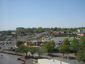
Downtown New Carrollton's Annapolis Road in 2010
|
|||
|
|||
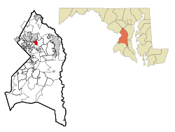
Location of New Carrollton, Maryland
|
|||
| Country | |||
| State | |||
| County | |||
| Incorporated | April 11, 1953 | ||
| Area | |||
| • Total | 1.57 sq mi (4.05 km2) | ||
| • Land | 1.57 sq mi (4.05 km2) | ||
| • Water | 0.00 sq mi (0.00 km2) | ||
| Elevation | 79 ft (24 m) | ||
| Population
(2020)
|
|||
| • Total | 13,715 | ||
| • Density | 8,757.98/sq mi (3,382.41/km2) | ||
| Time zone | UTC−5 (Eastern (EST)) | ||
| • Summer (DST) | UTC−4 (EDT) | ||
| ZIP Code |
20784
|
||
| Area code(s) | 301, 240 | ||
| FIPS code | 24-55400 | ||
| GNIS feature ID | 0597805 | ||
New Carrollton is a city located in central Prince George's County, Maryland, United States. It is about 10 miles (16 km) east of downtown Washington, D.C.. In 2020, about 13,715 people lived there. New Carrollton is known for its good transportation links.
Contents
History of New Carrollton
New Carrollton was built on land that once belonged to Edward L. Mahoney. He was a famous person in horse racing. After he passed away in 1957, a builder named Albert W. Turner bought the land.
How New Carrollton Started
Albert W. Turner wanted to create a new, planned community. This means he designed the whole area before building it. He received permission to create the "City of Carrollton" on April 11, 1953. This permission came from the Maryland General Assembly.
Naming the City
The city was named after Charles Carroll of Carrollton. He was an important early settler in Maryland. Charles Carroll was a delegate to the Continental Congress. He was also the last person to sign the Declaration of Independence who was still alive.
There were already two other places in Maryland called Carrollton. So, on May 2, 1966, people voted to change the name. They decided to call it New Carrollton to avoid confusion.
Neighboring Communities
New Carrollton is surrounded by several other towns and areas. These are its neighbors:
- Landover Hills (to the southwest)
- Woodlawn (to the southwest)
- East Riverdale (to the west)
- Greenbelt (to the north)
- Seabrook (to the northeast)
- Lanham (to the east)
Education in New Carrollton
New Carrollton has many schools for students. The Prince George's County Public Schools system serves the city.
Local Schools for Kids
Students in New Carrollton attend different elementary schools. These schools include:
- Carrollton Elementary School
- Robert Frost Elementary School
- Lamont Elementary School
- Glenridge Elementary School
- James McHenry Elementary School
Most middle school students go to Charles Carroll Middle School. Some students attend Thomas Johnson Middle School. For high school, most students go to Parkdale High School. A few others attend DuVal High School.
New Carrollton also has a special school. The Margaret Brent Regional Center helps children with special needs.
Public Library Services
The Prince George's County Memorial Library System runs the New Carrollton Library. This library offers books, computers, and programs for everyone.
Geography of New Carrollton
New Carrollton is located at coordinates 38°57′59″N 76°52′36″W. This is its exact spot on the map.
The United States Census Bureau says the city covers about 1.53 square miles (4.05 square kilometers). All of this area is land. There are no large bodies of water within the city limits.
Transportation Options
New Carrollton is a hub for travel. It has major roads and public transport.
Major Roads and Highways
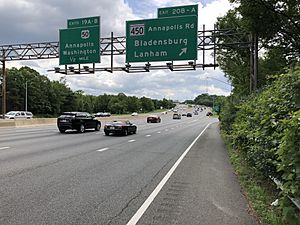
The most important highway near New Carrollton is Interstate 95/Interstate 495. This road is also known as the Capital Beltway. It's a big highway that circles Washington, D.C.. It helps people get to many other nearby towns.
I-95 is a very long highway. It goes north through cities like Baltimore and New York City. To the south, it goes through Richmond and all the way to Florida. You can get directly into New Carrollton using Maryland Route 450. Other important roads are Maryland Route 410 and Maryland Route 433.
Public Transport Services
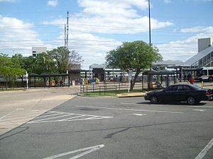
The New Carrollton station is just outside the city. It is a major transportation center.
- Amtrak: This station is the first Amtrak stop north of Washington Union Station on the Northeast Corridor. Amtrak trains travel long distances between cities.
- MARC Train: The station also serves the Penn Line of the MARC commuter rail. Commuter trains help people travel to work or school.
- Washington Metro: The New Carrollton station is the last stop on the Orange Line of the Washington Metro. The Metro is a subway system that serves the Washington D.C. area.
Population and People
New Carrollton has grown over the years. In 2020, the population was 13,715 people.
Who Lives in New Carrollton?
The city is home to a diverse group of people. Here's a quick look at the population in 2020:
- About 52% of residents were Black or African American.
- Around 36% of residents were Hispanic or Latino.
- About 5% were White.
- About 3% were Asian.
- The rest were Native American, Pacific Islander, or from other backgrounds.
In 2010, there were 12,135 people living in New Carrollton. About 39.6% of homes had children under 18. The average age of people in the city was 33 years old. About 26.2% of residents were under 18 years old.
| Historical population | |||
|---|---|---|---|
| Census | Pop. | %± | |
| 1960 | 3,385 | — | |
| 1970 | 14,870 | 339.3% | |
| 1980 | 12,632 | −15.1% | |
| 1990 | 12,002 | −5.0% | |
| 2000 | 12,589 | 4.9% | |
| 2010 | 12,135 | −3.6% | |
| 2020 | 13,715 | 13.0% | |
| U.S. Decennial Census 2010 2020 |
|||
See also
 In Spanish: New Carrollton para niños
 | Georgia Louise Harris Brown |
 | Julian Abele |
 | Norma Merrick Sklarek |
 | William Sidney Pittman |


