Queenstown, Maryland facts for kids
Quick facts for kids
Queenstown, Maryland
|
|||
|---|---|---|---|
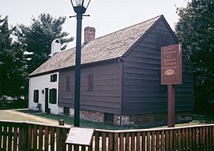
Courthouse of Queen Anne's County built in 1708
|
|||
|
|||
 |
|||
| Country | United States | ||
| State | Maryland | ||
| County | Queen Anne's | ||
| Incorporated | 1892 | ||
| Area | |||
| • Total | 2.01 sq mi (5.20 km2) | ||
| • Land | 2.01 sq mi (5.20 km2) | ||
| • Water | 0.00 sq mi (0.00 km2) | ||
| Elevation | 20 ft (6 m) | ||
| Population
(2020)
|
|||
| • Total | 705 | ||
| • Density | 350.92/sq mi (135.50/km2) | ||
| Time zone | UTC-5 (Eastern (EST)) | ||
| • Summer (DST) | UTC-4 (EDT) | ||
| ZIP code |
21658
|
||
| Area code(s) | 410 | ||
| FIPS code | 24-64600 | ||
| GNIS feature ID | 0597939 | ||
Queenstown is a small town located in Queen Anne's County, Maryland, in the United States. In 2020, about 705 people lived there.
Contents
Geography and Location
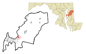
Queenstown is found at a specific point on the map: 38.989086 degrees north and 76.156645 degrees west.
The town covers a total area of about 1.45 square miles (3.76 square kilometers). All of this area is land, with no water.
History of Queenstown
Queenstown was once the main government center for Queen Anne's County. Later, this role moved to Centreville, Maryland.
In the 1700s, Queenstown was very important for trade. It was located near a creek that boats could use. This made it a busy place for sending and receiving goods.
During the War of 1812, English troops attacked Queenstown. This happened on August 13, 1813.
Some historic places in Queenstown are listed on the National Register of Historic Places. These include Bloomingdale, Bowlingly, and St. Peter's Church.
Getting Around Queenstown
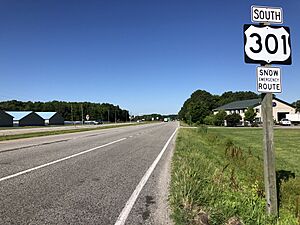
Today, most people travel to and from Queenstown by road. The town is right next to where two major highways meet: U.S. Route 301 and U.S. Route 50.
These highways connect Queenstown to big cities like Philadelphia, Washington, D.C., and the beach town of Ocean City. Other state roads that serve the town include Maryland Route 18, Maryland Route 456, and Maryland Route 656.
Population and People
| Historical population | |||
|---|---|---|---|
| Census | Pop. | %± | |
| 1900 | 374 | — | |
| 1910 | 279 | −25.4% | |
| 1920 | 270 | −3.2% | |
| 1930 | 288 | 6.7% | |
| 1940 | 275 | −4.5% | |
| 1950 | 316 | 14.9% | |
| 1960 | 395 | 25.0% | |
| 1970 | 387 | −2.0% | |
| 1980 | 491 | 26.9% | |
| 1990 | 453 | −7.7% | |
| 2000 | 617 | 36.2% | |
| 2010 | 664 | 7.6% | |
| 2020 | 705 | 6.2% | |
| U.S. Decennial Census | |||
Population in 2010
In 2010, there were 664 people living in Queenstown. These people made up 271 households. About 185 of these were families.
The town had about 458 people per square mile (177 people per square kilometer). There were 294 homes, with about 203 homes per square mile (78 homes per square kilometer).
Most of the people in Queenstown were White (92.9%). A smaller number were African American (3.2%), Asian (0.9%), or Native American (0.2%). Some people were from other races or mixed races. About 3.8% of the population was Hispanic or Latino.
Households and Families
About 32.8% of households had children under 18 living with them. More than half (50.9%) were married couples. About 14% of households had a female head with no husband. A small number (3.3%) had a male head with no wife.
About 26.6% of all households were single people living alone. About 10.4% of these were people aged 65 or older. The average household had 2.45 people. The average family had 2.92 people.
The average age of people in Queenstown was 40.2 years. About 25% of residents were under 18. About 15.2% were 65 or older. The town had slightly more females (51.5%) than males (48.5%).
Places to Visit
The Queenstown Premium Outlets is a popular shopping center. It is located near Routes 50 and 301. This outlet mall has more than 65 stores.
See also
 In Spanish: Queenstown (Maryland) para niños
 | Roy Wilkins |
 | John Lewis |
 | Linda Carol Brown |


