Gorman, Maryland facts for kids
Quick facts for kids
Gorman, Maryland
|
|
|---|---|
| Country | United States |
| State | Maryland |
| County | Garrett |
| Area | |
| • Total | 1.25 sq mi (3.25 km2) |
| • Land | 1.25 sq mi (3.25 km2) |
| • Water | 0.00 sq mi (0.00 km2) |
| Elevation | 2,602 ft (793 m) |
| Population
(2020)
|
|
| • Total | 85 |
| • Density | 67.78/sq mi (26.17/km2) |
| Time zone | UTC-5 (Eastern (EST)) |
| • Summer (DST) | UTC-4 (EDT) |
| ZIP code |
21550
|
| Area code(s) | 240 and 301 |
| FIPS code | 24-34150 |
| GNIS feature ID | 2583633 |
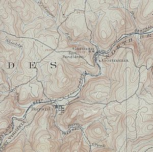
Gorman is a small community in Garrett County, Maryland, in the United States. It's called a "census-designated place" (CDP). This means it's an area that the government tracks for population numbers, even though it's not an official town or city.
Gorman is located right next to the North Branch Potomac River. It sits along Gorman Road, which is also known as Maryland Route 560. This road connects to the Northwestern Turnpike, or U.S. Route 50.
The Northwestern Turnpike crosses the North Branch Potomac River into a place called Gormania, West Virginia. This crossing happens over the Gormania Bridge. Both Gorman and Gormania were named after Arthur Pue Gorman. He was an important United States Senator from Maryland. He lived from 1839 to 1906.
Contents
Population in Gorman
Gorman is a very small community. Its population is counted by the United States Census.
- In 2010, there were 106 people living in Gorman.
- By 2020, the population had changed to 85 people.
| Historical population | |||
|---|---|---|---|
| Census | Pop. | %± | |
| 2020 | 85 | — | |
| U.S. Decennial Census | |||
Where is Gorman?
Gorman is located in the southern part of Garrett County. This county is in the western part of Maryland. The community is right on the border with West Virginia.
The North Branch Potomac River forms a natural border here. This river is a major waterway in the region.
Roads and Connections
Gorman is connected to other places by important roads.
- Maryland Route 560: This road is also known as Gorman Road. It runs through the community.
- U.S. Route 50: This is a much larger highway. It's often called the Northwestern Turnpike in this area. U.S. Route 50 is a major route that crosses the United States.
The Gormania Bridge helps people travel between Maryland and West Virginia. It connects Gorman to Gormania, West Virginia, across the river.
Who was Arthur Pue Gorman?
Gorman, Maryland, and Gormania, West Virginia, are both named after a famous person.
- Arthur Pue Gorman was a powerful politician from Maryland.
- He served as a United States Senator for many years.
- He was born in 1839 and passed away in 1906.
- Naming towns after important people was a common way to honor them in the past.
See also
 In Spanish: Gorman (Maryland) para niños
 | Laphonza Butler |
 | Daisy Bates |
 | Elizabeth Piper Ensley |


