Delmarva Peninsula facts for kids
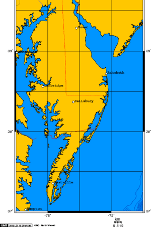
The Delmarva Peninsula is a large piece of land on the East Coast of the United States. It's special because it's made up of parts of three different states: Delaware, Maryland, and Virginia. That's where its name comes from – a mix of the first letters of those states!
This peninsula is about 180 miles long and 60 miles wide. It has the Chesapeake Bay on its west side. On its east side, you'll find the Delaware River, Delaware Bay, and the Atlantic Ocean.
The Delmarva Peninsula is famous for its beautiful beaches. Popular spots include Ocean City, Maryland and Bethany Beach, Delaware. Many people visit these beaches for fun in the sun!
Images for kids
-
This map shows the Delmarva Peninsula. The yellow area in the south is the Eastern Shore of Virginia. The orange area is the Eastern Shore of Maryland. The yellow area in the north is part of Delaware.
-
A wild pony from Assateague Island. These ponies roam freely on the island.
See also
 In Spanish: Península Delmarva para niños
 | DeHart Hubbard |
 | Wilma Rudolph |
 | Jesse Owens |
 | Jackie Joyner-Kersee |
 | Major Taylor |


